The HR2 postcode district is a postal district located in the HR Hereford postcode area with a population of 38,964 residents according to the 2021 England and Wales Census.
The area of the HR2 postcode district is 181.52 square miles which is 470.13 square kilometres or 116,171.67 acres.
Currently, the HR2 district has about 1302 postcode units spread across 5 geographic postcode sectors.
Given that each sector allows for 400 unique postcode combinations, the district has a capacity of 2,000 postcodes. With 1302 postcodes already in use, this leaves 698 units available.
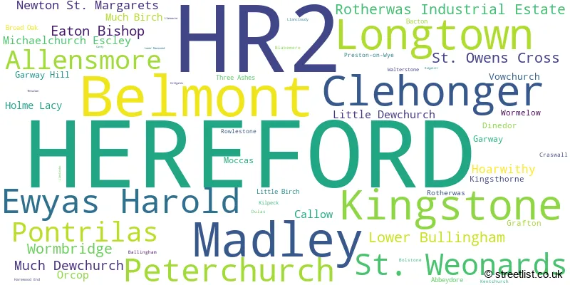
The largest settlement in the HR2 postal code is HEREFORD followed by Belmont, and Madley.
The HR2 Postcode shares a border with HR9 (ROSS-ON-WYE, Whitchurch, Lea), NP25 (MONMOUTH, WYESHAM, ROCKFIELD), HR1 (HEREFORD, Bartestree, Bodenham), HR3 (HAY-ON-WYE, Eardisley, GLASBURY), HR4 (HEREFORD, Credenhill, Weobley) and NP7 (ABERGAVENNY, Gilwern, Llanfoist).
The HR2 postcode district primarily consists of the settlement of Hereford in Herefordshire, a county in England. Other significant settlements include Ewyas Harold, Longtown, Peterchurch, Pontrilas, and St. Weonards. The most significant post town in the HR2 district is Hereford.
For the district HR2, we have data on 5 postcode sectors. Here's a breakdown: The sector HR2 0, covers Longtown and Ewyas Harold and Peterchurch and Pontrilas in Herefordshire. The sector HR2 6, covers Hereford in Herefordshire. The sector HR2 7, covers Hereford and Belmont in Herefordshire. The sector HR2 8, covers St. Weonards and St. Owens Cross in Herefordshire. The sector HR2 9, covers Madley and Kingstone and Clehonger in Herefordshire.

Map of the HR2 Postcode District
Explore the HR2 postcode district by using our free interactive map.

When it comes to local government, postal geography often disregards political borders. However, for a breakdown in the HR2 District: the district mostly encompasses the County of Herefordshire area with a total of 1307 postcodes.
Recent House Sales in HR2
| Date | Price | Address |
|---|---|---|
| 06/10/2023 | £585,000 | Ballingham, Hereford, HR2 6NL |
| 06/10/2023 | £481,500 | Longtown, Hereford, HR2 0LG |
| 29/09/2023 | £680,000 | Kilpeck, Hereford, HR2 9DR |
| 15/09/2023 | £185,000 | Heliston Place, Pontrilas, Hereford, HR2 0UD |
| 13/09/2023 | £321,000 | Oulton Avenue, Belmont, Hereford, HR2 7YX |
| 08/09/2023 | £330,000 | Peterchurch, Hereford, HR2 0RP |
| 08/09/2023 | £199,000 | Weobley Close, Hereford, HR2 7EJ |
| 08/09/2023 | £270,000 | Web Tree Avenue, Hereford, HR2 6HG |
| 08/09/2023 | £257,000 | Cumbrae Avenue, Hereford, HR2 6BX |
| 06/09/2023 | £520,000 | Garway Hill, Hereford, HR2 8EZ |
Weather Forecast for HR2
Press Button to Show Forecast for Hereford
| Time Period | Icon | Description | Temperature | Rain Probability | Wind |
|---|---|---|---|---|---|
| 12:00 to 15:00 | Overcast | 8.0°C (feels like 5.0°C) | 16.00% | ENE 11 mph | |
| 15:00 to 18:00 | Overcast | 9.0°C (feels like 6.0°C) | 14.00% | NE 11 mph | |
| 18:00 to 21:00 | Overcast | 8.0°C (feels like 6.0°C) | 12.00% | NE 11 mph | |
| 21:00 to 00:00 | Overcast | 7.0°C (feels like 4.0°C) | 10.00% | NNE 9 mph |
Press Button to Show Forecast for Hereford
| Time Period | Icon | Description | Temperature | Rain Probability | Wind |
|---|---|---|---|---|---|
| 00:00 to 03:00 | Overcast | 6.0°C (feels like 3.0°C) | 15.00% | NNE 11 mph | |
| 03:00 to 06:00 | Overcast | 6.0°C (feels like 2.0°C) | 19.00% | N 11 mph | |
| 06:00 to 09:00 | Light rain | 6.0°C (feels like 2.0°C) | 49.00% | NNW 11 mph | |
| 09:00 to 12:00 | Overcast | 8.0°C (feels like 5.0°C) | 20.00% | NNW 11 mph | |
| 12:00 to 15:00 | Cloudy | 10.0°C (feels like 7.0°C) | 15.00% | NW 9 mph | |
| 15:00 to 18:00 | Cloudy | 11.0°C (feels like 9.0°C) | 9.00% | W 9 mph | |
| 18:00 to 21:00 | Sunny day | 10.0°C (feels like 9.0°C) | 4.00% | W 7 mph | |
| 21:00 to 00:00 | Clear night | 6.0°C (feels like 4.0°C) | 0.00% | WSW 7 mph |
Press Button to Show Forecast for Hereford
| Time Period | Icon | Description | Temperature | Rain Probability | Wind |
|---|---|---|---|---|---|
| 00:00 to 03:00 | Clear night | 5.0°C (feels like 2.0°C) | 1.00% | SSW 7 mph | |
| 03:00 to 06:00 | Clear night | 4.0°C (feels like 2.0°C) | 2.00% | S 7 mph | |
| 06:00 to 09:00 | Sunny day | 6.0°C (feels like 3.0°C) | 2.00% | S 7 mph | |
| 09:00 to 12:00 | Partly cloudy (day) | 11.0°C (feels like 8.0°C) | 4.00% | S 13 mph | |
| 12:00 to 15:00 | Cloudy | 13.0°C (feels like 10.0°C) | 11.00% | S 16 mph | |
| 15:00 to 18:00 | Cloudy | 13.0°C (feels like 10.0°C) | 12.00% | S 16 mph | |
| 18:00 to 21:00 | Partly cloudy (day) | 12.0°C (feels like 10.0°C) | 5.00% | S 13 mph | |
| 21:00 to 00:00 | Clear night | 9.0°C (feels like 7.0°C) | 4.00% | SSE 9 mph |
Press Button to Show Forecast for Hereford
| Time Period | Icon | Description | Temperature | Rain Probability | Wind |
|---|---|---|---|---|---|
| 00:00 to 03:00 | Partly cloudy (night) | 8.0°C (feels like 6.0°C) | 6.00% | SE 9 mph | |
| 03:00 to 06:00 | Cloudy | 8.0°C (feels like 5.0°C) | 8.00% | SE 9 mph | |
| 06:00 to 09:00 | Sunny day | 8.0°C (feels like 6.0°C) | 7.00% | SE 9 mph | |
| 09:00 to 12:00 | Partly cloudy (day) | 12.0°C (feels like 10.0°C) | 9.00% | SE 11 mph | |
| 12:00 to 15:00 | Cloudy | 15.0°C (feels like 12.0°C) | 15.00% | SE 13 mph | |
| 15:00 to 18:00 | Cloudy | 15.0°C (feels like 13.0°C) | 16.00% | SE 13 mph | |
| 18:00 to 21:00 | Cloudy | 14.0°C (feels like 12.0°C) | 11.00% | SE 9 mph | |
| 21:00 to 00:00 | Partly cloudy (night) | 10.0°C (feels like 9.0°C) | 6.00% | ESE 7 mph |
Where is the HR2 Postcode District?
The data postcode district "HR2" is located in Hereford. It is associated with nearby towns such as Abergavenny, Ross-on-Wye, and Kington, situated in the South West, South East, and North West respectively. The distance between Hereford and London is approximately 121.23 miles.
The district is within the post town of HEREFORD.
The sector has postcodes within the nation of England.
The HR2 Postcode District is in the Herefordshire, County of region of Herefordshire, Worcestershire and Warwickshire within the West Midlands (England).
| Postcode Sector | Delivery Office |
|---|---|
| HR2 0 | Hereford Delivery Office |
| HR2 0 | Longtown (hr) Delivery Office |
| HR2 0 | Pontrilas Scale Payment Delivery Office |
| HR2 6 | Hereford Delivery Office |
| HR2 7 | Hereford Delivery Office |
| HR2 8 | Hereford Delivery Office |
| HR2 9 | Hereford Delivery Office |
| H | R | 2 | - | X | X | X |
| H | R | 2 | Space | Numeric | Letter | Letter |
Tourist Attractions within the Postcode Area
We found 1 visitor attractions within the HR2 postcode area
| Kilpeck Church (Church of St David and St Mary) |
|---|
| Places of Worship |
| Place of Worship (still in use) |
| View Kilpeck Church (Church of St David and St Mary) on Google Maps |
Current Monthly Rental Prices
| # Bedrooms | Min Price | Max Price | Avg Price |
|---|---|---|---|
| £395 | £395 | £395 | |
| 1 | £625 | £625 | £625 |
| 2 | £750 | £850 | £821 |
| 3 | £825 | £1,800 | £1,242 |
| 4 | £1,700 | £1,700 | £1,700 |
Current House Prices
| # Bedrooms | Min Price | Max Price | Avg Price |
|---|---|---|---|
| £15,000 | £1,350,000 | £349,565 | |
| 1 | £90,000 | £249,950 | £153,991 |
| 2 | £105,000 | £825,000 | £254,799 |
| 3 | £170,000 | £1,250,000 | £378,229 |
| 4 | £220,000 | £1,350,000 | £549,869 |
| 5 | £289,950 | £1,000,000 | £618,242 |
| 6 | £645,000 | £950,000 | £795,000 |
| 7 | £650,000 | £2,200,000 | £1,416,667 |
| 8 | £1,025,000 | £1,025,000 | £1,025,000 |
| 9 | £799,950 | £799,950 | £799,950 |
| 10 | £9,550,000 | £9,550,000 | £9,550,000 |
Estate Agents who Operate in the HR2 District
| Logo | Name | Brand Name | Address | Contact Number | Total Properties |
|---|---|---|---|---|---|
 | Hereford | Flint & Cook | 22 Broad Street Hereford HR4 9AP | 01432 355455 | 35 |
 | Hereford | Chancellors | 20 King Street, Hereford, HR4 9DB | 01432 808884 | 25 |
 | Hereford | Connells | 23 King Street, Hereford, Herefordshire, HR4 9BX | 01432 802236 | 15 |
 | Hereford | Glasshouse Estates and Properties LLP | Berrow Business Centre Bath Street Hereford HR1 2HE | 01432 805194 | 15 |
 | Hereford | Cobb Amos | 14 King Street, Hereford, HR4 9BW | 01432 805984 | 13 |
- Abbey Dore
- Allensmore
- Almeley
- Bacton
- Ballingham
- Bellamore
- Bredwardine
- Bridge Sollers
- Broad Oak
- Callow
- Clehonger
- Cobhall Common
- Dinedor
- Eaton Bishop
- Ewyas Harold
- Fownhope
- Garway
- Gilfach
- Grafton
- Great Brampton
- Grosmont
- Hereford
- Hinton
- Hoarwithy
- Holme Lacy
- Kilpeck
- King's Thorn
- Kingstone
- Little Birch
- Little Dewchurch
- Llangarron
- Longtown
- Lower Maes-coed
- Madley
- Michaelchurch Escley
- Moccas
- Much Birch
- Much Dewchurch
- Newton
- Orcop Hill / Cole's Tump
- Pandy
- Pen-pwll-sond
- Peterchurch
- Peterstow
- Pontrilas
- Preston on Wye
- Ridge Hill
- Shenmore
- Snodhill
- St Margarets
- St Weonards
- Upper Maes-coed
- Urishay Common
- Vowchurch Common
- Winnal
- Wormbridge
- Wormelow Tump
| Type of Property | 2018 Average | 2018 Sales | 2017 Average | 2017 Sales | 2016 Average | 2016 Sales | 2015 Average | 2015 Sales |
|---|---|---|---|---|---|---|---|---|
| Detached | £341,756 | 165 | £315,475 | 217 | £292,217 | 249 | £284,072 | 219 |
| Semi-Detached | £191,268 | 165 | £177,586 | 173 | £177,313 | 180 | £169,183 | 151 |
| Terraced | £162,064 | 140 | £154,882 | 161 | £147,215 | 190 | £141,783 | 171 |
| Flats | £137,861 | 30 | £120,443 | 25 | £108,887 | 32 | £92,636 | 24 |