This section of the site is all about the HS Postcode area, also known as the Outer Hebrides Postal Area. Explore links to the next level to learn more about specific postcode districts such as HS1.
The HS postcode area represents a group of postal districts in the Outer Hebrides area of the United Kingdom. The area code HS stands for the letters h and s in HebrideS. HS has a population of 27,684 and covers an area of 2,973,521 hectares. Fun fact: 0.04% of the population of Great Britain lives in this area.
The postcode area falls within the following counties: Western Isles (100.00%).
Post Towns and Postcode Districts for the HS Postcode
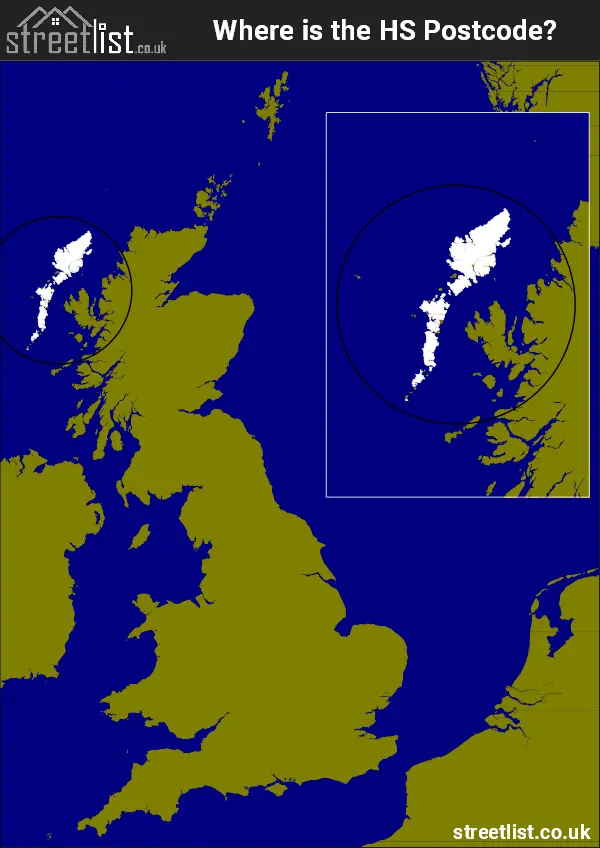
Where is the HS Postcode Area?
The HS Outer Hebrides Postcode is in Scotland. The postal area borders The North Atlantic Ocean, The Minch and Sea of the Hebredes.
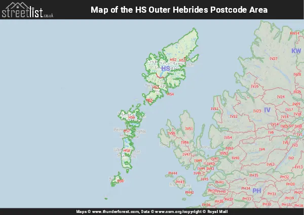
Map of the HS Outer Hebrides Postcode Area
Explore the HS Outer Hebrides postcode area by using our interactive map.
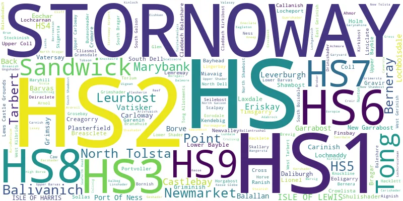
Postcode Districts within the HS Outer Hebrides Postcode Area
There are 9 postcode districts within the Outer Hebrides postcode area
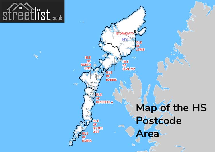
A map showing the boundary of in relation to other areas
| Unit | Area² |
|---|---|
| Hectares | 2,973,521² |
| Miles | 11,481² |
| Feet | 320,066,826,919² |
| Kilometres | 29,735² |
Postal Delivery Offices serving the HS Outer Hebrides Postcode Area
- Balallan Scale Payment Delivery Office
- Balivanich Scale Payment Delivery Office
- Barvas Scale Payment Delivery Office
- Bernera Scale Payment Delivery Office
- Berneray Scale Payment Delivery Office
- Callanish Scale Payment Delivery Office
- Castlebay Scale Payment Delivery Office
- Creagorry Scale Payment Delivery Office
- Daliburgh Scale Payment Delivery Office
- Eriskay Scale Payment Delivery Office
- Gravir Scale Payment Delivery Office
- Harris Scale Payment Delivery Office
- Howmore Scale Payment Delivery Office
- Leverburgh Scale Payment Delivery Office
- Lochboisdale Scale Payment Delivery Office
- Lochmaddy Delivery Office
- Ness Scale Payment Delivery Office
- Port Of Ness Scale Payment Delivery Office
- Scalpay Scale Payment Delivery Office
- Shawbost Scale Payment Delivery Office
- Stornoway Delivery Office
- Timsgarry Scale Payment Delivery Office
- Vatersay Scale Payment Delivery Office
Postcode Areas Closest to HS
Councils with Postcodes in HS
Towns and Villages within the HS Outer Hebrides Postcode Area
- Aird - village
- Aird Tong - village
- An t-Ob - village
- Bac - otherSettlement
- Baile a'Mhanaich (Balivanich) -
- Baile Ailein - village
- Barabhas - village
- Borgh - village
- Bragar - village
- Breasclete - village
- Brevig - village
- Cairinis - village
- Callanish - village
- Carloway - village
- Castlebay - village
- Col - otherSettlement
- Creagorry - village
- Crosbost - village
- Cross - village
- Daliburgh - village
- Eoligarry - village
- Garenin - village
- Garrabost - village
- Gravir / Grabhair - village
- Iochdar / Eochar - village
- Knock / An Cnoc - village
- Leumrabhagh / Lemreway - village
- Lionacleit / Liniclate - village
- Lionel - village
- Liurbost - village
- Loch Baghasdail / Lochboisdale - village
- Loch nam Madadh / Lochmaddy - village
- Lower Bayble / Pabail Iarach - village
- Melbost / Mealabost - village
- Newmarket, Lacasdal and Bruach Mairi (Newmarket, Laxdale and Marybank) -
- Nis / Ness - village
- Pabail Uarach / Upper Bayble - village
- Paibeil - village
- Rubha Ban - village
- Ruisgarry / Ruisigearraidh - village
- Sanndabhaig (Sandwick) -
- Sgalpaigh / Scalpay - village
- Shader / Siadar - village
- Shawbost / Siabost - village
- Solas / Sollas - otherSettlement
- Steornabhagh (Stornoway) -
- Sulaisiadar / Shulishader - village
- Tarbert / An Tairbeart - village
- Thiarabhagh / Bayherivagh - village
- Timsgearraidh / Timsgarry - village
- Tolastadh bho Thuath / North Tolsta - village
- Upper Coll - village