Given that each sector allows for 400 unique postcode combinations. Letters C, I, K, M, O and V are not allowed in the last two letters of a postcode. With 114 postcodes already in use, this leaves 286 units available.
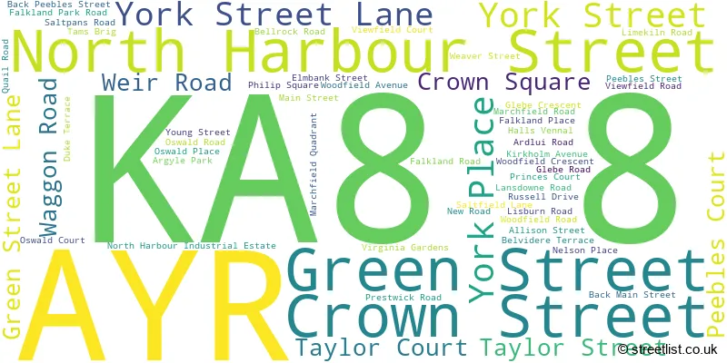
The KA8 8 postal code covers the settlement of AYR.
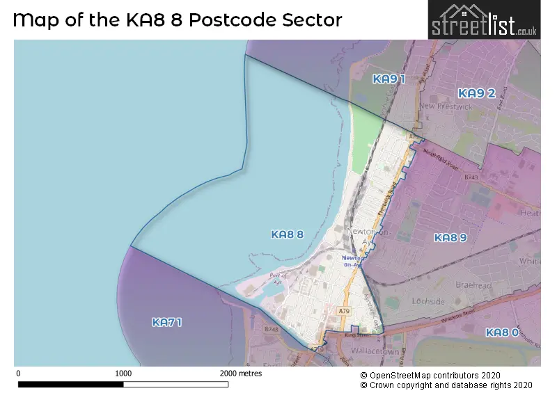
The KA8 8 Postcode shares a border with KA8 0 (AYR), KA9 1 (PRESTWICK, Monkton), KA9 2 (PRESTWICK, Monkton, Glasgow Prestwick Intnl Airport) and KA8 9 (AYR, Heathfield Industrial Estate).
The sector is within the post town of AYR.
KA8 8 is a postcode sector within the KA8 postcode district which is within the KA Kilmarnock postcode area.
The Royal Mail delivery office for the KA8 8 postal sector is the Ayr Delivery Office.
The area of the KA8 8 postcode sector is 0.54 square miles which is 1.39 square kilometres or 342.66 square acres.

Map of the KA8 8 Postcode Sector
Explore the KA8 8 postcode sector by using our free interactive map.
| K | A | 8 | - | 8 | X | X |
| K | A | 8 | Space | 8 | Letter | Letter |
Official List of Streets
AYR (58 Streets)
Unofficial Streets or Alternative Spellings
PRESTWICK
AYR ROADAYR
ALDERSTON AVENUE ANNPIT ROAD BELLESLEYHILL ROAD HAWKHILL AVENUE HEATHFIELD ROAD KING STREET LIMONDS WYND NEW BRIDGE STREET NORTHFIELD AVENUE RIVER STREET SEAFORTH ROAD TIG ROAD UNION AVENUE WHITLETTS ROAD DAMSIDE GRIFFIN DOCK ROAD MCCALLS AVENUE OSWALD LANE PROMENADE RUSSELL STREET SHORE ROAD SPUR ROADWeather Forecast for KA8 8
Press Button to Show Forecast for Ayr United F.C.
| Time Period | Icon | Description | Temperature | Rain Probability | Wind |
|---|---|---|---|---|---|
| 06:00 to 09:00 | Partly cloudy (day) | 3.0°C (feels like 2.0°C) | 1.00% | ENE 4 mph | |
| 09:00 to 12:00 | Partly cloudy (day) | 7.0°C (feels like 6.0°C) | 2.00% | NNE 4 mph | |
| 12:00 to 15:00 | Cloudy | 8.0°C (feels like 7.0°C) | 35.00% | NW 7 mph | |
| 15:00 to 18:00 | Cloudy | 8.0°C (feels like 7.0°C) | 9.00% | WNW 4 mph | |
| 18:00 to 21:00 | Cloudy | 8.0°C (feels like 7.0°C) | 9.00% | NW 4 mph | |
| 21:00 to 00:00 | Partly cloudy (night) | 5.0°C (feels like 4.0°C) | 3.00% | NNE 4 mph |
Press Button to Show Forecast for Ayr United F.C.
| Time Period | Icon | Description | Temperature | Rain Probability | Wind |
|---|---|---|---|---|---|
| 00:00 to 03:00 | Partly cloudy (night) | 4.0°C (feels like 2.0°C) | 1.00% | ENE 4 mph | |
| 03:00 to 06:00 | Mist | 3.0°C (feels like 1.0°C) | 12.00% | ENE 4 mph | |
| 06:00 to 09:00 | Mist | 3.0°C (feels like 2.0°C) | 12.00% | ENE 4 mph | |
| 09:00 to 12:00 | Cloudy | 8.0°C (feels like 7.0°C) | 7.00% | SE 4 mph | |
| 12:00 to 15:00 | Cloudy | 9.0°C (feels like 7.0°C) | 13.00% | NW 7 mph | |
| 15:00 to 18:00 | Cloudy | 9.0°C (feels like 8.0°C) | 18.00% | NW 7 mph | |
| 18:00 to 21:00 | Cloudy | 9.0°C (feels like 8.0°C) | 11.00% | WNW 4 mph | |
| 21:00 to 00:00 | Clear night | 7.0°C (feels like 5.0°C) | 3.00% | E 4 mph |
Press Button to Show Forecast for Ayr United F.C.
| Time Period | Icon | Description | Temperature | Rain Probability | Wind |
|---|---|---|---|---|---|
| 00:00 to 03:00 | Clear night | 5.0°C (feels like 4.0°C) | 4.00% | ENE 4 mph | |
| 03:00 to 06:00 | Partly cloudy (night) | 3.0°C (feels like 1.0°C) | 6.00% | N 7 mph | |
| 06:00 to 09:00 | Cloudy | 5.0°C (feels like 2.0°C) | 9.00% | N 7 mph | |
| 09:00 to 12:00 | Partly cloudy (day) | 8.0°C (feels like 6.0°C) | 10.00% | NNE 7 mph | |
| 12:00 to 15:00 | Cloudy | 10.0°C (feels like 8.0°C) | 15.00% | NW 7 mph | |
| 15:00 to 18:00 | Cloudy | 10.0°C (feels like 8.0°C) | 15.00% | WNW 11 mph | |
| 18:00 to 21:00 | Sunny day | 9.0°C (feels like 7.0°C) | 12.00% | WNW 11 mph | |
| 21:00 to 00:00 | Partly cloudy (night) | 7.0°C (feels like 5.0°C) | 9.00% | WNW 9 mph |
| The KA8 8 Sector is within these Local Authorities | |
|---|---|
| The KA8 8 Sector is within these Counties | |
| The KA8 8 Sector is within these Water Company Areas |