The L31 5 postcode sector is within the county of Merseyside.
Did you know? According to the 2021 Census, the L31 5 postcode sector is home to a bustling 3,438 residents!
Given that each sector allows for 400 unique postcode combinations. Letters C, I, K, M, O and V are not allowed in the last two letters of a postcode. With 62 postcodes already in use, this leaves 338 units available.
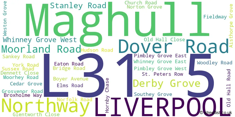
The largest settlements in the L31 5 postal code are LIVERPOOL and Maghull.
The L31 5 Postcode shares a border with L31 1 (Melling, Maghull, LIVERPOOL), L29 9 (LIVERPOOL, Sefton), L10 3 (LIVERPOOL, Aintree), L31 3 (LIVERPOOL, Maghull) and L31 7 (LIVERPOOL, Maghull).
The sector is within the post town of LIVERPOOL.
L31 5 is a postcode sector within the L31 postcode district which is within the L Liverpool postcode area.
The Royal Mail delivery office for the L31 5 postal sector is the Maghull Delivery Office.
The area of the L31 5 postcode sector is 0.27 square miles which is 0.70 square kilometres or 172.08 square acres.
Waterways within the L31 5 postcode sector include the Leeds and Liverpool Canal, River Alt.

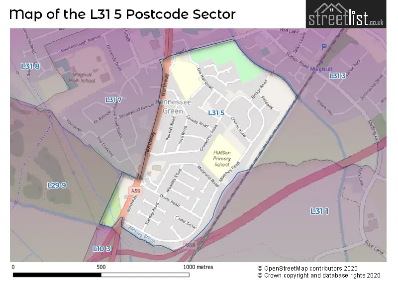
Map of the L31 5 Postcode Sector
Explore the L31 5 postcode sector by using our free interactive map.
| L | 3 | 1 | - | 5 | X | X |
| L | 3 | 1 | Space | 5 | Letter | Letter |
Official List of Streets
LIVERPOOL (23 Streets)
Unofficial Streets or Alternative Spellings
Maghull
HALL LANELIVERPOOL
BROADWOOD AVENUE GLENHOLM ROAD LIVERPOOL ROAD SOUTHAughton
NORTHWAY FOOTBRIDGEWeather Forecast for L31 5
Press Button to Show Forecast for Maghull
| Time Period | Icon | Description | Temperature | Rain Probability | Wind |
|---|---|---|---|---|---|
| 18:00 to 21:00 | Overcast | 8.0°C (feels like 7.0°C) | 48.00% | NNE 7 mph | |
| 21:00 to 00:00 | Cloudy | 7.0°C (feels like 5.0°C) | 7.00% | ENE 7 mph |
Press Button to Show Forecast for Maghull
| Time Period | Icon | Description | Temperature | Rain Probability | Wind |
|---|---|---|---|---|---|
| 00:00 to 03:00 | Cloudy | 6.0°C (feels like 4.0°C) | 4.00% | E 7 mph | |
| 03:00 to 06:00 | Partly cloudy (night) | 5.0°C (feels like 3.0°C) | 2.00% | ENE 7 mph | |
| 06:00 to 09:00 | Partly cloudy (day) | 5.0°C (feels like 3.0°C) | 2.00% | ENE 7 mph | |
| 09:00 to 12:00 | Cloudy | 8.0°C (feels like 6.0°C) | 5.00% | E 9 mph | |
| 12:00 to 15:00 | Cloudy | 10.0°C (feels like 8.0°C) | 48.00% | E 9 mph | |
| 15:00 to 18:00 | Light rain | 10.0°C (feels like 8.0°C) | 49.00% | ENE 7 mph | |
| 18:00 to 21:00 | Overcast | 9.0°C (feels like 7.0°C) | 12.00% | NE 9 mph | |
| 21:00 to 00:00 | Cloudy | 8.0°C (feels like 6.0°C) | 5.00% | NE 7 mph |
Press Button to Show Forecast for Maghull
| Time Period | Icon | Description | Temperature | Rain Probability | Wind |
|---|---|---|---|---|---|
| 00:00 to 03:00 | Partly cloudy (night) | 6.0°C (feels like 4.0°C) | 2.00% | NE 7 mph | |
| 03:00 to 06:00 | Cloudy | 5.0°C (feels like 3.0°C) | 4.00% | NNE 9 mph | |
| 06:00 to 09:00 | Cloudy | 6.0°C (feels like 3.0°C) | 8.00% | N 9 mph | |
| 09:00 to 12:00 | Cloudy | 8.0°C (feels like 5.0°C) | 10.00% | NNW 11 mph | |
| 12:00 to 15:00 | Partly cloudy (day) | 9.0°C (feels like 7.0°C) | 8.00% | NW 11 mph | |
| 15:00 to 18:00 | Sunny day | 10.0°C (feels like 7.0°C) | 8.00% | WNW 13 mph | |
| 18:00 to 21:00 | Sunny day | 10.0°C (feels like 8.0°C) | 3.00% | W 11 mph | |
| 21:00 to 00:00 | Clear night | 9.0°C (feels like 6.0°C) | 2.00% | SW 11 mph |
Press Button to Show Forecast for Maghull
| Time Period | Icon | Description | Temperature | Rain Probability | Wind |
|---|---|---|---|---|---|
| 00:00 to 03:00 | Clear night | 8.0°C (feels like 5.0°C) | 1.00% | SSW 9 mph | |
| 03:00 to 06:00 | Cloudy | 7.0°C (feels like 4.0°C) | 6.00% | S 9 mph | |
| 06:00 to 09:00 | Cloudy | 7.0°C (feels like 3.0°C) | 10.00% | SSE 11 mph | |
| 09:00 to 12:00 | Partly cloudy (day) | 10.0°C (feels like 7.0°C) | 2.00% | SSE 13 mph | |
| 12:00 to 15:00 | Cloudy | 13.0°C (feels like 10.0°C) | 8.00% | S 16 mph | |
| 15:00 to 18:00 | Overcast | 13.0°C (feels like 10.0°C) | 13.00% | S 16 mph | |
| 18:00 to 21:00 | Cloudy | 13.0°C (feels like 10.0°C) | 10.00% | SSE 16 mph | |
| 21:00 to 00:00 | Partly cloudy (night) | 11.0°C (feels like 9.0°C) | 3.00% | SSE 13 mph |
Press Button to Show Forecast for Maghull
| Time Period | Icon | Description | Temperature | Rain Probability | Wind |
|---|---|---|---|---|---|
| 00:00 to 03:00 | Partly cloudy (night) | 10.0°C (feels like 7.0°C) | 4.00% | SE 13 mph | |
| 03:00 to 06:00 | Cloudy | 9.0°C (feels like 6.0°C) | 7.00% | SE 13 mph | |
| 06:00 to 09:00 | Cloudy | 9.0°C (feels like 6.0°C) | 6.00% | SE 13 mph | |
| 09:00 to 12:00 | Partly cloudy (day) | 12.0°C (feels like 9.0°C) | 4.00% | SE 13 mph | |
| 12:00 to 15:00 | Partly cloudy (day) | 15.0°C (feels like 12.0°C) | 5.00% | SE 16 mph | |
| 15:00 to 18:00 | Cloudy | 16.0°C (feels like 13.0°C) | 11.00% | SE 13 mph | |
| 18:00 to 21:00 | Partly cloudy (day) | 15.0°C (feels like 13.0°C) | 6.00% | SE 11 mph | |
| 21:00 to 00:00 | Cloudy | 13.0°C (feels like 11.0°C) | 7.00% | ESE 11 mph |
Schools and Places of Education Within the L31 5 Postcode Sector
Hudson Primary School
Community school
Moorhey Road, Liverpool, Merseyside, L31 5LE
Head: Mrs Nicola Craddock
Ofsted Rating: Good
Inspection: 2023-07-19 (282 days ago)
Website: Visit Hudson Primary School Website
Phone: 01515261568
Number of Pupils: 304
St George's Catholic Primary School
Voluntary aided school
Dennett Close, Liverpool, Merseyside, L31 5PD
Head: Mr P Chapman
Ofsted Rating: Good
Inspection: 2023-01-25 (457 days ago)
Website: Visit St George's Catholic Primary School Website
Phone: 01512886630
Number of Pupils: 234
House Prices in the L31 5 Postcode Sector
| Type of Property | 2018 Average | 2018 Sales | 2017 Average | 2017 Sales | 2016 Average | 2016 Sales | 2015 Average | 2015 Sales |
|---|---|---|---|---|---|---|---|---|
| Detached | £246,750 | 4 | £227,488 | 4 | £222,500 | 2 | £192,590 | 5 |
| Semi-Detached | £154,000 | 40 | £153,150 | 31 | £146,474 | 35 | £147,070 | 25 |
| Terraced | £137,875 | 6 | £128,090 | 5 | £124,132 | 11 | £126,913 | 12 |
| Flats | £83,000 | 4 | £98,375 | 4 | £98,417 | 6 | £56,500 | 1 |
Important Postcodes L31 5 in the Postcode Sector
L31 5LE is the postcode for Hudson Primary School, Moorhey Road
L31 5PD is the postcode for St. Georges RC Primary School, Dennett Close
| The L31 5 Sector is within these Local Authorities |
|
|---|---|
| The L31 5 Sector is within these Counties |
|
| The L31 5 Sector is within these Water Company Areas |
|