The LN2 3 postcode sector is within the county of Lincolnshire.
Did you know? According to the 2021 Census, the LN2 3 postcode sector is home to a bustling 6,947 residents!
Given that each sector allows for 400 unique postcode combinations. Letters C, I, K, M, O and V are not allowed in the last two letters of a postcode. With 194 postcodes already in use, this leaves 206 units available.
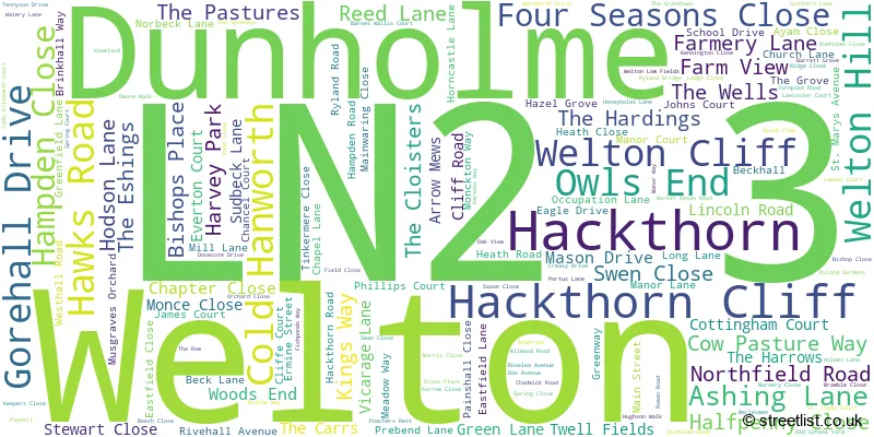
The largest settlement in the LN2 3 postal code is Welton followed by Dunholme, and Hackthorn.
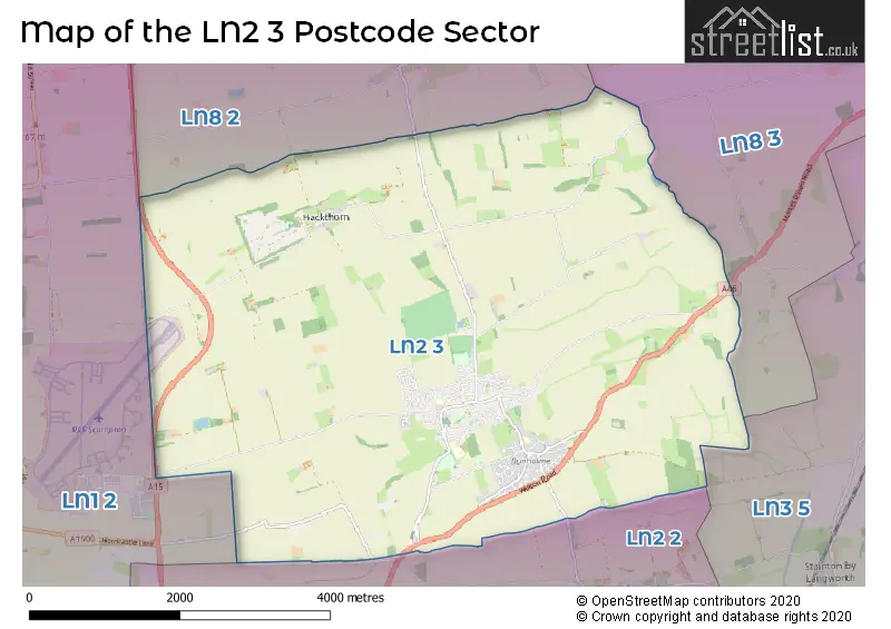
The LN2 3 Postcode shares a border with LN8 3 (MARKET RASEN, Middle Rasen, Tealby), LN1 2 (Saxilby, Sturton By Stow, Scampton), LN2 2 (LINCOLN, Nettleham, Sudbrooke), LN3 5 (Bardney, Langworth, Wickenby) and LN8 2 (Glentham, Normanby-by-Spital, Owmby-by-Spital).
The sector is within the post town of LINCOLN.
LN2 3 is a postcode sector within the LN2 postcode district which is within the LN Lincoln postcode area.
The Royal Mail delivery office for the LN2 3 postal sector is the Lincoln Delivery Office and Welton Scale Payment Delivery Office.
The area of the LN2 3 postcode sector is 14.89 square miles which is 38.57 square kilometres or 9,530.75 square acres.

Map of the LN2 3 Postcode Sector
Explore the LN2 3 postcode sector by using our free interactive map.
| L | N | 2 | - | 3 | X | X |
| L | N | 2 | Space | 3 | Letter | Letter |
Official List of Streets
Dunholme (48 Streets)
Welton (97 Streets)
Hackthorn (7 Streets)
Cold Hanworth (2 Streets)
Welton Hill (1 Streets)
Unofficial Streets or Alternative Spellings
Nettleham
WELTON ROADScothern
DUNHOLME ROAD ASHINGTON LANE BOMBER PASSAGE CREASEY DRIVE ERMINE CRESCENT ERMINE ROAD FROSLON COURT GREEN PASSAGE GREENWAY PARK PASSAGE HEATH LANE JANETS WAY MICKLEHOLME ROAD OCCUPATION PASSAGE OLD SCHOOL YARD PASSAGE PENNY LANE PILOT PASSAGE QUEENS WAY ROGERS PASSAGE SAINT CHADS COURT SMITHY LANE STONECLIFF PARK WALKER WALK WELTON CLIFF WETMOOR LANE WHARTON WALK WILLIAM FARR WALK WRIGHT WAYWeather Forecast for LN2 3
Press Button to Show Forecast for Scampton
| Time Period | Icon | Description | Temperature | Rain Probability | Wind |
|---|---|---|---|---|---|
| 06:00 to 09:00 | Partly cloudy (day) | 1.0°C (feels like -1.0°C) | 2.00% | NNW 4 mph | |
| 09:00 to 12:00 | Overcast | 7.0°C (feels like 6.0°C) | 17.00% | N 4 mph | |
| 12:00 to 15:00 | Cloudy | 8.0°C (feels like 7.0°C) | 11.00% | NE 7 mph | |
| 15:00 to 18:00 | Cloudy | 8.0°C (feels like 6.0°C) | 10.00% | ENE 7 mph | |
| 18:00 to 21:00 | Cloudy | 7.0°C (feels like 5.0°C) | 8.00% | ENE 7 mph | |
| 21:00 to 00:00 | Cloudy | 4.0°C (feels like 2.0°C) | 7.00% | ENE 4 mph |
Press Button to Show Forecast for Scampton
| Time Period | Icon | Description | Temperature | Rain Probability | Wind |
|---|---|---|---|---|---|
| 00:00 to 03:00 | Cloudy | 3.0°C (feels like 1.0°C) | 7.00% | ENE 4 mph | |
| 03:00 to 06:00 | Partly cloudy (night) | 2.0°C (feels like 0.0°C) | 6.00% | NE 4 mph | |
| 06:00 to 09:00 | Cloudy | 4.0°C (feels like 2.0°C) | 8.00% | ENE 7 mph | |
| 09:00 to 12:00 | Cloudy | 8.0°C (feels like 6.0°C) | 13.00% | E 9 mph | |
| 12:00 to 15:00 | Cloudy | 10.0°C (feels like 8.0°C) | 19.00% | E 11 mph | |
| 15:00 to 18:00 | Cloudy | 10.0°C (feels like 8.0°C) | 16.00% | ENE 11 mph | |
| 18:00 to 21:00 | Cloudy | 9.0°C (feels like 6.0°C) | 12.00% | ENE 11 mph | |
| 21:00 to 00:00 | Cloudy | 7.0°C (feels like 4.0°C) | 13.00% | NE 9 mph |
Press Button to Show Forecast for Scampton
| Time Period | Icon | Description | Temperature | Rain Probability | Wind |
|---|---|---|---|---|---|
| 00:00 to 03:00 | Cloudy | 7.0°C (feels like 4.0°C) | 20.00% | NE 11 mph | |
| 03:00 to 06:00 | Light rain | 7.0°C (feels like 4.0°C) | 51.00% | NE 13 mph | |
| 06:00 to 09:00 | Heavy rain | 8.0°C (feels like 4.0°C) | 78.00% | NE 13 mph | |
| 09:00 to 12:00 | Light rain | 10.0°C (feels like 7.0°C) | 54.00% | ENE 13 mph | |
| 12:00 to 15:00 | Heavy rain shower (day) | 11.0°C (feels like 8.0°C) | 56.00% | ENE 13 mph | |
| 15:00 to 18:00 | Heavy rain shower (day) | 10.0°C (feels like 8.0°C) | 61.00% | E 11 mph | |
| 18:00 to 21:00 | Light rain | 9.0°C (feels like 7.0°C) | 50.00% | ENE 11 mph | |
| 21:00 to 00:00 | Partly cloudy (night) | 7.0°C (feels like 5.0°C) | 8.00% | SSE 7 mph |
Schools and Places of Education Within the LN2 3 Postcode Sector
Dunholme St Chad's Church of England Primary School
Voluntary controlled school
Ryland Road, Lincoln, Lincolnshire, LN2 3NE
Head: Mrs Karen Appleby
Ofsted Rating: Requires improvement
Inspection: 2023-01-18 (464 days ago)
Website: Visit Dunholme St Chad's Church of England Primary School Website
Phone: 01673860597
Number of Pupils: 210
The Hackthorn Church of England Primary School
Voluntary controlled school
Main Street, Lincoln, Lincolnshire, LN2 3PF
Head: Mr David Gibbons
Ofsted Rating: Outstanding
Inspection: 2014-04-25 (3654 days ago)
Website: Visit The Hackthorn Church of England Primary School Website
Phone: 01673860295
Number of Pupils: 57
Welton St Mary's Church of England Primary Academy
Academy converter
School Drive, Lincoln, Lincolnshire, LN2 3LA
Head: Mrs Nicola Gough
Ofsted Rating: Good
Inspection: 2022-01-26 (821 days ago)
Website: Visit Welton St Mary's Church of England Primary Academy Website
Phone: 01673860339
Number of Pupils: 381
William Farr CofE Comprehensive School
Academy converter
Lincoln Road, Lincoln, Lincolnshire, LN2 3JB
Head: Mr Jonathan Knowler
Ofsted Rating: Good
Inspection: 2022-10-20 (554 days ago)
Website: Visit William Farr CofE Comprehensive School Website
Phone: 01673866900
Number of Pupils: 1428
House Prices in the LN2 3 Postcode Sector
| Type of Property | 2018 Average | 2018 Sales | 2017 Average | 2017 Sales | 2016 Average | 2016 Sales | 2015 Average | 2015 Sales |
|---|---|---|---|---|---|---|---|---|
| Detached | £281,705 | 111 | £274,595 | 77 | £248,672 | 72 | £253,166 | 93 |
| Semi-Detached | £171,284 | 34 | £169,882 | 17 | £146,994 | 27 | £155,509 | 22 |
| Terraced | £175,853 | 18 | £126,871 | 12 | £122,693 | 15 | £129,208 | 12 |
| Flats | £0 | 0 | £88,500 | 4 | £0 | 0 | £0 | 0 |
Important Postcodes LN2 3 in the Postcode Sector
LN2 3JH is the postcode for Health Centre, 4 Cliff Road
LN2 3LA is the postcode for St. Marys Primary School, School Drive, and St. Marys Primary School, School Drive, Welton
LN2 3NE is the postcode for ST CHADS CHURCH OF ENGLAND SCHOOL, RYLAND ROAD, DUNHOLME, Dunholme St. Chads C of E Primary School, Ryland Road, Dunholme, and Dunholme St. Chads C of E Primary School, Ryland Road
LN2 3PF is the postcode for Hackthorn C of E Primary School, Main Street
| The LN2 3 Sector is within these Local Authorities |
|
|---|---|
| The LN2 3 Sector is within these Counties |
|
| The LN2 3 Sector is within these Water Company Areas |
|