The LS14 3 postcode sector is within the county of West Yorkshire.
Did you know? According to the 2021 Census, the LS14 3 postcode sector is home to a bustling 3,198 residents!
Given that each sector allows for 400 unique postcode combinations. Letters C, I, K, M, O and V are not allowed in the last two letters of a postcode. With 126 postcodes already in use, this leaves 274 units available.
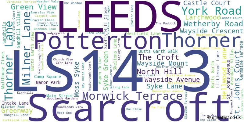
The largest settlement in the LS14 3 postal code is Thorner followed by Scarcroft, and LEEDS.
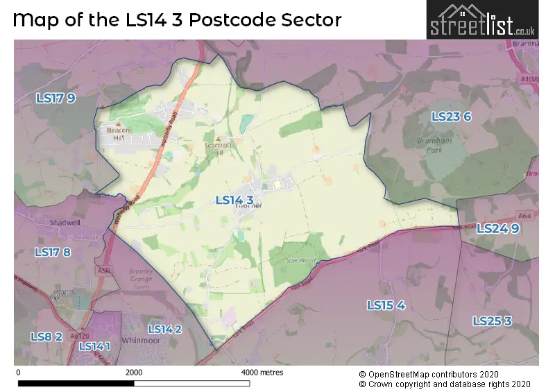
The LS14 3 Postcode shares a border with LS14 2 (LEEDS, Whinmoor), LS23 6 (Boston Spa, Bramham, Clifford), LS24 9 (TADCASTER, Church Fenton, Ulleskelf), LS15 4 (Barwick In Elmet, Scholes, LEEDS), LS17 8 (LEEDS, Shadwell, Moortown) and LS17 9 (Bardsey, Harewood, East Keswick).
The sector is within the post town of LEEDS.
LS14 3 is a postcode sector within the LS1 postcode district which is within the LS Leeds postcode area.
The Royal Mail delivery office for the LS14 3 postal sector is the Leeds City Delivery Office.
The area of the LS14 3 postcode sector is 6.35 square miles which is 16.44 square kilometres or 4,062.10 square acres.
Waterways within the LS14 3 postcode sector include the Collingham Beck.

Map of the LS14 3 Postcode Sector
Explore the LS14 3 postcode sector by using our free interactive map.
| L | S | 1 | 4 | - | 3 | X | X |
| L | S | 1 | 4 | Space | 3 | Letter | Letter |
Official List of Streets
Scarcroft (31 Streets)
Thorner (40 Streets)
LEEDS (7 Streets)
Potterton (2 Streets)
Unofficial Streets or Alternative Spellings
Scholes
SCHOLES LANELEEDS
BRANDON CRESCENT BARLEY MILL YARD BUTTS GARTH FARM CHAPEL WALK CHURCH FARM ELLERKER LANE ELTOFTS BRIDLEWAY KENNELS LANE KIDDAL HALL FARM KIDDAL LANE COTTAGES KIRK HILLS LOWER SANDHILLS MIRYCARR LANE PRESTON GINNEL SCARCROFT COURT SPION KOP STONEFIELD STONEY LANE THE JUBILEE BRIDGE THORNER ROAD WATERY LANEBardsey
BLACKMOOR LANE WETHERBY ROADSchools and Places of Education Within the LS14 3 Postcode Sector
Thorner Church of England Primary School
Academy converter
Kirkhills, Leeds, West Yorkshire, LS14 3JD
Head: Mrs Gemma Whawell
Ofsted Rating: Good
Inspection: 2022-11-02 (581 days ago)
Website: Visit Thorner Church of England Primary School Website
Phone: 01132892541
Number of Pupils: 202
House Prices in the LS14 3 Postcode Sector
| Type of Property | 2018 Average | 2018 Sales | 2017 Average | 2017 Sales | 2016 Average | 2016 Sales | 2015 Average | 2015 Sales |
|---|---|---|---|---|---|---|---|---|
| Detached | £590,643 | 21 | £653,815 | 30 | £588,179 | 32 | £591,744 | 38 |
| Semi-Detached | £290,042 | 6 | £305,167 | 6 | £282,083 | 12 | £278,750 | 6 |
| Terraced | £314,609 | 11 | £303,125 | 4 | £299,786 | 14 | £310,447 | 10 |
| Flats | £147,200 | 5 | £205,000 | 4 | £125,063 | 8 | £256,700 | 5 |
Important Postcodes LS14 3 in the Postcode Sector
LS14 3JD is the postcode for CEDAR-ELM BUILDING, Thorner C of E Primary School, Kirkhills, and MAIN BUILDING, Thorner C of E Primary School, Kirkhills
| The LS14 3 Sector is within these Local Authorities |
|
|---|---|
| The LS14 3 Sector is within these Counties |
|
| The LS14 3 Sector is within these Water Company Areas |
|