The MK13 7 postcode sector is within the county of Buckinghamshire.
Did you know? According to the 2021 Census, the MK13 7 postcode sector is home to a bustling 8,098 residents!
Given that each sector allows for 400 unique postcode combinations. Letters C, I, K, M, O and V are not allowed in the last two letters of a postcode. With 175 postcodes already in use, this leaves 225 units available.
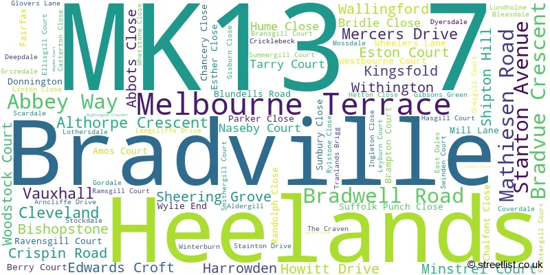
The largest settlements in the MK13 7 postal code are Bradville and Heelands.
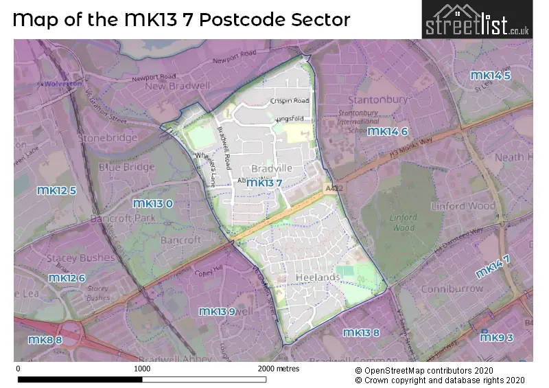
The MK13 7 Postcode shares a border with MK13 8 (Bradwell Common, Rooksley), MK13 9 (Bradwell, Bradwell Abbey), MK13 0 (New Bradwell, Bancroft, Blue Bridge) and MK14 6 (Stantonbury, Neath Hill, Oakridge Park).
The sector is within the post town of MILTON KEYNES.
MK13 7 is a postcode sector within the MK1 postcode district which is within the MK Milton Keynes postcode area.
The Royal Mail delivery office for the MK13 7 postal sector is the unknown.
The area of the MK13 7 postcode sector is 0.76 square miles which is 1.97 square kilometres or 487.23 square acres.
Waterways within the MK13 7 postcode sector include the Grand Union Canal.

Map of the MK13 7 Postcode Sector
Explore the MK13 7 postcode sector by using our free interactive map.
| M | K | 1 | 3 | - | 7 | X | X |
| M | K | 1 | 3 | Space | 7 | Letter | Letter |
Official List of Streets
Bradville (48 Streets)
Heelands (41 Streets)
Unofficial Streets or Alternative Spellings
Linford Wood
BRECKLAND SAXON STREETStantonbury
PURBECKBancroft
STONEGATECrownhill
DANSTEED WAYBradwell
RAWLINS ROADBlakelands
MONKS WAYWeather Forecast for MK13 7
Press Button to Show Forecast for Linford Wood
| Time Period | Icon | Description | Temperature | Rain Probability | Wind |
|---|---|---|---|---|---|
| 09:00 to 12:00 | Sunny day | 12.0°C (feels like 10.0°C) | 5.00% | SSW 9 mph | |
| 12:00 to 15:00 | Partly cloudy (day) | 15.0°C (feels like 13.0°C) | 9.00% | SSW 9 mph | |
| 15:00 to 18:00 | Cloudy | 16.0°C (feels like 14.0°C) | 13.00% | S 9 mph | |
| 18:00 to 21:00 | Cloudy | 15.0°C (feels like 13.0°C) | 12.00% | S 7 mph | |
| 21:00 to 00:00 | Partly cloudy (night) | 11.0°C (feels like 10.0°C) | 7.00% | SSE 7 mph |
Press Button to Show Forecast for Linford Wood
| Time Period | Icon | Description | Temperature | Rain Probability | Wind |
|---|---|---|---|---|---|
| 00:00 to 03:00 | Partly cloudy (night) | 9.0°C (feels like 8.0°C) | 10.00% | SSE 7 mph | |
| 03:00 to 06:00 | Cloudy | 8.0°C (feels like 6.0°C) | 11.00% | SSE 4 mph | |
| 06:00 to 09:00 | Cloudy | 9.0°C (feels like 8.0°C) | 9.00% | SSE 4 mph | |
| 09:00 to 12:00 | Overcast | 13.0°C (feels like 11.0°C) | 13.00% | SE 7 mph | |
| 12:00 to 15:00 | Overcast | 15.0°C (feels like 14.0°C) | 16.00% | SE 7 mph | |
| 15:00 to 18:00 | Light rain shower (day) | 15.0°C (feels like 14.0°C) | 35.00% | SW 7 mph | |
| 18:00 to 21:00 | Cloudy | 14.0°C (feels like 13.0°C) | 13.00% | SW 7 mph | |
| 21:00 to 00:00 | Cloudy | 11.0°C (feels like 10.0°C) | 9.00% | WSW 7 mph |
Schools and Places of Education Within the MK13 7 Postcode Sector
Heelands School
Community school
Glovers Lane, Milton Keynes, Buckinghamshire, MK13 7QL
Head: Mr Ian Fraser
Ofsted Rating: Good
Inspection: 2018-10-23 (2020 days ago)
Website: Visit Heelands School Website
Phone: 01908316306
Number of Pupils: 81
Pepper Hill School
Community school
Kingsfold, Milton Keynes, Buckinghamshire, MK13 7BQ
Head: Miss H Nicholson
Ofsted Rating: Good
Inspection: 2018-11-07 (2005 days ago)
Website: Visit Pepper Hill School Website
Phone: 01908221242
Number of Pupils: 141
Stanton School
Foundation school
Bradville, MILTON KEYNES, Buckinghamshire, MK13 7BE
Head: Miss Helen Nicholson
Ofsted Rating: Outstanding
Inspection: 2021-12-09 (877 days ago)
Website: Visit Stanton School Website
Phone: 01908221242
Number of Pupils: 311
House Prices in the MK13 7 Postcode Sector
| Type of Property | 2018 Average | 2018 Sales | 2017 Average | 2017 Sales | 2016 Average | 2016 Sales | 2015 Average | 2015 Sales |
|---|---|---|---|---|---|---|---|---|
| Detached | £383,526 | 19 | £341,858 | 25 | £297,375 | 16 | £296,097 | 20 |
| Semi-Detached | £235,794 | 50 | £231,837 | 40 | £212,753 | 49 | £185,581 | 30 |
| Terraced | £221,876 | 21 | £185,097 | 36 | £180,826 | 32 | £149,694 | 42 |
| Flats | £139,000 | 7 | £127,000 | 5 | £99,500 | 6 | £103,321 | 7 |
Important Postcodes MK13 7 in the Postcode Sector
MK13 7AG is the postcode for MATHIESON ROAD CLINIC, 6, Mathiesen Road, Bradville, and MATHIESON ROAD CLINIC, 4, Mathiesen Road, Bradville
MK13 7BE is the postcode for Stanton School, Bradville
MK13 7BQ is the postcode for RAINBOW CHILDREN'S CENTRE, Pepper Hill First School, Kingsfold, and Pepper Hill First School, Kingsfold
MK13 7QL is the postcode for Heelands School, Glovers Lane
| The MK13 7 Sector is within these Local Authorities |
|
|---|---|
| The MK13 7 Sector is within these Counties |
|
| The MK13 7 Sector is within these Water Company Areas |
|