The NP24 postcode district is a postal district located in the NP Newport postcode area with a population of 4,640 residents according to the 2021 England and Wales Census.
The area of the NP24 postcode district is 3.41 square miles which is 8.83 square kilometres or 2,180.94 acres.
Currently, the NP24 district has about 148 postcode units spread across 1 geographic postcode sectors.
Given that each sector allows for 400 unique postcode combinations, the district has a capacity of 400 postcodes. With 148 postcodes already in use, this leaves 252 units available.
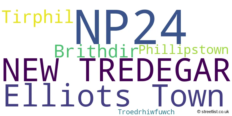
The largest settlement in the NP24 postal code is ELLIOT'S TOWN followed by PHILLIPSTOWN, and NEW TREDEGAR.
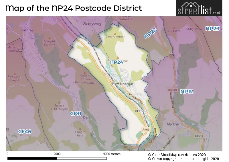
The NP24 Postcode shares a border with NP12 (BLACKWOOD, PONTLLANFRAITH, CEFN FFOREST), CF81 (BARGOED, ABERBARGOED, GILFACH) and NP22 (TREDEGAR, RHYMNEY, ABERTYSSWG).
The primary settlement in the NP24 postcode district is New Tredegar, located in Gwent, Wales. Other significant settlements in the district include Brithdir, Elliots Town, Phillipstown, Tirphil, and Troedrhiwfuwch. The most significant post town in the district is New Tredegar.
For the district NP24, we have data on 1 postcode sectors. Here's a breakdown: The sector NP24 6, covers New Tredegar and Elliots Town and Brithdir and Tirphil and Phillipstown in Gwent.
NP24 Postcode Sectors

Map of the NP24 Postcode District
Explore the NP24 postcode district by using our free interactive map.
When it comes to local government, postal geography often disregards political borders. However, for a breakdown in the NP24 District: the district mostly encompasses the Caerffili - Caerphilly area with a total of 147 postcodes.
Recent House Sales in NP24
| Date | Price | Address |
|---|---|---|
| 30/08/2023 | £50,000 | Pritchard Terrace, Phillipstown, New Tredegar, NP24 6BS |
| 07/08/2023 | £130,000 | School Street, Elliots Town, New Tredegar, NP24 6DW |
| 04/08/2023 | £70,000 | James Street, New Tredegar, NP24 6EN |
| 28/07/2023 | £117,000 | Fothergills Road, New Tredegar, NP24 6AP |
| 24/07/2023 | £43,000 | Derlwyn Street, Phillipstown, New Tredegar, NP24 6BA |
| 05/07/2023 | £112,500 | Pleasant View, Tirphil, New Tredegar, NP24 6HQ |
| 04/07/2023 | £90,000 | Derlwyn Street, Phillipstown, New Tredegar, NP24 6BA |
| 30/06/2023 | £97,000 | Jubilee Road, New Tredegar, NP24 6NY |
| 22/06/2023 | £97,500 | Phillips Street, Elliots Town, New Tredegar, NP24 6DT |
| 09/06/2023 | £130,000 | Sunnybank, Tirphil, New Tredegar, NP24 6EL |
Where is the NP24 Postcode District?
The data states that the postcode district for NP24 is located in New Tredegar. New Tredegar is near several towns: Bargoed to the south, Tredegar to the north, Ebbw Vale to the northeast, Blackwood to the southeast, Abertillery to the east, Treharris to the southwest, and Merthyr Tydfil to the west. Furthermore, the distance from New Tredegar to the center of London is 134.78 miles.
The district is within the post town of NEW TREDEGAR.
The sector has postcodes within the nation of Wales.
The NP24 Postcode District is in the Gwent Valleys region of West Wales within the Wales.
Weather Forecast for NP24
Press Button to Show Forecast for Bargoed
| Time Period | Icon | Description | Temperature | Rain Probability | Wind |
|---|---|---|---|---|---|
| 15:00 to 18:00 | Light rain shower (day) | 15.0°C (feels like 12.0°C) | 38.00% | SSE 13 mph | |
| 18:00 to 21:00 | Light rain shower (day) | 14.0°C (feels like 12.0°C) | 63.00% | SE 11 mph | |
| 21:00 to 00:00 | Cloudy | 12.0°C (feels like 11.0°C) | 7.00% | ESE 9 mph |
Press Button to Show Forecast for Bargoed
| Time Period | Icon | Description | Temperature | Rain Probability | Wind |
|---|---|---|---|---|---|
| 00:00 to 03:00 | Cloudy | 11.0°C (feels like 10.0°C) | 6.00% | ESE 9 mph | |
| 03:00 to 06:00 | Overcast | 11.0°C (feels like 9.0°C) | 9.00% | ESE 9 mph | |
| 06:00 to 09:00 | Overcast | 11.0°C (feels like 9.0°C) | 8.00% | ESE 9 mph | |
| 09:00 to 12:00 | Light rain shower (day) | 13.0°C (feels like 11.0°C) | 29.00% | ESE 11 mph | |
| 12:00 to 15:00 | Light rain shower (day) | 16.0°C (feels like 13.0°C) | 27.00% | SE 11 mph | |
| 15:00 to 18:00 | Partly cloudy (day) | 16.0°C (feels like 14.0°C) | 5.00% | SE 11 mph | |
| 18:00 to 21:00 | Partly cloudy (day) | 15.0°C (feels like 14.0°C) | 3.00% | SE 7 mph | |
| 21:00 to 00:00 | Clear night | 11.0°C (feels like 10.0°C) | 1.00% | ESE 4 mph |
Press Button to Show Forecast for Bargoed
| Time Period | Icon | Description | Temperature | Rain Probability | Wind |
|---|---|---|---|---|---|
| 00:00 to 03:00 | Clear night | 9.0°C (feels like 9.0°C) | 2.00% | E 2 mph | |
| 03:00 to 06:00 | Clear night | 8.0°C (feels like 7.0°C) | 2.00% | NE 4 mph | |
| 06:00 to 09:00 | Sunny day | 10.0°C (feels like 10.0°C) | 2.00% | NE 4 mph | |
| 09:00 to 12:00 | Cloudy | 14.0°C (feels like 13.0°C) | 7.00% | ESE 7 mph | |
| 12:00 to 15:00 | Light rain shower (day) | 16.0°C (feels like 15.0°C) | 30.00% | SE 7 mph | |
| 15:00 to 18:00 | Cloudy | 17.0°C (feels like 16.0°C) | 13.00% | SSE 4 mph | |
| 18:00 to 21:00 | Cloudy | 15.0°C (feels like 15.0°C) | 14.00% | S 4 mph | |
| 21:00 to 00:00 | Cloudy | 12.0°C (feels like 11.0°C) | 12.00% | WNW 4 mph |
Press Button to Show Forecast for Bargoed
| Time Period | Icon | Description | Temperature | Rain Probability | Wind |
|---|---|---|---|---|---|
| 00:00 to 03:00 | Cloudy | 11.0°C (feels like 10.0°C) | 9.00% | NW 4 mph | |
| 03:00 to 06:00 | Cloudy | 10.0°C (feels like 9.0°C) | 8.00% | NW 4 mph | |
| 06:00 to 09:00 | Partly cloudy (day) | 11.0°C (feels like 11.0°C) | 5.00% | WNW 4 mph | |
| 09:00 to 12:00 | Partly cloudy (day) | 15.0°C (feels like 14.0°C) | 7.00% | WNW 4 mph | |
| 12:00 to 15:00 | Light rain shower (day) | 17.0°C (feels like 16.0°C) | 39.00% | WSW 7 mph | |
| 15:00 to 18:00 | Light rain shower (day) | 17.0°C (feels like 16.0°C) | 42.00% | W 7 mph | |
| 18:00 to 21:00 | Light rain shower (day) | 16.0°C (feels like 15.0°C) | 37.00% | WNW 7 mph | |
| 21:00 to 00:00 | Clear night | 12.0°C (feels like 11.0°C) | 4.00% | NW 4 mph |
Press Button to Show Forecast for Bargoed
| Time Period | Icon | Description | Temperature | Rain Probability | Wind |
|---|---|---|---|---|---|
| 00:00 to 03:00 | Clear night | 10.0°C (feels like 10.0°C) | 2.00% | NNW 4 mph | |
| 03:00 to 06:00 | Fog | 9.0°C (feels like 8.0°C) | 14.00% | NW 4 mph | |
| 06:00 to 09:00 | Fog | 11.0°C (feels like 10.0°C) | 14.00% | N 4 mph | |
| 09:00 to 12:00 | Partly cloudy (day) | 15.0°C (feels like 14.0°C) | 2.00% | NNE 7 mph | |
| 12:00 to 15:00 | Light rain shower (day) | 17.0°C (feels like 16.0°C) | 30.00% | NNE 7 mph | |
| 15:00 to 18:00 | Light rain shower (day) | 17.0°C (feels like 16.0°C) | 32.00% | N 7 mph | |
| 18:00 to 21:00 | Light rain shower (day) | 16.0°C (feels like 15.0°C) | 31.00% | NNE 9 mph | |
| 21:00 to 00:00 | Clear night | 13.0°C (feels like 12.0°C) | 5.00% | NNE 7 mph |
Postcode Sectors within the NP24 District
| Postcode Sector | Delivery Office |
|---|---|
| NP24 6 | Tredegar Delivery Office |
| N | P | 2 | 4 | - | X | X | X |
| N | P | 2 | 4 | Space | Numeric | Letter | Letter |
Current Monthly Rental Prices
| # Bedrooms | Min Price | Max Price | Avg Price |
|---|---|---|---|
| 3 | £625 | £625 | £625 |
| 4 | £800 | £800 | £800 |
Current House Prices
| # Bedrooms | Min Price | Max Price | Avg Price |
|---|---|---|---|
| £18,000 | £130,000 | £74,000 | |
| 1 | £55,000 | £130,000 | £92,500 |
| 2 | £79,950 | £250,000 | £129,994 |
| 3 | £65,000 | £130,000 | £101,355 |
| 4 | £220,000 | £415,000 | £317,500 |
| 15 | £150,000 | £150,000 | £150,000 |
Estate Agents who Operate in the NP24 District
| Logo | Name | Brand Name | Address | Contact Number | Total Properties |
|---|---|---|---|---|---|
 | Blackwood | Peter Alan | 131 High Street, Blackwood, NP12 1AB | 01495 364679 | 6 |
 | Merthyr Tydfil | Darlows | 32 Victoria Street, Merthyr Tydfil, CF47 8BW | 01685 708673 | 5 |
 | Newport | Pinkmove | 30 Bridge Street Newport NP20 4BG | 01633 603386 | 3 |
 | Newport | Flying Keys | Ty mawr farm Crumlin, NP11 3BS | 01495 243473 | 2 |
 | Blackwood | Parkmans | 107 High Street, Blackwood NP12 1AD | 01495 364618 | 2 |
Yearly House Price Averages for the NP24 Postcode District
| Type of Property | 2018 Average | 2018 Sales | 2017 Average | 2017 Sales | 2016 Average | 2016 Sales | 2015 Average | 2015 Sales |
|---|---|---|---|---|---|---|---|---|
| Detached | £0 | 0 | £223,490 | 5 | £241,000 | 2 | £171,650 | 3 |
| Semi-Detached | £141,750 | 2 | £85,888 | 4 | £79,124 | 4 | £84,078 | 4 |
| Terraced | £65,673 | 58 | £59,300 | 70 | £54,684 | 57 | £55,667 | 50 |
| Flats | £0 | 0 | £56,750 | 2 | £0 | 0 | £0 | 0 |