The NR12 7 postcode sector is within the county of Norfolk.
Did you know? According to the 2021 Census, the NR12 7 postcode sector is home to a bustling 3,581 residents!
Given that each sector allows for 400 unique postcode combinations. Letters C, I, K, M, O and V are not allowed in the last two letters of a postcode. With 144 postcodes already in use, this leaves 256 units available.
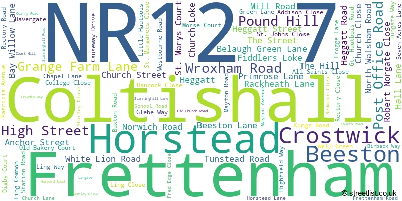
The largest settlement in the NR12 7 postal code is Coltishall followed by Horstead, and Frettenham.
The NR12 7 Postcode shares a border with NR10 3 (Horsford, Spixworth, Horsham St. Faith), NR10 5 (Badersfield, Hevingham, Buxton), NR6 6 (NORWICH), NR6 7 (NORWICH, Old Catton), NR7 8 (NORWICH, Sprowston), NR12 8 (Hoveton, Horning, Wroxham) and NR13 6 (Rackheath, Salhouse, South Walsham).
The sector is within the post town of NORWICH.
NR12 7 is a postcode sector within the NR1 postcode district which is within the NR Norwich postcode area.
The Royal Mail delivery office for the NR12 7 postal sector is the unknown.
The area of the NR12 7 postcode sector is 11.99 square miles which is 31.06 square kilometres or 7,675.28 square acres.
Waterways within the NR12 7 postcode sector include the River Bure.

Map of the NR12 7 Postcode Sector
Explore the NR12 7 postcode sector by using our free interactive map.
| N | R | 1 | 2 | - | 7 | X | X |
| N | R | 1 | 2 | Space | 7 | Letter | Letter |
Official List of Streets
Coltishall (34 Streets)
Horstead (24 Streets)
Frettenham (21 Streets)
Crostwick (7 Streets)
Beeston (2 Streets)
Unofficial Streets or Alternative Spellings
Spixworth
CROSTWICK LANE QUAKER LANE TRAFFORD WAYBelaugh
COLTISHALL ROADTunstead
COLTISHALL LANEBadersfield
HAUTBOIS ROADLamas
LITTLE HAUTBOIS ROADHainford
OLD CHURCH ROAD SPIXWORTH ROADSprowston
CHURCH LANEWeather Forecast for NR12 7
Press Button to Show Forecast for Wroxham
| Time Period | Icon | Description | Temperature | Rain Probability | Wind |
|---|---|---|---|---|---|
| 18:00 to 21:00 | Overcast | 9.0°C (feels like 6.0°C) | 10.00% | NE 9 mph | |
| 21:00 to 00:00 | Heavy rain | 8.0°C (feels like 6.0°C) | 90.00% | NE 11 mph |
Press Button to Show Forecast for Wroxham
| Time Period | Icon | Description | Temperature | Rain Probability | Wind |
|---|---|---|---|---|---|
| 00:00 to 03:00 | Heavy rain | 9.0°C (feels like 6.0°C) | 93.00% | NE 11 mph | |
| 03:00 to 06:00 | Heavy rain | 10.0°C (feels like 8.0°C) | 88.00% | ESE 9 mph | |
| 06:00 to 09:00 | Light rain | 11.0°C (feels like 8.0°C) | 43.00% | SSE 11 mph | |
| 09:00 to 12:00 | Light rain | 11.0°C (feels like 9.0°C) | 47.00% | S 13 mph | |
| 12:00 to 15:00 | Thunder | 13.0°C (feels like 9.0°C) | 81.00% | SSW 16 mph | |
| 15:00 to 18:00 | Light rain | 8.0°C (feels like 4.0°C) | 49.00% | WSW 18 mph | |
| 18:00 to 21:00 | Cloudy | 9.0°C (feels like 6.0°C) | 9.00% | SW 11 mph | |
| 21:00 to 00:00 | Partly cloudy (night) | 8.0°C (feels like 5.0°C) | 6.00% | SSW 9 mph |
Press Button to Show Forecast for Wroxham
| Time Period | Icon | Description | Temperature | Rain Probability | Wind |
|---|---|---|---|---|---|
| 00:00 to 03:00 | Clear night | 7.0°C (feels like 4.0°C) | 0.00% | SSW 9 mph | |
| 03:00 to 06:00 | Clear night | 6.0°C (feels like 3.0°C) | 0.00% | SSW 7 mph | |
| 06:00 to 09:00 | Sunny day | 6.0°C (feels like 4.0°C) | 0.00% | SSW 9 mph | |
| 09:00 to 12:00 | Sunny day | 12.0°C (feels like 10.0°C) | 0.00% | SSW 11 mph | |
| 12:00 to 15:00 | Cloudy | 15.0°C (feels like 12.0°C) | 6.00% | S 13 mph | |
| 15:00 to 18:00 | Sunny day | 15.0°C (feels like 12.0°C) | 2.00% | S 16 mph | |
| 18:00 to 21:00 | Sunny day | 13.0°C (feels like 11.0°C) | 1.00% | SSE 11 mph | |
| 21:00 to 00:00 | Clear night | 9.0°C (feels like 7.0°C) | 0.00% | SSE 9 mph |
Press Button to Show Forecast for Wroxham
| Time Period | Icon | Description | Temperature | Rain Probability | Wind |
|---|---|---|---|---|---|
| 00:00 to 03:00 | Clear night | 8.0°C (feels like 6.0°C) | 1.00% | SE 7 mph | |
| 03:00 to 06:00 | Partly cloudy (night) | 8.0°C (feels like 6.0°C) | 1.00% | ESE 7 mph | |
| 06:00 to 09:00 | Partly cloudy (day) | 10.0°C (feels like 9.0°C) | 3.00% | ESE 7 mph | |
| 09:00 to 12:00 | Cloudy | 14.0°C (feels like 12.0°C) | 8.00% | SE 9 mph | |
| 12:00 to 15:00 | Cloudy | 15.0°C (feels like 14.0°C) | 7.00% | SE 9 mph | |
| 15:00 to 18:00 | Cloudy | 15.0°C (feels like 14.0°C) | 5.00% | ESE 9 mph | |
| 18:00 to 21:00 | Cloudy | 14.0°C (feels like 13.0°C) | 8.00% | ESE 7 mph | |
| 21:00 to 00:00 | Cloudy | 12.0°C (feels like 11.0°C) | 23.00% | ESE 7 mph |
Press Button to Show Forecast for Wroxham
| Time Period | Icon | Description | Temperature | Rain Probability | Wind |
|---|---|---|---|---|---|
| 00:00 to 03:00 | Light rain shower (night) | 12.0°C (feels like 11.0°C) | 30.00% | E 7 mph | |
| 03:00 to 06:00 | Cloudy | 11.0°C (feels like 10.0°C) | 11.00% | E 4 mph | |
| 06:00 to 09:00 | Cloudy | 12.0°C (feels like 11.0°C) | 10.00% | E 4 mph | |
| 09:00 to 12:00 | Cloudy | 15.0°C (feels like 14.0°C) | 7.00% | ENE 7 mph | |
| 12:00 to 15:00 | Partly cloudy (day) | 16.0°C (feels like 15.0°C) | 5.00% | NE 9 mph | |
| 15:00 to 18:00 | Cloudy | 15.0°C (feels like 14.0°C) | 7.00% | NE 9 mph | |
| 18:00 to 21:00 | Cloudy | 13.0°C (feels like 11.0°C) | 5.00% | NE 9 mph | |
| 21:00 to 00:00 | Cloudy | 11.0°C (feels like 9.0°C) | 6.00% | NE 7 mph |
Schools and Places of Education Within the NR12 7 Postcode Sector
Coltishall Primary School
Community school
St John's Close, Norwich, Norfolk, NR12 7HA
Head: Mr Dan Mckeown
Ofsted Rating: Outstanding
Inspection: 2013-12-06 (3795 days ago)
Website: Visit Coltishall Primary School Website
Phone: 01603737481
Number of Pupils: 198
Frettenham Primary School
Community school
School Road, Norwich, Norfolk, NR12 7LL
Head: Mrs Ashley Best-White
Ofsted Rating: Good
Inspection: 2018-07-12 (2116 days ago)
Website: Visit Frettenham Primary School Website
Phone: 01603737405
Number of Pupils: 70

House Prices in the NR12 7 Postcode Sector
| Type of Property | 2018 Average | 2018 Sales | 2017 Average | 2017 Sales | 2016 Average | 2016 Sales | 2015 Average | 2015 Sales |
|---|---|---|---|---|---|---|---|---|
| Detached | £388,949 | 37 | £392,630 | 27 | £335,700 | 35 | £292,598 | 23 |
| Semi-Detached | £239,727 | 11 | £243,318 | 14 | £225,143 | 14 | £207,908 | 6 |
| Terraced | £272,333 | 12 | £246,375 | 12 | £220,938 | 9 | £200,405 | 21 |
| Flats | £137,000 | 2 | £179,333 | 3 | £98,000 | 1 | £169,000 | 2 |
Important Postcodes NR12 7 in the Postcode Sector
NR12 7HA is the postcode for Coltishall Community Primary School, 5 St. Johns Close, and Coltishall Medical Practice, 3 St. Johns Close
| The NR12 7 Sector is within these Local Authorities |
|
|---|---|
| The NR12 7 Sector is within these Counties |
|
| The NR12 7 Sector is within these Water Company Areas |
|