The OX18 3 postcode sector is within the county of Oxfordshire.
Did you know? According to the 2021 Census, the OX18 3 postcode sector is home to a bustling 10,264 residents!
Given that each sector allows for 400 unique postcode combinations. Letters C, I, K, M, O and V are not allowed in the last two letters of a postcode. With 247 postcodes already in use, this leaves 153 units available.
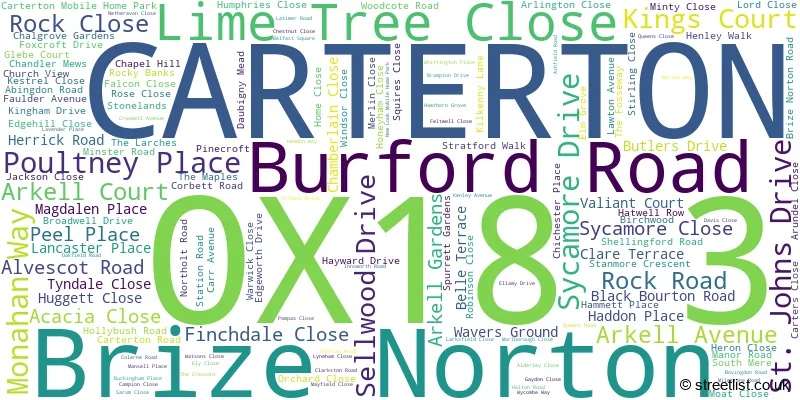
The largest settlements in the OX18 3 postal code are CARTERTON and Brize Norton.
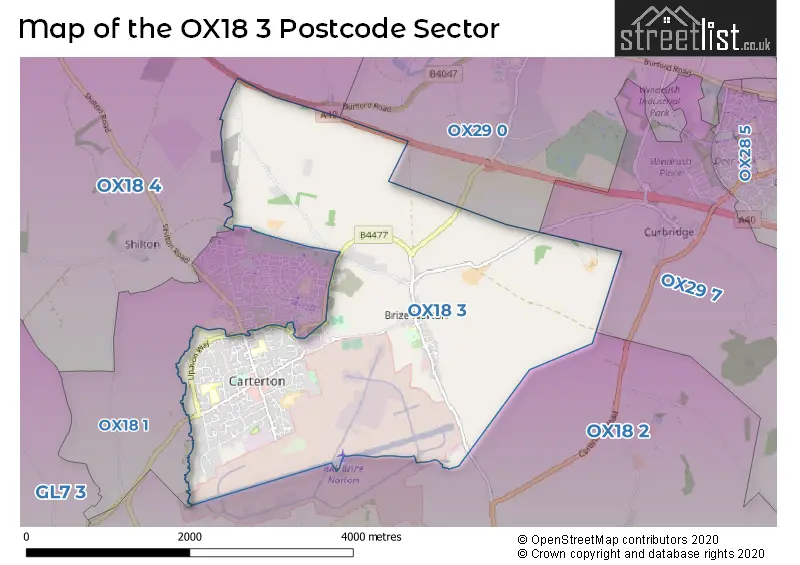
The OX18 3 Postcode shares a border with OX18 1 (CARTERTON, Brize Norton), OX18 2 (BAMPTON, Aston, Clanfield), OX18 4 (BURFORD, Fulbrook, Shilton), OX29 0 (Minster Lovell, Curbridge, WITNEY) and OX29 7 (WITNEY, Ducklington, Standlake).
The sector is within the post town of CARTERTON.
OX18 3 is a postcode sector within the OX1 postcode district which is within the OX Oxford postcode area.
The Royal Mail delivery office for the OX18 3 postal sector is the Oxford Delivery Office.
The area of the OX18 3 postcode sector is 5.69 square miles which is 14.74 square kilometres or 3,643.30 square acres.

Map of the OX18 3 Postcode Sector
Explore the OX18 3 postcode sector by using our free interactive map.
| O | X | 1 | 8 | - | 3 | X | X |
| O | X | 1 | 8 | Space | 3 | Letter | Letter |
Official List of Streets
CARTERTON (119 Streets)
Brize Norton (23 Streets)
Schools and Places of Education Within the OX18 3 Postcode Sector
Edith Moorhouse Primary School
Academy converter
Lawton Avenue, Carterton, Oxfordshire, OX18 3HP
Head: Mrs Pam Evans
Ofsted Rating: Good
Inspection: 2019-10-23 (1677 days ago)
Website: Visit Edith Moorhouse Primary School Website
Phone: 01993842372
Number of Pupils: 370
Gateway Primary School
Community school
Netheravon Close, Carterton, Oxfordshire, OX18 3SF
Head: Mrs Kayleigh Anstee
Ofsted Rating: Good
Inspection: 2023-03-01 (452 days ago)
Website: Visit Gateway Primary School Website
Phone: 01993842189
Number of Pupils: 239
St Joseph's Catholic Primary School, Carterton
Academy converter
Lawton Avenue, Carterton, Oxfordshire, OX18 3JY
Head: Ms Cheryl MacLennan
Ofsted Rating: Good
Inspection: 2023-11-22 (186 days ago)
Website: Visit St Joseph's Catholic Primary School, Carterton Website
Phone: 01993841240
Number of Pupils: 100
House Prices in the OX18 3 Postcode Sector
| Type of Property | 2018 Average | 2018 Sales | 2017 Average | 2017 Sales | 2016 Average | 2016 Sales | 2015 Average | 2015 Sales |
|---|---|---|---|---|---|---|---|---|
| Detached | £357,267 | 45 | £335,292 | 24 | £351,581 | 44 | £314,762 | 41 |
| Semi-Detached | £311,161 | 28 | £283,543 | 35 | £282,315 | 17 | £252,208 | 31 |
| Terraced | £265,056 | 18 | £239,697 | 19 | £228,573 | 28 | £223,666 | 22 |
| Flats | £152,278 | 9 | £177,471 | 9 | £158,148 | 20 | £146,222 | 29 |
Important Postcodes OX18 3 in the Postcode Sector
OX18 3AD is the postcode for Carterton Primary School, Burford Road, and BLOCK A, Carterton Primary School, Burford Road
OX18 3AN is the postcode for The Sports Pavilion, Monahan Way
OX18 3HP is the postcode for Edith Moorhouse Primary School, Lawton Avenue
OX18 3JY is the postcode for St. Josephs Primary School, Lawton Avenue
OX18 3PL is the postcode for Brize Norton Primary School, 10 Station Road
OX18 3SF is the postcode for A BLOCK, Gateway School, Netheravon Close, and D BLOCK (HALL), Gateway School, Netheravon Close
| The OX18 3 Sector is within these Local Authorities |
|
|---|---|
| The OX18 3 Sector is within these Counties |
|
| The OX18 3 Sector is within these Water Company Areas |
|