The PE22 9 postcode sector is within the county of Lincolnshire.
Did you know? According to the 2021 Census, the PE22 9 postcode sector is home to a bustling 3,655 residents!
Given that each sector allows for 400 unique postcode combinations. Letters C, I, K, M, O and V are not allowed in the last two letters of a postcode. With 184 postcodes already in use, this leaves 216 units available.
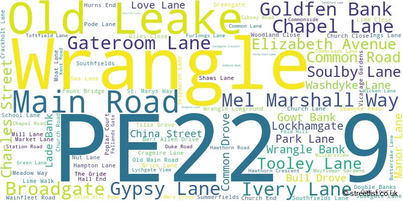
The largest settlements in the PE22 9 postal code are Old Leake and Wrangle.
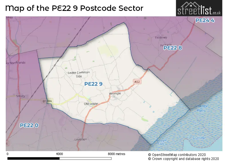
The PE22 9 Postcode shares a border with PE22 0 (Sibsey, Butterwick, Freiston) and PE22 8 (Stickney, Friskney, Stickford).
The sector is within the post town of BOSTON.
PE22 9 is a postcode sector within the PE2 postcode district which is within the PE Peterborough postcode area.
The Royal Mail delivery office for the PE22 9 postal sector is the Peterborough South Postal Delivery Office.
The area of the PE22 9 postcode sector is 20.11 square miles which is 52.09 square kilometres or 12,870.82 square acres.
Waterways within the PE22 9 postcode sector include the Hobhole Drain.

Map of the PE22 9 Postcode Sector
Explore the PE22 9 postcode sector by using our free interactive map.
| P | E | 2 | 2 | - | 9 | X | X |
| P | E | 2 | 2 | Space | 9 | Letter | Letter |
Official List of Streets
Old Leake (62 Streets)
Wrangle (36 Streets)
Unofficial Streets or Alternative Spellings
Old Leake
HUNSTAN LANE SHAWS LANEFreiston Ings
HOBHOLE BANKSibsey
STATION ROADFriskney
CLAXY BANK HOLLAND LANEEastville
BOSTON ROADLeverton
HIGHGATE OLDFIELD LANEBenington
MAIN ROADSchools and Places of Education Within the PE22 9 Postcode Sector
The Giles Academy
Academy sponsor led
Church Lane, Boston, Lincolnshire, PE22 9LD
Head: Mrs Lucy Conley
Ofsted Rating: Good
Inspection: 2023-05-11 (390 days ago)
Website: Visit The Giles Academy Website
Phone: 01205870693
Number of Pupils: 768
House Prices in the PE22 9 Postcode Sector
| Type of Property | 2018 Average | 2018 Sales | 2017 Average | 2017 Sales | 2016 Average | 2016 Sales | 2015 Average | 2015 Sales |
|---|---|---|---|---|---|---|---|---|
| Detached | £194,391 | 29 | £215,498 | 45 | £191,863 | 52 | £184,560 | 45 |
| Semi-Detached | £124,590 | 5 | £128,714 | 7 | £126,778 | 9 | £108,891 | 11 |
| Terraced | £124,875 | 2 | £166,500 | 5 | £113,000 | 1 | £119,500 | 7 |
| Flats | £0 | 0 | £0 | 0 | £0 | 0 | £0 | 0 |
Important Postcodes PE22 9 in the Postcode Sector
PE22 9AS is the postcode for Wrangle Primary School, Main Road, Wrangle, and Wrangle Primary School, Main Road
PE22 9HR is the postcode for Old Leake Primary School, Old Main Road, and OLD LEAKE PRIMARY AND NURSERY SCHOOL, OLD MAIN ROAD, OLD LEAKE
PE22 9LD is the postcode for ARTS BUILDING, The Giles School, Church End, MAIN SCHOOL, The Giles School, Church End, and ENGLISH BUILDING, The Giles School, Church End
| The PE22 9 Sector is within these Local Authorities |
|
|---|---|
| The PE22 9 Sector is within these Counties |
|
| The PE22 9 Sector is within these Water Company Areas |
|