The PE27 4 postcode sector is within the county of Cambridgeshire.
Did you know? According to the 2021 Census, the PE27 4 postcode sector is home to a bustling 2,374 residents!
Given that each sector allows for 400 unique postcode combinations. Letters C, I, K, M, O and V are not allowed in the last two letters of a postcode. With 57 postcodes already in use, this leaves 343 units available.
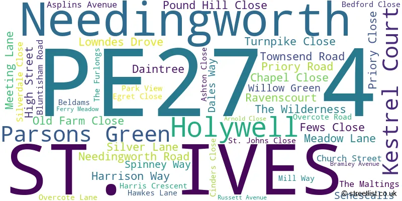
The largest settlement in the PE27 4 postal code is Needingworth followed by ST. IVES, and Holywell.
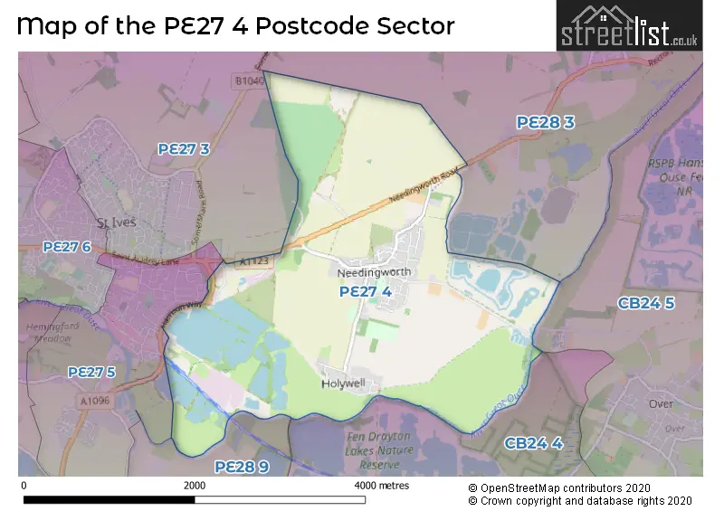
The PE27 4 Postcode shares a border with PE27 3 (ST. IVES), PE27 5 (ST. IVES), PE28 3 (Somersham, Bluntisham, Earith), PE28 9 (Fenstanton, Hemingford Grey, Hilton), CB24 5 (Willingham, Over) and CB24 4 (Swavesey, Fen Drayton).
The sector is within the post town of ST. IVES.
PE27 4 is a postcode sector within the PE2 postcode district which is within the PE Peterborough postcode area.
The Royal Mail delivery office for the PE27 4 postal sector is the unknown.
The area of the PE27 4 postcode sector is 4.49 square miles which is 11.62 square kilometres or 2,872.49 square acres.
Waterways within the PE27 4 postcode sector include the River Great Ouse.

Map of the PE27 4 Postcode Sector
Explore the PE27 4 postcode sector by using our free interactive map.
| P | E | 2 | 7 | - | 4 | X | X |
| P | E | 2 | 7 | Space | 4 | Letter | Letter |
Official List of Streets
Needingworth (43 Streets)
Holywell (1 Streets)
Unofficial Streets or Alternative Spellings
Schools and Places of Education Within the PE27 4 Postcode Sector
Holywell CofE Primary School
Voluntary controlled school
Mill Way, St Ives, Cambridgeshire, PE27 4TF
Head: Mr Paul Baddeley
Ofsted Rating: Outstanding
Inspection: 2013-06-07 (4003 days ago)
Website: Visit Holywell CofE Primary School Website
Phone: 01480462007
Number of Pupils: 205
House Prices in the PE27 4 Postcode Sector
| Type of Property | 2018 Average | 2018 Sales | 2017 Average | 2017 Sales | 2016 Average | 2016 Sales | 2015 Average | 2015 Sales |
|---|---|---|---|---|---|---|---|---|
| Detached | £455,033 | 15 | £409,813 | 24 | £450,666 | 18 | £352,942 | 26 |
| Semi-Detached | £246,503 | 13 | £256,389 | 9 | £269,786 | 14 | £240,384 | 13 |
| Terraced | £226,000 | 5 | £290,000 | 3 | £204,750 | 4 | £258,000 | 2 |
| Flats | £162,000 | 1 | £174,226 | 15 | £215,000 | 1 | £0 | 0 |
Important Postcodes PE27 4 in the Postcode Sector
PE27 4LG is the postcode for Cambridgeshire Community Services NHS Trust, Meadow Lane
PE27 4TF is the postcode for Holywell C of E Primary School, Mill Way, Needingworth, Holywell Church of England Primary School, Mill Way, Needingworth, and Holywell C of E Primary School, Mill Way
| The PE27 4 Sector is within these Local Authorities |
|
|---|---|
| The PE27 4 Sector is within these Counties |
|
| The PE27 4 Sector is within these Water Company Areas |
|