The PO22 9 postcode sector is within the county of West Sussex.
Did you know? According to the 2021 Census, the PO22 9 postcode sector is home to a bustling 8,011 residents!
Given that each sector allows for 400 unique postcode combinations. Letters C, I, K, M, O and V are not allowed in the last two letters of a postcode. With 238 postcodes already in use, this leaves 162 units available.
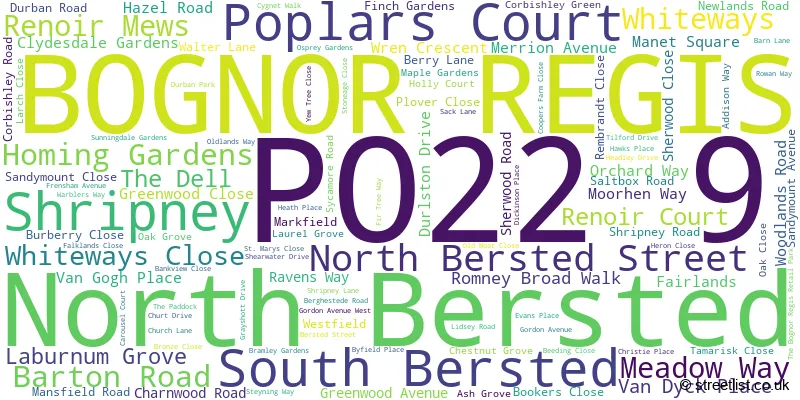
The largest settlement in the PO22 9 postal code is BOGNOR REGIS followed by Poplars Court, and South Bersted.
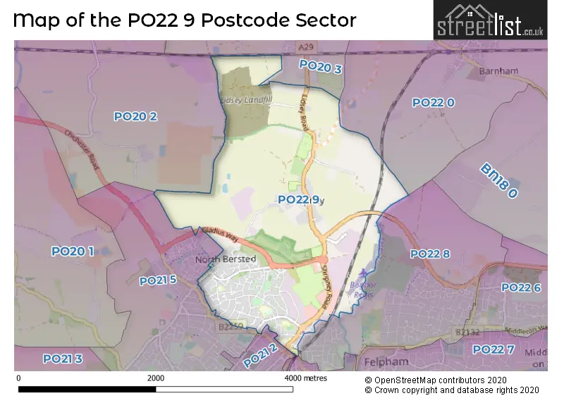
The PO22 9 Postcode shares a border with PO20 2 (Tangmere, CHICHESTER, Oving), PO21 1 (BOGNOR REGIS), PO21 2 (BOGNOR REGIS), PO21 5 (BOGNOR REGIS, North Bersted), PO22 0 (Barnham), PO22 8 (BOGNOR REGIS, Felpham, Flansham) and PO20 3 (Eastergate, Westergate, Aldingbourne).
The sector is within the post town of BOGNOR REGIS.
PO22 9 is a postcode sector within the PO2 postcode district which is within the PO Portsmouth postcode area.
The Royal Mail delivery office for the PO22 9 postal sector is the Portsmouth Delivery Office.
The area of the PO22 9 postcode sector is 3.37 square miles which is 8.73 square kilometres or 2,158.17 square acres.

Map of the PO22 9 Postcode Sector
Explore the PO22 9 postcode sector by using our free interactive map.
| P | O | 2 | 2 | - | 9 | X | X |
| P | O | 2 | 2 | Space | 9 | Letter | Letter |
Official List of Streets
BOGNOR REGIS (88 Streets)
North Bersted (2 Streets)
South Bersted (2 Streets)
Unofficial Streets or Alternative Spellings
Woodgate
LIDSEY ROADBOGNOR REGIS
BROOKS LANE WEST CAROUSEL COURT CHICHESTER ROAD ELM TREE CLOSE HAWTHORN ROAD HIGHFIELD ROAD IVY LANE LAKELAND AVENUEWeather Forecast for PO22 9
Press Button to Show Forecast for Bognor Regis
| Time Period | Icon | Description | Temperature | Rain Probability | Wind |
|---|---|---|---|---|---|
| 21:00 to 00:00 | Cloudy | 11.0°C (feels like 10.0°C) | 7.00% | SE 7 mph |
Press Button to Show Forecast for Bognor Regis
| Time Period | Icon | Description | Temperature | Rain Probability | Wind |
|---|---|---|---|---|---|
| 00:00 to 03:00 | Partly cloudy (night) | 10.0°C (feels like 9.0°C) | 6.00% | ESE 7 mph | |
| 03:00 to 06:00 | Cloudy | 10.0°C (feels like 9.0°C) | 9.00% | NE 4 mph | |
| 06:00 to 09:00 | Light rain | 10.0°C (feels like 9.0°C) | 56.00% | NNE 7 mph | |
| 09:00 to 12:00 | Heavy rain | 12.0°C (feels like 11.0°C) | 80.00% | NNE 7 mph | |
| 12:00 to 15:00 | Heavy rain | 13.0°C (feels like 11.0°C) | 86.00% | E 7 mph | |
| 15:00 to 18:00 | Light rain | 13.0°C (feels like 12.0°C) | 54.00% | WNW 7 mph | |
| 18:00 to 21:00 | Light rain | 13.0°C (feels like 12.0°C) | 43.00% | WNW 4 mph | |
| 21:00 to 00:00 | Cloudy | 12.0°C (feels like 11.0°C) | 16.00% | WNW 4 mph |
Press Button to Show Forecast for Bognor Regis
| Time Period | Icon | Description | Temperature | Rain Probability | Wind |
|---|---|---|---|---|---|
| 00:00 to 03:00 | Cloudy | 11.0°C (feels like 10.0°C) | 8.00% | NNW 4 mph | |
| 03:00 to 06:00 | Cloudy | 10.0°C (feels like 9.0°C) | 7.00% | N 4 mph | |
| 06:00 to 09:00 | Sunny day | 11.0°C (feels like 10.0°C) | 2.00% | N 7 mph | |
| 09:00 to 12:00 | Sunny day | 15.0°C (feels like 14.0°C) | 1.00% | NNE 9 mph | |
| 12:00 to 15:00 | Sunny day | 18.0°C (feels like 17.0°C) | 5.00% | N 7 mph | |
| 15:00 to 18:00 | Partly cloudy (day) | 19.0°C (feels like 17.0°C) | 6.00% | NW 7 mph | |
| 18:00 to 21:00 | Partly cloudy (day) | 17.0°C (feels like 16.0°C) | 5.00% | NNW 7 mph | |
| 21:00 to 00:00 | Clear night | 14.0°C (feels like 13.0°C) | 1.00% | NNE 7 mph |
Press Button to Show Forecast for Bognor Regis
| Time Period | Icon | Description | Temperature | Rain Probability | Wind |
|---|---|---|---|---|---|
| 00:00 to 03:00 | Clear night | 11.0°C (feels like 10.0°C) | 0.00% | NE 4 mph | |
| 03:00 to 06:00 | Clear night | 9.0°C (feels like 8.0°C) | 0.00% | NE 7 mph | |
| 06:00 to 09:00 | Cloudy | 10.0°C (feels like 9.0°C) | 5.00% | NNE 7 mph | |
| 09:00 to 12:00 | Cloudy | 14.0°C (feels like 13.0°C) | 5.00% | NE 7 mph | |
| 12:00 to 15:00 | Cloudy | 16.0°C (feels like 15.0°C) | 4.00% | E 4 mph | |
| 15:00 to 18:00 | Cloudy | 17.0°C (feels like 16.0°C) | 4.00% | SSE 7 mph | |
| 18:00 to 21:00 | Cloudy | 15.0°C (feels like 14.0°C) | 4.00% | S 7 mph | |
| 21:00 to 00:00 | Partly cloudy (night) | 12.0°C (feels like 11.0°C) | 1.00% | S 4 mph |
Press Button to Show Forecast for Bognor Regis
| Time Period | Icon | Description | Temperature | Rain Probability | Wind |
|---|---|---|---|---|---|
| 00:00 to 03:00 | Cloudy | 10.0°C (feels like 9.0°C) | 3.00% | SSE 4 mph | |
| 03:00 to 06:00 | Cloudy | 9.0°C (feels like 8.0°C) | 7.00% | SSE 4 mph | |
| 06:00 to 09:00 | Partly cloudy (day) | 10.0°C (feels like 10.0°C) | 3.00% | E 4 mph | |
| 09:00 to 12:00 | Partly cloudy (day) | 14.0°C (feels like 14.0°C) | 1.00% | SE 4 mph | |
| 12:00 to 15:00 | Cloudy | 16.0°C (feels like 16.0°C) | 4.00% | SSE 7 mph | |
| 15:00 to 18:00 | Cloudy | 17.0°C (feels like 16.0°C) | 3.00% | S 7 mph | |
| 18:00 to 21:00 | Cloudy | 16.0°C (feels like 15.0°C) | 3.00% | S 7 mph | |
| 21:00 to 00:00 | Cloudy | 13.0°C (feels like 12.0°C) | 3.00% | S 7 mph |
Schools and Places of Education Within the PO22 9 Postcode Sector
Bersted Green Primary School, Bognor Regis
Community school
Laburnum Grove, Bognor Regis, West Sussex, PO22 9HT
Head: Dr Katie Jarvis
Ofsted Rating: Good
Inspection: 2019-03-05 (1888 days ago)
Website: Visit Bersted Green Primary School, Bognor Regis Website
Phone: 01243822885
Number of Pupils: 290
South Bersted CofE Primary School
Voluntary controlled school
Church Lane, Bognor Regis, West Sussex, PO22 9PZ
Head: Mr Noel Goodwin
Ofsted Rating: Good
Inspection: 2022-09-14 (599 days ago)
Website: Visit South Bersted CofE Primary School Website
Phone: 01243821678
Number of Pupils: 202
House Prices in the PO22 9 Postcode Sector
| Type of Property | 2018 Average | 2018 Sales | 2017 Average | 2017 Sales | 2016 Average | 2016 Sales | 2015 Average | 2015 Sales |
|---|---|---|---|---|---|---|---|---|
| Detached | £339,500 | 12 | £433,225 | 22 | £474,186 | 19 | £303,471 | 19 |
| Semi-Detached | £252,670 | 53 | £246,193 | 58 | £234,126 | 53 | £224,653 | 52 |
| Terraced | £209,635 | 40 | £210,163 | 58 | £211,978 | 47 | £185,890 | 47 |
| Flats | £146,841 | 16 | £153,122 | 16 | £139,608 | 25 | £134,677 | 22 |
Important Postcodes PO22 9 in the Postcode Sector
PO22 9HT is the postcode for Tree House Children & Family Centre, Laburnum Grove, Bersted Green Primary School, Laburnum Grove, and NEW BUILD, Bersted Green Primary School, Laburnum Grove
PO22 9PP is the postcode for RICHARD HOTHAM UNIT, Bognor Regis War Memorial Hospital, Shripney Road, WAR MEMORIAL HOSPITAL, Bognor Regis War Memorial Hospital, Shripney Road, and Bognor Regis War Memorial Hospital, Shripney Road
PO22 9PZ is the postcode for KS1, South Bersted C of E Primary School, Church Lane
PO22 9RE is the postcode for Durban House, Durban Road
PO22 9TD is the postcode for Bersted Green Surgery, 32 Durlston Drive
| The PO22 9 Sector is within these Local Authorities |
|
|---|---|
| The PO22 9 Sector is within these Counties |
|
| The PO22 9 Sector is within these Water Company Areas |
|