The PO21 5 postcode sector is within the county of West Sussex.
Did you know? According to the 2021 Census, the PO21 5 postcode sector is home to a bustling 11,121 residents!
Given that each sector allows for 400 unique postcode combinations. Letters C, I, K, M, O and V are not allowed in the last two letters of a postcode. With 264 postcodes already in use, this leaves 136 units available.
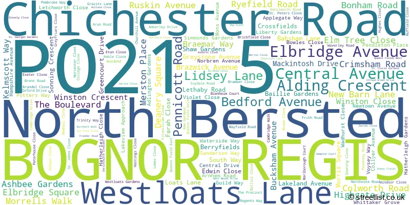
The largest settlements in the PO21 5 postal code are BOGNOR REGIS and North Bersted.
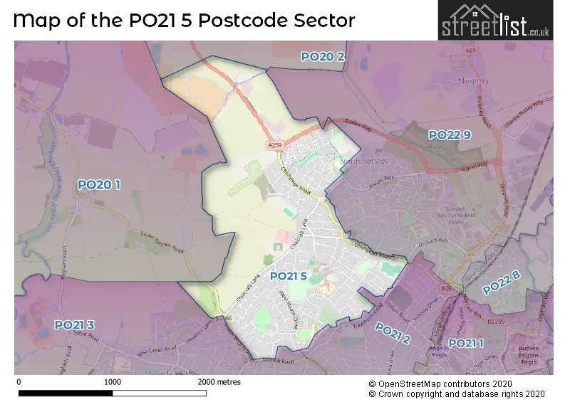
The PO21 5 Postcode shares a border with PO20 2 (Tangmere, CHICHESTER, Oving), PO21 2 (BOGNOR REGIS), PO20 1 (Hunston, Runcton, North Mundham), PO21 3 (BOGNOR REGIS, Rose Green) and PO22 9 (BOGNOR REGIS, Poplars Court, South Bersted).
The sector is within the post town of BOGNOR REGIS.
PO21 5 is a postcode sector within the PO22 postcode district which is within the PO Portsmouth postcode area.
The Royal Mail delivery office for the PO21 5 postal sector is the unknown.
The area of the PO21 5 postcode sector is 1.65 square miles which is 4.28 square kilometres or 1,057.61 square acres.

Map of the PO21 5 Postcode Sector
Explore the PO21 5 postcode sector by using our free interactive map.
| P | O | 2 | 1 | - | 5 | X | X |
| P | O | 2 | 1 | Space | 5 | Letter | Letter |
Official List of Streets
BOGNOR REGIS (134 Streets)
Unofficial Streets or Alternative Spellings
BOGNOR REGIS
ALDWICK ROAD BERRY LANE FAIRLANDS HAWTHORN ROAD MANSFIELD ROAD MERRION AVENUE NORTH BERSTED STREET ORCHARD WAY RENOIR MEWS SANDRINGHAM WAY SHERWOOD ROAD YEOMANS ACRE BAILLE GARDENS BERRYFIELDS COURT COLWORTH LANE GLADIUS WAY HEWARTS LANE JASMINE COURT NEWBARN LANE PENDLETON RUNNYMEDE COURT SONNING CRESENT ST. PETERS COURT STROUDS LANE WEST MEAD DRIVELagness
LOWER BOGNOR ROADWeather Forecast for PO21 5
Press Button to Show Forecast for Bognor Regis
| Time Period | Icon | Description | Temperature | Rain Probability | Wind |
|---|---|---|---|---|---|
| 03:00 to 06:00 | Clear night | 9.0°C (feels like 7.0°C) | 0.00% | SSE 7 mph | |
| 06:00 to 09:00 | Sunny day | 10.0°C (feels like 9.0°C) | 0.00% | SSE 7 mph | |
| 09:00 to 12:00 | Sunny day | 13.0°C (feels like 11.0°C) | 1.00% | SSE 11 mph | |
| 12:00 to 15:00 | Partly cloudy (day) | 14.0°C (feels like 12.0°C) | 3.00% | SSE 11 mph | |
| 15:00 to 18:00 | Partly cloudy (day) | 15.0°C (feels like 13.0°C) | 6.00% | SSE 11 mph | |
| 18:00 to 21:00 | Sunny day | 14.0°C (feels like 12.0°C) | 7.00% | SE 9 mph | |
| 21:00 to 00:00 | Cloudy | 11.0°C (feels like 9.0°C) | 9.00% | SE 7 mph |
Press Button to Show Forecast for Bognor Regis
| Time Period | Icon | Description | Temperature | Rain Probability | Wind |
|---|---|---|---|---|---|
| 00:00 to 03:00 | Cloudy | 10.0°C (feels like 9.0°C) | 6.00% | S 4 mph | |
| 03:00 to 06:00 | Partly cloudy (night) | 8.0°C (feels like 7.0°C) | 5.00% | SSW 4 mph | |
| 06:00 to 09:00 | Cloudy | 9.0°C (feels like 8.0°C) | 9.00% | N 4 mph | |
| 09:00 to 12:00 | Cloudy | 13.0°C (feels like 12.0°C) | 11.00% | N 4 mph | |
| 12:00 to 15:00 | Cloudy | 15.0°C (feels like 14.0°C) | 17.00% | N 4 mph | |
| 15:00 to 18:00 | Cloudy | 15.0°C (feels like 14.0°C) | 20.00% | NNW 7 mph | |
| 18:00 to 21:00 | Cloudy | 14.0°C (feels like 13.0°C) | 23.00% | N 7 mph | |
| 21:00 to 00:00 | Cloudy | 12.0°C (feels like 11.0°C) | 21.00% | WNW 7 mph |
Press Button to Show Forecast for Bognor Regis
| Time Period | Icon | Description | Temperature | Rain Probability | Wind |
|---|---|---|---|---|---|
| 00:00 to 03:00 | Cloudy | 11.0°C (feels like 9.0°C) | 24.00% | NW 9 mph | |
| 03:00 to 06:00 | Light rain | 11.0°C (feels like 9.0°C) | 45.00% | NW 7 mph | |
| 06:00 to 09:00 | Cloudy | 11.0°C (feels like 9.0°C) | 15.00% | NW 9 mph | |
| 09:00 to 12:00 | Cloudy | 13.0°C (feels like 11.0°C) | 15.00% | NW 9 mph | |
| 12:00 to 15:00 | Cloudy | 16.0°C (feels like 14.0°C) | 11.00% | NW 9 mph | |
| 15:00 to 18:00 | Cloudy | 17.0°C (feels like 15.0°C) | 13.00% | NW 9 mph | |
| 18:00 to 21:00 | Partly cloudy (day) | 15.0°C (feels like 14.0°C) | 10.00% | WNW 9 mph | |
| 21:00 to 00:00 | Cloudy | 13.0°C (feels like 12.0°C) | 10.00% | WNW 9 mph |
Schools and Places of Education Within the PO21 5 Postcode Sector
Bartons Primary School, Bognor Regis
Community school
Lethaby Road, Bognor Regis, West Sussex, PO21 5EJ
Head: Mrs Kate Powell
Ofsted Rating: Good
Inspection: 2019-12-05 (1608 days ago)
Website: Visit Bartons Primary School, Bognor Regis Website
Phone: 01243822056
Number of Pupils: 207
Nyewood CofE Infant School, Bognor Regis
Voluntary aided school
Brent Road, Bognor Regis, West Sussex, PO21 5NW
Head: Miss Anna Wells
Ofsted Rating: Good
Inspection: 2023-09-20 (223 days ago)
Website: Visit Nyewood CofE Infant School, Bognor Regis Website
Phone: 01243823283
Number of Pupils: 220
Nyewood CofE Junior School
Voluntary aided school
Brent Road, Bognor Regis, West Sussex, PO21 5NW
Head: Mr Tom Spurle
Ofsted Rating: Good
Inspection: 2018-07-17 (2114 days ago)
Website: Visit Nyewood CofE Junior School Website
Phone: 01243825871
Number of Pupils: 311
Southway Primary School
Academy sponsor led
South Way, Bognor Regis, West Sussex, PO21 5EZ
Head: Mr Mike Wood
Ofsted Rating: Good
Inspection: 2022-03-02 (790 days ago)
Website: Visit Southway Primary School Website
Phone: 01243810200
Number of Pupils: 554
The Regis School
Academy sponsor led
Westloats Lane, West Sussex, , PO21 5LH
Head: Mr David Oakes
Ofsted Rating: Good
Inspection: 2023-03-08 (419 days ago)
Website: Visit The Regis School Website
Phone: 01243871010
Number of Pupils: 1613
House Prices in the PO21 5 Postcode Sector
| Type of Property | 2018 Average | 2018 Sales | 2017 Average | 2017 Sales | 2016 Average | 2016 Sales | 2015 Average | 2015 Sales |
|---|---|---|---|---|---|---|---|---|
| Detached | £367,710 | 48 | £351,262 | 49 | £324,850 | 61 | £295,518 | 44 |
| Semi-Detached | £266,913 | 62 | £270,929 | 73 | £258,978 | 63 | £243,134 | 78 |
| Terraced | £260,507 | 71 | £251,575 | 59 | £238,808 | 73 | £215,883 | 71 |
| Flats | £143,350 | 26 | £149,940 | 26 | £129,591 | 16 | £142,588 | 32 |
Important Postcodes PO21 5 in the Postcode Sector
PO21 5EJ is the postcode for Bartons Infant School, Lethaby Road
PO21 5EZ is the postcode for Michael Ayres Junior School, South Way, and Southway Primary School, South Way
PO21 5FF is the postcode for Community Building, Lakeland Avenue
PO21 5LH is the postcode for The Regis School, Swimming Pool, Westloats Lane, UPPER SCHOOL, Bognor Regis Community College, Westloats Lane, PHOENIX CENTRE, Bognor Regis Community College, Westloats Lane, Arena Skills Centre, Westloats Lane, The Regis School, Main Building, Westloats Lane, The Regis School, Westloats Lane, and ARENA SPORTS CENTRE, Bognor Regis Community College, Westloats Lane
PO21 5LQ is the postcode for Glade Infant School, Westloats Lane
PO21 5NW is the postcode for Nyewood C of E Junior School, Brent Road, and Nyewood C of E Infant School, Brent Road
PO21 5PB is the postcode for Lower School, Bognor Regis Community College
PO21 5SB is the postcode for West Meads Surgery, 2-6 The Precinct
PO21 5TB is the postcode for West Sussex Fire & Rescue Service, Fire Station, West Meads Drive
| The PO21 5 Sector is within these Local Authorities |
|
|---|---|
| The PO21 5 Sector is within these Counties |
|
| The PO21 5 Sector is within these Water Company Areas |
|