The PO30 3 postcode sector is within the county of Isle of Wight.
Did you know? According to the 2021 Census, the PO30 3 postcode sector is home to a bustling 2,423 residents!
Given that each sector allows for 400 unique postcode combinations. Letters C, I, K, M, O and V are not allowed in the last two letters of a postcode. With 135 postcodes already in use, this leaves 265 units available.
The largest settlement in the PO30 3 postal code is NEWPORT followed by Shorwell, and Arreton.
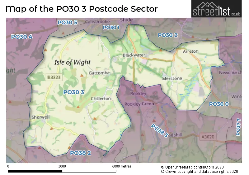
The PO30 3 Postcode shares a border with PO30 1 (NEWPORT), PO30 2 (NEWPORT, Binfield, Barton), PO30 4 (Brighstone, Shalfleet, Calbourne), PO30 5 (NEWPORT, Camp Hill), PO36 0 (Brading, Apse Heath, Newchurch), PO38 2 (Niton, Whitwell, Chale Green) and PO38 3 (Wroxall, Godshill, Rookley).
The sector is within the post town of NEWPORT.
PO30 3 is a postcode sector within the PO3 postcode district which is within the PO Portsmouth postcode area.
The Royal Mail delivery office for the PO30 3 postal sector is the unknown.
The area of the PO30 3 postcode sector is 18.20 square miles which is 47.14 square kilometres or 11,648.95 square acres.
Waterways within the PO30 3 postcode sector include the River Yar.

Map of the PO30 3 Postcode Sector
Explore the PO30 3 postcode sector by using our free interactive map.
| P | O | 3 | 0 | - | 3 | X | X |
| P | O | 3 | 0 | Space | 3 | Letter | Letter |
Official List of Streets
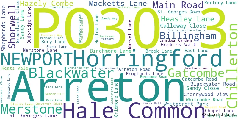
Arreton (8 Streets)
Billingham (1 Streets)
Blackwater (3 Streets)
NEWPORT (11 Streets)
Chillerton (7 Streets)
Merstone (5 Streets)
Shorwell (22 Streets)
Gatcombe (3 Streets)
Hale Common (1 Streets)
Unofficial Streets or Alternative Spellings
NEWPORT
DOWNEND ROADRookley
HIGHWOOD LANEKingston
KINGSTON ROADAtherfield
ATHERFIELD ROADBrighstone
THORNCROSS LANESchools and Places of Education Within the PO30 3 Postcode Sector
Arreton St George's Church of England (Aided) Primary School
Voluntary aided school
School Lane, Main Road, Newport, Isle of Wight, PO30 3AD
Head: Mrs Nichola Coates
Ofsted Rating: Requires improvement
Inspection: 2022-07-13 (692 days ago)
Website: Visit Arreton St George's Church of England (Aided) Primary School Website
Phone: 01983528429
Number of Pupils: 171
House Prices in the PO30 3 Postcode Sector
| Type of Property | 2018 Average | 2018 Sales | 2017 Average | 2017 Sales | 2016 Average | 2016 Sales | 2015 Average | 2015 Sales |
|---|---|---|---|---|---|---|---|---|
| Detached | £416,958 | 12 | £356,648 | 21 | £451,806 | 18 | £360,171 | 12 |
| Semi-Detached | £233,125 | 4 | £253,844 | 16 | £242,995 | 10 | £235,800 | 10 |
| Terraced | £246,383 | 3 | £191,250 | 8 | £221,667 | 6 | £229,250 | 8 |
| Flats | £171,500 | 2 | £187,125 | 8 | £202,750 | 14 | £216,889 | 9 |
Important Postcodes PO30 3 in the Postcode Sector
PO30 3NA is the postcode for Isle of Wight Council, Thompson House, Sandy Lane
| The PO30 3 Sector is within these Local Authorities |
|
|---|---|
| The PO30 3 Sector is within these Counties |
|
| The PO30 3 Sector is within these Water Company Areas |
|