The PO33 2 postcode sector is within the county of Isle of Wight.
Did you know? According to the 2021 Census, the PO33 2 postcode sector is home to a bustling 8,099 residents!
Given that each sector allows for 400 unique postcode combinations. Letters C, I, K, M, O and V are not allowed in the last two letters of a postcode. With 274 postcodes already in use, this leaves 126 units available.
The PO33 2 postal code covers the settlement of RYDE.
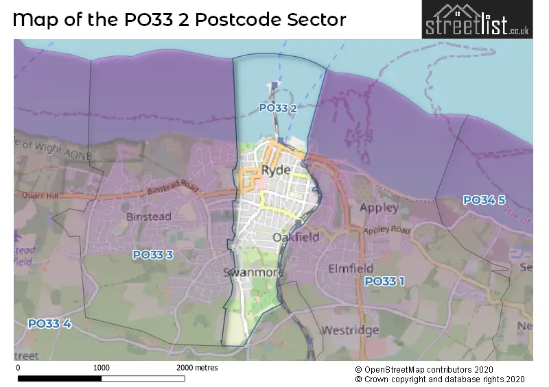
The PO33 2 Postcode shares a border with PO33 1 (RYDE, St. Helens, Oakfield), PO33 3 (RYDE, Binstead) and PO33 4 (Wootton Bridge, RYDE, Havenstreet).
The sector is within the post town of RYDE.
PO33 2 is a postcode sector within the PO3 postcode district which is within the PO Portsmouth postcode area.
The Royal Mail delivery office for the PO33 2 postal sector is the unknown.
The area of the PO33 2 postcode sector is 0.68 square miles which is 1.75 square kilometres or 433.13 square acres.

Map of the PO33 2 Postcode Sector
Explore the PO33 2 postcode sector by using our free interactive map.
| P | O | 3 | 3 | - | 2 | X | X |
| P | O | 3 | 3 | Space | 2 | Letter | Letter |
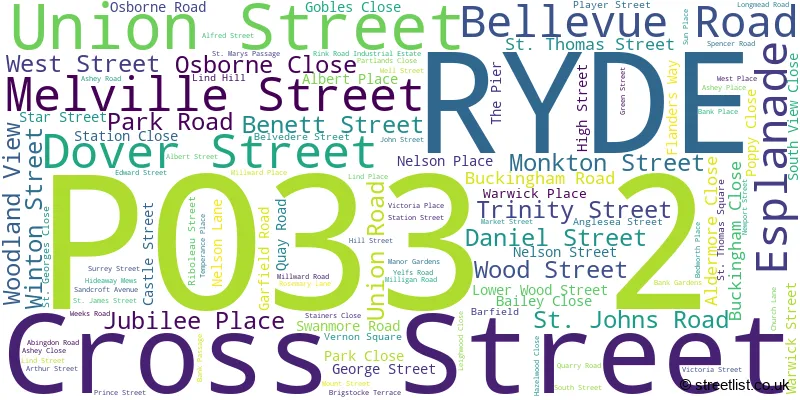
Official List of Streets
RYDE (105 Streets)
Unofficial Streets or Alternative Spellings
RYDE
ADELAIDE PLACE ARGYLL STREET BETTESWORTH ROAD EAST STREET PARTLANDS AVENUE PITT STREET RATCLIFFE AVENUE RINK ROAD SOVEREIGN WAY THE STRAND UPTON ROAD WRAY STREET ALBERT PALCE CROWN STREET LANGDON MEWS MOUNT CLOSE NURSERY GARDENS PIG LEG LANE QUEENS ROAD RYDE PIER SAINT GEORGES CLOSE SAINT JAMES STREET SOUTHVIEW CLOSE ST JOHNS HILL WAYS MEWS WINCHESTER MEWSSchools and Places of Education Within the PO33 2 Postcode Sector
Dover Park Primary School
Community school
Dover Street, Ryde, Isle of Wight, Isle of Wight, PO33 2BN
Head: Mr JONATHAN KIRBY
Ofsted Rating: Good
Inspection: 2018-10-11 (2051 days ago)
Website: Visit Dover Park Primary School Website
Phone: 01983562617
Number of Pupils: 207
House Prices in the PO33 2 Postcode Sector
| Type of Property | 2018 Average | 2018 Sales | 2017 Average | 2017 Sales | 2016 Average | 2016 Sales | 2015 Average | 2015 Sales |
|---|---|---|---|---|---|---|---|---|
| Detached | £227,454 | 12 | £261,493 | 14 | £260,700 | 24 | £272,270 | 23 |
| Semi-Detached | £189,086 | 54 | £190,643 | 52 | £165,844 | 64 | £162,368 | 76 |
| Terraced | £172,909 | 28 | £161,674 | 44 | £141,401 | 44 | £149,894 | 54 |
| Flats | £124,559 | 81 | £119,409 | 105 | £101,984 | 77 | £111,320 | 75 |
Important Postcodes PO33 2 in the Postcode Sector
PO33 2BN is the postcode for Dover Park Cp School, Dover Street
PO33 2EH is the postcode for The Surgery, 19 Esplanade
PO33 2NL is the postcode for Ryde Theatre, Lind Street
PO33 2QG is the postcode for Argyll House, 78, West Street
PO33 2RB is the postcode for Jobcentre Plus, 150 High Street
| The PO33 2 Sector is within these Local Authorities |
|
|---|---|
| The PO33 2 Sector is within these Counties |
|
| The PO33 2 Sector is within these Water Company Areas |
|
Tourist Attractions within the PO33 2 Postcode Area
We found 1 visitor attractions within the PO3 postcode area
| Isle of Wight Bus & Coach Museum Ltd |
|---|
| Historic Properties |
| Other Historic / Scenic Transport Operator |
| View Isle of Wight Bus & Coach Museum Ltd on Google Maps |