The PO39 0 postcode sector is within the county of Isle of Wight.
Did you know? According to the 2021 Census, the PO39 0 postcode sector is home to a bustling 2,624 residents!
Given that each sector allows for 400 unique postcode combinations. Letters C, I, K, M, O and V are not allowed in the last two letters of a postcode. With 116 postcodes already in use, this leaves 284 units available.
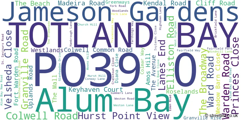
The largest settlements in the PO39 0 postal code are TOTLAND BAY and Alum Bay.
The PO39 0 Postcode shares a border with PO40 9 (FRESHWATER).
The sector is within the post town of TOTLAND BAY.
PO39 0 is a postcode sector within the PO3 postcode district which is within the PO Portsmouth postcode area.
The Royal Mail delivery office for the PO39 0 postal sector is the unknown.
The area of the PO39 0 postcode sector is 1.96 square miles which is 5.07 square kilometres or 1,251.90 square acres.

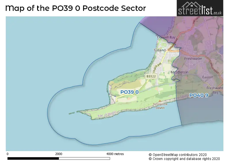
Map of the PO39 0 Postcode Sector
Explore the PO39 0 postcode sector by using our free interactive map.
| P | O | 3 | 9 | - | 0 | X | X |
| P | O | 3 | 9 | Space | 0 | Letter | Letter |
Official List of Streets
TOTLAND BAY (58 Streets)
Unofficial Streets or Alternative Spellings
Schools and Places of Education Within the PO39 0 Postcode Sector
St Saviour's Catholic Primary School
Voluntary aided school
Summers Lane, Totland Bay, Isle of Wight, PO39 0HQ
Head: Mrs Maggie Sanderson
Ofsted Rating: Good
Inspection: 2019-01-22 (1960 days ago)
Website: Visit St Saviour's Catholic Primary School Website
Phone: 01983752175
Number of Pupils: 146
House Prices in the PO39 0 Postcode Sector
| Type of Property | 2018 Average | 2018 Sales | 2017 Average | 2017 Sales | 2016 Average | 2016 Sales | 2015 Average | 2015 Sales |
|---|---|---|---|---|---|---|---|---|
| Detached | £338,055 | 24 | £396,790 | 31 | £294,567 | 30 | £326,875 | 28 |
| Semi-Detached | £219,806 | 9 | £230,154 | 12 | £199,725 | 20 | £202,909 | 11 |
| Terraced | £194,227 | 11 | £183,431 | 8 | £193,223 | 13 | £187,339 | 17 |
| Flats | £185,125 | 28 | £141,585 | 15 | £160,867 | 27 | £190,045 | 10 |
Important Postcodes PO39 0 in the Postcode Sector
PO39 0HQ is the postcode for St. Saviours RC Primary School, Summers Lane
| The PO39 0 Sector is within these Local Authorities |
|
|---|---|
| The PO39 0 Sector is within these Counties |
|
| The PO39 0 Sector is within these Water Company Areas |
|
Tourist Attractions within the PO39 0 Postcode Area
We found 1 visitor attractions within the PO3 postcode area
| The Needles Old Battery & New Battery |
|---|
| Historic Properties |
| Castle / Fort |
| View The Needles Old Battery & New Battery on Google Maps |