Map of Baydon Road
| Postcodes | ||
|---|---|---|
| Icon | Postcodes for Baydon Road | |
| Walking Distances | ||
| Distance Info | Green Circle = 10 Minutes Walk (800 metres) | |
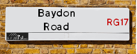
About Baydon Road
Baydon Road is a street located in the village of Wickham. The street has a length of approximately 2,349 metres.
Baydon Road is located within the West Berkshire Council's jurisdiction. They provide various services, like refuse collection, and manage council tax collection. It's situated in the South East region of the UK.
Baydon Road has been assigned the Unique Street Reference Numbers of 26900143, 26910011, 26900674 and 26903447 in the National Street Gazetteer.
Baydon Road is located within the county of Berkshire, situated in the South East region of the UK. It's 57.82 miles West from central London., 16.61 miles North from Andover, 16.63 miles South East from Swindon and 20.04 miles North West from Basingstoke.

Do you know why this road is called Baydon Road?
What's it like to live here?
Ask the community a question about Baydon Road.
Do you have any questions, memories to share or know any facts about Baydon Road? We'd love to know more.
Also on streetlist.co.uk, can you help?
Swing Swang Lane
28th April 2024
I am trying to find out why the lane is named Swing Swang?
It has been known known this since at least 1905 when hedge making contents used to be held here.
Swing Swang is often used to describe a fairground ride. I remember Swing Boats. Were they a bit like this or is Swing Swang another name for swings?
Swing Swangs are also mentioned in connection to orchards. Or were orchards just good places to have swings?
Eldroth Road
15th April 2024
I wondered if anyone has any old pictures of Wenning Bank House in the 1940’s and also Lane Side before of the same era .. we visited today with my Mum in law as she used to live at both these properties. Also any photos of the schools around that time .. thank you.
Can You Help?Napps Way
15th April 2024
Why is the road called Napps Way (belonging to Napp, but minus an
apostrophe as is usual with such nomenclature)? Moreover, who or
what is, or was, “Napp” in the respective, possessive case?
Several years ago, I met an elderly man (probably in his late-eighties)
who lives on Bentham Drive, Liverpool 16, and during a conversation
with him whilst in a Northwest Passenger Transport Ambulance on the
way to the former RLUH (Royal Liverpool University Hospital), he told
me that he could remember (when he was a boy, living in Childwall,
Liverpool 16) that, “Where Napps Way is now, during WW2, there was
a two-man gun emplacement on the, then, open land to protect the
railway line passing over Childwall Valley Road - next to the railway
bridge - when suddenly, as they were loading a live “shell” into the gun’s
breach, the aforementioned “shell” accidentally exploded in the gun’s
breach killing both of the two soldiers, that had been manning the gun,
instantly! (Very sad, of course, but could - perhaps - two ghosts relating
to those two, very unfortunately and prematurely-killed soldiers have
haunted that place of their deaths ever since - and have any residents
of Napps Way - formerly and in its latest incarnation - seen two, WW2
(uniformed) soldiers unexpectedly appear in or near their homes?)
Estate Agents near Baydon Road
| Name | Address | Website |
|---|---|---|
| Nye & Co | 114 High Street, Hungerford, RG17 0LU | Visit Website |
| Russell Marshall | Kennet House, 19 High Street, Hungerford, Berkshire, RG17 0NL | Visit Website |
| Marc Allen Estate Agents | 110 High Street, Hungerford, RG17 0NB | Visit Website |
Location Details
| Baydon Road | |
|---|---|

| |
| Latitude | 51.446749 |
| Longitude | -1.444712 |
| OS Easting (X): | 438585 |
| OS Northing (Y): | 172174 |
| OS Grid Reference: | SU386722 |
Neighbourhood Policing |
| Police Force: Thames Valley |
 View Neighbourhood Crime and Policing View Neighbourhood Crime and Policing |
| Find a Local Neighbourhood Watch Scheme |
Frequently asked Questions for Baydon Road
What Council (Local Authority) is Baydon Road in?
Baydon Road is located within the local authority area of West Berkshire Council which is a Unitary Authority.
What Parish Council is Baydon Road in?
Baydon Road is located within the area of Welford Parish Council.
What Electoral Ward is Baydon Road in?
Baydon Road is located within the ward of Hungerford & Kintbury.
What County is Baydon Road in?
Baydon Road is located within the ceremonial county of Berkshire.
What Constituency is Baydon Road in?
Baydon Road is located within the constituency of Newbury.
What Part of the UK is Baydon Road in?
Baydon Road is located within the South East (England) region of the United Kingdom.
What County Council area is Baydon Road in?
Baydon Road is located within the West Berkshire Council area.
What Police Force area is Baydon Road in?
Baydon Road is located within the Thames Valley Police area.
Roads that have a Junction with Baydon Road
| Street | Junction Type |
|---|---|
| Ermin Street (B4000) | pseudo node |
| Welford Road | junction |
Sunset and Sunrise times for Baydon Road
| Sunrise | 05:20 |
|---|---|
| Sunset | 20:43 |
Latest Weather Conditions for Baydon Road
| Observed at Weather Station: | Benson 9 May 2024 at 07:00 (19.15 miles away) |
|---|---|
| Current Weather: | Sunny day |
| Temperature and Humidity: | 12.5°C (85.7%) |
| Wind Direction and Speed: | S (3 mph) |
Population Statistics
| ONS Area Code | E00082348 |
|---|---|
| ONS Area Name | Ageing Rural Flat Tenants |
| Average Age | 43.84 |
| Area Population | 1930.00 |
| Male Population | 979.00 (51%) |
| Female Population | 951.00 (49%) |
| Benefit Claimants | 6 (0%) |
| LSOA Code: | E01016301 |
|---|---|
| LSOA Name: | West Berkshire 018B |
| SOA Code: | 2b |
| SOA Name: | |
| MSOA Code: | E02003384 |
| MSOA Name: | West Berkshire 018 |
Nearest Supermarkets
| Tesco Hungerford Superstore |
|---|
| Everland Rd, Hungerford, RG17 0DX |
| 0345 671 9455 |
| Distance: 3.66 Miles |
| Directions from Baydon Road to Tesco Hungerford Superstore |
| Waitrose At Membury West Services |
|---|
| M4 Motorway, Junction 14/15, Membury, Lambourne, Hungerford, Berkshire |
| RG17 7TZ |
| Distance: 5.49 Miles |
| Directions from Baydon Road to Waitrose At Membury West Services |
| Waitrose At Membury North Services |
|---|
| M4 Motorway, Junction 14/15, Membury, Lambourne, Hungerford |
| RG17 7TZ |
| Distance: 5.53 Miles |
| Directions from Baydon Road to Waitrose At Membury North Services |
| Waitrose Newbury |
|---|
| Oxford Road, Newbury, Berkshire, RG14 1NB |
| 01635 552061 |
| Distance: 5.67 Miles |
| Directions from Baydon Road to Waitrose Newbury |
Telephone Information
| Area Code |
|---|
| Area Code: 01488 - Hungerford |
| Area Code: 01635 - Newbury |
Local Government
| Local Council Details |
|---|
| Within the area of West Berkshire |
| Visit the Council's Website |
| Council Offices, Market Street, Newbury, West Berkshire &RG14 5LD |
| Send email |
| Telephone Number: 01635 424 00 |
| Local Member of Parliament |
|---|
| Within the Westminster Parliamentary Constituency of Newbury |
| The Member of Parliament is Laura Farris |
| Details for the MP Laura Farris on parliament.uk |
| Details for the MP Laura Farris on theyworkforyou.com |
| In the 2019 General Election Laura Farris won with a majority of 16,047 the result was Con hold. The total electorate was 83,414 |
| Wards, Parish Councils and County Councils |
|---|
| Ward: Hungerford & Kintbury Ward |
| Ceremonial County: Berkshire |
Nearest Schools
England Primary Schools
Welford and Wickham C.E. Primary School
Address: Welford and Wickham C.E. Primary School, Welford Road, Newbury, Berkshire, RG20 8HL
Distance: 0.61 miles
Contact: 01488608306
Nearest Hospitals
| Name | Address | Postcode | Distance | Map |
|---|
Nearest Dentists
Dentists near Baydon Road
| Name | Address | Postcode | Distance | Map |
|---|
Nearest GP Surgeries
Doctors near Baydon Road
KINTBURY & WOOLTON HILL SURGERY
Address: KINTBURY SURGERY, KINTBURY, HUNGERFORD, BERKSHIRE, RG17 9UX
Distance: 3.30 miles
Contact: tel: 01488 658294
HUNGERFORD SURGERY
Address: THE CROFT, HUNGERFORD, BERKSHIRE, RG17 0HY
Distance: 3.81 miles
Contact: tel: 01488 682507
LAMBOURN SURGERY
Address: BOCKHAMPTON ROAD, LAMBOURN, HUNGERFORD, BERKSHIRE, RG17 8PS
Distance: 5.28 miles
Contact: tel: 01488 71715
LAMBOURN SURGERY - COVID LOCAL VACCINATION SERVICE
Address: BOCKHAMPTON ROAD, LAMBOURN, HUNGERFORD, RG17 8PS
Distance: 5.28 miles
Contact: :
STRAWBERRY HILL MEDICAL CENTRE - COVID LOCAL VACCINATION SERVICE
Address: STRAWBERRY HILL HOUSE, OLD BATH ROAD, NEWBURY, BERKSHIRE, RG14 1JU
Distance: 5.78 miles
Contact: :
STRAWBERRY HILL MEDICAL CENTRE
Address: STRAWBERRY HILL MED.CTR, OLD BATH ROAD, NEWBURY, BERKSHIRE, RG14 1JU
Distance: 5.78 miles
Contact: tel: 01635 917917
Nearest Dispensing Chemists
Pharmacies near Baydon Road
| Name | Address | Postcode | Telephone | Map | Distance in Km |
|---|
Nearest Opticians
Opticians near Baydon Road
VISION EXPRESS (HUNGERFORD)
Address: 21 HIGH STREET, HUNGERFORD, BERKSHIRE, RG17 0NF
Distance: 3.81 miles
Contact: :
SPECSAVERS (NEWBURY)
Address: 42 NORTHBROOK STREET, NEWBURY, BERKSHIRE, RG14 1DT
Distance: 5.94 miles
Contact: :
BOOTS OPTICIANS (NEWBURY)
Address: 4-5 NORTHBROOK STREET, NEWBURY, BERKSHIRE, RG14 1DJ
Distance: 6.01 miles
Contact: :
NEWBURY OPTICAL
Address: 98 NORTHBROOK STREET, NEWBURY, RG14 1AA
Distance: 6.03 miles
Contact: :
VISION EXPRESS (NEWBURY)
Address: 92 NORTHBROOK STREET, NEWBURY, BERKSHIRE, RG14 1AA
Distance: 6.03 miles
Contact: :
SPECSAVERS - NEWBURY HECTORS WAY
Address: SAINSBURYS SUPERMARKETS LTD, HECTORS WAY, NEWBURY, RG14 5AB
Distance: 6.36 miles
Contact: :
Transport
Nearest Rail Stations
Kintbury Station is 3.06 miles away.
Address: Kintbury station, Station Road, Kintbury, Berkshire, RG17 9UT
Kintbury is situated on the Reading to Taunton Line and is managed by Great Western Railway.
Kintbury Station is an unstaffed station.
Hungerford Station is 3.65 miles away.
Address: Hungerford station, Station Road, Hungerford, Berkshire, RG17 0DY
Hungerford is situated on the Reading to Taunton Line and is managed by Great Western Railway.
Hungerford Station is an unstaffed station.