The RG17 postcode district is a postal district located in the RG Reading postcode area with a population of 15,472 residents according to the 2021 England and Wales Census.
The area of the RG17 postcode district is 72.84 square miles which is 188.65 square kilometres or 46,617.10 acres.
Currently, the RG17 district has about 656 postcode units spread across 4 geographic postcode sectors.
Given that each sector allows for 400 unique postcode combinations, the district has a capacity of 1,600 postcodes. With 656 postcodes already in use, this leaves 944 units available.
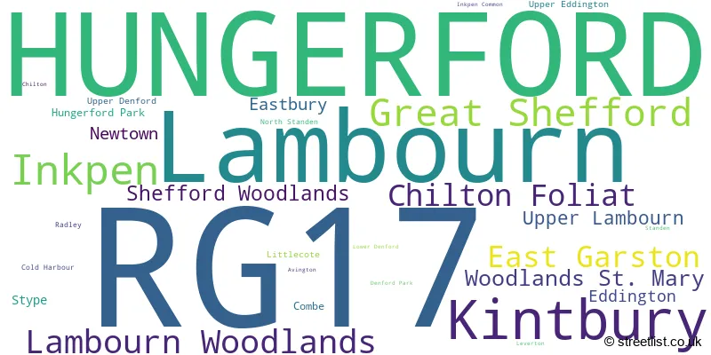
The largest settlement in the RG17 postal code is HUNGERFORD followed by Lambourn, and Kintbury.
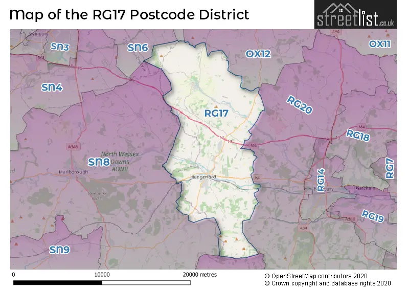
The RG17 Postcode shares a border with SN7 (FARINGDON, Stanford In The Vale, Uffington), RG20 (Kingsclere, Woolton Hill, Compton), OX12 (WANTAGE, Grove, East Challow), SN8 (MARLBOROUGH, Ramsbury, Aldbourne) and SP11 (ANDOVER, Ludgershall, Picket Piece).
The primary settlement in the RG17 postcode district is Hungerford, a town located in the county of Berkshire in England. Other significant settlements in the district include Avington, Chilton, Cold Harbour, Denford Park, Eddington, Hungerford Park, Leverton, Lower Denford, Newtown, North Standen, Radley, Standen, Upper Denford, and Upper Eddington. The data also includes settlements in the counties of Wiltshire and Oxfordshire, but they represent a small proportion of the data. The significant post town for the RG17 postcode district is Hungerford.
For the district RG17, we have data on 5 postcode sectors. Here's a breakdown: The sector RG17 0, covers Hungerford in Berkshire. The sector RG17 0, covers Chilton Foliat in Wiltshire. The sector RG17 1 is non-geographic. It's often designated for PO Boxes, large organisations, or special services. The sector RG17 7, covers Great Shefford and Lambourn Woodlands and Lambourn and East Garston and Woodlands St. Mary and Shefford Woodlands in Berkshire. The sector RG17 8, covers Lambourn and Upper Lambourn in Berkshire. The sector RG17 9, covers Kintbury and Inkpen in Berkshire.

Map of the RG17 Postcode District
Explore the RG17 postcode district by using our free interactive map.
When it comes to local government, postal geography often disregards political borders. However, for a breakdown in the RG17 District: the district mostly encompasses the West Berkshire (622 postcodes), and finally, the Wiltshire area (39 postcodes).
Recent House Sales in RG17
| Date | Price | Address |
|---|---|---|
| 17/10/2023 | £200,000 | Shalbourne Close, Hungerford, RG17 0QH |
| 02/10/2023 | £1,410,000 | Bridge Street, Hungerford, RG17 0EG |
| 02/10/2023 | £1,410,000 | Bridge Street, Hungerford, RG17 0EG |
| 22/09/2023 | £265,000 | Crown Mews, Hungerford, RG17 0NR |
| 22/09/2023 | £200,000 | Chapel Court, Hungerford, RG17 0HW |
| 15/09/2023 | £345,000 | Chilton Way, Hungerford, RG17 0JF |
| 13/09/2023 | £1,030,000 | Chilton Foliat, Hungerford, RG17 0TG |
| 05/09/2023 | £315,000 | Close Court, Lambourn, Hungerford, RG17 8XJ |
| 04/09/2023 | £740,000 | Post Office Road, Inkpen, Hungerford, RG17 9PU |
| 01/09/2023 | £600,000 | Church Street, Hungerford, RG17 0JG |
Weather Forecast for RG17
Press Button to Show Forecast for Hungerford
| Time Period | Icon | Description | Temperature | Rain Probability | Wind |
|---|---|---|---|---|---|
| 06:00 to 09:00 | Light rain | 5.0°C (feels like 2.0°C) | 58.00% | NE 9 mph | |
| 09:00 to 12:00 | Overcast | 6.0°C (feels like 3.0°C) | 18.00% | NE 11 mph | |
| 12:00 to 15:00 | Overcast | 8.0°C (feels like 6.0°C) | 14.00% | ENE 9 mph | |
| 15:00 to 18:00 | Cloudy | 10.0°C (feels like 8.0°C) | 13.00% | NE 11 mph | |
| 18:00 to 21:00 | Cloudy | 9.0°C (feels like 6.0°C) | 15.00% | NNE 11 mph | |
| 21:00 to 00:00 | Heavy rain | 7.0°C (feels like 4.0°C) | 82.00% | NNE 11 mph |
Press Button to Show Forecast for Hungerford
| Time Period | Icon | Description | Temperature | Rain Probability | Wind |
|---|---|---|---|---|---|
| 00:00 to 03:00 | Heavy rain | 7.0°C (feels like 3.0°C) | 87.00% | NNE 13 mph | |
| 03:00 to 06:00 | Heavy rain | 6.0°C (feels like 3.0°C) | 87.00% | N 13 mph | |
| 06:00 to 09:00 | Heavy rain | 6.0°C (feels like 2.0°C) | 89.00% | NNW 11 mph | |
| 09:00 to 12:00 | Heavy rain | 6.0°C (feels like 3.0°C) | 81.00% | NW 11 mph | |
| 12:00 to 15:00 | Light rain | 8.0°C (feels like 5.0°C) | 52.00% | WNW 11 mph | |
| 15:00 to 18:00 | Cloudy | 10.0°C (feels like 7.0°C) | 13.00% | WNW 9 mph | |
| 18:00 to 21:00 | Cloudy | 9.0°C (feels like 7.0°C) | 8.00% | WSW 7 mph | |
| 21:00 to 00:00 | Partly cloudy (night) | 6.0°C (feels like 4.0°C) | 3.00% | SW 7 mph |
Press Button to Show Forecast for Hungerford
| Time Period | Icon | Description | Temperature | Rain Probability | Wind |
|---|---|---|---|---|---|
| 00:00 to 03:00 | Clear night | 4.0°C (feels like 2.0°C) | 1.00% | SW 7 mph | |
| 03:00 to 06:00 | Clear night | 3.0°C (feels like 1.0°C) | 1.00% | SSW 4 mph | |
| 06:00 to 09:00 | Sunny day | 5.0°C (feels like 3.0°C) | 1.00% | S 7 mph | |
| 09:00 to 12:00 | Sunny day | 10.0°C (feels like 8.0°C) | 2.00% | S 11 mph | |
| 12:00 to 15:00 | Cloudy | 12.0°C (feels like 10.0°C) | 7.00% | S 13 mph | |
| 15:00 to 18:00 | Partly cloudy (day) | 13.0°C (feels like 10.0°C) | 3.00% | S 13 mph | |
| 18:00 to 21:00 | Sunny day | 11.0°C (feels like 9.0°C) | 3.00% | S 11 mph | |
| 21:00 to 00:00 | Clear night | 8.0°C (feels like 5.0°C) | 3.00% | SSE 9 mph |
Press Button to Show Forecast for Hungerford
| Time Period | Icon | Description | Temperature | Rain Probability | Wind |
|---|---|---|---|---|---|
| 00:00 to 03:00 | Clear night | 7.0°C (feels like 5.0°C) | 2.00% | SE 9 mph | |
| 03:00 to 06:00 | Clear night | 7.0°C (feels like 4.0°C) | 3.00% | SE 9 mph | |
| 06:00 to 09:00 | Sunny day | 8.0°C (feels like 6.0°C) | 5.00% | SE 9 mph | |
| 09:00 to 12:00 | Sunny day | 13.0°C (feels like 10.0°C) | 9.00% | SE 11 mph | |
| 12:00 to 15:00 | Sunny day | 15.0°C (feels like 12.0°C) | 10.00% | SE 13 mph | |
| 15:00 to 18:00 | Cloudy | 15.0°C (feels like 12.0°C) | 11.00% | SSE 11 mph | |
| 18:00 to 21:00 | Sunny day | 13.0°C (feels like 12.0°C) | 7.00% | SSE 9 mph | |
| 21:00 to 00:00 | Partly cloudy (night) | 10.0°C (feels like 9.0°C) | 6.00% | SE 7 mph |
Where is the RG17 Postcode District?
The data indicates that the postcode district RG17 is located in Hungerford, a town in Berkshire. Hungerford is situated near several other towns, including Newbury to the east (6.89 miles away), Wantage to the north (9.04 miles away), Marlborough to the west (9.34 miles away), Pewsey to the southwest (13.55 miles away), Swindon to the northwest (14.45 miles away), Didcot to the northeast (14.53 miles away), and Whitchurch to the southeast (16.09 miles away). In terms of distance, Hungerford is approximately 59.56 miles away from the center of London.
The district is within the post town of HUNGERFORD.
The sector has postcodes within the nation of England.
The RG17 Postcode District is covers the following regions.
- Berkshire - Berkshire, Buckinghamshire and Oxfordshire - South East (England)
- Wiltshire - Gloucestershire, Wiltshire and Bath/Bristol area - South West (England)
- Oxfordshire - Berkshire, Buckinghamshire and Oxfordshire - South East (England)
| Postcode Sector | Delivery Office |
|---|---|
| RG17 0 | Hungerford Delivery Office |
| RG17 7 | Lambourn Scale Payment Delivery Office |
| RG17 7 | Hungerford Delivery Office |
| RG17 8 | Lambourn Scale Payment Delivery Office |
| RG17 8 | Hungerford Delivery Office |
| RG17 9 | Hungerford Delivery Office |
| R | G | 1 | 7 | - | X | X | X |
| R | G | 1 | 7 | Space | Numeric | Letter | Letter |
Tourist Attractions within the Postcode Area
We found 2 visitor attractions within the RG17 postcode area
| Ashdown House |
|---|
| Historic Properties |
| Historic House / House and Garden / Palace |
| View Ashdown House on Google Maps |
| The Rose of Hungerford |
| Historic Properties |
| Other Historic / Scenic Transport Operator |
| View The Rose of Hungerford on Google Maps |
Current Monthly Rental Prices
| # Bedrooms | Min Price | Max Price | Avg Price |
|---|---|---|---|
| 1 | £900 | £900 | £900 |
| 2 | £995 | £1,300 | £1,199 |
| 3 | £1,200 | £2,500 | £1,783 |
| 5 | £3,650 | £3,650 | £3,650 |
| 6 | £7,000 | £7,000 | £7,000 |
| 10 | £10,000 | £12,000 | £11,000 |
Current House Prices
| # Bedrooms | Min Price | Max Price | Avg Price |
|---|---|---|---|
| £295,000 | £1,250,000 | £636,250 | |
| 1 | £135,000 | £280,000 | £176,996 |
| 2 | £150,000 | £600,000 | £366,495 |
| 3 | £195,000 | £1,200,000 | £490,383 |
| 4 | £350,000 | £2,000,000 | £976,498 |
| 5 | £565,000 | £2,250,000 | £1,218,929 |
| 6 | £1,200,000 | £2,350,000 | £1,912,500 |
| 10 | £5,450,000 | £5,450,000 | £5,450,000 |
| 12 | £5,450,000 | £5,450,000 | £5,450,000 |
Estate Agents who Operate in the RG17 District
| Logo | Name | Brand Name | Address | Contact Number | Total Properties |
|---|---|---|---|---|---|
 | Hungerford | Marc Allen Estate Agents | 110 High Street, Hungerford, RG17 0NB | 01488 508498 | 29 |
 | Hungerford | Russell Marshall | Kennet House, 19 High Street, Hungerford, Berkshire, RG17 0NL | 01488 508387 | 19 |
 | Newbury | Jones Robinson | 118 Bartholomew Street Newbury, RG14 5DT | 01639 505688 | 17 |
 | Hungerford | Knight Frank | Ramsbury House, 22 High Street, Hungerford, RG17 0NF | 01488 505111 | 8 |
 | Newbury | Strutt & Parker | 55 Northbrook Street, Newbury, RG14 1AN | 01635 886918 | 8 |
- Baydon
- Chaddleworth
- Chilton Foliat
- Clapton
- Combe
- East Garston
- Eastbury
- Eddington
- Froxfield
- Great Shefford
- Ham
- Hungerford
- Hungerford Newtown
- Inkpen
- Kintbury
- Lambourn
- Lambourn Woodlands
- Letcombe Bassett
- Little Bedwyn
- Lower Green
- Shalbourne
- Shefford Woodlands
- Upper Green
- Upper Lambourn
- Weston
- Woodlands St Mary
| Type of Property | 2018 Average | 2018 Sales | 2017 Average | 2017 Sales | 2016 Average | 2016 Sales | 2015 Average | 2015 Sales |
|---|---|---|---|---|---|---|---|---|
| Detached | £598,905 | 75 | £575,171 | 87 | £540,202 | 81 | £483,582 | 85 |
| Semi-Detached | £348,661 | 61 | £351,846 | 64 | £331,410 | 50 | £301,096 | 63 |
| Terraced | £277,265 | 60 | £269,216 | 62 | £277,209 | 75 | £253,598 | 91 |
| Flats | £291,186 | 28 | £288,417 | 43 | £362,199 | 65 | £183,681 | 36 |