
Map of the Postcode District
Explore the postcode district by using our interactive map.
Circles represent recorded crime; the larger the circle, the higher the crime rates.
Your support helps keep this site running!
If you enjoy using this website, consider buying me a coffee to help cover hosting costs.
The postcode district located in the SP Salisbury postal area , SP11 has a population of 35,724 residents according to the 2021 England and Wales Census.
The area of the district is 117.20 square miles (303.54 square kilometers or 75,005.27 acres).
Where is the SP11 District?
To give you an idea where the district is located we have created the following table showing nearby towns.
Nearest Towns to SP11
| Town | Distance (miles) | Direction |
|---|---|---|
| Andover | 2.41 | SSE |
| Tidworth | 6.73 | W |
| Whitchurch | 7.41 | E |
| Hungerford | 12.31 | N |
| Amesbury | 12.59 | WSW |
| Newbury | 13.90 | NE |
| Winchester | 14.85 | SE |
| Thatcham | 15.87 | NE |
| Marlborough | 15.94 | NW |
| Salisbury | 16.96 | SW |
| Romsey | 17.12 | S |
| Tadley | 17.71 | ENE |
| New Alresford | 18.19 | ESE |
| Basingstoke | 18.40 | E |
| Wilton | 18.83 | SW |
| Eastleigh | 19.69 | SSE |
| Totton | 21.98 | S |
| Devizes | 22.51 | WNW |
| Bishop's Waltham | 23.36 | SSE |
The post town for this district is ANDOVER.
Postcode Information for District SP11 (Total Geographical Postcodes: 1349)
| Location | Post Town | Sector | Number of Postcodes |
|---|---|---|---|
| ANDOVER | ANDOVER | SP11 6 | 174 |
| Ludgershall | ANDOVER | SP11 9 | 154 |
| St. Mary Bourne | ANDOVER | SP11 6 | 63 |
| Longparish | ANDOVER | SP11 6 | 43 |
| Picket Piece | ANDOVER | SP11 6 | 43 |
| Hurstbourne Tarrant | ANDOVER | SP11 0 | 42 |
| Abbotts Ann | ANDOVER | SP11 7 | 41 |
| Goodworth Clatford | ANDOVER | SP11 7 | 37 |
| Upper Clatford | ANDOVER | SP11 7 | 32 |
| Weyhill | ANDOVER | SP11 0 | 31 |
| Grateley | ANDOVER | SP11 8 | 31 |
| Stoke | ANDOVER | SP11 0 | 30 |
| Anna Valley | ANDOVER | SP11 7 | 29 |
| Wherwell | ANDOVER | SP11 7 | 29 |
| Amport | ANDOVER | SP11 8 | 27 |
| Enham Alamein | ANDOVER | SP11 6 | 27 |
| Weyhill | ANDOVER | SP11 8 | 25 |
| Thruxton | ANDOVER | SP11 8 | 22 |
| ANDOVER | ANDOVER | SP11 8 | 20 |
| Appleshaw | ANDOVER | SP11 9 | 18 |
| Vernham Dean | ANDOVER | SP11 0 | 18 |
| Upper Chute | ANDOVER | SP11 9 | 17 |
| Perham Down | ANDOVER | SP11 9 | 17 |
| Penton Mewsey | ANDOVER | SP11 0 | 15 |
| Hatherden | ANDOVER | SP11 0 | 15 |
| Tangley | ANDOVER | SP11 0 | 14 |
| Redenham | ANDOVER | SP11 9 | 13 |
| Little Ann | ANDOVER | SP11 7 | 13 |
| Grateley | ANDOVER | SP11 7 | 13 |
| Palestine | ANDOVER | SP11 7 | 13 |
| Ibthorpe | ANDOVER | SP11 0 | 12 |
| Fyfield | ANDOVER | SP11 8 | 11 |
| Quarley | ANDOVER | SP11 8 | 11 |
| Monxton | ANDOVER | SP11 8 | 11 |
| Kimpton | ANDOVER | SP11 8 | 11 |
| Ragged Appleshaw | ANDOVER | SP11 9 | 10 |
| Andover Down | ANDOVER | SP11 6 | 10 |
| Red Rice | ANDOVER | SP11 7 | 8 |
| Smannell | ANDOVER | SP11 6 | 8 |
| Upton | ANDOVER | SP11 0 | 8 |
| ANDOVER | ANDOVER | SP11 7 | 8 |
| Picket Twenty | ANDOVER | SP11 6 | 8 |
| Clanville | ANDOVER | SP11 9 | 7 |
| Faccombe | ANDOVER | SP11 0 | 7 |
| Forton | ANDOVER | SP11 6 | 7 |
| Biddesden | ANDOVER | SP11 9 | 6 |
| Penton Grafton | ANDOVER | SP11 0 | 6 |
| Great Shoddesden | ANDOVER | SP11 9 | 6 |
| Chute Forest | ANDOVER | SP11 9 | 6 |
| Red Post Bridge | ANDOVER | SP11 8 | 5 |
| Longparish | ANDOVER | SP11 7 | 5 |
| Finkley | ANDOVER | SP11 6 | 5 |
| Chute Cadley | ANDOVER | SP11 9 | 5 |
| Conholt | ANDOVER | SP11 9 | 5 |
| Binley | ANDOVER | SP11 6 | 5 |
| Fullerton | ANDOVER | SP11 7 | 5 |
| Little London | ANDOVER | SP11 6 | 4 |
| Charlton Down | ANDOVER | SP11 0 | 4 |
| Linkenholt | ANDOVER | SP11 0 | 4 |
| Abbotts Ann Down | ANDOVER | SP11 7 | 4 |
| Penton Harroway | ANDOVER | SP11 0 | 4 |
| Vernham Street | ANDOVER | SP11 0 | 3 |
| East Cholderton | ANDOVER | SP11 8 | 3 |
| East Anton | ANDOVER | SP11 6 | 3 |
| Lower Chute | ANDOVER | SP11 9 | 3 |
| Wildhern | ANDOVER | SP11 0 | 3 |
| Penton Corner | ANDOVER | SP11 0 | 3 |
| Weyhill | ANDOVER | SP11 9 | 3 |
| Upper Enham | ANDOVER | SP11 6 | 3 |
| Andover Business Park | ANDOVER | SP11 8 | 3 |
| Fox Amport | ANDOVER | SP11 8 | 3 |
| Wadwick | ANDOVER | SP11 6 | 2 |
| Kimpton Down | ANDOVER | SP11 8 | 2 |
| Lower Wyke | ANDOVER | SP11 6 | 2 |
| Netherton | ANDOVER | SP11 0 | 2 |
| Little Park | ANDOVER | SP11 8 | 2 |
| Little Park | ANDOVER | SP11 7 | 2 |
| Ramridge Park | ANDOVER | SP11 9 | 2 |
| Cottonworth | ANDOVER | SP11 7 | 2 |
| Finkley Down | ANDOVER | SP11 6 | 2 |
| Pill Heath | ANDOVER | SP11 0 | 2 |
| Thruxton Down | ANDOVER | SP11 8 | 2 |
| Redenham Park | ANDOVER | SP11 9 | 2 |
| Little Hatherden | ANDOVER | SP11 0 | 1 |
| Binley | ANDOVER | SP11 0 | 1 |
| Wherwell Wood | ANDOVER | SP11 7 | 1 |
| Kimpton | ANDOVER | SP11 9 | 1 |
| Forton | ANDOVER | SP11 7 | 1 |
| Middle Wyke | ANDOVER | SP11 6 | 1 |
| Little Down | ANDOVER | SP11 0 | 1 |
| Charlton | ANDOVER | SP11 0 | 1 |
| Little Shoddesden | ANDOVER | SP11 9 | 1 |
| South Harewood | ANDOVER | SP11 7 | 1 |
| Clanville | ANDOVER | SP11 0 | 1 |
| Monxton | ANDOVER | SP11 7 | 1 |
| Chute Standen | ANDOVER | SP11 9 | 1 |
Retail and Shopping in SP11
Street
Town
Locality
Number of Shops
Central Postcode
View on Google Maps
ANDOVER ROAD
ANDOVER
LUDGERSHALL
13
SP11 9LU
View on Google Maps
HIGH STREET
ANDOVER
LUDGERSHALL
10
SP11 9PZ
View on Google Maps
SALISBURY ROAD
ANDOVER
ABBOTTS ANN
6
SP11 7DN
View on Google Maps
| Street | Town | Locality | Number of Shops | Central Postcode | View on Google Maps |
|---|---|---|---|---|---|
| ANDOVER ROAD | ANDOVER | LUDGERSHALL | 13 | SP11 9LU | View on Google Maps |
| HIGH STREET | ANDOVER | LUDGERSHALL | 10 | SP11 9PZ | View on Google Maps |
| SALISBURY ROAD | ANDOVER | ABBOTTS ANN | 6 | SP11 7DN | View on Google Maps |
In the SP11 postcode district, the primary settlement is Andover, located in Hampshire, England. Other significant settlements include Abbotts Ann and Ludgershall, also in Hampshire. The main post town associated with the SP11 postcode district is Andover.
When it comes to local government, postal geography often disregards political borders. However, this district intersects the following councils: the district mostly encompasses the Test Valley District (950 postal codes), followed by the Wiltshire area (219 postal codes), and finally, the Basingstoke and Deane District (B) area (111 postal codes).
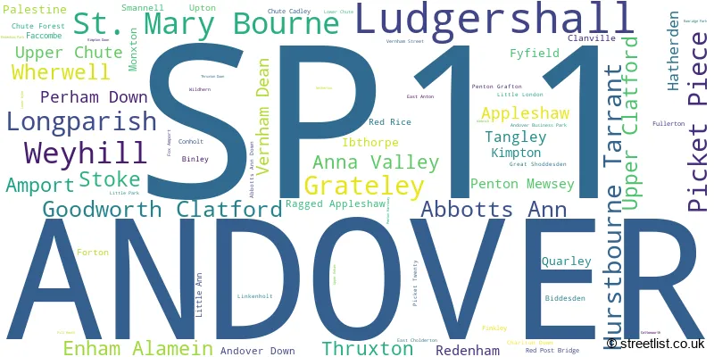
The largest settlement in the SP11 postal code is ANDOVER followed by Ludgershall, and Picket Piece.
The SP11 Postcode shares a border with RG17 (HUNGERFORD, Lambourn, Kintbury), RG20 (Kingsclere, Woolton Hill, Compton), RG28 (WHITCHURCH, Hurstbourne Priors, Laverstoke), SN8 (MARLBOROUGH, Ramsbury, Aldbourne), SP10 (ANDOVER, Charlton), SP9 (TIDWORTH, Shipton Bellinger), SP5 (Downton, Winterslow, Alderbury), SO21 (Colden Common, Sutton Scotney, Twyford) and SO20 (Kings Somborne, Middle Wallop, STOCKBRIDGE).


Schools in the Sector
Hurstbourne Tarrant Church of England Primary School
Phase: Primary
Address: Church Street , Hurstbourne Tarrant , Andover
Postcode: SP11 0AX
Headteacher: Mr Gareth Dee (Headteacher)
Ofsted Rating: Outstanding
Hatherden Church of England Primary School
Phase: Primary
Address: Hatherden Lane , Hatherden , Andover
Postcode: SP11 0HT
Headteacher: Mr Dan Genn (Headteacher)
Ofsted Rating: Serious Weaknesses
Vernham Dean Gillum's Church of England Primary School
Phase: Primary
Address: Vernham Dean , Andover
Postcode: SP11 0JY
Headteacher: Miss Sharon Pole (Headteacher)
Ofsted Rating: Good
St Mary Bourne Primary School
Phase: Primary
Address: School Lane , St Mary Bourne , Andover
Postcode: SP11 6AU
Headteacher: Mrs Jacqueline Hopkins (Headteacher)
Ofsted Rating: Good
Smannell and Enham Church of England (Aided) Primary School
Phase: Primary
Address: Smannell , Andover
Postcode: SP11 6JJ
Headteacher: Mrs Emma Jefferies (Interim) (Headteacher)
Ofsted Rating: Good
Smannell Field School
Phase: Not applicable
Address: Smannell Road , Andover
Postcode: SP11 6JP
Headteacher: Mrs Amanda Edney (Headteacher)
Ofsted Rating: Good
Icknield School
Phase: Not applicable
Address: River Way , Andover
Postcode: SP11 6LT
Headteacher: Mr Sean Cannon (Headteacher)
Ofsted Rating: Outstanding
Longparish Church of England Primary School
Phase: Primary
Address: Longparish , Andover
Postcode: SP11 6PB
Headteacher: Mr Mark Ward (Headteacher)
Ofsted Rating: Outstanding
Endeavour Primary School
Phase: Primary
Address: East Anton Farm Road , Andover
Postcode: SP11 6RD
Headteacher: Miss Helen Palmer (Headteacher (Acting))
Ofsted Rating: Requires improvement
Pilgrims' Cross CofE Aided Primary School
Phase: Primary
Address: Picket Twenty Way , Picket Twenty , Andover
Postcode: SP11 6TY
Headteacher: Mr Richard Osmond (Headteacher)
Ofsted Rating: Requires improvement
Abbotts Ann Church of England Primary School
Phase: Primary
Address: Duck Street , Abbotts Ann , Andover
Postcode: SP11 7FE
Headteacher: Mrs Claire Vignaux (Headteacher)
Ofsted Rating: Good
Wherwell Primary School
Phase: Primary
Address: Wherwell , Andover
Postcode: SP11 7JP
Headteacher: Mrs Mandy Ovenden (Headteacher)
Ofsted Rating: Good
Clatford Church of England Primary School
Phase: Primary
Address: Village Street , Goodworth Clatford , Andover
Postcode: SP11 7RE
Headteacher: Mr Matthew Kirk (Headteacher)
Ofsted Rating: Outstanding
Amport Church of England Primary School
Phase: Primary
Address: The Green , Amport , Andover
Postcode: SP11 8BA
Headteacher: Mrs Nicky King (Headteacher)
Ofsted Rating: Good
Grateley Primary School
Phase: Primary
Address: Grateley , Andover
Postcode: SP11 8JS
Headteacher: Mrs Amelia Norman (Headteacher)
Ofsted Rating: Good
Kimpton, Thruxton and Fyfield Church of England Primary School
Phase: Primary
Address: Thruxton Hill , Kimpton , Andover
Postcode: SP11 8NT
Headteacher: Mr Ian Hickman (Headteacher)
Ofsted Rating: Good
Grateley House School
Phase: Not applicable
Address: Pond Lane , Grateley , Andover
Postcode: SP11 8TA
Headteacher: Mrs Eva Pereira (Interim Principal)
Ofsted Rating: Good
Appleshaw St Peter's CofE Primary School
Phase: Primary
Address: Ragged Appleshaw , Andover
Postcode: SP11 9HR
Headteacher: Mr Ian Hickman (Headteacher)
Ofsted Rating: Good
Ludgershall Castle Primary School
Phase: Primary
Address: Short Street , Ludgershall , Andover
Postcode: SP11 9RB
Headteacher: Mr Andy Bridewell (Headteacher)
Ofsted Rating: Good
The Wellington Academy
Phase: Secondary
Address: Tidworth Road , Ludgershall
Postcode: SP11 9RR
Headteacher: Mr Rob Wood ()
Ofsted Rating: Good
Stations in the Sector
Grateley
CRS Code: GRT
Operator: SW
Line: South Western Main Line
Company: South Western Railway
Accessable Motorway Junctions
M3 J7
Average Driving Time from within the district: 19.38
Average Driving Distance: 17.34
Number of Postcodes that can access the Motorway Junction: 705
M3 J9
Average Driving Time from within the district: 20.75
Average Driving Distance: 18.40
Number of Postcodes that can access the Motorway Junction: 1203
M3 J10
Average Driving Time from within the district: 21.40
Average Driving Distance: 19.10
Number of Postcodes that can access the Motorway Junction: 888
M3 J11
Average Driving Time from within the district: 22.14
Average Driving Distance: 20.01
Number of Postcodes that can access the Motorway Junction: 777
M3 J6
Average Driving Time from within the district: 22.95
Average Driving Distance: 20.09
Number of Postcodes that can access the Motorway Junction: 54
M4 J13
Average Driving Time from within the district: 25.51
Average Driving Distance: 20.12
Number of Postcodes that can access the Motorway Junction: 413
M3 J12
Average Driving Time from within the district: 25.81
Average Driving Distance: 22.91
Number of Postcodes that can access the Motorway Junction: 245
M3 J13
Average Driving Time from within the district: 25.86
Average Driving Distance: 22.23
Number of Postcodes that can access the Motorway Junction: 12
M4 J14
Average Driving Time from within the district: 26.25
Average Driving Distance: 17.80
Number of Postcodes that can access the Motorway Junction: 631
M27 J2
Average Driving Time from within the district: 28.85
Average Driving Distance: 19.01
Number of Postcodes that can access the Motorway Junction: 76
M27 J3
Average Driving Time from within the district: 30.09
Average Driving Distance: 19.94
Number of Postcodes that can access the Motorway Junction: 10
M4 J15
Average Driving Time from within the district: 30.57
Average Driving Distance: 22.17
Number of Postcodes that can access the Motorway Junction: 173
Weather Forecast for Thruxton Motor Racing Circuit
| Time Period | Icon | Description | Temperature | Rain Probability | Wind |
|---|---|---|---|---|---|
| 12:00 to 15:00 | Cloudy | 14.0°C (feels like 13.0°C) | 11.00% | WSW 9 mph | |
| 15:00 to 18:00 | Partly cloudy (day) | 15.0°C (feels like 14.0°C) | 4.00% | W 7 mph | |
| 18:00 to 21:00 | Clear night | 11.0°C (feels like 11.0°C) | 0.00% | WSW 4 mph | |
| 21:00 to 00:00 | Clear night | 9.0°C (feels like 8.0°C) | 1.00% | WSW 4 mph |
| Time Period | Icon | Description | Temperature | Rain Probability | Wind |
|---|---|---|---|---|---|
| 00:00 to 03:00 | Fog | 8.0°C (feels like 7.0°C) | 16.00% | S 2 mph | |
| 03:00 to 06:00 | Fog | 7.0°C (feels like 7.0°C) | 19.00% | SE 2 mph | |
| 06:00 to 09:00 | Fog | 8.0°C (feels like 7.0°C) | 18.00% | SE 2 mph | |
| 09:00 to 12:00 | Mist | 10.0°C (feels like 10.0°C) | 17.00% | SSE 4 mph | |
| 12:00 to 15:00 | Cloudy | 15.0°C (feels like 13.0°C) | 7.00% | S 9 mph | |
| 15:00 to 18:00 | Partly cloudy (day) | 15.0°C (feels like 13.0°C) | 3.00% | S 9 mph | |
| 18:00 to 21:00 | Clear night | 11.0°C (feels like 10.0°C) | 0.00% | SSE 7 mph | |
| 21:00 to 00:00 | Clear night | 10.0°C (feels like 9.0°C) | 1.00% | SE 7 mph |
| Time Period | Icon | Description | Temperature | Rain Probability | Wind |
|---|---|---|---|---|---|
| 00:00 to 03:00 | Clear night | 11.0°C (feels like 9.0°C) | 1.00% | SSE 9 mph | |
| 03:00 to 06:00 | Clear night | 10.0°C (feels like 9.0°C) | 0.00% | SE 9 mph | |
| 06:00 to 09:00 | Partly cloudy (night) | 11.0°C (feels like 8.0°C) | 1.00% | SSE 9 mph | |
| 09:00 to 12:00 | Cloudy | 13.0°C (feels like 10.0°C) | 5.00% | SSE 13 mph | |
| 12:00 to 15:00 | Overcast | 15.0°C (feels like 12.0°C) | 11.00% | S 16 mph | |
| 15:00 to 18:00 | Overcast | 15.0°C (feels like 12.0°C) | 10.00% | S 13 mph | |
| 18:00 to 21:00 | Cloudy | 14.0°C (feels like 12.0°C) | 13.00% | SSE 11 mph | |
| 21:00 to 00:00 | Light rain shower (night) | 14.0°C (feels like 12.0°C) | 41.00% | S 13 mph |
| Time Period | Icon | Description | Temperature | Rain Probability | Wind |
|---|---|---|---|---|---|
| 00:00 to 03:00 | Heavy rain shower (night) | 13.0°C (feels like 11.0°C) | 59.00% | SSW 13 mph | |
| 03:00 to 06:00 | Light rain shower (night) | 11.0°C (feels like 9.0°C) | 37.00% | SSW 11 mph | |
| 06:00 to 09:00 | Clear night | 10.0°C (feels like 8.0°C) | 6.00% | SSW 9 mph | |
| 09:00 to 12:00 | Partly cloudy (day) | 11.0°C (feels like 9.0°C) | 8.00% | SSW 11 mph | |
| 12:00 to 15:00 | Light rain shower (day) | 12.0°C (feels like 10.0°C) | 37.00% | SW 13 mph | |
| 15:00 to 18:00 | Light rain shower (day) | 12.0°C (feels like 10.0°C) | 36.00% | SW 13 mph | |
| 18:00 to 21:00 | Clear night | 10.0°C (feels like 7.0°C) | 4.00% | WSW 11 mph | |
| 21:00 to 00:00 | Clear night | 8.0°C (feels like 6.0°C) | 3.00% | WSW 9 mph |
| Time Period | Icon | Description | Temperature | Rain Probability | Wind |
|---|---|---|---|---|---|
| 00:00 to 03:00 | Clear night | 8.0°C (feels like 5.0°C) | 4.00% | SW 9 mph | |
| 03:00 to 06:00 | Partly cloudy (night) | 8.0°C (feels like 5.0°C) | 5.00% | SW 9 mph | |
| 06:00 to 09:00 | Partly cloudy (night) | 8.0°C (feels like 6.0°C) | 9.00% | SW 9 mph | |
| 09:00 to 12:00 | Partly cloudy (day) | 10.0°C (feels like 8.0°C) | 9.00% | SW 11 mph | |
| 12:00 to 15:00 | Cloudy | 12.0°C (feels like 10.0°C) | 15.00% | SW 13 mph | |
| 15:00 to 18:00 | Cloudy | 13.0°C (feels like 11.0°C) | 33.00% | WSW 11 mph | |
| 18:00 to 21:00 | Partly cloudy (night) | 12.0°C (feels like 9.0°C) | 9.00% | WSW 11 mph | |
| 21:00 to 00:00 | Cloudy | 11.0°C (feels like 9.0°C) | 9.00% | WSW 9 mph |
| Postal Sector | Delivery Office |
|---|---|
| SP11 0 | Andover Delivery Office |
| SP11 6 | Andover Delivery Office |
| SP11 7 | Andover Delivery Office |
| SP11 8 | Andover Delivery Office |
| SP11 9 | Andover Delivery Office |
| SP11 9 | Tidworth Delivery Office |
| S | P | 1 | 1 | - | X | X | X |
| S | P | 1 | 1 | Space | Numeric | Letter | Letter |
Street List for the SP11 District
Current Monthly Rental Prices
| # Bedrooms | Min Price | Max Price | Avg Price |
|---|---|---|---|
| 1 | £650 | £650 | £650 |
| 2 | £950 | £1,500 | £1,057 |
| 3 | £875 | £3,250 | £1,563 |
| 4 | £1,995 | £3,250 | £2,415 |
| 5 | £3,200 | £5,000 | £4,100 |
Current House Prices
| # Bedrooms | Min Price | Max Price | Avg Price |
|---|---|---|---|
| £80,000 | £7,410,000 | £1,189,579 | |
| 1 | £75,000 | £169,995 | £120,174 |
| 2 | £128,250 | £615,000 | £258,003 |
| 3 | £201,000 | £1,575,000 | £454,092 |
| 4 | £310,000 | £1,500,000 | £589,087 |
| 5 | £450,000 | £1,800,000 | £1,062,497 |
| 6 | £1,200,000 | £11,500,000 | £3,620,833 |
| 7 | £699,950 | £975,000 | £883,317 |
| 9 | £3,650,000 | £3,650,000 | £3,650,000 |
Estate Agents
| Logo | Name | Brand Name | Address | Contact Number |
|---|---|---|---|---|
 | Andover | Graham & Co | 13 London Street, Andover, SP10 2NU | 01264 312452 |
 | Andover | Austin Hawk Estate Agents | 1-2 Swan Court East Street Andover SP10 1EZ | 01264 312482 |
 | Andover | Connells | Winchester House Winchester street Andover SP10 2EA | 01264 608252 |
 | Stockbridge | Evans & Partridge | Agriculture House,High Street, Stockbridge, SO20 6HF | 01264 810702 |
 | Andover | Belvoir | 18 Bridge Street Andover SP10 1BH | 01264 608119 |
- Abbotts Ann
- Amport
- Andover Down
- Andover
- Anna Valley
- Appleshaw
- Ashmansworth
- Binley
- Buttermere
- Chilbolton
- Chute Cadley
- Chute Forest
- Clanville
- Cottonworth
- East Anton
- East Cholderton
- Enham Alamein
- Faccombe
- Forton
- Fullerton
- Fyfield
- Goodworth Clatford
- Grateley
- Great Shoddesden
- Hatherden
- Hurstbourne Priors
- Hurstbourne Tarrant
- Ibthorpe
- Kentsboro
- Kimpton
- Linkenholt
- Longparish
- Longstock
- Ludgershall
- Middleton
- Monxton
- Mullenspond
- Palestine
- Penton Corner
- Penton Grafton
- Penton Mewsey
- Perham Down
- Picket Piece
- Quarley
- Red Rice
- Redenham
- Smannell
- St Mary Bourne
- Stoke
- Tangley
- Thruxton
- Upper Chute
- Upper Clatford
- Upton
- Vernham Dean
- Vernham Street
- Wadwick
- Weyhill
- Wherwell
- Whitchurch
- Wildhern
Yearly House Price Averages for the District
| Type of Property | 2018 Average | 2018 Sales | 2017 Average | 2017 Sales | 2016 Average | 2016 Sales | 2015 Average | 2015 Sales |
|---|---|---|---|---|---|---|---|---|
| Detached | £472,137 | 256 | £460,653 | 287 | £438,251 | 235 | £431,998 | 282 |
| Semi-Detached | £271,734 | 249 | £280,690 | 215 | £287,145 | 215 | £250,140 | 208 |
| Terraced | £257,139 | 176 | £254,772 | 125 | £248,831 | 179 | £227,168 | 194 |
| Flats | £147,691 | 69 | £157,148 | 100 | £164,776 | 74 | £131,743 | 97 |