The RG20 5 postcode sector is within the county of Hampshire.
Did you know? According to the 2021 Census, the RG20 5 postcode sector is home to a bustling 2,992 residents!
Given that each sector allows for 400 unique postcode combinations. Letters C, I, K, M, O and V are not allowed in the last two letters of a postcode. With 101 postcodes already in use, this leaves 299 units available.
The RG20 5 postal code covers the settlement of Kingsclere.
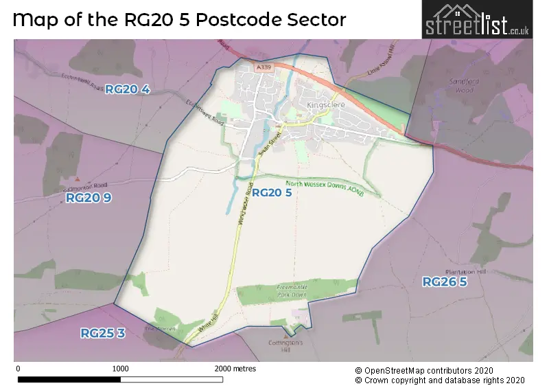
The RG20 5 Postcode shares a border with RG20 4 (Bishops Green, Kingsclere, Ecchinswell), RG20 9 (Woolton Hill, Highclere, Burghclere), RG25 3 (Overton, Steventon, Deane) and RG26 5 (Bramley, Baughurst, Little London).
The sector is within the post town of NEWBURY.
RG20 5 is a postcode sector within the RG20 postcode district which is within the RG Reading postcode area.
The Royal Mail delivery office for the RG20 5 postal sector is the Newbury Delivery Office and Kingsclere Scale Payment Delivery Office.
The area of the RG20 5 postcode sector is 2.22 square miles which is 5.74 square kilometres or 1,418.96 square acres.

Map of the RG20 5 Postcode Sector
Explore the RG20 5 postcode sector by using our free interactive map.
| R | G | 2 | 0 | - | 5 | X | X |
| R | G | 2 | 0 | Space | 5 | Letter | Letter |
Official List of Streets
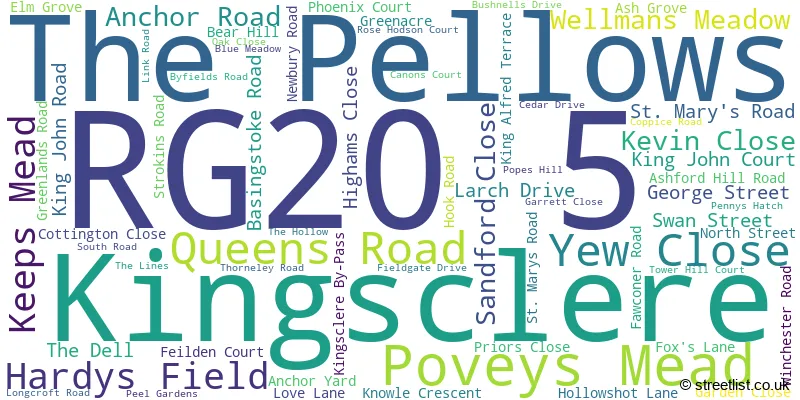
Kingsclere (61 Streets)
Unofficial Streets or Alternative Spellings
Weather Forecast for RG20 5
Press Button to Show Forecast for Whitway
| Time Period | Icon | Description | Temperature | Rain Probability | Wind |
|---|---|---|---|---|---|
| 18:00 to 21:00 | Partly cloudy (day) | 19.0°C (feels like 19.0°C) | 0.00% | SSE 4 mph | |
| 21:00 to 00:00 | Partly cloudy (night) | 15.0°C (feels like 15.0°C) | 0.00% | S 4 mph |
Press Button to Show Forecast for Whitway
| Time Period | Icon | Description | Temperature | Rain Probability | Wind |
|---|---|---|---|---|---|
| 00:00 to 03:00 | Clear night | 12.0°C (feels like 12.0°C) | 0.00% | E 4 mph | |
| 03:00 to 06:00 | Clear night | 10.0°C (feels like 9.0°C) | 0.00% | E 4 mph | |
| 06:00 to 09:00 | Sunny day | 11.0°C (feels like 10.0°C) | 0.00% | ENE 4 mph | |
| 09:00 to 12:00 | Partly cloudy (day) | 16.0°C (feels like 16.0°C) | 0.00% | E 7 mph | |
| 12:00 to 15:00 | Cloudy | 21.0°C (feels like 19.0°C) | 3.00% | ESE 9 mph | |
| 15:00 to 18:00 | Cloudy | 21.0°C (feels like 20.0°C) | 4.00% | SE 7 mph | |
| 18:00 to 21:00 | Partly cloudy (day) | 20.0°C (feels like 19.0°C) | 0.00% | SE 7 mph | |
| 21:00 to 00:00 | Clear night | 15.0°C (feels like 14.0°C) | 0.00% | ESE 7 mph |
Press Button to Show Forecast for Whitway
| Time Period | Icon | Description | Temperature | Rain Probability | Wind |
|---|---|---|---|---|---|
| 00:00 to 03:00 | Partly cloudy (night) | 13.0°C (feels like 12.0°C) | 1.00% | E 7 mph | |
| 03:00 to 06:00 | Partly cloudy (night) | 12.0°C (feels like 11.0°C) | 1.00% | E 7 mph | |
| 06:00 to 09:00 | Cloudy | 14.0°C (feels like 13.0°C) | 4.00% | E 7 mph | |
| 09:00 to 12:00 | Cloudy | 18.0°C (feels like 18.0°C) | 5.00% | ESE 7 mph | |
| 12:00 to 15:00 | Cloudy | 21.0°C (feels like 20.0°C) | 12.00% | SSE 9 mph | |
| 15:00 to 18:00 | Light rain shower (day) | 20.0°C (feels like 19.0°C) | 34.00% | SSW 9 mph | |
| 18:00 to 21:00 | Cloudy | 17.0°C (feels like 16.0°C) | 9.00% | SSW 7 mph | |
| 21:00 to 00:00 | Partly cloudy (night) | 14.0°C (feels like 13.0°C) | 7.00% | SSW 7 mph |
Press Button to Show Forecast for Whitway
| Time Period | Icon | Description | Temperature | Rain Probability | Wind |
|---|---|---|---|---|---|
| 00:00 to 03:00 | Overcast | 12.0°C (feels like 11.0°C) | 10.00% | SSW 7 mph | |
| 03:00 to 06:00 | Overcast | 11.0°C (feels like 10.0°C) | 15.00% | SSW 9 mph | |
| 06:00 to 09:00 | Overcast | 12.0°C (feels like 10.0°C) | 16.00% | S 9 mph | |
| 09:00 to 12:00 | Cloudy | 14.0°C (feels like 11.0°C) | 19.00% | S 13 mph | |
| 12:00 to 15:00 | Light rain | 14.0°C (feels like 12.0°C) | 53.00% | S 13 mph | |
| 15:00 to 18:00 | Heavy rain | 14.0°C (feels like 12.0°C) | 80.00% | SSE 16 mph | |
| 18:00 to 21:00 | Heavy rain | 13.0°C (feels like 11.0°C) | 85.00% | S 13 mph | |
| 21:00 to 00:00 | Light rain shower (night) | 12.0°C (feels like 10.0°C) | 49.00% | S 11 mph |
Press Button to Show Forecast for Whitway
| Time Period | Icon | Description | Temperature | Rain Probability | Wind |
|---|---|---|---|---|---|
| 00:00 to 03:00 | Light rain shower (night) | 11.0°C (feels like 9.0°C) | 43.00% | S 9 mph | |
| 03:00 to 06:00 | Cloudy | 10.0°C (feels like 8.0°C) | 16.00% | S 9 mph | |
| 06:00 to 09:00 | Cloudy | 11.0°C (feels like 9.0°C) | 14.00% | S 11 mph | |
| 09:00 to 12:00 | Cloudy | 13.0°C (feels like 10.0°C) | 18.00% | S 13 mph | |
| 12:00 to 15:00 | Light rain shower (day) | 14.0°C (feels like 11.0°C) | 38.00% | S 16 mph | |
| 15:00 to 18:00 | Light rain shower (day) | 14.0°C (feels like 11.0°C) | 35.00% | S 16 mph | |
| 18:00 to 21:00 | Light rain shower (day) | 13.0°C (feels like 11.0°C) | 33.00% | SSW 13 mph | |
| 21:00 to 00:00 | Clear night | 11.0°C (feels like 9.0°C) | 7.00% | S 9 mph |
Schools and Places of Education Within the RG20 5 Postcode Sector
Kingsclere Church of England Primary School
Voluntary controlled school
Ash Grove, Newbury, Berkshire, RG20 5RE
Head: Mrs Joanna Messenger
Ofsted Rating: Good
Inspection: 2019-01-30 (1927 days ago)
Website: Visit Kingsclere Church of England Primary School Website
Phone: 01635298583
Number of Pupils: 206
House Prices in the RG20 5 Postcode Sector
| Type of Property | 2018 Average | 2018 Sales | 2017 Average | 2017 Sales | 2016 Average | 2016 Sales | 2015 Average | 2015 Sales |
|---|---|---|---|---|---|---|---|---|
| Detached | £633,900 | 10 | £456,033 | 15 | £621,795 | 10 | £446,012 | 10 |
| Semi-Detached | £462,500 | 6 | £370,433 | 19 | £321,730 | 15 | £334,888 | 13 |
| Terraced | £310,788 | 13 | £298,767 | 15 | £285,173 | 24 | £268,807 | 23 |
| Flats | £198,738 | 4 | £170,500 | 4 | £185,231 | 13 | £152,750 | 4 |
Important Postcodes RG20 5 in the Postcode Sector
RG20 5QX is the postcode for Kingsclere Medical Practice, Kingsclere Health Centre, North Street, and Kingsclere Health Centre, North Street
RG20 5RE is the postcode for Kingsclere CE (C) Primary School, Ash Grove
| The RG20 5 Sector is within these Local Authorities |
|
|---|---|
| The RG20 5 Sector is within these Counties |
|
| The RG20 5 Sector is within these Water Company Areas |
|