The RG5 3 postcode sector is within the county of Berkshire.
Did you know? According to the 2021 Census, the RG5 3 postcode sector is home to a bustling 11,557 residents!
Given that each sector allows for 400 unique postcode combinations. Letters C, I, K, M, O and V are not allowed in the last two letters of a postcode. With 211 postcodes already in use, this leaves 189 units available.
The RG5 3 postal code covers the settlement of Woodley.
The RG5 3 Postcode shares a border with RG5 4 (Woodley), RG6 1 (Earley, READING), RG6 7 (Earley, READING, Lower Earley) and RG4 6 (Caversham, Sonning, Sonning Eye).
The sector is within the post town of READING.
RG5 3 is a postcode sector within the RG5 postcode district which is within the RG Reading postcode area.
The Royal Mail delivery office for the RG5 3 postal sector is the East Reading Delivery Office.
The area of the RG5 3 postcode sector is 1.18 square miles which is 3.07 square kilometres or 757.94 square acres.

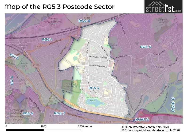
Map of the RG5 3 Postcode Sector
Explore the RG5 3 postcode sector by using our free interactive map.
| R | G | 5 | - | 3 | X | X |
| R | G | 5 | Space | 3 | Letter | Letter |
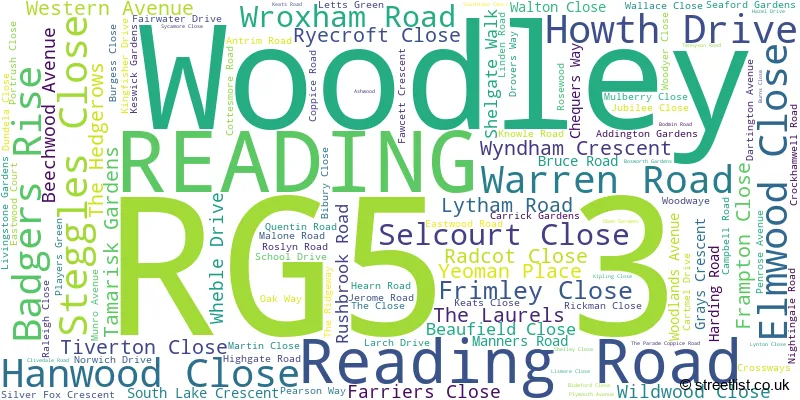
Official List of Streets
Woodley (106 Streets)
Unofficial Streets or Alternative Spellings
Weather Forecast for RG5 3
Press Button to Show Forecast for Reading University
| Time Period | Icon | Description | Temperature | Rain Probability | Wind |
|---|---|---|---|---|---|
| 18:00 to 21:00 | Cloudy | 10.0°C (feels like 9.0°C) | 8.00% | ESE 7 mph | |
| 21:00 to 00:00 | Overcast | 8.0°C (feels like 7.0°C) | 12.00% | E 7 mph |
Press Button to Show Forecast for Reading University
| Time Period | Icon | Description | Temperature | Rain Probability | Wind |
|---|---|---|---|---|---|
| 00:00 to 03:00 | Overcast | 8.0°C (feels like 5.0°C) | 49.00% | ENE 9 mph | |
| 03:00 to 06:00 | Overcast | 7.0°C (feels like 4.0°C) | 19.00% | NE 11 mph | |
| 06:00 to 09:00 | Light rain | 6.0°C (feels like 3.0°C) | 57.00% | ENE 11 mph | |
| 09:00 to 12:00 | Light rain | 7.0°C (feels like 4.0°C) | 76.00% | ENE 11 mph | |
| 12:00 to 15:00 | Overcast | 9.0°C (feels like 7.0°C) | 11.00% | ENE 9 mph | |
| 15:00 to 18:00 | Cloudy | 11.0°C (feels like 9.0°C) | 8.00% | NE 9 mph | |
| 18:00 to 21:00 | Overcast | 10.0°C (feels like 8.0°C) | 23.00% | NE 11 mph | |
| 21:00 to 00:00 | Heavy rain | 9.0°C (feels like 6.0°C) | 87.00% | NNE 11 mph |
Press Button to Show Forecast for Reading University
| Time Period | Icon | Description | Temperature | Rain Probability | Wind |
|---|---|---|---|---|---|
| 00:00 to 03:00 | Heavy rain | 8.0°C (feels like 5.0°C) | 90.00% | NNE 11 mph | |
| 03:00 to 06:00 | Heavy rain | 7.0°C (feels like 4.0°C) | 91.00% | NNE 11 mph | |
| 06:00 to 09:00 | Heavy rain | 7.0°C (feels like 4.0°C) | 85.00% | N 11 mph | |
| 09:00 to 12:00 | Light rain | 7.0°C (feels like 4.0°C) | 55.00% | NW 11 mph | |
| 12:00 to 15:00 | Light rain | 8.0°C (feels like 6.0°C) | 56.00% | WNW 11 mph | |
| 15:00 to 18:00 | Cloudy | 10.0°C (feels like 8.0°C) | 11.00% | W 9 mph | |
| 18:00 to 21:00 | Cloudy | 10.0°C (feels like 9.0°C) | 6.00% | WSW 7 mph | |
| 21:00 to 00:00 | Partly cloudy (night) | 8.0°C (feels like 6.0°C) | 3.00% | SW 7 mph |
Press Button to Show Forecast for Reading University
| Time Period | Icon | Description | Temperature | Rain Probability | Wind |
|---|---|---|---|---|---|
| 00:00 to 03:00 | Clear night | 6.0°C (feels like 4.0°C) | 1.00% | SW 4 mph | |
| 03:00 to 06:00 | Clear night | 5.0°C (feels like 3.0°C) | 1.00% | SSW 4 mph | |
| 06:00 to 09:00 | Sunny day | 6.0°C (feels like 4.0°C) | 1.00% | S 4 mph | |
| 09:00 to 12:00 | Partly cloudy (day) | 11.0°C (feels like 9.0°C) | 1.00% | S 9 mph | |
| 12:00 to 15:00 | Cloudy | 13.0°C (feels like 11.0°C) | 6.00% | S 11 mph | |
| 15:00 to 18:00 | Partly cloudy (day) | 14.0°C (feels like 11.0°C) | 2.00% | S 11 mph | |
| 18:00 to 21:00 | Sunny day | 13.0°C (feels like 11.0°C) | 1.00% | S 9 mph | |
| 21:00 to 00:00 | Clear night | 9.0°C (feels like 8.0°C) | 2.00% | SSE 7 mph |
Press Button to Show Forecast for Reading University
| Time Period | Icon | Description | Temperature | Rain Probability | Wind |
|---|---|---|---|---|---|
| 00:00 to 03:00 | Clear night | 8.0°C (feels like 6.0°C) | 3.00% | SE 7 mph | |
| 03:00 to 06:00 | Clear night | 8.0°C (feels like 6.0°C) | 3.00% | ESE 7 mph | |
| 06:00 to 09:00 | Sunny day | 9.0°C (feels like 7.0°C) | 3.00% | ESE 7 mph | |
| 09:00 to 12:00 | Partly cloudy (day) | 13.0°C (feels like 11.0°C) | 3.00% | SE 9 mph | |
| 12:00 to 15:00 | Partly cloudy (day) | 16.0°C (feels like 13.0°C) | 6.00% | SE 11 mph | |
| 15:00 to 18:00 | Cloudy | 16.0°C (feels like 14.0°C) | 7.00% | SSE 11 mph | |
| 18:00 to 21:00 | Sunny day | 15.0°C (feels like 13.0°C) | 6.00% | SE 9 mph | |
| 21:00 to 00:00 | Partly cloudy (night) | 12.0°C (feels like 11.0°C) | 6.00% | SE 7 mph |
Schools and Places of Education Within the RG5 3 Postcode Sector
Addington School
Community special school
Woodlands Avenue, Reading, Berkshire, RG5 3EU
Head: Mrs Sara Attra
Ofsted Rating: Outstanding
Inspection: 2023-03-29 (394 days ago)
Website: Visit Addington School Website
Phone: 01189669073
Number of Pupils: 273
Highwood Primary School
Community school
Fairwater Drive, Reading, Berkshire, RG5 3JE
Head: Mr Matthew Hickey
Ofsted Rating: Good
Inspection: 2021-12-02 (876 days ago)
Website: Visit Highwood Primary School Website
Phone: 01189265493
Number of Pupils: 480
St Dominic Savio Catholic Primary School
Voluntary aided school
Western Avenue, Woodley, Berkshire, RG5 3BH
Head: Mrs Laura Hulland
Ofsted Rating: Outstanding
Inspection: 2020-02-12 (1535 days ago)
Website: Visit St Dominic Savio Catholic Primary School Website
Phone: 01189693893
Number of Pupils: 420
House Prices in the RG5 3 Postcode Sector
| Type of Property | 2018 Average | 2018 Sales | 2017 Average | 2017 Sales | 2016 Average | 2016 Sales | 2015 Average | 2015 Sales |
|---|---|---|---|---|---|---|---|---|
| Detached | £507,983 | 23 | £464,902 | 28 | £470,533 | 15 | £453,694 | 32 |
| Semi-Detached | £380,364 | 55 | £382,173 | 70 | £364,519 | 50 | £335,935 | 68 |
| Terraced | £328,043 | 34 | £320,727 | 46 | £333,556 | 45 | £296,737 | 43 |
| Flats | £208,556 | 9 | £224,682 | 22 | £215,791 | 23 | £195,795 | 21 |
Important Postcodes RG5 3 in the Postcode Sector
RG5 3BH is the postcode for St. Dominic Savio RC (Aided) Primary School, Western Avenue, and St. Dominic Savio RC (Aided) Primary School, Western Avenue, Woodley
RG5 3EL is the postcode for G ROOMS, The Bulmershe School, Chequers Way, The Bulmershe School, Chequers Way, LOWER SCHOOL, HUMANITIES & SCIENCE, The Bulmershe School, Chequers Way, TECHNOLOGY BLOCK, The Bulmershe School, Chequers Way, ART & IT BLOCK, The Bulmershe School, Chequers Way, 6TH FORM, The Bulmershe School, Chequers Way, and RECEPTION, The Bulmershe School, Chequers Way
RG5 3EU is the postcode for Bulmershe Centre, Woodlands Avenue, Addington School, Woodlands Avenue, Addington SEN School, Woodlands Avenue, Bulmershe Leisure Centre, Woodlands Avenue, and Bulmershe Leisure Centre, Woodlands Avenue, Woodley
RG5 3JE is the postcode for Highwood Primary School, Fairwater Drive, Woodley, and Highwood Primary School, Fairwater Drive
RG5 3NA is the postcode for South Lake Primary School, Campbell Road, Woodley, Southlake County Junior School, Campbell Road, and South Lake Primary School, Campbell Road
| The RG5 3 Sector is within these Local Authorities |
|
|---|---|
| The RG5 3 Sector is within these Counties |
|
| The RG5 3 Sector is within these Water Company Areas |
|