Advertisement
The RM20 1 postcode sector is within the county of Essex.
Given that each sector allows for 400 unique postcode combinations. Letters C, I, K, M, O and V are not allowed in the last two letters of a postcode. With 3 postcodes already in use, this leaves 397 units available.
The sector is within the post town of GRAYS.
RM20 1 is a postcode sector within the RM2 postcode district which is within the RM Romford postcode area.
The Royal Mail delivery office for the RM20 1 postal sector is the unknown.
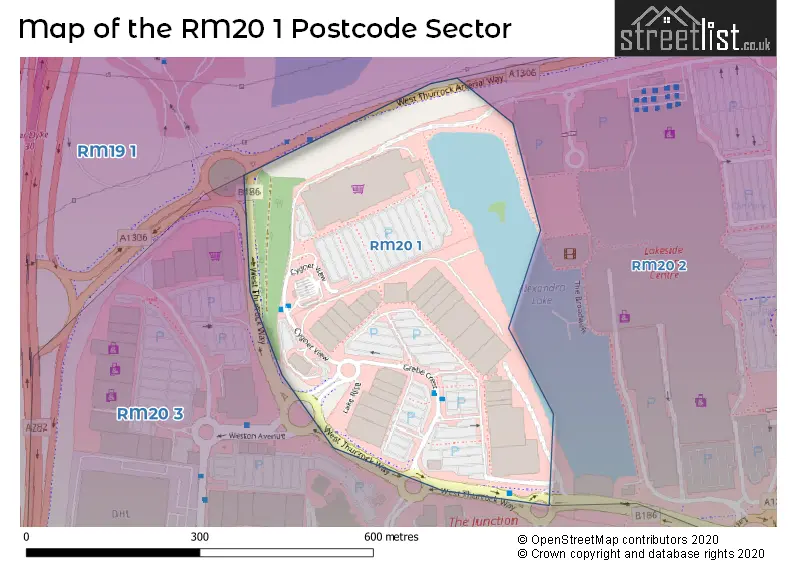
The area of the RM20 1 postcode sector is 0.11 square miles which is 0.28 square kilometres or 70.15 square acres.
Advertisement


Map of the RM20 1 Postcode Sector
Explore the RM20 1 postcode sector by using our free interactive map.
| R | M | 2 | 0 | - | 1 | X | X |
| R | M | 2 | 0 | Space | 1 | Letter | Letter |
Official List of Streets
Unofficial Streets or Alternative Spellings
House Prices in the RM20 1 Postcode Sector
| Type of Property | 2018 Average | 2018 Sales | 2017 Average | 2017 Sales | 2016 Average | 2016 Sales | 2015 Average | 2015 Sales |
|---|---|---|---|---|---|---|---|---|
| Detached | £0 | 0 | £0 | 0 | £0 | 0 | £0 | 0 |
| Semi-Detached | £0 | 0 | £0 | 0 | £0 | 0 | £0 | 0 |
| Terraced | £0 | 0 | £0 | 0 | £0 | 0 | £0 | 0 |
| Flats | £0 | 0 | £0 | 0 | £0 | 0 | £0 | 0 |
| The RM20 1 Sector is within these Local Authorities |
|
|---|---|
| The RM20 1 Sector is within these Counties |
|
| The RM20 1 Sector is within these Water Company Areas |
|