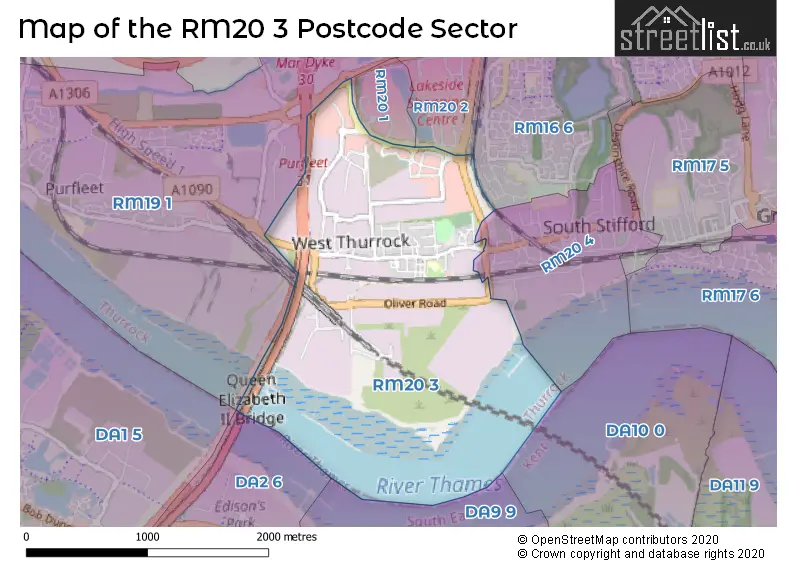
The RM20 3 postcode sector stands on the Essex and Kent border.
Did you know? According to the 2021 Census, the RM20 3 postcode sector is home to a bustling 3,209 residents!
Given that each sector allows for 400 unique postcode combinations. Letters C, I, K, M, O and V are not allowed in the last two letters of a postcode. With 82 postcodes already in use, this leaves 318 units available.
The RM20 3 postal code covers the settlement of WEST THURROCK .
The RM20 3 Postcode shares a border with RM20 4 (WEST THURROCK , SOUTH STIFFORD ), DA2 6 (DARTFORD, STONE, DARENTH), RM16 6 (CHAFFORD HUNDRED, GRAYS) and RM19 1 (PURFLEET ).
The sector is within the post town of GRAYS.
RM20 3 is a postcode sector within the RM2 postcode district which is within the RM Romford postcode area.
The Royal Mail delivery office for the RM20 3 postal sector is the unknown.
The area of the RM20 3 postcode sector is 1.50 square miles which is 3.89 square kilometres or 961.42 square acres.
The RM20 3 postcode sector is crossed by the M25 motorway.
The RM20 3 postcode sector is crossed by the A282 Major A road.
The RM20 3 postcode sector is crossed by the A13 Major A road.

Map of the RM20 3 Postcode Sector
Explore the RM20 3 postcode sector by using our free interactive map.
| R | M | 2 | 0 | - | 3 | X | X |
| R | M | 2 | 0 | Space | 3 | Letter | Letter |
Official List of Streets
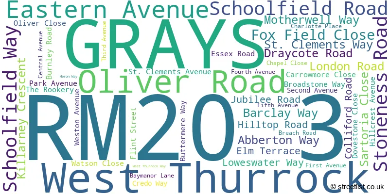
West Thurrock (15 Streets)
GRAYS (32 Streets)
Unofficial Streets or Alternative Spellings
Schools and Places of Education Within the RM20 3 Postcode Sector
West Thurrock Academy
Academy converter
Schoolfield Road, Grays, Essex, RM20 3HR
Head: Mr Sam Proctor
Ofsted Rating: Good
Inspection: 2022-07-13 (691 days ago)
Website: Visit West Thurrock Academy Website
Phone: 01708866743
Number of Pupils: 442
House Prices in the RM20 3 Postcode Sector
| Type of Property | 2018 Average | 2018 Sales | 2017 Average | 2017 Sales | 2016 Average | 2016 Sales | 2015 Average | 2015 Sales |
|---|---|---|---|---|---|---|---|---|
| Detached | £340,000 | 1 | £342,000 | 1 | £322,500 | 2 | £0 | 0 |
| Semi-Detached | £293,500 | 9 | £292,545 | 11 | £267,250 | 8 | £232,313 | 8 |
| Terraced | £337,572 | 43 | £294,313 | 27 | £242,808 | 23 | £194,604 | 24 |
| Flats | £167,750 | 10 | £186,961 | 19 | £171,161 | 17 | £128,441 | 17 |
Important Postcodes RM20 3 in the Postcode Sector
RM20 3AE is the postcode for West Thurrock Academy, Schoolfield Road
RM20 3FJ is the postcode for ROYAL MAIL DISTRIBUTION CENTRE, Unit 6a, Trade Link, Weston Avenue, Waterglade Industrial Park
RM20 3LP is the postcode for Decathlon UK Ltd, Unit 11 The Junction Thurrock Shopping Park, Weston Avenue
| The RM20 3 Sector is within these Local Authorities |
|
|---|---|
| The RM20 3 Sector is within these Counties |
|
| The RM20 3 Sector is within these Water Company Areas |
|