The S60 4 postcode sector is within the county of South Yorkshire.
Did you know? According to the 2021 Census, the S60 4 postcode sector is home to a bustling 6,376 residents!
Given that each sector allows for 400 unique postcode combinations. Letters C, I, K, M, O and V are not allowed in the last two letters of a postcode. With 141 postcodes already in use, this leaves 259 units available.
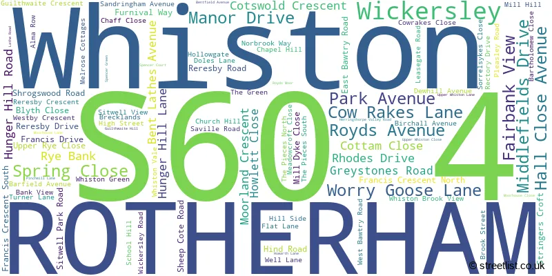
The largest settlements in the S60 4 postal code are Whiston and ROTHERHAM.
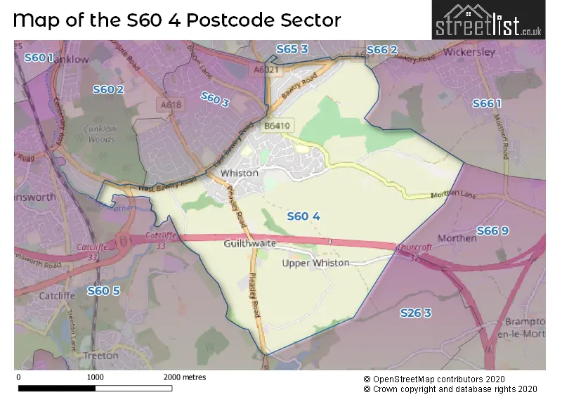
The S60 4 Postcode shares a border with S60 2 (ROTHERHAM), S60 3 (ROTHERHAM), S66 1 (Wickersley, Bramley), S66 2 (Wickersley, Bramley, Flanderwell), S26 3 (Aughton, Swallownest, Ulley), S66 9 (Thurcroft, Brampton-en-le-Morthen, Morthen), S60 5 (Brinsworth, Treeton, Catcliffe) and S65 3 (ROTHERHAM, Dalton).
The sector is within the post town of ROTHERHAM.
S60 4 is a postcode sector within the S6 postcode district which is within the S Sheffield postcode area.
The Royal Mail delivery office for the S60 4 postal sector is the Sheffield Npostal Delivery Office.
The area of the S60 4 postcode sector is 3.36 square miles which is 8.70 square kilometres or 2,149.17 square acres.
The S60 4 postcode sector is crossed by the M1 motorway.
The S60 4 postcode sector is crossed by the M18 motorway.
Waterways within the S60 4 postcode sector include the River Rother.

Map of the S60 4 Postcode Sector
Explore the S60 4 postcode sector by using our free interactive map.
| S | 6 | 0 | - | 4 | X | X |
| S | 6 | 0 | Space | 4 | Letter | Letter |
Official List of Streets
Whiston (74 Streets)
ROTHERHAM (13 Streets)
Wickersley (1 Streets)
Unofficial Streets or Alternative Spellings
Bramley
BAWTRY ROADROTHERHAM
BRECKS LANE BROOM LANE GALLOW TREE ROAD GREAT BANK ROAD HAWORTH CRESCENT MAYNARD ROADWhiston
MELROSE COTTAGESAughton
PLEASLEY ROAD CHAFF LANE FIELD LANE GUILTHWAITE COMMON LANE HAWORTH LANE HOLLOW GATE LEASE GATE ROAD LITTLE COMMON LANE LONG LANE MORTHEN LANE PINCH MILL LANE ROTHERHAM ROUNDWALK ROTHERWAY ROTHERWAY ROUNDABOUT ROYDS MOOR HILL STAG ROUNDABOUT STOW BRIDGE LANE WORRYGOOSE ROUNDABOUTUlley
RESERVOIR ROADWickersley
SANDY FLAT LANEThurcroft
MORTHEN LANESchools and Places of Education Within the S60 4 Postcode Sector
Whiston Junior and Infant School
Academy converter
Saville Road, Rotherham, South Yorkshire, S60 4DX
Head: Mrs Tina Angell
Ofsted Rating: Good
Inspection: 2020-01-22 (1593 days ago)
Website: Visit Whiston Junior and Infant School Website
Phone: 01709828189
Number of Pupils: 206
Whiston Worrygoose Junior and Infant School
Academy converter
Hall Close Avenue, Rotherham, South Yorkshire, S60 4AG
Head: Mrs Vanessa Hill
Ofsted Rating: Outstanding
Inspection: 2021-10-07 (969 days ago)
Website: Visit Whiston Worrygoose Junior and Infant School Website
Phone: 01709541878
Number of Pupils: 239
House Prices in the S60 4 Postcode Sector
| Type of Property | 2018 Average | 2018 Sales | 2017 Average | 2017 Sales | 2016 Average | 2016 Sales | 2015 Average | 2015 Sales |
|---|---|---|---|---|---|---|---|---|
| Detached | £301,429 | 7 | £302,416 | 23 | £295,100 | 20 | £219,900 | 15 |
| Semi-Detached | £174,653 | 43 | £166,421 | 75 | £150,078 | 60 | £144,522 | 57 |
| Terraced | £129,339 | 14 | £120,409 | 11 | £140,500 | 9 | £109,800 | 10 |
| Flats | £157,000 | 1 | £138,500 | 2 | £0 | 0 | £185,000 | 1 |
Important Postcodes S60 4 in the Postcode Sector
S60 4AG is the postcode for MAIN BUILDING, Whiston Worry Goose Junior & Infants School, Hall Close Avenue, Whiston Worry Goose Junior & Infants School, Hall Close Avenue, and Whiston Worry Goose Junior & Infants School, Hall Close Avenue, Whiston
S60 4DX is the postcode for Whiston Junior & Infant School, Saville Road, and MAIN BUILDING, Whiston Junior & Infant School, Saville Road
| The S60 4 Sector is within these Local Authorities |
|
|---|---|
| The S60 4 Sector is within these Counties |
|
| The S60 4 Sector is within these Water Company Areas |
|