The SA5 9 postcode sector is within the county of West Glamorgan.
Did you know? According to the 2021 Census, the SA5 9 postcode sector is home to a bustling 8,116 residents!
Given that each sector allows for 400 unique postcode combinations. Letters C, I, K, M, O and V are not allowed in the last two letters of a postcode. With 143 postcodes already in use, this leaves 257 units available.
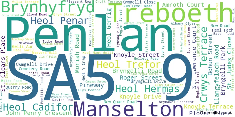
The largest settlement in the SA5 9 postal code is TREBOETH followed by BRYNHYFRYD, and MANSELTON.
The SA5 9 Postcode shares a border with SA1 2 (HAFOD, LANDORE, WAUN WEN), SA5 8 (GENDROS, MANSELTON, CWMBWRLA), SA6 7 (MORRISTON, CLASE), SA6 8 (MORRISTON, PLASMARL, SWANSEA ENTERPRISE PARK) and SA5 7 (PENLAN, LLANGYFELACH, FELINDRE).
The sector is within the post town of SWANSEA.
SA5 9 is a postcode sector within the SA5 postcode district which is within the SA Swansea postcode area.
The Royal Mail delivery office for the SA5 9 postal sector is the Swansea Delivery Office.
The area of the SA5 9 postcode sector is 0.71 square miles which is 1.84 square kilometres or 454.58 square acres.

Map of the SA5 9 Postcode Sector
Explore the SA5 9 postcode sector by using our free interactive map.
| S | A | 5 | - | 9 | X | X |
| S | A | 5 | Space | 9 | Letter | Letter |
Official List of Streets
Brynhyfryd (26 Streets)
Penlan (9 Streets)
Manselton (18 Streets)
Treboeth (33 Streets)
Unofficial Streets or Alternative Spellings
Landore
BRYN TERRACE CWMLAN TERRACE MYSYDD TERRACE PLOUGH ROAD SILOH ROADManselton
CECIL STREET ELGIN STREET MANSELTON ROAD RICHARD STREET CAE-BRICKS ROAD CAE-PYS ROAD COURTENAY STREET HOPKINS STREET LLYS-Y-FELIN PENTRE MAWR ROAD ST JOHNS ROAD WAUN-GRON ROAD WOODLAND HOUSETreboeth
CLIFTON COURT PARKHILL ROAD PARKHILL TERRACE PENLAN ROADSWANSEA
MAINWARING TERRACEPenlan
HEOL GWYROSYDD MYNYDD NEWYDD ROADMorriston
CWMGELLI ROADCwmbwrla
DAVID STREET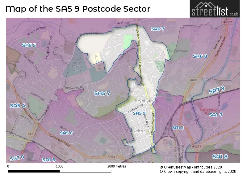
House Prices in the SA5 9 Postcode Sector
| Type of Property | 2018 Average | 2018 Sales | 2017 Average | 2017 Sales | 2016 Average | 2016 Sales | 2015 Average | 2015 Sales |
|---|---|---|---|---|---|---|---|---|
| Detached | £188,728 | 9 | £179,720 | 10 | £187,983 | 13 | £202,722 | 9 |
| Semi-Detached | £127,607 | 23 | £114,568 | 22 | £121,017 | 32 | £116,386 | 18 |
| Terraced | £97,905 | 69 | £89,924 | 74 | £90,296 | 81 | £82,928 | 74 |
| Flats | £67,000 | 1 | £80,000 | 1 | £0 | 0 | £0 | 0 |
Important Postcodes SA5 9 in the Postcode Sector
SA5 9AN is the postcode for Penlan Community Centre North, John Perry Crescent, Penlan
SA5 9EA is the postcode for Brynhyfryd Medical Centre, 499 Llangyfelach Road, Brynhyfryd
SA5 9EL is the postcode for Treboeth Community Centre, Llngyfelach Road, Treboeth
SA5 9LN is the postcode for Brynhyfryd Junior School, Llangyfelach Road, West Site, Brynhyfryd Infant School, Llangyfelach Road, Brynhyfryd Infant School, Llangyfelach Road, and East Site, Brynhyfryd Junior School, Llangyfelach Road
| The SA5 9 Sector is within these Local Authorities |
|
|---|---|
| The SA5 9 Sector is within these Counties |
|
| The SA5 9 Sector is within these Water Company Areas |
|