The SO16 0 postcode sector is within the county of Hampshire.
Did you know? According to the 2021 Census, the SO16 0 postcode sector is home to a bustling 2,535 residents!
Given that each sector allows for 400 unique postcode combinations. Letters C, I, K, M, O and V are not allowed in the last two letters of a postcode. With 72 postcodes already in use, this leaves 328 units available.
The SO16 0 postal code covers the settlement of Nursling.
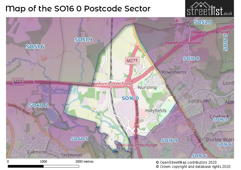
The SO16 0 Postcode shares a border with SO40 2 (Calmore, Totton, Cadnam), SO40 3 (Totton), SO16 8 (SOUTHAMPTON, Rownhams, Nursling), SO16 9 (SOUTHAMPTON) and SO51 9 (Ampfield, ROMSEY, Crampmoor).
The sector is within the post town of SOUTHAMPTON.
SO16 0 is a postcode sector within the SO16 postcode district which is within the SO Southampton postcode area.
The Royal Mail delivery office for the SO16 0 postal sector is the Shirley (so) Delivery Office.
The area of the SO16 0 postcode sector is 2.29 square miles which is 5.93 square kilometres or 1,465.95 square acres.
The SO16 0 postcode sector is crossed by the M271 motorway.
The SO16 0 postcode sector is crossed by the M27 motorway.
Waterways within the SO16 0 postcode sector include the River Test.

Map of the SO16 0 Postcode Sector
Explore the SO16 0 postcode sector by using our free interactive map.
| S | O | 1 | 6 | - | 0 | X | X |
| S | O | 1 | 6 | Space | 0 | Letter | Letter |
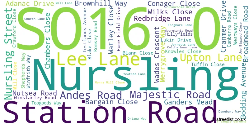
Official List of Streets
Nursling (50 Streets)
Unofficial Streets or Alternative Spellings
Nursling
UPTON CRESCENTLee
LEE LANERownhams
BAKERS DROVE BALMORAL WAY HORNS DROVE CONAGAR BRIDGE DAIRY LANE DUNNOCK COURT GOLDFINCH COURT HURST WAY LYMER LANE LYMER VILLAS NURSLING INTERCHANGE NURSLING SPUR MOTORWAY PAULETTE LACAVE AVENUE ROMSEY ROAD ROUNDABOUT ROWNHAMS INTERCHANGE STANDEN ROAD TEST BOARDWALK THE MILL YARD WALNUT WAY WESTON LANESOUTHAMPTON
TEST LANEWeather Forecast for SO16 0
Press Button to Show Forecast for Totton
| Time Period | Icon | Description | Temperature | Rain Probability | Wind |
|---|---|---|---|---|---|
| 09:00 to 12:00 | Cloudy | 8.0°C (feels like 6.0°C) | 9.00% | ENE 9 mph | |
| 12:00 to 15:00 | Overcast | 10.0°C (feels like 8.0°C) | 18.00% | E 9 mph | |
| 15:00 to 18:00 | Overcast | 10.0°C (feels like 9.0°C) | 19.00% | ESE 7 mph | |
| 18:00 to 21:00 | Overcast | 10.0°C (feels like 9.0°C) | 14.00% | ESE 7 mph | |
| 21:00 to 00:00 | Cloudy | 8.0°C (feels like 6.0°C) | 13.00% | ESE 7 mph |
Press Button to Show Forecast for Totton
| Time Period | Icon | Description | Temperature | Rain Probability | Wind |
|---|---|---|---|---|---|
| 00:00 to 03:00 | Cloudy | 8.0°C (feels like 6.0°C) | 16.00% | ENE 7 mph | |
| 03:00 to 06:00 | Light rain | 7.0°C (feels like 4.0°C) | 51.00% | ENE 9 mph | |
| 06:00 to 09:00 | Overcast | 7.0°C (feels like 4.0°C) | 21.00% | ENE 11 mph | |
| 09:00 to 12:00 | Cloudy | 9.0°C (feels like 7.0°C) | 14.00% | ENE 11 mph | |
| 12:00 to 15:00 | Cloudy | 12.0°C (feels like 9.0°C) | 16.00% | E 13 mph | |
| 15:00 to 18:00 | Light rain | 12.0°C (feels like 9.0°C) | 53.00% | ENE 11 mph | |
| 18:00 to 21:00 | Light rain | 11.0°C (feels like 8.0°C) | 54.00% | ENE 13 mph | |
| 21:00 to 00:00 | Heavy rain | 10.0°C (feels like 7.0°C) | 73.00% | ENE 13 mph |
Press Button to Show Forecast for Totton
| Time Period | Icon | Description | Temperature | Rain Probability | Wind |
|---|---|---|---|---|---|
| 00:00 to 03:00 | Heavy rain | 9.0°C (feels like 6.0°C) | 77.00% | ENE 13 mph | |
| 03:00 to 06:00 | Heavy rain shower (night) | 9.0°C (feels like 6.0°C) | 62.00% | E 11 mph | |
| 06:00 to 09:00 | Cloudy | 9.0°C (feels like 7.0°C) | 21.00% | ESE 9 mph | |
| 09:00 to 12:00 | Light rain shower (day) | 11.0°C (feels like 9.0°C) | 39.00% | SSE 9 mph | |
| 12:00 to 15:00 | Light rain shower (day) | 12.0°C (feels like 10.0°C) | 42.00% | SW 11 mph | |
| 15:00 to 18:00 | Light rain shower (day) | 12.0°C (feels like 9.0°C) | 39.00% | W 13 mph | |
| 18:00 to 21:00 | Light rain shower (day) | 11.0°C (feels like 9.0°C) | 32.00% | W 11 mph | |
| 21:00 to 00:00 | Clear night | 9.0°C (feels like 8.0°C) | 7.00% | WSW 7 mph |
Schools and Places of Education Within the SO16 0 Postcode Sector
Nursling Church of England Primary School
Voluntary controlled school
Nursling Street, Southampton, Hampshire, SO16 0XH
Head: Mrs Joanne Jearrad
Ofsted Rating: Good
Inspection: 2019-10-09 (1661 days ago)
Website: Visit Nursling Church of England Primary School Website
Phone: 02380732289
Number of Pupils: 205
The Cedar School
Community special school
Redbridge Lane, Southampton, Hampshire, SO16 0XN
Head: Mr Neil Revell
Ofsted Rating: Good
Inspection: 2018-07-03 (2124 days ago)
Website: Visit The Cedar School Website
Phone: 02380734205
Number of Pupils: 92
House Prices in the SO16 0 Postcode Sector
| Type of Property | 2018 Average | 2018 Sales | 2017 Average | 2017 Sales | 2016 Average | 2016 Sales | 2015 Average | 2015 Sales |
|---|---|---|---|---|---|---|---|---|
| Detached | £420,482 | 53 | £416,478 | 36 | £384,591 | 22 | £343,650 | 13 |
| Semi-Detached | £321,238 | 8 | £302,103 | 17 | £271,250 | 1 | £245,817 | 3 |
| Terraced | £278,333 | 6 | £283,790 | 10 | £216,000 | 2 | £180,000 | 2 |
| Flats | £430,000 | 7 | £314,200 | 9 | £430,714 | 7 | £411,667 | 6 |
Important Postcodes SO16 0 in the Postcode Sector
SO16 0AS is the postcode for Ordnance Survey, Adanac Drive
SO16 0XH is the postcode for Nursling Cp School, Nursling Street
SO16 0XN is the postcode for The Cedar School, Redbridge Lane, and Lordshill Recreation Ground, Redbridge Lane
| The SO16 0 Sector is within these Local Authorities |
|
|---|---|
| The SO16 0 Sector is within these Counties |
|
| The SO16 0 Sector is within these Water Company Areas |
|