The SO45 postcode district is a postal district located in the SO Southampton postcode area with a population of 34,373 residents according to the 2021 England and Wales Census.
The area of the SO45 postcode district is 20.09 square miles which is 52.04 square kilometres or 12,859.64 acres.
Currently, the SO45 district has about 970 postcode units spread across 6 geographic postcode sectors.
Given that each sector allows for 400 unique postcode combinations, the district has a capacity of 2,400 postcodes. With 970 postcodes already in use, this leaves 1430 units available.
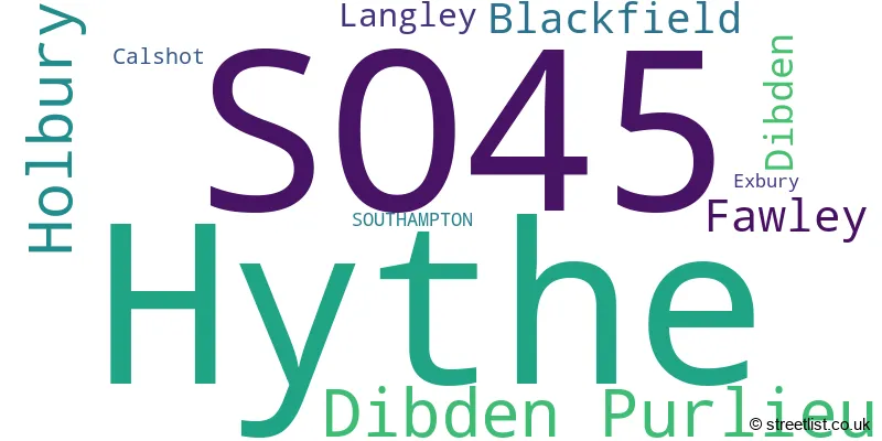
The largest settlement in the SO45 postal code is Hythe followed by Holbury, and Dibden Purlieu.
The postcode area has a boundary with The Solent.
The SO45 Postcode shares a border with SO42 (BROCKENHURST, Beaulieu, East Boldre) and SO40 (Totton, Marchwood, Calmore).
In the SO45 postcode district in Hampshire, the primary settlement is Blackfield. Other significant settlements include Calshot, Exbury, Fawley, and Langley. The post town for this postcode district is Southampton.
For the district SO45, we have data on 7 postcode sectors. Here's a breakdown: The sector SO45 1, covers Fawley and Blackfield and Langley in Hampshire. The sector SO45 2, covers Holbury in Hampshire. The sector SO45 3, covers Hythe in Hampshire. The sector SO45 4, covers Dibden Purlieu in Hampshire. The sector SO45 5, covers Hythe and Dibden and Dibden Purlieu in Hampshire. The sector SO45 6, covers Hythe in Hampshire. The sector SO45 9 is non-geographic. It's often designated for PO Boxes, large organisations, or special services.

Map of the SO45 Postcode District
Explore the SO45 postcode district by using our free interactive map.

When it comes to local government, postal geography often disregards political borders. However, for a breakdown in the SO45 District: the district mostly encompasses the New Forest District area with a total of 972 postcodes.
Recent House Sales in SO45
| Date | Price | Address |
|---|---|---|
| 10/10/2023 | £400,000 | Norman Road, Blackfield, Southampton, SO45 1YF |
| 06/10/2023 | £400,000 | Southbourne Avenue, Holbury, Southampton, SO45 2NT |
| 05/10/2023 | £257,500 | Whitefield Road, Holbury, Southampton, SO45 2HS |
| 28/09/2023 | £233,000 | Malwood Road West, Hythe, Southampton, SO45 5DB |
| 25/09/2023 | £325,000 | Furzedale Park, Hythe, Southampton, SO45 3HU |
| 22/09/2023 | £420,000 | Whinfield Road, Dibden Purlieu, Southampton, SO45 4QB |
| 14/09/2023 | £355,000 | Tormead, Hythe, Southampton, SO45 5AW |
| 14/09/2023 | £335,000 | Ashlett Close, Fawley, Southampton, SO45 1DR |
| 13/09/2023 | £620,000 | Hollybank Close, Hythe, Southampton, SO45 5GE |
| 12/09/2023 | £565,000 | Mountfield, Hythe, Southampton, SO45 5AQ |
Weather Forecast for SO45
Press Button to Show Forecast for Calshot (Beach)
| Time Period | Icon | Description | Temperature | Rain Probability | Wind |
|---|---|---|---|---|---|
| 09:00 to 12:00 | Cloudy | 10.0°C (feels like 8.0°C) | 7.00% | ENE 11 mph | |
| 12:00 to 15:00 | Cloudy | 12.0°C (feels like 10.0°C) | 10.00% | ESE 11 mph | |
| 15:00 to 18:00 | Cloudy | 12.0°C (feels like 10.0°C) | 17.00% | ESE 11 mph | |
| 18:00 to 21:00 | Light rain | 11.0°C (feels like 9.0°C) | 59.00% | NE 11 mph | |
| 21:00 to 00:00 | Heavy rain | 10.0°C (feels like 7.0°C) | 82.00% | NNE 16 mph |
Press Button to Show Forecast for Calshot (Beach)
| Time Period | Icon | Description | Temperature | Rain Probability | Wind |
|---|---|---|---|---|---|
| 00:00 to 03:00 | Heavy rain | 9.0°C (feels like 6.0°C) | 87.00% | NNE 16 mph | |
| 03:00 to 06:00 | Heavy rain | 9.0°C (feels like 6.0°C) | 91.00% | NE 13 mph | |
| 06:00 to 09:00 | Heavy rain | 8.0°C (feels like 5.0°C) | 88.00% | NW 16 mph | |
| 09:00 to 12:00 | Heavy rain | 8.0°C (feels like 5.0°C) | 73.00% | WNW 16 mph | |
| 12:00 to 15:00 | Light rain | 10.0°C (feels like 6.0°C) | 51.00% | WNW 16 mph | |
| 15:00 to 18:00 | Cloudy | 11.0°C (feels like 9.0°C) | 11.00% | W 13 mph | |
| 18:00 to 21:00 | Overcast | 11.0°C (feels like 9.0°C) | 10.00% | WSW 11 mph | |
| 21:00 to 00:00 | Cloudy | 10.0°C (feels like 8.0°C) | 5.00% | WSW 9 mph |
Press Button to Show Forecast for Calshot (Beach)
| Time Period | Icon | Description | Temperature | Rain Probability | Wind |
|---|---|---|---|---|---|
| 00:00 to 03:00 | Partly cloudy (night) | 9.0°C (feels like 7.0°C) | 2.00% | WSW 9 mph | |
| 03:00 to 06:00 | Clear night | 8.0°C (feels like 6.0°C) | 2.00% | SW 7 mph | |
| 06:00 to 09:00 | Sunny day | 9.0°C (feels like 8.0°C) | 1.00% | S 9 mph | |
| 09:00 to 12:00 | Sunny day | 11.0°C (feels like 9.0°C) | 2.00% | S 11 mph | |
| 12:00 to 15:00 | Sunny day | 12.0°C (feels like 10.0°C) | 1.00% | S 13 mph | |
| 15:00 to 18:00 | Partly cloudy (day) | 12.0°C (feels like 10.0°C) | 1.00% | SSE 11 mph | |
| 18:00 to 21:00 | Sunny day | 12.0°C (feels like 10.0°C) | 1.00% | SE 11 mph | |
| 21:00 to 00:00 | Clear night | 11.0°C (feels like 9.0°C) | 1.00% | SE 13 mph |
Press Button to Show Forecast for Calshot (Beach)
| Time Period | Icon | Description | Temperature | Rain Probability | Wind |
|---|---|---|---|---|---|
| 00:00 to 03:00 | Clear night | 11.0°C (feels like 9.0°C) | 1.00% | SE 13 mph | |
| 03:00 to 06:00 | Clear night | 11.0°C (feels like 9.0°C) | 1.00% | SE 11 mph | |
| 06:00 to 09:00 | Sunny day | 11.0°C (feels like 9.0°C) | 3.00% | SE 11 mph | |
| 09:00 to 12:00 | Sunny day | 12.0°C (feels like 9.0°C) | 6.00% | SE 13 mph | |
| 12:00 to 15:00 | Sunny day | 13.0°C (feels like 10.0°C) | 7.00% | SE 13 mph | |
| 15:00 to 18:00 | Sunny day | 13.0°C (feels like 11.0°C) | 9.00% | SE 13 mph | |
| 18:00 to 21:00 | Partly cloudy (day) | 13.0°C (feels like 11.0°C) | 8.00% | SE 11 mph | |
| 21:00 to 00:00 | Partly cloudy (night) | 12.0°C (feels like 10.0°C) | 3.00% | ESE 11 mph |
Where is the SO45 Postcode District?
The postcode district of SO45 is located in SOUTHAMPTON. It is situated nearby the towns of COWES (6.32 miles to the South East), FAREHAM (8.19 miles to the East), BROCKENHURST (8.29 miles to the West), LYMINGTON (8.76 miles to the South West), EASTLEIGH (9.76 miles to the North), and NEWPORT (10.03 miles to the South). Additionally, the distance from this postcode district to the centre of London is 71.81 miles.
The district is within the post town of SOUTHAMPTON.
The sector has postcodes within the nation of England.
The SO45 Postcode District is in the Central Hampshire region of Hampshire and Isle of Wight within the South East (England).
| Postcode Sector | Delivery Office |
|---|---|
| SO45 1 | Hythe (so) Delivery Office |
| SO45 2 | Hythe (so) Delivery Office |
| SO45 3 | Hythe (so) Delivery Office |
| SO45 4 | Hythe (so) Delivery Office |
| SO45 5 | Hythe (so) Delivery Office |
| SO45 6 | Hythe (so) Delivery Office |
| S | O | 4 | 5 | - | X | X | X |
| S | O | 4 | 5 | Space | Numeric | Letter | Letter |
Tourist Attractions within the Postcode Area
We found 1 visitor attractions within the SO45 postcode area
| Calshot Castle |
|---|
| Historic Properties |
| Castle / Fort |
| View Calshot Castle on Google Maps |
Current Monthly Rental Prices
| # Bedrooms | Min Price | Max Price | Avg Price |
|---|---|---|---|
| £100 | £100 | £100 | |
| 1 | £750 | £750 | £750 |
| 2 | £1,100 | £1,475 | £1,258 |
| 3 | £1,200 | £1,500 | £1,317 |
| 4 | £2,000 | £2,000 | £2,000 |
Current House Prices
| # Bedrooms | Min Price | Max Price | Avg Price |
|---|---|---|---|
| £125,000 | £125,000 | £125,000 | |
| 1 | £89,950 | £279,950 | £165,352 |
| 2 | £98,000 | £665,000 | £281,688 |
| 3 | £90,000 | £795,000 | £398,692 |
| 4 | £275,000 | £2,495,000 | £547,663 |
| 5 | £449,950 | £899,950 | £643,480 |
| 6 | £425,000 | £575,000 | £500,000 |
| 7 | £595,000 | £595,000 | £595,000 |
| 12 | £800,000 | £800,000 | £800,000 |
Estate Agents who Operate in the SO45 District
| Logo | Name | Brand Name | Address | Contact Number | Total Properties |
|---|---|---|---|---|---|
 | Holbury | Easton Residential | 77-79 Long Lane , Holbury , Southampton , SO45 2ND | 0238 024 3866 | 57 |
 | Hythe | Pearsons | 7 & 9 The Marsh, Hythe, SO45 6AJ | 0238 084 4131 | 47 |
 | Dibden Purlieu | Anthony James Properties | 1 Southward House, Beaulieu Road Dibden Purlieu SO45 4PT | 0238 084 4405 | 37 |
 | Hythe | Enfields | 3 Marsh Parade, Hythe, SO45 6AN | 0238 001 5474 | 24 |
 | Hythe | Paul Jeffreys | 10 The Marsh, Hythe, SO45 6AL | 0238 001 4487 | 20 |
| Type of Property | 2018 Average | 2018 Sales | 2017 Average | 2017 Sales | 2016 Average | 2016 Sales | 2015 Average | 2015 Sales |
|---|---|---|---|---|---|---|---|---|
| Detached | £378,541 | 182 | £372,783 | 196 | £342,694 | 229 | £330,897 | 242 |
| Semi-Detached | £270,519 | 125 | £271,211 | 150 | £250,774 | 125 | £237,729 | 135 |
| Terraced | £243,778 | 118 | £238,897 | 127 | £251,768 | 143 | £225,858 | 125 |
| Flats | £218,109 | 71 | £193,499 | 85 | £203,524 | 129 | £158,139 | 85 |