The SW1X postcode district is a postal district located in the SW London - SW postcode area with a population of 4,855 residents according to the 2021 England and Wales Census.
The area of the SW1X postcode district is 0.31 square miles which is 0.80 square kilometres or 196.49 acres.
Currently, the SW1X district has about 413 postcode units spread across 4 geographic postcode sectors.
Given that each sector allows for 400 unique postcode combinations, the district has a capacity of 1,600 postcodes. With 413 postcodes already in use, this leaves 1187 units available.
The SW1X postal code covers the settlement of LONDON.
The SW1X Postcode shares a border with SW1W (LONDON) and SW3 (LONDON).
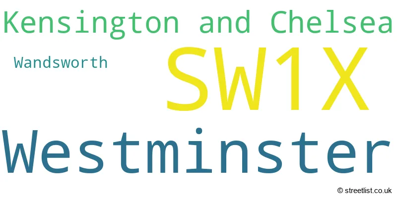
The primary settlement in the SW1X postcode district is Kensington and Chelsea, located in the Greater London county. Other significant settlements in this district include Wandsworth and Westminster, also located in the Greater London county. The post town associated with the highest number of postcodes is London.
For the district SW1X, we have data on 4 postcode sectors. Here's a breakdown: The sector SW1X 0, covers Kensington And Chelsea in Greater London. The sector SW1X 7, covers Westminster in Greater London. The sector SW1X 8, covers Westminster in Greater London. The sector SW1X 9, covers Kensington And Chelsea and Westminster in Greater London.

Map of the SW1X Postcode District
Explore the SW1X postcode district by using our free interactive map.

When it comes to local government, postal geography often disregards political borders. However, for a breakdown in the SW1X District: the district mostly encompasses the City of Westminster London Boro (218 postcodes), followed by the Kensington and Chelsea London Boro area (193 postcodes), and finally, the Wandsworth London Boro area (3 postcodes).
Recent House Sales in SW1X
| Date | Price | Address |
|---|---|---|
| 08/09/2023 | £5,650,000 | Lowndes Square, London, SW1X 9JT |
| 01/09/2023 | £4,600,000 | Sloane Street, London, SW1X 9PA |
| 30/08/2023 | £6,700,000 | Sloane Terrace, London, SW1X 9DG |
| 22/08/2023 | £1,850,000 | Knightsbridge, London, SW1X 7QS |
| 22/08/2023 | £16,750,000 | Lennox Gardens, London, SW1X 0DE |
| 21/07/2023 | £750,000 | Little Chester Street, London, SW1X 7AL |
| 21/07/2023 | £2,750,000 | Pont Street, London, SW1X 0BH |
| 18/07/2023 | £1,225,000 | Lennox Gardens, London, SW1X 0DF |
| 18/07/2023 | £1,675,000 | Lowndes Square, London, SW1X 9JU |
| 11/07/2023 | £900,000 | D'oyley Street, London, SW1X 9AQ |
Weather Forecast for SW1X
Press Button to Show Forecast for Hyde Park
| Time Period | Icon | Description | Temperature | Rain Probability | Wind |
|---|---|---|---|---|---|
| 09:00 to 12:00 | Overcast | 8.0°C (feels like 6.0°C) | 16.00% | NE 9 mph | |
| 12:00 to 15:00 | Cloudy | 11.0°C (feels like 9.0°C) | 12.00% | ENE 9 mph | |
| 15:00 to 18:00 | Cloudy | 12.0°C (feels like 11.0°C) | 17.00% | ENE 7 mph | |
| 18:00 to 21:00 | Overcast | 12.0°C (feels like 10.0°C) | 54.00% | NE 9 mph | |
| 21:00 to 00:00 | Heavy rain | 10.0°C (feels like 8.0°C) | 82.00% | NE 11 mph |
Press Button to Show Forecast for Hyde Park
| Time Period | Icon | Description | Temperature | Rain Probability | Wind |
|---|---|---|---|---|---|
| 00:00 to 03:00 | Heavy rain | 9.0°C (feels like 7.0°C) | 84.00% | NE 11 mph | |
| 03:00 to 06:00 | Heavy rain | 9.0°C (feels like 7.0°C) | 90.00% | NE 9 mph | |
| 06:00 to 09:00 | Heavy rain | 9.0°C (feels like 7.0°C) | 80.00% | NW 7 mph | |
| 09:00 to 12:00 | Heavy rain | 9.0°C (feels like 7.0°C) | 81.00% | W 9 mph | |
| 12:00 to 15:00 | Light rain | 10.0°C (feels like 7.0°C) | 57.00% | WNW 11 mph | |
| 15:00 to 18:00 | Cloudy | 11.0°C (feels like 8.0°C) | 19.00% | W 9 mph | |
| 18:00 to 21:00 | Cloudy | 11.0°C (feels like 10.0°C) | 10.00% | WSW 7 mph | |
| 21:00 to 00:00 | Partly cloudy (night) | 10.0°C (feels like 8.0°C) | 4.00% | SW 7 mph |
Press Button to Show Forecast for Hyde Park
| Time Period | Icon | Description | Temperature | Rain Probability | Wind |
|---|---|---|---|---|---|
| 00:00 to 03:00 | Clear night | 9.0°C (feels like 7.0°C) | 2.00% | SW 4 mph | |
| 03:00 to 06:00 | Clear night | 7.0°C (feels like 6.0°C) | 1.00% | SSW 4 mph | |
| 06:00 to 09:00 | Sunny day | 7.0°C (feels like 6.0°C) | 1.00% | S 4 mph | |
| 09:00 to 12:00 | Partly cloudy (day) | 12.0°C (feels like 10.0°C) | 2.00% | S 9 mph | |
| 12:00 to 15:00 | Cloudy | 15.0°C (feels like 12.0°C) | 5.00% | S 9 mph | |
| 15:00 to 18:00 | Partly cloudy (day) | 15.0°C (feels like 13.0°C) | 2.00% | S 11 mph | |
| 18:00 to 21:00 | Sunny day | 14.0°C (feels like 13.0°C) | 2.00% | S 9 mph | |
| 21:00 to 00:00 | Clear night | 12.0°C (feels like 11.0°C) | 1.00% | SE 7 mph |
Press Button to Show Forecast for Hyde Park
| Time Period | Icon | Description | Temperature | Rain Probability | Wind |
|---|---|---|---|---|---|
| 00:00 to 03:00 | Clear night | 11.0°C (feels like 9.0°C) | 1.00% | SE 7 mph | |
| 03:00 to 06:00 | Clear night | 10.0°C (feels like 8.0°C) | 3.00% | ESE 7 mph | |
| 06:00 to 09:00 | Sunny day | 10.0°C (feels like 8.0°C) | 5.00% | ESE 7 mph | |
| 09:00 to 12:00 | Partly cloudy (day) | 13.0°C (feels like 12.0°C) | 4.00% | ESE 7 mph | |
| 12:00 to 15:00 | Cloudy | 16.0°C (feels like 14.0°C) | 10.00% | SE 9 mph | |
| 15:00 to 18:00 | Cloudy | 17.0°C (feels like 15.0°C) | 13.00% | SE 9 mph | |
| 18:00 to 21:00 | Cloudy | 16.0°C (feels like 15.0°C) | 11.00% | SE 9 mph | |
| 21:00 to 00:00 | Cloudy | 14.0°C (feels like 13.0°C) | 11.00% | ESE 7 mph |
Where is the SW1X Postcode District?
The SW1X postcode district is located in LONDON. It is approximately 1.39 miles away from the centre of London. It is surrounded by nearby towns such as ST GEORGE'S (0.78 miles to the South East), ST JAMES'S (0.99 miles to the North East), MAYFAIR (1.08 miles to the North), BAYSWATER (1.52 miles to the North West), and CHELSEA HARBOUR (1.87 miles to the South West).
The district is within the post town of LONDON.
The sector has postcodes within the nation of England.
The SW1X Postcode District is covers the following regions.
- Kensington & Chelsea and Hammersmith & Fulham - Inner London - West - London
- Westminster - Inner London - West - London
- Wandsworth - Inner London - West - London
| Postcode Sector | Delivery Office |
|---|
| S | W | 1 | X | - | X | X | X |
| S | W | 1 | X | Space | Numeric | Letter | Letter |
Current Monthly Rental Prices
| # Bedrooms | Min Price | Max Price | Avg Price |
|---|---|---|---|
| £2,145 | £4,350 | £2,826 | |
| 1 | £2,708 | £8,667 | £4,294 |
| 2 | £3,012 | £24,050 | £8,552 |
| 3 | £4,117 | £47,667 | £18,763 |
| 4 | £7,778 | £52,000 | £24,253 |
| 5 | £15,167 | £195,000 | £50,072 |
| 6 | £27,083 | £27,083 | £27,083 |
| 7 | £54,167 | £67,167 | £57,417 |
Current House Prices
| # Bedrooms | Min Price | Max Price | Avg Price |
|---|---|---|---|
| £245,000 | £19,500,000 | £9,810,000 | |
| 1 | £800,000 | £5,500,000 | £1,544,375 |
| 2 | £1,150,000 | £5,750,000 | £2,600,293 |
| 3 | £2,100,000 | £11,795,000 | £5,790,066 |
| 4 | £3,350,000 | £14,950,000 | £7,490,161 |
| 5 | £3,500,000 | £22,500,000 | £12,372,576 |
| 6 | £3,200,000 | £43,700,000 | £18,512,083 |
| 7 | £12,000,000 | £24,950,000 | £16,690,000 |
| 8 | £3,950,000 | £3,950,000 | £3,950,000 |
| 9 | £20,000,000 | £20,000,000 | £20,000,000 |
| 10 | £16,500,000 | £25,000,000 | £20,750,000 |
Estate Agents who Operate in the SW1X District
| Logo | Name | Brand Name | Address | Contact Number | Total Properties |
|---|---|---|---|---|---|
 | Sloane Square | Foxtons | Sloane Avenue London SW3 (By appointment only) | 020 3908 8522 | 31 |
 | Knightsbridge Lettings | Chestertons Estate Agents | 31 Lowndes Street, Knightsbridge, London, SW1X 9HX | 020 3835 4156 | 27 |
 | Belgravia, Westminster & Pimlico | Knight Frank | 47 Lower Belgrave Street, London, SW1W 0LS | 020 3907 3590 | 21 |
 | Knightsbridge | Savills | 188 Brompton Road, London, SW3 1HQ | 020 3835 3959 | 19 |
 | Knightsbridge | Knight Frank - Lettings | 52 - 54 Sloane Avenue London SW3 3DD | 020 3872 7801 | 19 |
| Type of Property | 2018 Average | 2018 Sales | 2017 Average | 2017 Sales | 2016 Average | 2016 Sales | 2015 Average | 2015 Sales |
|---|---|---|---|---|---|---|---|---|
| Detached | £0 | 0 | £4,800,000 | 2 | £0 | 0 | £0 | 0 |
| Semi-Detached | £0 | 0 | £4,900,000 | 1 | £0 | 0 | £0 | 0 |
| Terraced | £5,708,611 | 18 | £4,320,589 | 19 | £5,639,505 | 21 | £6,268,915 | 26 |
| Flats | £5,870,316 | 74 | £3,747,640 | 110 | £3,251,966 | 84 | £3,913,002 | 115 |