The SY16 postcode district is a postal district located in the SY Shrewsbury postcode area with a population of 16,008 residents according to the 2021 England and Wales Census.
The area of the SY16 postcode district is 84.42 square miles which is 218.64 square kilometres or 54,025.99 acres.
Currently, the SY16 district has about 681 postcode units spread across 4 geographic postcode sectors.
Given that each sector allows for 400 unique postcode combinations, the district has a capacity of 1,600 postcodes. With 681 postcodes already in use, this leaves 919 units available.
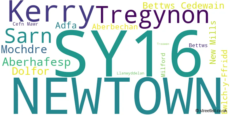
The largest settlement in the SY16 postal code is NEWTOWN followed by KERRY, and TREGYNON.
The SY16 Postcode shares a border with SY15 (CHURCHSTOKE, MONTGOMERY, ABERMULE), SY17 (CAERSWS, TREFEGLWYS, CARNO), SY21 (WELSHPOOL, LLANFAIR CAEREINION, GUILSFIELD), LD1 (LLANDRINDOD WELLS, HOWEY, NEWBRIDGE-ON-WYE), SY7 (CRAVEN ARMS, Leintwardine, Clun) and LD7 (KNIGHTON, KNUCKLAS, LLANGUNLLO).
The primary settlement in the SY16 postcode district is Newtown, located in the county of Powys, Wales. Other significant settlements in the district are Treowen, Aberbechan, Aberhafesp, Adfa, Bettws Cedewain, Bwlch-y-Ffridd, Cefn Mawr, Llanwyddelan, Milford, New Mills, Tregynon, Dolfor, Kerry, Mochdre, and Sarn. The post town associated with the district is Newtown.
For the district SY16, we have data on 5 postcode sectors. Here's a breakdown: The sector SY16 1, covers Newtown in Powys. The sector SY16 2, covers Newtown in Powys. The sector SY16 3, covers Tregynon and Newtown and Aberhafesp in Powys. The sector SY16 4, covers Kerry and Sarn and Mochdre and Dolfor in Powys. The sector SY16 9 is non-geographic. It's often designated for PO Boxes, large organisations, or special services.

Map of the SY16 Postcode District
Explore the SY16 postcode district by using our free interactive map.

When it comes to local government, postal geography often disregards political borders. However, for a breakdown in the SY16 District: the district mostly encompasses the Powys - Powys area with a total of 687 postcodes.
Recent House Sales in SY16
| Date | Price | Address |
|---|---|---|
| 06/10/2023 | £100,000 | Afon Way, Newtown, SY16 2JG |
| 18/09/2023 | £146,000 | Cambrian Gardens, Newtown, SY16 2AW |
| 15/09/2023 | £300,000 | Bwlch Y Ffridd, Newtown, SY16 3JB |
| 15/09/2023 | £62,000 | Lon Maesycoed, Newtown, SY16 1QQ |
| 08/09/2023 | £160,000 | Davern Cottages, Kerry, Newtown, SY16 4PF |
| 31/08/2023 | £145,000 | Crescent Gardens, Newtown, SY16 2HQ |
| 30/08/2023 | £170,000 | New Road, Newtown, SY16 1AS |
| 25/08/2023 | £355,000 | Sarn, Newtown, SY16 4EJ |
| 25/08/2023 | £89,950 | St Marys Close, Newtown, SY16 2BG |
| 23/08/2023 | £196,000 | Tregynon, Newtown, SY16 3EP |
Weather Forecast for SY16
Press Button to Show Forecast for Newtown (Powys)
| Time Period | Icon | Description | Temperature | Rain Probability | Wind |
|---|---|---|---|---|---|
| 09:00 to 12:00 | Light rain shower (day) | 6.0°C (feels like 5.0°C) | 39.00% | ENE 4 mph | |
| 12:00 to 15:00 | Overcast | 8.0°C (feels like 7.0°C) | 17.00% | ENE 7 mph | |
| 15:00 to 18:00 | Cloudy | 10.0°C (feels like 9.0°C) | 9.00% | ENE 4 mph | |
| 18:00 to 21:00 | Cloudy | 9.0°C (feels like 8.0°C) | 10.00% | NE 4 mph | |
| 21:00 to 00:00 | Partly cloudy (night) | 4.0°C (feels like 3.0°C) | 7.00% | NE 4 mph |
Press Button to Show Forecast for Newtown (Powys)
| Time Period | Icon | Description | Temperature | Rain Probability | Wind |
|---|---|---|---|---|---|
| 00:00 to 03:00 | Cloudy | 3.0°C (feels like 1.0°C) | 12.00% | NE 4 mph | |
| 03:00 to 06:00 | Cloudy | 2.0°C (feels like 0.0°C) | 11.00% | NNE 4 mph | |
| 06:00 to 09:00 | Cloudy | 3.0°C (feels like 1.0°C) | 13.00% | NNE 4 mph | |
| 09:00 to 12:00 | Overcast | 7.0°C (feels like 5.0°C) | 14.00% | ENE 7 mph | |
| 12:00 to 15:00 | Cloudy | 9.0°C (feels like 7.0°C) | 17.00% | E 9 mph | |
| 15:00 to 18:00 | Overcast | 10.0°C (feels like 8.0°C) | 20.00% | ENE 9 mph | |
| 18:00 to 21:00 | Cloudy | 9.0°C (feels like 8.0°C) | 16.00% | ENE 7 mph | |
| 21:00 to 00:00 | Light rain | 7.0°C (feels like 5.0°C) | 46.00% | NE 7 mph |
Press Button to Show Forecast for Newtown (Powys)
| Time Period | Icon | Description | Temperature | Rain Probability | Wind |
|---|---|---|---|---|---|
| 00:00 to 03:00 | Light rain | 6.0°C (feels like 3.0°C) | 52.00% | NNE 9 mph | |
| 03:00 to 06:00 | Light rain | 5.0°C (feels like 2.0°C) | 47.00% | NNE 9 mph | |
| 06:00 to 09:00 | Light rain | 6.0°C (feels like 3.0°C) | 53.00% | N 11 mph | |
| 09:00 to 12:00 | Light rain | 7.0°C (feels like 4.0°C) | 54.00% | N 11 mph | |
| 12:00 to 15:00 | Light rain | 9.0°C (feels like 7.0°C) | 52.00% | N 11 mph | |
| 15:00 to 18:00 | Light rain shower (day) | 10.0°C (feels like 8.0°C) | 39.00% | N 11 mph | |
| 18:00 to 21:00 | Sunny day | 10.0°C (feels like 8.0°C) | 14.00% | NNW 7 mph | |
| 21:00 to 00:00 | Clear night | 6.0°C (feels like 4.0°C) | 9.00% | WNW 7 mph |
Where is the SY16 Postcode District?
The postcode district SY16 is located in the town of Newtown. Newtown is surrounded by several nearby towns. Caersws is located to the North West at a distance of 4.95 miles. Llandinam is situated to the South West, around 6.17 miles away. Montgomery is located to the East, at a distance of approximately 8.94 miles. Welshpool is situated to the North East, around 12.09 miles away. Meifod is to the North, approximately 13.88 miles away. Llanbrynmair is located to the West, around 14.32 miles away. Lastly, Llandrindod Wells is situated to the South, around 15.13 miles away. Additionally, the distance from SY16 to the centre of London is approximately 152.74 miles.
The district is within the post town of NEWTOWN.
The sector has postcodes within the nation of Wales.
The SY16 Postcode District is in the Powys region of East Wales within the Wales.
| Postcode Sector | Delivery Office |
|---|---|
| SY16 1 | Newtown Delivery Office |
| SY16 2 | Newtown Delivery Office |
| SY16 3 | Newtown Delivery Office |
| SY16 4 | Newtown Delivery Office |
| S | Y | 1 | 6 | - | X | X | X |
| S | Y | 1 | 6 | Space | Numeric | Letter | Letter |
Tourist Attractions within the Postcode Area
We found 1 visitor attractions within the SY16 postcode area
| Newtown Textile Museum |
|---|
| View Newtown Textile Museum on Google Maps |
Current Monthly Rental Prices
| # Bedrooms | Min Price | Max Price | Avg Price |
|---|---|---|---|
| 1 | £370 | £495 | £430 |
| 2 | £575 | £595 | £588 |
| 3 | £625 | £900 | £750 |
Current House Prices
| # Bedrooms | Min Price | Max Price | Avg Price |
|---|---|---|---|
| £50,000 | £850,000 | £223,681 | |
| 1 | £78,000 | £149,950 | £113,975 |
| 2 | £95,000 | £630,000 | £202,898 |
| 3 | £50,000 | £615,000 | £220,167 |
| 4 | £100,000 | £650,000 | £342,775 |
| 5 | £390,000 | £630,000 | £503,000 |
| 6 | £240,000 | £1,400,000 | £820,000 |
| 7 | £575,000 | £575,000 | £575,000 |
Estate Agents who Operate in the SY16 District
| Logo | Name | Brand Name | Address | Contact Number | Total Properties |
|---|---|---|---|---|---|
 | Newtown | Morris Marshall & Poole | 10 Broad Street, Newtown, Montgomeryshire, SY16 2LZ | 01686 805790 | 56 |
 | Newtown | McCartneys LLP | 39 Broad Street, Newtown, SY16 2BQ | 01686 806149 | 17 |
 | Welshpool | Roger Parry & Partners | 1 Berriew Street, Welshpool, SY21 7SQ | 01938 554499 | 12 |
 | Shrewsbury | Grantham's Estates Limited | Hyssington, SY15 6AT | 01743 652213 | 5 |
 | Shrewsbury | Roger Parry & Partners | 165, Welsh Bridge, Frankwell, Shrewsbury, SY3 8LG | 01743 664106 | 5 |
| Type of Property | 2018 Average | 2018 Sales | 2017 Average | 2017 Sales | 2016 Average | 2016 Sales | 2015 Average | 2015 Sales |
|---|---|---|---|---|---|---|---|---|
| Detached | £235,282 | 82 | £219,694 | 84 | £214,055 | 92 | £201,738 | 98 |
| Semi-Detached | £140,906 | 47 | £134,026 | 52 | £120,334 | 38 | £135,058 | 53 |
| Terraced | £109,952 | 64 | £101,842 | 70 | £105,511 | 61 | £101,050 | 53 |
| Flats | £74,321 | 7 | £82,429 | 7 | £87,500 | 5 | £78,417 | 6 |