The TA14 6 postcode sector is within the county of Somerset.
Did you know? According to the 2021 Census, the TA14 6 postcode sector is home to a bustling 3,182 residents!
Given that each sector allows for 400 unique postcode combinations. Letters C, I, K, M, O and V are not allowed in the last two letters of a postcode. With 88 postcodes already in use, this leaves 312 units available.
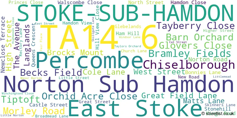
The largest settlement in the TA14 6 postal code is STOKE-SUB-HAMDON followed by Norton Sub Hamdon, and Chiselborough.
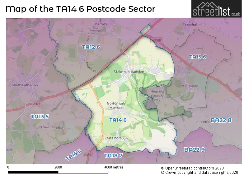
The TA14 6 Postcode shares a border with TA12 6 (MARTOCK, Kingsbury Episcopi, Bower Hinton), TA13 5 (SOUTH PETHERTON, Lopen, Over Stratton), TA15 6 (MONTACUTE), TA16 5 (MERRIOTT), TA18 7 (CREWKERNE, Haselbury Plucknett, North Perrott), BA22 8 (Ilchester, Houndstone, Tintinhull) and BA22 9 (East Coker, West Coker, East Chinnock).
The sector is within the post town of STOKE-SUB-HAMDON.
TA14 6 is a postcode sector within the TA1 postcode district which is within the TA Taunton postcode area.
The Royal Mail delivery office for the TA14 6 postal sector is the unknown.
The area of the TA14 6 postcode sector is 4.72 square miles which is 12.22 square kilometres or 3,018.83 square acres.
The TA14 6 postcode sector is crossed by the A303 Major A road.
Waterways within the TA14 6 postcode sector include the River Parratt.

Map of the TA14 6 Postcode Sector
Explore the TA14 6 postcode sector by using our free interactive map.
| T | A | 1 | 4 | - | 6 | X | X |
| T | A | 1 | 4 | Space | 6 | Letter | Letter |
Official List of Streets
Norton Sub Hamdon (16 Streets)
STOKE-SUB-HAMDON (27 Streets)
Chiselborough (7 Streets)
East Stoke (2 Streets)
Unofficial Streets or Alternative Spellings
Schools and Places of Education Within the TA14 6 Postcode Sector
Castle Primary School
Academy sponsor led
Castle Street, Stoke-Sub-Hamdon, Somerset, TA14 6RE
Head: Mr Steve Morton
Ofsted Rating: Good
Inspection: 2023-06-21 (337 days ago)
Website: Visit Castle Primary School Website
Phone: 01935822342
Number of Pupils: 141
Stanchester Academy
Academy converter
East Stoke, Stoke-sub-Hamdon, Somerset, TA14 6UG
Head: Mr Gregg Mockridge
Ofsted Rating: Good
Inspection: 2019-10-16 (1681 days ago)
Website: Visit Stanchester Academy Website
Phone: 01935823200
Number of Pupils: 787
House Prices in the TA14 6 Postcode Sector
| Type of Property | 2018 Average | 2018 Sales | 2017 Average | 2017 Sales | 2016 Average | 2016 Sales | 2015 Average | 2015 Sales |
|---|---|---|---|---|---|---|---|---|
| Detached | £372,374 | 27 | £345,417 | 12 | £406,406 | 16 | £320,674 | 23 |
| Semi-Detached | £313,333 | 9 | £214,458 | 12 | £269,495 | 11 | £197,361 | 9 |
| Terraced | £235,348 | 26 | £214,762 | 21 | £208,605 | 33 | £191,631 | 24 |
| Flats | £0 | 0 | £0 | 0 | £88,500 | 1 | £89,000 | 1 |
Important Postcodes TA14 6 in the Postcode Sector
TA14 6QE is the postcode for Hamdon Medical Centre, Matts Lane
TA14 6SF is the postcode for Norton Sub Hamdon Primary School, New Road, Norton Sub Hamdon
TA14 6UG is the postcode for REFECTORY, Stanchester Community School, East Stoke, NORTH QUAD, Stanchester Community School, East Stoke, WESTLAND, Stanchester Community School, East Stoke, EAST QUAD, Stanchester Community School, East Stoke, 1610 STANCHESTER SPORTS CENTRE, Stanchester Community School, East Stoke, WEST BLOCK, Stanchester Community School, East Stoke, and Stanchester Community School, East Stoke
| The TA14 6 Sector is within these Local Authorities |
|
|---|---|
| The TA14 6 Sector is within these Counties |
|
| The TA14 6 Sector is within these Water Company Areas |
|