This section of the site is all about the TA Postcode area, also known as the Taunton Postal Area. Explore links to the next level to learn more about specific postcode districts such as TA1.
Map of the TA Postcode for Taunton
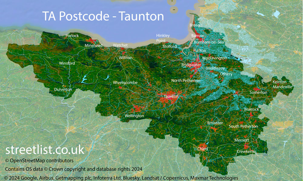
The TA postcode area represents a group of postal districts in the Taunton area of the United Kingdom. The area code TA stands for the letters t and a in TAunton. TA has a population of 322,197 and covers an area of 2,225,580 hectares. Fun fact: 0.50% of the population of Great Britain lives in this area.
The postcode area falls within the following counties: Somerset (99.02%), Devon (0.52%), Dorset (0.46%).
Post Towns and Postcode Districts for the TA Postcode
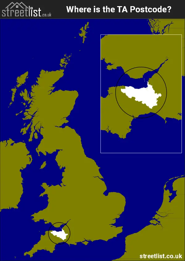
Where is the TA Postcode Area?
The TA Taunton Postcode is in the South West of England. The postal area borders the following neighbouring postal areas: EX - Exeter, BA - Bath, DT - Dorchester and BS - Bristol, It also borders The Bristol Channel,
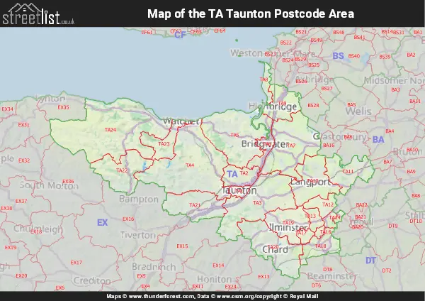
Map of the TA Taunton Postcode Area
Explore the TA Taunton postcode area by using our interactive map.
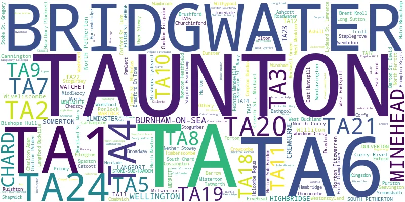
Postcode Districts within the TA Taunton Postcode Area
There are 24 postcode districts within the Taunton postcode area
A map showing the boundary of in relation to other areas
There are 15 towns within the Taunton postcode area.

| Unit | Area² |
|---|---|
| Hectares | 2,225,580² |
| Miles | 8,593² |
| Feet | 239,559,205,620² |
| Kilometres | 22,256² |
Postal Delivery Offices serving the TA Taunton Postcode Area
- Bishops Lydeard Scale Payment Delivery Office
- Bridgwater Delivery Office
- Burnham On Sea Delivery Office
- Chard Delivery Office
- Crewkerne Delivery Office
- Dulverton Scale Payment Delivery Office
- Exford Scale Payment Delivery Office
- Ilminster Scale Payment Delivery Office
- Langport Delivery Office
- Lydeard St Lawrence Scale Payment Delivery Office
- Martock Scale Payment Delivery Office
- Minehead Delivery Office
- Somerton Delivery Office
- South Petherton Scale Payment Delivery Office
- Stoke Sub Ham Delivery Office N Scale Payment Delivery Office
- Taunton Delivery Office
- Watchet Scale Payment Delivery Office
- Wellington (ta) Delivery Office
- Williton Scale Payment Delivery Office
- Wiveliscombe Scale Payment Delivery Office
- Woolavington Scale Payment Delivery Office
Councils with Postcodes in TA
Towns and Villages within the TA Taunton Postcode Area
- Adsborough - village
- Aller - village
- Allerford - village
- Alstone - village
- Ash - village
- Ash Priors - village
- Ashbrittle - village
- Ashcott - village
- Ashill - village
- Babcary - village
- Barrington - village
- Barton St David - village
- Bathpool - village
- Battleton - village
- Bawdrip - village
- Berrow - village
- Bicknoller - village
- Bilbrook - village
- Bishops Lydeard - village
- Bishopswood - village
- Blagdon Hill - village
- Blue Anchor - village
- Bradford-on-Tone - village
- Brean - village
- Brent Knoll - village
- Bridgwater - town
- Broadshard - village
- Broadway - village
- Brompton Regis - village
- Brushford - village
- Buckland St Mary - village
- Burnham-on-Sea - town
- Burrowbridge - village
- Burtle - village
- Cannington - village
- Carhampton - village
- Catcott - village
- Chaffcombe - village
- Chapel Cleeve - village
- Chard - town
- Charlton Adam - village
- Charlton Mackrell - village
- Cheddon Fitzpaine - village
- Chedzoy - village
- Chelston - village
- Chilton Polden - village
- Chilton Trinity - village
- Chiselborough - village
- Churchinford - village
- Clapton - village
- Combe Florey - village
- Combe St Nicholas - village
- Combwich - village
- Compton Dundon - village
- Corfe - village
- Cossington - village
- Cotford St Luke - village
- Creech Heathfield - village
- Creech St Michael - village
- Crewkerne - town
- Crowcombe - village
- Curload - village
- Curry Mallet - village
- Curry Rivel - village
- Cutcombe - village
- Doniford - village
- Donyatt - village
- Dowlish Ford - village
- Dowlish Wake - village
- Down End - village
- Drayton - village
- Dulverton - town
- Dundon - village
- Dunster - village
- Durston - village
- East Brent - village
- East Huntspill - village
- East Lambrook - village
- East Lydford - village
- Edington - village
- Enmore - village
- Exebridge - village
- Fitzhead - village
- Fivehead - village
- Forton - village
- Four Forks - village
- Goathurst - village
- Halse - village
- Hambridge - village
- Haselbury Plucknett - village
- Hatch Beauchamp - village
- Henley - village
- Hewish - village
- High Ham - village
- Highbridge - village
- Hillcommon - village
- Hinton St George - village
- Holcombe Rogus - village
- Holford - village
- Holywell Lake - village
- Horsey - village
- Horton - village
- Huish Champflower - village
- Huntspill - village
- Huntworth - village
- Ilminster - town
- Ilton - village
- Isle Abbotts - village
- Isle Brewers - village
- Keinton Mandeville - village
- Kilve - village
- Kingsbury Episcopi - village
- Kingsdon - village
- Kingston St Mary - village
- Kingstone - village
- Knapp - village
- Knole - village
- Langford - village
- Langford Budville - village
- Langley Marsh - village
- Langport - town
- Long Load - village
- Long Sutton - village
- Lopen - village
- Low Ham - village
- Luccombe - village
- Luxborough - village
- Lydeard St Lawrence - village
- Lydford-on Fosse - village
- Mark - village
- Mark Causeway - village
- Martock - village
- Meare Green - village
- Merriott - village
- Middlezoy - village
- Milverton - village
- Minehead - town
- Misterton - village
- Monksilver - village
- Monkton Heathfield - village
- Montacute - village
- Moorland / Northmoor Green - village
- Moorlinch - village
- Muchelney - village
- Nether Stowey - village
- North Curry - village
- North Newton - village
- North Perrott - village
- North Petherton - town
- Norton Fitzwarren - village
- Norton sub Hamdon - village
- Nynehead - village
- Oake - village
- Old Cleeve - village
- Othery - village
- Over Stratton - village
- Pawlett - village
- Pedwell - village
- Pict's Hill - village
- Pitminster - village
- Pitney - village
- Plot Gate - village
- Porlock - village
- Porlock Weir - village
- Puckington - village
- Puddle Town - village
- Puriton - village
- Roadwater - village
- Rockwell Green - village
- Ruishton - village
- Sampford Arundel - village
- Sampford Brett - village
- Seavington St Mary - village
- Seavington St Michael - village
- Shapwick - village
- Shepton Beauchamp - village
- Shoreditch - village
- Simonsbath - village
- Somerton - town
- South Petherton - town
- Spaxton - village
- Staple Fitzpaine - village
- Staplegrove - village
- Stawell - village
- Stembridge - village
- Stockland Bristol - village
- Stocklinch - village
- Stogumber - village
- Stogursey - village
- Stoke St Gregory - village
- Stoke St Mary - village
- Stoke sub Hamdon - village
- Sutton Mallet - village
- Tatworth - village
- Taunton - town
- Thorncombe - village
- Thorney - village
- Thurloxton - village
- Timberscombe - village
- Trull - village
- Upton - village
- Upton - village
- Wadeford - village
- Wambrook - village
- Washford - village
- Watchet - town
- Watchfield - village
- Wayford - village
- Wellington - town
- Wembdon - village
- West Bagborough - village
- West Buckland - village
- West Chinnock - village
- West Lydford - village
- West Monkton - village
- West Quantoxhead - village
- Westford - village
- Westonzoyland - village
- Westport - village
- Wheddon Cross - village
- White Ball - village
- Whitelackington - village
- Williton - village
- Windmill Hill - village
- Winsford - village
- Winsham - village
- Withycombe - village
- Withypool - village
- Wiveliscombe - town
- Woolavington - village
- Wootton Courtenay - village
- Wrantage - village