The TN2 postcode district is a postal district located in the TN Tonbridge postcode area with a population of 29,750 residents according to the 2021 England and Wales Census.
The area of the TN2 postcode district is 9.18 square miles which is 23.78 square kilometres or 5,876.79 acres.
Currently, the TN2 district has about 835 postcode units spread across 34 geographic postcode sectors.
Given that each sector allows for 400 unique postcode combinations, the district has a capacity of 13,600 postcodes. With 835 postcodes already in use, this leaves 12765 units available.
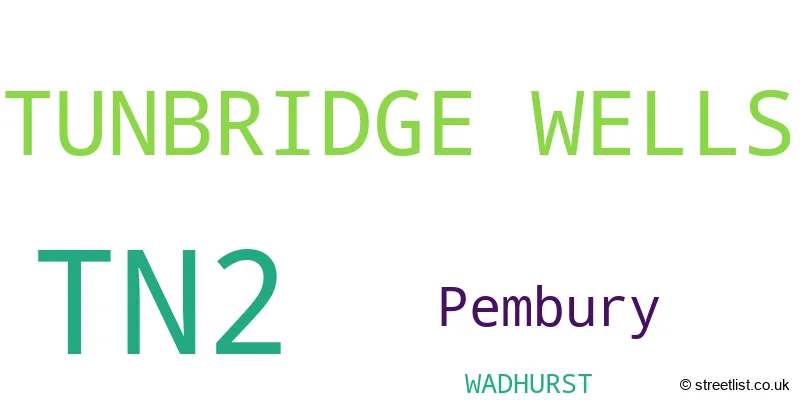
The largest settlements in the TN2 postal code are TUNBRIDGE WELLS and Pembury.
The TN2 Postcode shares a border with TN4 (TUNBRIDGE WELLS, Southborough, Rusthall), TN1 (TUNBRIDGE WELLS), TN3 (Langton Green, Lamberhurst, Groombridge), TN11 (Hildenborough, Hadlow, TONBRIDGE) and TN12 (Paddock Wood, Staplehurst, Marden).
The primary settlement in the TN2 postcode district is Tunbridge Wells, located in the county of Kent, England. Other significant settlements within this district include Pembury, also in Kent. The most significant post town in this district is Tunbridge Wells.
For the district TN2, we have data on 4 postcode sectors. Here's a breakdown: The sector TN2 3, covers Tunbridge Wells in Kent. The sector TN2 4, covers Pembury and Tunbridge Wells in Kent. The sector TN2 5, covers Tunbridge Wells in Kent. The sector TN2 9 is non-geographic. It's often designated for PO Boxes, large organisations, or special services.

Map of the TN2 Postcode District
Explore the TN2 postcode district by using our free interactive map.

When it comes to local government, postal geography often disregards political borders. However, for a breakdown in the TN2 District: the district mostly encompasses the Tunbridge Wells District (B) (793 postcodes), followed by the Wealden District area (38 postcodes), and finally, the Tonbridge and Malling District (B) area (5 postcodes).
Recent House Sales in TN24
| Date | Price | Address |
|---|---|---|
| 06/10/2023 | £105,000 | Hill View, Ashford, TN24 8YE |
| 25/09/2023 | £106,000 | Park Street, Ashford, TN24 8DF |
| 11/09/2023 | £315,000 | Highfield Road, Willesborough, Ashford, TN24 0JJ |
| 08/09/2023 | £310,000 | Birling Road, Ashford, TN24 8BQ |
| 08/09/2023 | £280,000 | Harvey Road, Willesborough, Ashford, TN24 0AR |
| 05/09/2023 | £270,000 | Quantock Drive, Ashford, TN24 8QL |
| 04/09/2023 | £280,000 | Grasmere Road, Kennington, Ashford, TN24 9BE |
| 01/09/2023 | £535,000 | Romsey Close, Willesborough, Ashford, TN24 0QX |
| 01/09/2023 | £290,000 | Belmont Road, Kennington, Ashford, TN24 9LS |
| 30/08/2023 | £540,000 | Billington Gardens, Kennington, Ashford, TN24 9HF |
Where is the TN2 Postcode District?
The TN2 postcode district is located in Tunbridge Wells. It is nearby several towns: Tonbridge is located to the North West at a distance of 4.22 miles, Wadhurst is located to the South at a distance of 5.73 miles, Crowborough is located to the South West at a distance of 8.55 miles, Hartfield is located to the West at a distance of 9.38 miles, and Cranbrook is located to the East at a distance of 9.83 miles. Additionally, the centre of London is located approximately 31.49 miles away from this postcode district.
The district covers the post towns of TUNBRIDGE WELLS, WADHURST.
The sector has postcodes within the nation of England.
The TN2 Postcode District is covers the following regions.
- West Kent - Kent - South East (England)
- East Sussex CC - Surrey, East and West Sussex - South East (England)
Weather Forecast for TN2
Press Button to Show Forecast for Royal Tunbridge Wells
| Time Period | Icon | Description | Temperature | Rain Probability | Wind |
|---|---|---|---|---|---|
| 09:00 to 12:00 | Cloudy | 13.0°C (feels like 13.0°C) | 3.00% | SSW 2 mph | |
| 12:00 to 15:00 | Sunny day | 17.0°C (feels like 17.0°C) | 0.00% | S 2 mph | |
| 15:00 to 18:00 | Partly cloudy (day) | 20.0°C (feels like 19.0°C) | 0.00% | SE 4 mph | |
| 18:00 to 21:00 | Sunny day | 17.0°C (feels like 16.0°C) | 0.00% | S 7 mph | |
| 21:00 to 00:00 | Clear night | 13.0°C (feels like 13.0°C) | 0.00% | SSW 2 mph |
Press Button to Show Forecast for Royal Tunbridge Wells
| Time Period | Icon | Description | Temperature | Rain Probability | Wind |
|---|---|---|---|---|---|
| 00:00 to 03:00 | Clear night | 11.0°C (feels like 11.0°C) | 0.00% | W 2 mph | |
| 03:00 to 06:00 | Clear night | 10.0°C (feels like 9.0°C) | 0.00% | ESE 4 mph | |
| 06:00 to 09:00 | Sunny day | 12.0°C (feels like 12.0°C) | 0.00% | ESE 2 mph | |
| 09:00 to 12:00 | Cloudy | 17.0°C (feels like 17.0°C) | 4.00% | ESE 4 mph | |
| 12:00 to 15:00 | Partly cloudy (day) | 20.0°C (feels like 19.0°C) | 1.00% | ESE 7 mph | |
| 15:00 to 18:00 | Cloudy | 20.0°C (feels like 19.0°C) | 4.00% | ESE 9 mph | |
| 18:00 to 21:00 | Partly cloudy (day) | 18.0°C (feels like 17.0°C) | 0.00% | E 7 mph | |
| 21:00 to 00:00 | Partly cloudy (night) | 13.0°C (feels like 12.0°C) | 1.00% | E 7 mph |
Press Button to Show Forecast for Royal Tunbridge Wells
| Time Period | Icon | Description | Temperature | Rain Probability | Wind |
|---|---|---|---|---|---|
| 00:00 to 03:00 | Partly cloudy (night) | 11.0°C (feels like 10.0°C) | 0.00% | ENE 4 mph | |
| 03:00 to 06:00 | Cloudy | 10.0°C (feels like 9.0°C) | 3.00% | ENE 4 mph | |
| 06:00 to 09:00 | Partly cloudy (day) | 12.0°C (feels like 11.0°C) | 0.00% | ENE 4 mph | |
| 09:00 to 12:00 | Sunny day | 18.0°C (feels like 18.0°C) | 1.00% | E 7 mph | |
| 12:00 to 15:00 | Partly cloudy (day) | 21.0°C (feels like 20.0°C) | 0.00% | ESE 7 mph | |
| 15:00 to 18:00 | Cloudy | 21.0°C (feels like 20.0°C) | 3.00% | ESE 7 mph | |
| 18:00 to 21:00 | Sunny day | 19.0°C (feels like 18.0°C) | 0.00% | E 7 mph | |
| 21:00 to 00:00 | Clear night | 14.0°C (feels like 13.0°C) | 0.00% | ENE 7 mph |
Press Button to Show Forecast for Royal Tunbridge Wells
| Time Period | Icon | Description | Temperature | Rain Probability | Wind |
|---|---|---|---|---|---|
| 00:00 to 03:00 | Clear night | 12.0°C (feels like 11.0°C) | 0.00% | E 7 mph | |
| 03:00 to 06:00 | Clear night | 11.0°C (feels like 10.0°C) | 0.00% | E 4 mph | |
| 06:00 to 09:00 | Sunny day | 14.0°C (feels like 13.0°C) | 0.00% | ESE 4 mph | |
| 09:00 to 12:00 | Partly cloudy (day) | 19.0°C (feels like 19.0°C) | 1.00% | SE 7 mph | |
| 12:00 to 15:00 | Cloudy | 22.0°C (feels like 21.0°C) | 4.00% | SSE 9 mph | |
| 15:00 to 18:00 | Cloudy | 22.0°C (feels like 20.0°C) | 9.00% | S 9 mph | |
| 18:00 to 21:00 | Cloudy | 19.0°C (feels like 18.0°C) | 8.00% | S 7 mph | |
| 21:00 to 00:00 | Cloudy | 15.0°C (feels like 14.0°C) | 13.00% | S 7 mph |
Press Button to Show Forecast for Royal Tunbridge Wells
| Time Period | Icon | Description | Temperature | Rain Probability | Wind |
|---|---|---|---|---|---|
| 00:00 to 03:00 | Cloudy | 13.0°C (feels like 13.0°C) | 14.00% | SSW 4 mph | |
| 03:00 to 06:00 | Cloudy | 13.0°C (feels like 12.0°C) | 15.00% | SSW 7 mph | |
| 06:00 to 09:00 | Cloudy | 13.0°C (feels like 12.0°C) | 17.00% | SSW 7 mph | |
| 09:00 to 12:00 | Cloudy | 15.0°C (feels like 14.0°C) | 19.00% | SSW 9 mph | |
| 12:00 to 15:00 | Light rain shower (day) | 16.0°C (feels like 14.0°C) | 37.00% | SSW 11 mph | |
| 15:00 to 18:00 | Cloudy | 17.0°C (feels like 15.0°C) | 16.00% | SSW 11 mph | |
| 18:00 to 21:00 | Cloudy | 15.0°C (feels like 14.0°C) | 11.00% | S 9 mph | |
| 21:00 to 00:00 | Light rain shower (night) | 13.0°C (feels like 11.0°C) | 41.00% | S 9 mph |
Postcode Sectors within the TN2 District
| Postcode Sector | Delivery Office |
|---|---|
| TN2 3 | Tunbridge Wells Delivery Office |
| TN2 4 | Tunbridge Wells Delivery Office |
| TN2 5 | Tunbridge Wells Delivery Office |
| T | N | 2 | - | X | X | X |
| T | N | 2 | Space | Numeric | Letter | Letter |
Tourist Attractions within the TN2 Postcode Area
We found 1 visitor attractions within the TN2 postcode area
| Spa Valley Railway |
|---|
| Railways |
| Steam / Heritage Railway |
| View Spa Valley Railway on Google Maps |
Current Monthly Rental Prices
| # Bedrooms | Min Price | Max Price | Avg Price |
|---|---|---|---|
| 1 | £775 | £1,400 | £1,043 |
| 2 | £950 | £2,250 | £1,519 |
| 3 | £1,500 | £3,000 | £2,235 |
| 4 | £2,400 | £6,000 | £3,335 |
| 5 | £2,500 | £2,500 | £2,500 |
Current House Prices
| # Bedrooms | Min Price | Max Price | Avg Price |
|---|---|---|---|
| £2,750 | £160,000 | £100,550 | |
| 1 | £80,000 | £360,000 | £217,971 |
| 2 | £105,000 | £4,600,000 | £445,623 |
| 3 | £310,000 | £850,000 | £530,943 |
| 4 | £396,000 | £2,100,000 | £925,033 |
| 5 | £525,000 | £2,395,000 | £1,146,036 |
| 6 | £975,000 | £975,000 | £975,000 |
| 8 | £2,000,000 | £2,000,000 | £2,000,000 |
Estate Agents who Operate in the TN2 District
| Logo | Name | Brand Name | Address | Contact Number | Total Properties |
|---|---|---|---|---|---|
 | Tunbridge Wells | Connells | 5 Vale Road, Tunbridge Wells, Kent, TN1 1BS | 01892 362188 | 16 |
 | Tunbridge Wells | Wards | 20 High Street, Tunbridge Wells, Kent, TN1 1UX | 01892 362232 | 14 |
 | Tunbridge Wells | Bracketts Chartered Surveyors | 27-29 High Street, Tunbridge Wells, TN1 1UU | 01892 362226 | 13 |
 | Tunbridge Wells | Freeman Forman | 22-24 High Street Tunbridge Wells TN1 1UX | 01892 362234 | 13 |
 | Tunbridge Wells | Savills | 53 High Street, Tunbridge Wells, TN1 1XU | 01892 362215 | 12 |
Yearly House Price Averages for the TN2 Postcode District
| Type of Property | 2018 Average | 2018 Sales | 2017 Average | 2017 Sales | 2016 Average | 2016 Sales | 2015 Average | 2015 Sales |
|---|---|---|---|---|---|---|---|---|
| Detached | £766,947 | 136 | £738,535 | 133 | £724,000 | 146 | £666,297 | 139 |
| Semi-Detached | £459,948 | 97 | £428,988 | 128 | £423,867 | 164 | £379,208 | 116 |
| Terraced | £363,677 | 112 | £357,238 | 96 | £325,593 | 114 | £336,924 | 125 |
| Flats | £280,235 | 155 | £254,968 | 134 | £260,959 | 157 | £242,970 | 170 |