The TW19 6 postcode sector lies where the three counties of Berkshire, Greater London, and Surrey meet.
Did you know? According to the 2021 Census, the TW19 6 postcode sector is home to a bustling 1,781 residents!
Given that each sector allows for 400 unique postcode combinations. Letters C, I, K, M, O and V are not allowed in the last two letters of a postcode. With 51 postcodes already in use, this leaves 349 units available.
The largest settlement in the TW19 6 postal code is STANWELL MOOR followed by STAINES-UPON-THAMES, and WRAYSBURY.
The TW19 6 Postcode shares a border with TW6 2 (LONDON HEATHROW AIRPORT , HEATHROW ), TW18 4 (STAINES-UPON-THAMES , STAINES , WRAYSBURY ), TW19 7 (STANWELL), TW20 0 (Englefield Green, EGHAM), SL3 0 (POYLE, COLNBROOK), SL3 9 (Datchet, HORTON), TW19 5 (WRAYSBURY) and UB7 0 (WEST DRAYTON , LONGFORD , SIPSON ).
The sector is within the post town of STAINES-UPON-THAMES.
TW19 6 is a postcode sector within the TW18 postcode district which is within the TW Twickenham postcode area.
The Royal Mail delivery office for the TW19 6 postal sector is the unknown.
The area of the TW19 6 postcode sector is 4.02 square miles which is 10.42 square kilometres or 2,573.68 square acres.
The TW19 6 postcode sector is crossed by the A3113 Major A road.
The TW19 6 postcode sector is crossed by the A30 Major A road.
The TW19 6 postcode sector is crossed by the M25 motorway.
Waterways within the TW19 6 postcode sector include the Longford River, River Colne, Staines Aqueduct, Wraysbury River, Colne Brook.

Map of the TW19 6 Postcode Sector
Explore the TW19 6 postcode sector by using our free interactive map.
| T | W | 1 | 9 | - | 6 | X | X |
| T | W | 1 | 9 | Space | 6 | Letter | Letter |
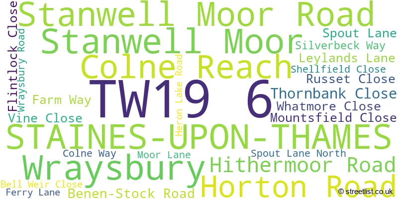
Official List of Streets
STAINES-UPON-THAMES (20 Streets)
Wraysbury (1 Streets)
Stanwell Moor (1 Streets)
Unofficial Streets or Alternative Spellings
London Heathrow Airport
SOUTHERN PERIMETER ROADStanwell
PARK ROADSTAINES-UPON-THAMES
BENEN-STOCK ROAD FARNELL ROAD AIRPORT WAY BEDFONT COURT BERKELEY CLOSE CROOKED BILLET ROUNDABOUT HYTHE END BRIDGE MEADOW VIEW MINERVA CLOSE POYLE INTERCHANGE RUNNYMEDE ROUNDABOUT STAINES BY-PASS TERMINAL 5 SPUR WESTERN PERIMETER ROAD WESTERN PERIMETER ROAD ROUNDABOUT YEOVENEY CLOSEColnbrook
HORTON ROADWraysbury
HYTHE END ROADWeather Forecast for TW19 6
Press Button to Show Forecast for Staines
| Time Period | Icon | Description | Temperature | Rain Probability | Wind |
|---|---|---|---|---|---|
| 21:00 to 00:00 | Clear night | 10.0°C (feels like 9.0°C) | 0.00% | SSE 7 mph |
Press Button to Show Forecast for Staines
| Time Period | Icon | Description | Temperature | Rain Probability | Wind |
|---|---|---|---|---|---|
| 00:00 to 03:00 | Clear night | 9.0°C (feels like 7.0°C) | 0.00% | SSE 7 mph | |
| 03:00 to 06:00 | Clear night | 8.0°C (feels like 6.0°C) | 0.00% | SE 7 mph | |
| 06:00 to 09:00 | Sunny day | 9.0°C (feels like 7.0°C) | 0.00% | SE 4 mph | |
| 09:00 to 12:00 | Sunny day | 14.0°C (feels like 13.0°C) | 1.00% | SSE 9 mph | |
| 12:00 to 15:00 | Cloudy | 17.0°C (feels like 14.0°C) | 6.00% | S 11 mph | |
| 15:00 to 18:00 | Partly cloudy (day) | 17.0°C (feels like 14.0°C) | 7.00% | SSE 11 mph | |
| 18:00 to 21:00 | Partly cloudy (day) | 15.0°C (feels like 14.0°C) | 7.00% | SSE 7 mph | |
| 21:00 to 00:00 | Partly cloudy (night) | 11.0°C (feels like 10.0°C) | 7.00% | SE 7 mph |
Press Button to Show Forecast for Staines
| Time Period | Icon | Description | Temperature | Rain Probability | Wind |
|---|---|---|---|---|---|
| 00:00 to 03:00 | Cloudy | 11.0°C (feels like 10.0°C) | 9.00% | SE 4 mph | |
| 03:00 to 06:00 | Cloudy | 10.0°C (feels like 9.0°C) | 8.00% | S 4 mph | |
| 06:00 to 09:00 | Cloudy | 10.0°C (feels like 9.0°C) | 9.00% | N 2 mph | |
| 09:00 to 12:00 | Cloudy | 13.0°C (feels like 12.0°C) | 10.00% | NNW 2 mph | |
| 12:00 to 15:00 | Cloudy | 15.0°C (feels like 15.0°C) | 11.00% | E 2 mph | |
| 15:00 to 18:00 | Cloudy | 16.0°C (feels like 15.0°C) | 13.00% | NE 4 mph | |
| 18:00 to 21:00 | Cloudy | 15.0°C (feels like 14.0°C) | 15.00% | NE 4 mph | |
| 21:00 to 00:00 | Cloudy | 13.0°C (feels like 12.0°C) | 19.00% | N 7 mph |
Press Button to Show Forecast for Staines
| Time Period | Icon | Description | Temperature | Rain Probability | Wind |
|---|---|---|---|---|---|
| 00:00 to 03:00 | Light rain shower (night) | 12.0°C (feels like 11.0°C) | 39.00% | N 4 mph | |
| 03:00 to 06:00 | Light rain | 11.0°C (feels like 10.0°C) | 42.00% | NNW 4 mph | |
| 06:00 to 09:00 | Overcast | 11.0°C (feels like 10.0°C) | 17.00% | NW 7 mph | |
| 09:00 to 12:00 | Overcast | 13.0°C (feels like 12.0°C) | 16.00% | WNW 7 mph | |
| 12:00 to 15:00 | Cloudy | 16.0°C (feels like 15.0°C) | 9.00% | NW 7 mph | |
| 15:00 to 18:00 | Partly cloudy (day) | 18.0°C (feels like 17.0°C) | 8.00% | NW 9 mph | |
| 18:00 to 21:00 | Cloudy | 17.0°C (feels like 16.0°C) | 10.00% | NNW 9 mph | |
| 21:00 to 00:00 | Partly cloudy (night) | 14.0°C (feels like 13.0°C) | 5.00% | NNW 9 mph |

House Prices in the TW19 6 Postcode Sector
| Type of Property | 2018 Average | 2018 Sales | 2017 Average | 2017 Sales | 2016 Average | 2016 Sales | 2015 Average | 2015 Sales |
|---|---|---|---|---|---|---|---|---|
| Detached | £625,000 | 1 | £660,000 | 2 | £467,000 | 7 | £324,617 | 6 |
| Semi-Detached | £395,286 | 7 | £413,636 | 11 | £392,929 | 7 | £326,455 | 11 |
| Terraced | £325,364 | 7 | £312,475 | 14 | £295,333 | 15 | £277,033 | 15 |
| Flats | £268,000 | 2 | £262,800 | 5 | £235,500 | 2 | £191,290 | 5 |
| The TW19 6 Sector is within these Local Authorities |
|
|---|---|
| The TW19 6 Sector is within these Counties |
|
| The TW19 6 Sector is within these Water Company Areas |
|