The TW18 4 postcode sector stands on the Surrey and Berkshire border.
Did you know? According to the 2021 Census, the TW18 4 postcode sector is home to a bustling 6,062 residents!
Given that each sector allows for 400 unique postcode combinations. Letters C, I, K, M, O and V are not allowed in the last two letters of a postcode. With 186 postcodes already in use, this leaves 214 units available.
The largest settlement in the TW18 4 postal code is STAINES-UPON-THAMES followed by STAINES , and WRAYSBURY .
The TW18 4 Postcode shares a border with TW15 3 (ASHFORD ), TW18 1 (STAINES-UPON-THAMES , LALEHAM ), TW18 3 (STAINES-UPON-THAMES , EGHAM , THORPE ), TW19 7 (STANWELL), TW20 0 (Englefield Green, EGHAM), TW20 9 (EGHAM, Englefield Green), TW18 2 (STAINES-UPON-THAMES , LALEHAM ) and TW19 6 (STANWELL MOOR, STAINES-UPON-THAMES, WRAYSBURY).
The sector is within the post town of STAINES-UPON-THAMES.
TW18 4 is a postcode sector within the TW19 postcode district which is within the TW Twickenham postcode area.
The Royal Mail delivery office for the TW18 4 postal sector is the unknown.
The area of the TW18 4 postcode sector is 1.04 square miles which is 2.70 square kilometres or 666.33 square acres.
The TW18 4 postcode sector is crossed by the A30 Major A road.
The TW18 4 postcode sector is crossed by the M25 motorway.
Waterways within the TW18 4 postcode sector include the River Thames, River Colne, Staines Aqueduct, River Ash.

Map of the TW18 4 Postcode Sector
Explore the TW18 4 postcode sector by using our free interactive map.
| T | W | 1 | 8 | - | 4 | X | X |
| T | W | 1 | 8 | Space | 4 | Letter | Letter |
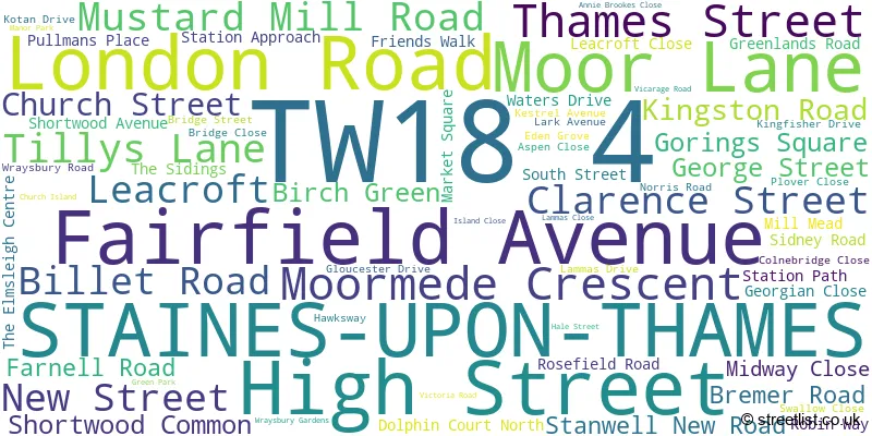
Official List of Streets
STAINES-UPON-THAMES (65 Streets)
Unofficial Streets or Alternative Spellings
STAINES-UPON-THAMES
GRESHAM ROAD STANWELL MOOR ROAD THAMES SIDE COOPERS LANE CROOKED BILLET ROUNDABOUT DOLPHIN COURT ELMSLEIGH ROAD FURLONG ROAD GOODMAN PLACE HALE STREET CYCLE PATH LOVE LOCKS BRIDGE MATTHEWS LANE MEADOW COURT MUSTARD MILL ROAD CYCLE PATH RALEIGH COURT SILVERDALE COURT SOUTH STREET CYCLE PATH STAINES BRIDGE STAINES BY-PASS STONEGATE COURT THAMES STREET CYCLE PATH THE MALTINGS THE OAKS WESTBROOK ROADASHFORD,
KINGSTON ROAD LONDON ROAD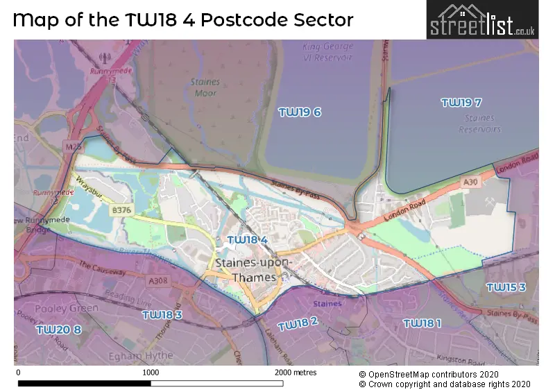
House Prices in the TW18 4 Postcode Sector
| Type of Property | 2018 Average | 2018 Sales | 2017 Average | 2017 Sales | 2016 Average | 2016 Sales | 2015 Average | 2015 Sales |
|---|---|---|---|---|---|---|---|---|
| Detached | £589,818 | 11 | £676,250 | 8 | £600,573 | 13 | £432,500 | 6 |
| Semi-Detached | £422,074 | 17 | £424,957 | 21 | £391,909 | 11 | £355,030 | 15 |
| Terraced | £400,950 | 20 | £406,873 | 26 | £450,798 | 20 | £346,994 | 39 |
| Flats | £275,319 | 50 | £287,709 | 80 | £286,429 | 47 | £267,332 | 85 |
Important Postcodes TW18 4 in the Postcode Sector
TW18 4BP is the postcode for 2, London Road, and H M REVENUE & CUSTOMS, HELITING HOUSE, 2, London Road
TW18 4DQ is the postcode for Century House, 100 Church Street
TW18 4EA is the postcode for Staines Community Centre, Thames Street
TW18 4HB is the postcode for Department for Work and Pensions, Jobcentre Plus, 62 London Road, and Jobcentre Plus, 62 London Road
TW18 4HZ is the postcode for NESSS School, Stanwell New Road
TW18 4LQ is the postcode for Staines Police Station, 22 Kingston Road
TW18 4PB is the postcode for Staines Youth Sports Centre, Leacroft
TW18 4PG is the postcode for STAINES LIBRARY, FRIENDS WALK, STAINES-UPON-THAMES, and Staines Library, Friends Walk
TW18 4QB is the postcode for DECATHLON UK LTD, UNIT MSU2, The Elmsleigh Centre
TW18 4UD is the postcode for H M Revenue & Customs, Forum House
| The TW18 4 Sector is within these Local Authorities |
|
|---|---|
| The TW18 4 Sector is within these Counties |
|
| The TW18 4 Sector is within these Water Company Areas |
|