UB4 9YB is a postal code used within the United Kingdom for delivering mail.
Postcodes are made up of two parts. The part before the space (UB4) is called the outward code. The part after the space (9YB) is called the inward code. The letters C, I, K, M, O and V are not allowed in the inward code. In addition to the inward and outward code, the postcode can be broken up into four parts:
- Postal Area. In our case UB which means Uxbridge.
- Postal District. In our case UB4.
- Postal Sector. In our case UB4 9.
- Postcode Unit. The last two letters. In our case YB.
The regional mail center for the post area UB is the Princess Royal Distribution Centre, which is located at Blackmore Drive, North Circular, LONDON , NW10 7RH.
The final port of call for any post addressed to the UB4 9YB postcode is the local delivery office (DO) which is HAYES DO. Here the post will be sorted ready for delivery.
The properties in the UB4 9YB postcode have the street address of Lyminster Close.
A close-knit community! The 2021 Census indicates that only 10 individuals call the UB4 9YB postcode their home.
It is situated within the post town of HAYES within the old postal county of Middlesex.
UB4 9YB is within Hayes Hillingdon.
Our data shows that UB4 9YB is a residential postcode.
The UB4 9YB postcode area is composed of 100% residential properties, 0% commercial properties, and 0% public properties.
According to our data. Most dwellings in UB4 9YB are houses. Of these houses, most are detached. The remainder are mid-terraced and semi-detached.
Most properties in UB4 9YB are owned by the occupiers with the rest being unknown tenure.

Interactive Mapping Showing UPRNs within the UB4 9YB Postcode Boundaries
Use the search box to search for other postcodes or places.
Map of the UB4 9YB Postcode

| Property Type | Percentage |
|---|---|
| Residential | 100% |
| Commercial | 0% |
| Public | 0% |
Telephone Area Code for UB4 9YB
The telephone area code for UB4 9YB is 020 London.
Map Coordinates for UB4 9YB
| Latitude | 51.5227230887 |
|---|---|
| Longitude | -0.385611358006 |
Ordnance Survey Maps for UB4 9YB
| Map Series | Amazon | Ordnance Survey |
| Explorer 1:25,000 173 London North, The City, West End, Enfield, Ealing, Harrow & Watford | Check Price on Amazon | Buy Direct from the Ordnance Survey |
| Landranger 1:50,000 176 West London | Check Price on Amazon | Buy Direct from the Ordnance Survey |
Weather Forecast for UB4 9YB
Sat 27th Apr
Press Button to Show Forecast for Northolt
| Time Period | Icon | Description | Temperature | Rain Probability | Wind |
|---|---|---|---|---|---|
| 18:00 to 21:00 | Heavy rain | 11.0°C (feels like 8.0°C) | 93.00% | NE 11 mph | |
| 21:00 to 00:00 | Heavy rain | 9.0°C (feels like 6.0°C) | 92.00% | NNE 11 mph |
Sun 28th Apr
Press Button to Show Forecast for Northolt
| Time Period | Icon | Description | Temperature | Rain Probability | Wind |
|---|---|---|---|---|---|
| 00:00 to 03:00 | Heavy rain | 8.0°C (feels like 5.0°C) | 87.00% | NNE 11 mph | |
| 03:00 to 06:00 | Heavy rain | 8.0°C (feels like 6.0°C) | 87.00% | NNE 9 mph | |
| 06:00 to 09:00 | Light rain shower (day) | 8.0°C (feels like 6.0°C) | 44.00% | NNW 7 mph | |
| 09:00 to 12:00 | Light rain | 8.0°C (feels like 5.0°C) | 57.00% | WNW 11 mph | |
| 12:00 to 15:00 | Light rain | 8.0°C (feels like 5.0°C) | 54.00% | W 16 mph | |
| 15:00 to 18:00 | Cloudy | 10.0°C (feels like 8.0°C) | 12.00% | WSW 13 mph | |
| 18:00 to 21:00 | Cloudy | 11.0°C (feels like 9.0°C) | 10.00% | SW 11 mph | |
| 21:00 to 00:00 | Clear night | 9.0°C (feels like 7.0°C) | 2.00% | SW 7 mph |
Mon 29th Apr
Press Button to Show Forecast for Northolt
| Time Period | Icon | Description | Temperature | Rain Probability | Wind |
|---|---|---|---|---|---|
| 00:00 to 03:00 | Clear night | 6.0°C (feels like 5.0°C) | 1.00% | SW 4 mph | |
| 03:00 to 06:00 | Clear night | 5.0°C (feels like 3.0°C) | 0.00% | SSW 4 mph | |
| 06:00 to 09:00 | Sunny day | 7.0°C (feels like 5.0°C) | 0.00% | S 7 mph | |
| 09:00 to 12:00 | Partly cloudy (day) | 13.0°C (feels like 10.0°C) | 1.00% | SSW 13 mph | |
| 12:00 to 15:00 | Partly cloudy (day) | 15.0°C (feels like 12.0°C) | 1.00% | SSW 16 mph | |
| 15:00 to 18:00 | Partly cloudy (day) | 15.0°C (feels like 12.0°C) | 2.00% | SSW 16 mph | |
| 18:00 to 21:00 | Sunny day | 14.0°C (feels like 12.0°C) | 1.00% | S 11 mph | |
| 21:00 to 00:00 | Clear night | 10.0°C (feels like 9.0°C) | 1.00% | SSE 7 mph |
Tue 30th Apr
Press Button to Show Forecast for Northolt
| Time Period | Icon | Description | Temperature | Rain Probability | Wind |
|---|---|---|---|---|---|
| 00:00 to 03:00 | Clear night | 9.0°C (feels like 7.0°C) | 1.00% | SE 7 mph | |
| 03:00 to 06:00 | Clear night | 8.0°C (feels like 6.0°C) | 0.00% | ESE 4 mph | |
| 06:00 to 09:00 | Sunny day | 9.0°C (feels like 8.0°C) | 1.00% | ESE 4 mph | |
| 09:00 to 12:00 | Sunny day | 14.0°C (feels like 13.0°C) | 7.00% | SE 9 mph | |
| 12:00 to 15:00 | Cloudy | 16.0°C (feels like 14.0°C) | 14.00% | SSE 11 mph | |
| 15:00 to 18:00 | Cloudy | 16.0°C (feels like 14.0°C) | 14.00% | SSE 11 mph | |
| 18:00 to 21:00 | Cloudy | 15.0°C (feels like 14.0°C) | 12.00% | SSE 9 mph | |
| 21:00 to 00:00 | Cloudy | 12.0°C (feels like 11.0°C) | 12.00% | SE 4 mph |
Wed 1st May
Press Button to Show Forecast for Northolt
| Time Period | Icon | Description | Temperature | Rain Probability | Wind |
|---|---|---|---|---|---|
| 00:00 to 03:00 | Cloudy | 11.0°C (feels like 10.0°C) | 13.00% | ESE 4 mph | |
| 03:00 to 06:00 | Cloudy | 10.0°C (feels like 9.0°C) | 12.00% | ENE 2 mph | |
| 06:00 to 09:00 | Fog | 10.0°C (feels like 10.0°C) | 20.00% | NE 2 mph | |
| 09:00 to 12:00 | Cloudy | 14.0°C (feels like 13.0°C) | 13.00% | ENE 7 mph | |
| 12:00 to 15:00 | Cloudy | 17.0°C (feels like 16.0°C) | 14.00% | ESE 9 mph | |
| 15:00 to 18:00 | Cloudy | 17.0°C (feels like 17.0°C) | 14.00% | SSE 9 mph | |
| 18:00 to 21:00 | Cloudy | 16.0°C (feels like 16.0°C) | 14.00% | S 7 mph | |
| 21:00 to 00:00 | Cloudy | 14.0°C (feels like 13.0°C) | 18.00% | SSW 7 mph |
Schools within a five minute drive of UB4 9YB Postcode
England Primary Schools
Blair Peach Primary School
Address: Blair Peach Primary School, Beaconsfield Road, Southall, UB1 1DD
Distance: 1.01 miles
Contact: 02085719947
Tudor Primary School
Address: Tudor Primary School, Tudor Road, Southall, UB1 1NX
Distance: 0.63 miles
Contact: 02085714818
Viking Primary School
Address: Viking Primary School, Radcliffe Way, Northolt, UB5 6HW
Distance: 0.78 miles
Contact: 02088453186
St Raphael's Catholic Primary School
Address: St Raphael's Catholic Primary School, Hartfield Avenue, Northolt, UB5 6NL
Distance: 1.17 miles
Contact: 02088410848
Downe Manor Primary School
Address: Downe Manor Primary School, Down Way, Northolt, UB5 6NW
Distance: 1.11 miles
Contact: 02088451155
Minet Infant and Nursery School
Address: Minet Infant and Nursery School, Avondale Drive, Hayes, Middlesex, UB3 3NR
Distance: 1.26 miles
Contact: 02085735177
Minet Junior School
Address: Minet Junior School, Avondale Drive, Hayes, Middlesex, UB3 3NR
Distance: 1.26 miles
Contact: 01895462362
Yeading Infant and Nursery School
Address: Yeading Infant and Nursery School, Carlyon Road, Yeading Lane, Hayes, Middlesex, UB4 0NR
Distance: 0.56 miles
Contact: 02085733389
Yeading Junior School
Address: Yeading Junior School, Carlyon Road, Hayes, UB4 0NR
Distance: 0.56 miles
Contact: 01895462396
Dr Triplett's CofE Primary School
Address: Dr Triplett's CofE Primary School, Hemmen Lane, Hayes, Middlesex, UB3 2JQ
Distance: 1.37 miles
Contact: 02085731617
Grange Park Infant and Nursery School
Address: Grange Park Infant and Nursery School, Lansbury Drive, Hayes, Middlesex, UB4 8SF
Distance: 1.40 miles
Contact: 02038860887
Grange Park Junior School
Address: Grange Park Junior School, Lansbury Drive, Hayes, Middlesex, UB4 8SF
Distance: 1.40 miles
Contact: 02083534265
Nanaksar Primary School
Address: Nanaksar Primary School, Springfield Road, Hillingdon, Hayes, Middlesex, UB4 0LT
Distance: 1.10 miles
Contact: 02085736085
Belmore Primary Academy
Address: Belmore Primary Academy, Belmore Primary Academy, Owen Road, Hayes, Middlesex, UB4 9LF
Distance: 0.93 miles
Contact: 01895462364
Brookside Primary School
Address: Brookside Primary School, Perth Avenue, Hayes, UB4 9LW
Distance: 0.71 miles
Contact: 02088456634
England Secondary Schools
Guru Nanak Sikh Academy
Address: Guru Nanak Sikh Academy, Springfield Road, Hayes, Middlesex, UB4 0LT
Distance: 1.10 miles
Contact: 02085736085
Alec Reed Academy
Address: Alec Reed Academy, Bengarth Road, Northolt, Middlesex, UB5 5LQ
Distance: 1.48 miles
Contact: 02088414511
Barnhill Community High School
Address: Barnhill Community High School, Yeading Lane, Hayes, UB4 9LE
Distance: 0.78 miles
Contact: 02088390600
Nearest Dentists
Dentists near UB4 9YB
DENTAL SURGERY
Address: 152-152A LADY MARGARET ROAD, SOUTHALL, MIDDLESEX, UB1 2RW
Distance: 0.54 miles
Contact: :
YEADING DENTAL CARE
Address: 1A CARLYON ROAD, HAYES, MIDDLESEX, UB4 0NR
Distance: 0.56 miles
Contact: :
COLOSSEUM DENTAL (HIGHVIEW)
Address: 170 BYRON WAY, NORTHOLT, MIDDLESEX, UB5 6BW
Distance: 0.69 miles
Contact: :
TAYWOOD ROAD (DENTAL SURGERY)
Address: TAYWOOD ROAD, MIDDLESEX, NORTHOLT, GREATER LONDON, UB5 6WL
Distance: 0.73 miles
Contact: :
ST BERNARDS HOSPITAL
Address: FORENSIC SERVICES - REGIONAL SECURE, UXBRIDGE ROAD, SOUTHALL, GREATER LONDON, UB1 1EU
Distance: 0.88 miles
Contact: :
DENTAL SURGERY
Address: 4A SOUTH ROAD, SOUTHALL, MIDDLESEX, UB1 1RT
Distance: 0.93 miles
Contact: :
Nearest Chemists
Pharmacies near UB4 9YB
TESCO INSTORE PHARMACY
Address: GLENCOE ROAD, HAYES, UB4 9SQ
Distance: 0.15 miles
Contact: tel: 020 82107247
H.J.DIXON CHEMIST
Address: 185 LADY MARGARET ROAD, SOUTHALL, MIDDLESEX, UB1 2PT
Distance: 0.51 miles
Contact: tel: 020 85742767
LADY MARGARET
Address: 223 LADY MARGARET ROAD, SOUTHALL, UB1 2PT
Distance: 0.51 miles
Contact: tel: 020 88679798
BOOTS
Address: 236 YEADING LANE, HAYES, MIDDLESEX, UB4 9AX
Distance: 0.68 miles
Contact: tel: 020 88452024
WOODLAND PHARMACY
Address: 227 THE BROADWAY, SOUTHALL, MIDDLESEX, UB1 1ND
Distance: 0.70 miles
Contact: tel: 020 85741572
NORTHOLT PHARMACY
Address: GRAND UNION HEALTH CENTRE, TAYWOOD ROAD, NORTHOLT, MIDDLESEX, UB5 6WL
Distance: 0.73 miles
Contact: tel: 020 33137500
Nearest Opticians
Opticians near UB4 9YB
TESCO OPTICIANS (YEADING)
Address: GLENCOE ROAD, HAYES, MIDDLESEX, UB4 9SQ
Distance: 0.15 miles
Contact: :
YEADING EXTRA
Address: GLENCOE ROAD, HAYES, MIDDLESEX, UB4 9SQ
Distance: 0.15 miles
Contact: :
MANSONS EYECARE
Address: 14 JOLLYS LANE, WILLOW DISTRICT CENTRAL, HAYES, MIDDLESEX, UB4 9NS
Distance: 0.18 miles
Contact: :
ULTIMATE EYECARE
Address: 49 THE BROADWAY, SOUTHALL, MIDDLESEX, UB1 1JY
Distance: 0.86 miles
Contact: :
OPTICAL WORLD
Address: 11 THE BROADWAY, SOUTHALL, MIDDLESEX, UB1 1JR
Distance: 0.89 miles
Contact: :
HAYES LOMBARDY SPECSAVERS LIMITED
Address: LOMBARDY RETAIL PARK, COLDHARBOUR LANE, HAYES, UB3 3EX
Distance: 0.95 miles
Contact: :
Nearest GP Surgeries
Doctors near UB4 9YB
WILLOW TREE SURGERY
Address: 2 JOLLYS LANE, HAYES, MIDDLESEX, UB4 9BG
Distance: 0.14 miles
Contact: tel: 020 88421024
ST. GEORGES MEDICAL CTR.
Address: 276 LADY MARGARET ROAD, SOUTHALL, MIDDLESEX, UB1 2RX
Distance: 0.48 miles
Contact: tel: 020 85782421
THE SOUTHALL MEDICAL CTR.
Address: SOUTHALL MEDICAL CENTRE, 223 LADY MARGARET ROAD, SOUTHALL, MIDDLESEX, UB1 2PT
Distance: 0.51 miles
Contact: tel: 020 85744381
CHEPSTOW GARDENS MEDICAL CENTRE
Address: 150 LADY MARGARET ROAD, SOUTHALL, MIDDLESEX, UB1 2RL
Distance: 0.57 miles
Contact: tel: 020 85742812
SOMERSET FHP O
Address: 76 SOMERSET ROAD, SOUTHALL, MIDDLESEX, UB1 2TU
Distance: 0.71 miles
Contact: tel: 020 85788255
THE SALUJA CLINIC
Address: 36A NORTHCOTE AVENUE, SOUTHALL, MIDDLESEX, UB1 2AY
Distance: 0.72 miles
Contact: tel: 020 85745136
Transport Links near UB4 9YB
Train Stations
Nearest stations for postcode: UB4 9YB
- Southall
Southall station, South Road, Southall, Greater London, UB2 4AADistance: 2.56 milesDriving Time: 6.06 minutes - Hayes & Harlington
Hayes & Harlington station, Station Road, Hayes, Greater London, UB3 4BXDistance: 3.35 milesDriving Time: 5.64 minutes - Greenford
Greenford station, Oldfield Lane, Greenford, Greater London, UB6 8PXDistance: 3.87 milesDriving Time: 7.20 minutes - South Greenford
South Greenford station, Leaver Gardens, Greenford, Greater London, UB6 2WEDistance: 4.59 milesDriving Time: 9.04 minutes - Hanwell
Hanwell station, Campbell Road, Hanwell, Greater London, W7 3EBDistance: 4.63 milesDriving Time: 11.65 minutes
Distances represent the quickest route by car.
Motorway Junctions near UB4 9YB
Train Stations
Motorway Junctions near UB4 9YB
Distances represent the quickest route by car.
Who are my Elected Representatives in the UB4 9YB Postcode?
| Westminster Constituency | Hayes and Harlington Boro Const |
|---|---|
| Member or Parliament | 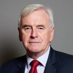 |
| Contact Details | Contact John McDonnell |
| Political Party | Labour |
What Council is the UB4 9YB Postcode in?
The Local Council for this Postcode is Hillingdon London Boro Council and the County Council is Greater London Authority Council.
Greater London Authority Council is responsible for providing education, libraries and maintaining highways.
Hillingdon London Boro Council is responsible for duties such as council tax, rubbish collection, housing, environmental health and planning.
You can visit the website for Hillingdon London Boro at the following link Hillingdon London Boro.How much is the Council Tax?
Hillingdon London Boro Council is responsible for collecting council tax. This will vary depending on which council tax band the property falls within. You can check the council tax band at the gov.uk website.
Once you know the council tax band you can view how much Hillingdon London Boro charge for that band by visiting the The Council Tax section of their website.
Where can I find out where the nearest Library to the UB4 9YB Postcode is?
Libraries are the responsibility of Hillingdon council
Visit the link for more information. Please note that some councils outsource library services to private companies and community groups ran by volunteers.
Libraries - Hillingdon CouncilHouse Sales in UB4 9YB
| Year | High | Low | Average | Sales |
|---|---|---|---|---|
| 2013 | £295,000 | £295,000 | £295,000 | 1 |
Contains HM Land Registry data © Crown copyright and database right 2024. This data is licensed under the Open Government Licence v3.0.
Postcodes near the UB4 9YB Postcode
What Popular Supermarkets are near the UB4 9YB Postcode?
| Supermarket | Distance | Directions |
|---|---|---|
| Sainsburys, Lombardy Retail Park, Coldharbour Lane, HAYES, UB3 3EX | 1.53 miles | Directions from UB4 9YB to Sainsburys |
| Lidl, High Street, SOUTHALL, UB1 3DB | 1.58 miles | Directions from UB4 9YB to Lidl |
| Iceland, South Road, SOUTHALL, UB1 1SQ | 1.72 miles | Directions from UB4 9YB to Iceland |
| Asda, Church Road, NORTHOLT, UB5 5AW | 2.24 miles | Directions from UB4 9YB to Asda |
| Iceland, The Broadway, GREENFORD, UB6 9PT | 2.29 miles | Directions from UB4 9YB to Iceland |
What Popular Restaurants are near the UB4 9YB Postcode?
| Burger King | Distance | Directions |
|---|---|---|
| Glencoe Road, Yeading, Yeading, UB4 9SN | 0.18 miles | Directions from UB4 9YB to Glencoe Road, Yeading |
| Heston Service Area, Hounslow, TW5 9NB | 2.40 miles | Directions from UB4 9YB to Heston Service Area |
| Heston Service Area, Hounslow, TW5 9NA | 2.41 miles | Directions from UB4 9YB to Heston Service Area |
| Unit A3,5, Treaty Shopping Centre, Hounslow, TW3 1ES | 3.90 miles | Directions from UB4 9YB to Unit A3,5, Treaty Shopping Centre |
| Mcdonald's | Distance | Directions |
|---|---|---|
| McDonald's, The Broadway, SOUTHALL, UB1 1NN | 0.72 miles | Directions from UB4 9YB to McDonald's, The Broadway, SOUTHALL, UB1 1NN |
| McDonald's, Lombardy Retail Park, Coldharbour Lane, HAYES, UB3 3EX | 0.95 miles | Directions from UB4 9YB to McDonald's, Lombardy Retail Park, Coldharbour Lane, HAYES, UB3 3EX |
| McDonald's, Church Road, NORTHOLT, UB5 5AW | 1.39 miles | Directions from UB4 9YB to McDonald's, Church Road, NORTHOLT, UB5 5AW |
| McDonald's, Uxbridge Road, SOUTHALL, UB1 3EG | 1.59 miles | Directions from UB4 9YB to McDonald's, Uxbridge Road, SOUTHALL, UB1 3EG |
| Restaurant | Distance | Directions |
|---|---|---|
| KFC, Uxbridge Road, HAYES, UB4 0RY | 1.17 miles | Directions from UB4 9YB to KFC Hayes End - Uxbridge Road |
| KFC, The Broadway, GREENFORD, UB6 9PH | 1.42 miles | Directions from UB4 9YB to KFC Greenford - The Broadway |
| KFC, Mandeville Road, NORTHOLT, UB5 5BJ | 1.64 miles | Directions from UB4 9YB to KFC Northolt - Mandeville Road |
| KFC, Broadway, Ealing, LONDON, W13 9BE | 2.64 miles | Directions from UB4 9YB to KFC West Ealing - The Broadway |
| KFC, Whiteleys Parade, Uxbridge Road, Hillingdon, UXBRIDGE, UB10 0PD | 2.69 miles | Directions from UB4 9YB to KFC Hillingdon - Whiteleys Parade |