UB6 0HE is a postal code used within the United Kingdom for delivering mail.
Postcodes are made up of two parts. The part before the space (UB6) is called the outward code. The part after the space (0HE) is called the inward code. The letters C, I, K, M, O and V are not allowed in the inward code. In addition to the inward and outward code, the postcode can be broken up into four parts:
- Postal Area. In our case UB which means Uxbridge.
- Postal District. In our case UB6.
- Postal Sector. In our case UB6 0.
- Postcode Unit. The last two letters. In our case HE.
The regional mail center for the post area UB is the Princess Royal Distribution Centre, which is located at Blackmore Drive, North Circular, LONDON , NW10 7RH.
The final port of call for any post addressed to the UB6 0HE postcode is the local delivery office (DO) which is NORTHOLT DO. Here the post will be sorted ready for delivery.
The properties in the UB6 0HE postcode have the street address of Greenford Road
It is situated within the post town of GREENFORD within the old postal county of Middlesex.
UB6 0HE is within Greenford.
According to our data UB6 0HE is a commercial postcode.
The UB6 0HE postcode area is composed of 0% residential properties, 100% commercial properties, and 0% public properties.
None Domestic Buildings in UB6 0HE fall under these categories: Offices.
Offices include Horsenden House 891, and Ferrero Hq Uk 889, Greenford Road.
Interactive Mapping Showing UPRNs within the UB6 0HE Postcode Boundaries
Use the search box to search for other postcodes or places.
Map of the UB6 0HE Postcode

UB6 0HE: Points of Interest
CH & Co At Ferrero UK
CH & Co At Ferrero UK is an establishment offering meals and refreshments located at former Glaxo Smithkline building, 891-995 Greenford Road, Greenford, UB6 0HE.
Dijon Catering
Dijon Catering is an establishment offering meals and refreshments located at Horsenden House, 891 Greenford Road, Greenford, Middlesex, UB6 0HE.
Global Banking School Starbucks
Global Banking School Starbucks is an establishment offering meals and refreshments located at Horsenden House, 891 Greenford Road, Greenford, Middlesex, UB6 0HE.
| Property Type | Percentage |
|---|---|
| Residential | 0% |
| Commercial | 100% |
| Public | 0% |
Telephone Area Code for UB6 0HE
The telephone area code for UB6 0HE is 020 London.
Map Coordinates for UB6 0HE
| Latitude | 51.5496655949 |
|---|---|
| Longitude | -0.34125856128 |
Ordnance Survey Maps for UB6 0HE
| Map Series | Amazon | Ordnance Survey |
| Explorer 1:25,000 173 London North, The City, West End, Enfield, Ealing, Harrow & Watford | Check Price on Amazon | Buy Direct from the Ordnance Survey |
| Landranger 1:50,000 176 West London | Check Price on Amazon | Buy Direct from the Ordnance Survey |
Weather Forecast for UB6 0HE
Thu 2nd May
Press Button to Show Forecast for Wembley
| Time Period | Icon | Description | Temperature | Rain Probability | Wind |
|---|---|---|---|---|---|
| 18:00 to 21:00 | Light rain shower (day) | 16.0°C (feels like 15.0°C) | 28.00% | W 9 mph | |
| 21:00 to 00:00 | Light rain | 13.0°C (feels like 11.0°C) | 41.00% | WNW 9 mph |
Fri 3rd May
Press Button to Show Forecast for Wembley
| Time Period | Icon | Description | Temperature | Rain Probability | Wind |
|---|---|---|---|---|---|
| 00:00 to 03:00 | Overcast | 12.0°C (feels like 10.0°C) | 15.00% | W 9 mph | |
| 03:00 to 06:00 | Overcast | 11.0°C (feels like 9.0°C) | 21.00% | W 9 mph | |
| 06:00 to 09:00 | Overcast | 10.0°C (feels like 8.0°C) | 46.00% | WSW 9 mph | |
| 09:00 to 12:00 | Light rain | 11.0°C (feels like 9.0°C) | 49.00% | WSW 11 mph | |
| 12:00 to 15:00 | Light rain | 13.0°C (feels like 11.0°C) | 42.00% | WSW 11 mph | |
| 15:00 to 18:00 | Cloudy | 14.0°C (feels like 12.0°C) | 13.00% | WSW 11 mph | |
| 18:00 to 21:00 | Cloudy | 14.0°C (feels like 12.0°C) | 11.00% | WSW 11 mph | |
| 21:00 to 00:00 | Partly cloudy (night) | 12.0°C (feels like 10.0°C) | 4.00% | SW 9 mph |
Sat 4th May
Press Button to Show Forecast for Wembley
| Time Period | Icon | Description | Temperature | Rain Probability | Wind |
|---|---|---|---|---|---|
| 00:00 to 03:00 | Clear night | 10.0°C (feels like 9.0°C) | 1.00% | SW 7 mph | |
| 03:00 to 06:00 | Clear night | 9.0°C (feels like 8.0°C) | 1.00% | SSW 4 mph | |
| 06:00 to 09:00 | Sunny day | 9.0°C (feels like 8.0°C) | 4.00% | SSW 4 mph | |
| 09:00 to 12:00 | Partly cloudy (day) | 13.0°C (feels like 11.0°C) | 7.00% | S 7 mph | |
| 12:00 to 15:00 | Partly cloudy (day) | 16.0°C (feels like 14.0°C) | 9.00% | S 9 mph | |
| 15:00 to 18:00 | Cloudy | 16.0°C (feels like 14.0°C) | 16.00% | S 9 mph | |
| 18:00 to 21:00 | Cloudy | 15.0°C (feels like 14.0°C) | 15.00% | S 9 mph | |
| 21:00 to 00:00 | Clear night | 13.0°C (feels like 12.0°C) | 8.00% | S 7 mph |
Sun 5th May
Press Button to Show Forecast for Wembley
| Time Period | Icon | Description | Temperature | Rain Probability | Wind |
|---|---|---|---|---|---|
| 00:00 to 03:00 | Partly cloudy (night) | 12.0°C (feels like 11.0°C) | 10.00% | SSW 7 mph | |
| 03:00 to 06:00 | Overcast | 11.0°C (feels like 10.0°C) | 11.00% | S 7 mph | |
| 06:00 to 09:00 | Cloudy | 11.0°C (feels like 10.0°C) | 10.00% | SSW 7 mph | |
| 09:00 to 12:00 | Partly cloudy (day) | 13.0°C (feels like 12.0°C) | 10.00% | S 7 mph | |
| 12:00 to 15:00 | Cloudy | 15.0°C (feels like 14.0°C) | 15.00% | SW 9 mph | |
| 15:00 to 18:00 | Cloudy | 16.0°C (feels like 15.0°C) | 16.00% | SSW 9 mph | |
| 18:00 to 21:00 | Cloudy | 16.0°C (feels like 15.0°C) | 11.00% | S 9 mph | |
| 21:00 to 00:00 | Cloudy | 14.0°C (feels like 13.0°C) | 10.00% | S 7 mph |
Schools within a five minute drive of UB6 0HE Postcode
England Primary Schools
Sudbury Primary School
Address: Sudbury Primary School, Watford Road, Wembley, HA0 3EY
Distance: 1.13 miles
Contact: 02083854444
Wood End Primary School
Address: Wood End Primary School, Whitton Avenue West, Northolt, Middlesex, UB5 4LB
Distance: 0.46 miles
Contact: 02084226175
Petts Hill Primary School
Address: Petts Hill Primary School, Newmarket Avenue, 1 Newmarket Avenue, Northolt, UB5 4HB
Distance: 0.93 miles
Contact: 02084224095
Byron Court Primary School
Address: Byron Court Primary School, Spencer Road, Wembley, Middlesex, HA0 3SF
Distance: 1.84 miles
Contact: 02089042785
Selborne Primary School
Address: Selborne Primary School, Conway Crescent, Perivale, Greenford, Middlesex, UB6 8JD
Distance: 0.90 miles
Contact: 02089971947
Roxeth Primary School
Address: Roxeth Primary School, Brickfields, Byron Hill Road, Harrow, Middlesex, HA2 0JA
Distance: 1.36 miles
Contact: 02084221344
St George's Primary School
Address: St George's Primary School, Sudbury Hill, Harrow, Middlesex, HA1 3SB
Distance: 0.96 miles
Contact:
Horsenden Primary School
Address: Horsenden Primary School, Horsenden Lane North, Greenford, Middlesex, UB6 0PB
Distance: 0.26 miles
Contact: 02084225985
Greenwood Primary School
Address: Greenwood Primary School, Wood End Way, Northolt, UB5 4QG
Distance: 0.50 miles
Contact: 02084229630
Wood End Infant School
Address: Wood End Infant School, Whitton Avenue West, Northolt, Middlesex, UB5 4LB
Distance: 0.46 miles
Contact:
Our Lady of the Visitation Catholic Primary School
Address: Our Lady of the Visitation Catholic Primary School, Greenford Road, Greenford, UB6 9AN
Distance: 1.87 miles
Contact: 02085755344
The Edward Betham Church of England Primary School
Address: The Edward Betham Church of England Primary School, Oldfield Lane South, Greenford, UB6 9JU
Distance: 1.14 miles
Contact: 02085788928
Coston Primary School
Address: Coston Primary School, Oldfield Lane South, Greenford, Middlesex, UB6 9JU
Distance: 1.14 miles
Contact: 02085781515
Oldfield Primary School
Address: Oldfield Primary School, Oldfield Lane North, Greenford, Middlesex, UB6 8PR
Distance: 0.89 miles
Contact: 02085782507
Stanhope Primary School
Address: Stanhope Primary School, Mansell Road, Greenford, UB6 9EG
Distance: 1.67 miles
Contact: 02085759989
The Welldon Park Academy
Address: The Welldon Park Academy, Wyvenhoe Road, Harrow, HA2 8LS
Distance: 1.00 miles
Contact: 02088649378
Heathland School
Address: Heathland School, Eastcote Lane, South Harrow, Harrow, Middlesex, HA2 9AG
Distance: 1.54 miles
Contact: 02084224503
Heathland School
Address: Heathland School, Eastcote Lane, South Harrow, Harrow, Middlesex, HA2 9AG
Distance: 1.54 miles
Contact:
Earlsmead Primary School
Address: Earlsmead Primary School, Arundel Drive, South Harrow, Harrow, HA2 8PW
Distance: 1.45 miles
Contact:
Ravenor Primary School
Address: Ravenor Primary School, Greenway Gardens, Greenford, UB6 9TT
Distance: 1.57 miles
Contact: 02085781654
England Higher Schools
St Dominic's Sixth Form College
Address: St Dominic's Sixth Form College, Mount Park Avenue, Harrow-on-the-Hill, Middlesex, HA1 3HX
Distance: 1.15 miles
Contact: 02084228084
England Secondary Schools
The Cardinal Wiseman Catholic School
Address: The Cardinal Wiseman Catholic School, Greenford Road, Greenford, Middlesex, UB6 9AW
Distance: 1.75 miles
Contact: 02085758222
Whitmore High School
Address: Whitmore High School, Porlock Avenue, Harrow, HA2 0AD
Distance: 1.73 miles
Contact: 02088647688
William Perkin Church of England High School
Address: William Perkin Church of England High School, Oldfield Lane North, Greenford, Middlesex, UB6 8PR
Distance: 0.89 miles
Contact: 02088328950
Northolt High School
Address: Northolt High School, Eastcote Lane, Northolt, Middlesex, UB5 4HP
Distance: 1.46 miles
Contact: 02088648544
Nearest Dentists
Dentists near UB6 0HE
DENTAL SURGERY
Address: 1552 GREENFORD ROAD, GREENFORD, MIDDLESEX, UB6 0HR
Distance: 0.44 miles
Contact: :
DENTAL SURGERY
Address: 72 PETTS HILL, NORTHOLT, MIDDLESEX, UB5 4NN
Distance: 0.85 miles
Contact: :
HARROW ROAD DENTAL SURGERY
Address: 883 HARROW ROAD, WEMBLEY, MIDDLESEX, HA0 2RH
Distance: 0.94 miles
Contact: :
DENTAEL
Address: 6 MEDWAY PARADE, PERIVALE, GREENFORD, UB6 8HR
Distance: 1.10 miles
Contact: :
DENTAL SURGERY
Address: 807 HARROW ROAD, WEMBLEY, MIDDLESEX, HA0 2LP
Distance: 1.12 miles
Contact: :
NORTHOLT ROAD DENTAL SURGERY
Address: 271 NORTHOLT ROAD, HARROW, MIDDLESEX, HA2 8HS
Distance: 1.12 miles
Contact: :
Nearest Chemists
Pharmacies near UB6 0HE
BRIGHT HEALTH PHARMACY
Address: 1318 GREENFORD ROAD, GREENFORD, UB6 0HL
Distance: 0.14 miles
Contact: tel: 02084 221831
BOOTS
Address: 47A-47B OLDFIELDS CIRCUS, NORTHOLT, MIDDLESEX, UB5 4RR
Distance: 0.41 miles
Contact: tel: 020 84236470
ELITE PHARMACY
Address: 107 ICG HOUSE, STATION APPROACH, OLDFIELD LANE NORTH, GREENFORD, GREATER LONDON, UB6 0AL
Distance: 0.53 miles
Contact: tel: 02085 782634
BOOTS
Address: BOOTS THE CHEMISTS LTD, UNIT 11, SE, 1000 GREENFORD ROAD, GREENFORD, MIDDLESEX, UB6 0UW
Distance: 0.54 miles
Contact: tel: 020 85786431
PARADE PHARMACY
Address: 386 OLDFIELD LANE NORTH, GREENFORD, MIDDLESEX, UB6 8PU
Distance: 0.57 miles
Contact: tel: 02085 758041
CURAPHARM CHEMIST
Address: 154 GREENFORD ROAD, SUDBURY HILL, HARROW, HA1 3QS
Distance: 0.59 miles
Contact: tel: 02084 221250
Nearest Opticians
Opticians near UB6 0HE
SPECSAVERS (WESTWAY CROSS SHOPPING PARK)
Address: WESTWAY CROSS RETAIL PARK, GREENFORD ROAD, GREENFORD, MIDDLESEX, UB6 0UW
Distance: 0.54 miles
Contact: :
BOOTS OPTICIANS - WESTWAY CROSS RETAIL PARK
Address: BOOTS THE CHEMISTS LTD, UNIT 11, WESTWAY CROSS RETAIL PARK, 1000 GREENFORD ROAD, GREENFORD, MIDDLESEX, UB6 0UW
Distance: 0.54 miles
Contact: :
DUNN & MCLEAN
Address: 465 NORTHOLT ROAD, HARROW, MIDDLESEX, HA2 8JN
Distance: 1.01 miles
Contact: :
SPECSAVERS (SOUTH HARROW)
Address: 308 NORTHOLT ROAD, SOUTH HARROW, MIDDLESEX, HA2 8EE
Distance: 1.12 miles
Contact: :
PARKER & HAMMOND OPTICIANS
Address: 302 NORTHOLT ROAD, HARROW, MIDDLESEX, HA2 8EE
Distance: 1.12 miles
Contact: :
FAMILY EYECARE
Address: 246 NORTHOLT ROAD, SOUTH HARROW, MIDDLESEX, HA2 8DU
Distance: 1.17 miles
Contact: :
Nearest GP Surgeries
Doctors near UB6 0HE
ELMTREES SURGERY
Address: 2A HORSENDEN LANE NORTH, GREENFORD, UB6 0PA
Distance: 0.24 miles
Contact: tel: 020 88697910
THE BARNABAS MEDICAL CTRE
Address: GIRTON ROAD, NORTHOLT, MIDDLESEX, UB5 4SQ
Distance: 0.53 miles
Contact: tel: 020 88644437
GREENFORD ROAD MED.CTR.
Address: 591 GREENFORD ROAD, GREENFORD, MIDDLESEX, UB6 8QH
Distance: 0.85 miles
Contact: tel: 020 85758347
MEADOW VIEW
Address: 141 MANDEVILLE ROAD, NORTHOLT, MIDDLESEX, UB5 4LZ
Distance: 0.85 miles
Contact: tel: 020 84223181
LANFRANC MEDICAL CENTRE
Address: LANFRANC COURT, GREENFORD ROAD, HARROW, MIDDLESEX, HA1 3QE
Distance: 0.90 miles
Contact: tel: 020 84221813
THE ALLENDALE ROAD SURGERY
Address: 35 ALLENDALE ROAD, GREENFORD, MIDDLESEX, UB6 0RA
Distance: 0.93 miles
Contact: tel: 020 89028146
Transport Links near UB6 0HE
Train Stations
Nearest stations for postcode: UB6 0HE
- Greenford
Greenford station, Oldfield Lane, Greenford, Greater London, UB6 8PXDistance: 0.70 milesDriving Time: 2.26 minutes - Sudbury Hill Harrow
Sudbury Hill Harrow station, Greenford Road, Sudbury Hill, Harrow, HA1 3RJDistance: 0.92 milesDriving Time: 2.37 minutes - Northolt Park
Northolt Park station, Cadogan Court, South Harrow, Greater London, UB5 4NPDistance: 1.79 milesDriving Time: 4.77 minutes - Sudbury & Harrow Road
Sudbury & Harrow Road station, Harrow Road, Sudbury, Greater London, HA0 2LWDistance: 1.80 milesDriving Time: 4.16 minutes - South Greenford
South Greenford station, Leaver Gardens, Greenford, Greater London, UB6 2WEDistance: 2.28 milesDriving Time: 5.39 minutes
Distances represent the quickest route by car.
Motorway Junctions near UB6 0HE
Train Stations
Motorway Junctions near UB6 0HE
Distances represent the quickest route by car.
Who are my Elected Representatives in the UB6 0HE Postcode?
| Westminster Constituency | Ealing North Boro Const |
|---|---|
| Member or Parliament | 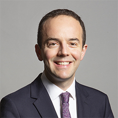 |
| Contact Details | Contact James Murray |
| Political Party | Labour (Co-op) |
What Council is the UB6 0HE Postcode in?
The Local Council for this Postcode is Ealing London Boro Council and the County Council is Greater London Authority Council.
Greater London Authority Council is responsible for providing education, libraries and maintaining highways.
Ealing London Boro Council is responsible for duties such as council tax, rubbish collection, housing, environmental health and planning.
You can visit the website for Ealing London Boro at the following link Ealing London Boro.How much is the Council Tax?
Ealing London Boro Council is responsible for collecting council tax. This will vary depending on which council tax band the property falls within. You can check the council tax band at the gov.uk website.
Once you know the council tax band you can view how much Ealing London Boro charge for that band by visiting the The Council Tax section of their website.
Planning Applications
When moving house to a new post code it is worth checking out what will be built in the neighbourhood.
Few people want to live next door to a building site, have their garden overlooked or have the views from their property ruined.
Visit the local planning department and search for planning applications in this postcode granted within the last three years or still awaiting a decision. This will give an indication of what could still be built.
Where can I find out where the nearest Library to the UB6 0HE Postcode is?
Libraries are the responsibility of Ealing council
Visit the link for more information. Please note that some councils outsource library services to private companies and community groups ran by volunteers.
Libraries | Ealing CouncilHouse Sales in UB6 0HE
| Year | High | Low | Average | Sales |
|---|---|---|---|---|
| 2017 | £100 | £6,234,571 | £4,964,899 | 4 |
Contains HM Land Registry data © Crown copyright and database right 2024. This data is licensed under the Open Government Licence v3.0.
Postcodes near the UB6 0HE Postcode
What Popular Supermarkets are near the UB6 0HE Postcode?
| Supermarket | Distance | Directions |
|---|---|---|
| Iceland, Greenford Road, GREENFORD, UB6 0HY | 0.76 miles | Directions from UB6 0HE to Iceland |
| Aldi, Northolt Road, HARROW, HA2 8EQ | 1.78 miles | Directions from UB6 0HE to Aldi |
| Iceland, Northolt Road, HARROW, HA2 8EB | 1.82 miles | Directions from UB6 0HE to Iceland |
| Waitrose, Northolt Road, HARROW, HA2 0EG | 2.14 miles | Directions from UB6 0HE to Waitrose |
| Tesco, Western Avenue, Perivale, GREENFORD, UB6 8DW | 2.35 miles | Directions from UB6 0HE to Tesco |
What Popular Restaurants are near the UB6 0HE Postcode?
| Burger King | Distance | Directions |
|---|---|---|
| St Annes Centre Food Court, Harrow, HA1 1AT | 2.16 miles | Directions from UB6 0HE to St Annes Centre Food Court |
| Glencoe Road, Yeading, Yeading, UB4 9SN | 2.68 miles | Directions from UB6 0HE to Glencoe Road, Yeading |
| Royale Leisure Park, Kendal Avenue, London, W3 0PA | 3.02 miles | Directions from UB6 0HE to Royale Leisure Park, Kendal Avenue |
| Harlesden, London, NW10 4JJ | 4.11 miles | Directions from UB6 0HE to Harlesden |
| Mcdonald's | Distance | Directions |
|---|---|---|
| McDonald's, Greenford Road, GREENFORD, UB6 0UW | 0.54 miles | Directions from UB6 0HE to McDonald's, Greenford Road, GREENFORD, UB6 0UW |
| McDonald's, Shaftesbury Circle, Shaftesbury Avenue, South Harrow, HARROW, HA2 0AG | 1.63 miles | Directions from UB6 0HE to McDonald's, Shaftesbury Circle, Shaftesbury Avenue, South Harrow, HARROW, HA2 0AG |
| McDonald's, Church Road, NORTHOLT, UB5 5AW | 1.72 miles | Directions from UB6 0HE to McDonald's, Church Road, NORTHOLT, UB5 5AW |
| McDonald's, High Road, WEMBLEY, HA9 7BH | 1.99 miles | Directions from UB6 0HE to McDonald's, High Road, WEMBLEY, HA9 7BH |
| Restaurant | Distance | Directions |
|---|---|---|
| KFC, Northolt Road, HARROW, HA2 8DY | 1.14 miles | Directions from UB6 0HE to KFC South Harrow - Northolt Road |
| KFC, Mandeville Road, NORTHOLT, UB5 5BJ | 1.38 miles | Directions from UB6 0HE to KFC Northolt - Mandeville Road |
| KFC, The Broadway, GREENFORD, UB6 9PH | 1.61 miles | Directions from UB6 0HE to KFC Greenford - The Broadway |
| KFC, College Road, HARROW, HA1 1AR | 2.09 miles | Directions from UB6 0HE to KFC Harrow - St Ann's Shopping Centre |
| KFC, Alexandra Avenue, HARROW, HA2 9SE | 2.12 miles | Directions from UB6 0HE to KFC Rayners Lane - Alexandra Avenue |