UB7 8BB is a postal code used within the United Kingdom for delivering mail.
Postcodes are made up of two parts. The part before the space (UB7) is called the outward code. The part after the space (8BB) is called the inward code. The letters C, I, K, M, O and V are not allowed in the inward code. In addition to the inward and outward code, the postcode can be broken up into four parts:
- Postal Area. In our case UB which means Uxbridge.
- Postal District. In our case UB7.
- Postal Sector. In our case UB7 8.
- Postcode Unit. The last two letters. In our case BB.
The regional mail center for the post area UB is the Princess Royal Distribution Centre, which is located at Blackmore Drive, North Circular, LONDON , NW10 7RH.
The final port of call for any post addressed to the UB7 8BB postcode is the local delivery office (DO) which is UXBRIDGE DO. Here the post will be sorted ready for delivery.
The properties in the UB7 8BB postcode have the street address of Lowdell Close
Did you know? According to the 2021 Census, the UB7 8BB postcode is home to a bustling 95 residents!
It is situated within the post town of WEST DRAYTON within the old postal county of Middlesex.
UB7 8BB is within Colham Green.
Our data shows that UB7 8BB is a residential postcode.
The UB7 8BB postcode area is composed of 100% residential properties, 0% commercial properties, and 0% public properties.
According to our data. There is an equal mix of houses and flats in UB7 8BB. Of these houses, most are mid-terraced. The remainder are end-terraced and semi-detached. Of these flats, most are end-terraced. The remainder are detached, semi-detached and mid-terraced. Of these maisonettes, most are mid-terraced. The remainder are semi-detached and end-terraced.
Most properties in UB7 8BB are owned by the occupiers with the rest being privately rented.

Interactive Mapping Showing UPRNs within the UB7 8BB Postcode Boundaries
Use the search box to search for other postcodes or places.
Map of the UB7 8BB Postcode

| Property Type | Percentage |
|---|---|
| Residential | 100% |
| Commercial | 0% |
| Public | 0% |
Telephone Area Code for UB7 8BB
The telephone area code for UB7 8BB is 01895 Uxbridge.
Map Coordinates for UB7 8BB
| Latitude | 51.5198630062 |
|---|---|
| Longitude | -0.468735057584 |
Ordnance Survey Maps for UB7 8BB
| Map Series | Amazon | Ordnance Survey |
| Explorer 1:25,000 172 Chiltern Hills East | Check Price on Amazon | Buy Direct from the Ordnance Survey |
| Landranger 1:50,000 176 West London | Check Price on Amazon | Buy Direct from the Ordnance Survey |
Weather Forecast for UB7 8BB
Fri 3rd May
Press Button to Show Forecast for Yiewsley
| Time Period | Icon | Description | Temperature | Rain Probability | Wind |
|---|---|---|---|---|---|
| 00:00 to 03:00 | Overcast | 11.0°C (feels like 9.0°C) | 17.00% | W 9 mph | |
| 03:00 to 06:00 | Light rain | 10.0°C (feels like 8.0°C) | 46.00% | W 11 mph | |
| 06:00 to 09:00 | Light rain | 10.0°C (feels like 8.0°C) | 45.00% | WSW 11 mph | |
| 09:00 to 12:00 | Light rain | 11.0°C (feels like 8.0°C) | 46.00% | WSW 13 mph | |
| 12:00 to 15:00 | Light rain | 13.0°C (feels like 10.0°C) | 45.00% | WSW 13 mph | |
| 15:00 to 18:00 | Cloudy | 14.0°C (feels like 11.0°C) | 15.00% | WSW 13 mph | |
| 18:00 to 21:00 | Cloudy | 13.0°C (feels like 12.0°C) | 10.00% | WSW 9 mph | |
| 21:00 to 00:00 | Clear night | 11.0°C (feels like 9.0°C) | 4.00% | SW 7 mph |
Sat 4th May
Press Button to Show Forecast for Yiewsley
| Time Period | Icon | Description | Temperature | Rain Probability | Wind |
|---|---|---|---|---|---|
| 00:00 to 03:00 | Clear night | 9.0°C (feels like 7.0°C) | 2.00% | SW 7 mph | |
| 03:00 to 06:00 | Clear night | 7.0°C (feels like 6.0°C) | 1.00% | SW 4 mph | |
| 06:00 to 09:00 | Partly cloudy (day) | 8.0°C (feels like 7.0°C) | 4.00% | SSW 4 mph | |
| 09:00 to 12:00 | Partly cloudy (day) | 13.0°C (feels like 12.0°C) | 6.00% | S 7 mph | |
| 12:00 to 15:00 | Cloudy | 16.0°C (feels like 14.0°C) | 11.00% | S 9 mph | |
| 15:00 to 18:00 | Cloudy | 16.0°C (feels like 14.0°C) | 14.00% | S 7 mph | |
| 18:00 to 21:00 | Cloudy | 15.0°C (feels like 14.0°C) | 13.00% | S 7 mph | |
| 21:00 to 00:00 | Cloudy | 12.0°C (feels like 11.0°C) | 10.00% | S 7 mph |
Sun 5th May
Press Button to Show Forecast for Yiewsley
| Time Period | Icon | Description | Temperature | Rain Probability | Wind |
|---|---|---|---|---|---|
| 00:00 to 03:00 | Cloudy | 10.0°C (feels like 8.0°C) | 12.00% | S 7 mph | |
| 03:00 to 06:00 | Cloudy | 9.0°C (feels like 8.0°C) | 8.00% | S 4 mph | |
| 06:00 to 09:00 | Cloudy | 10.0°C (feels like 9.0°C) | 11.00% | S 4 mph | |
| 09:00 to 12:00 | Cloudy | 13.0°C (feels like 12.0°C) | 12.00% | S 7 mph | |
| 12:00 to 15:00 | Cloudy | 15.0°C (feels like 14.0°C) | 14.00% | SSW 7 mph | |
| 15:00 to 18:00 | Cloudy | 16.0°C (feels like 14.0°C) | 17.00% | SW 7 mph | |
| 18:00 to 21:00 | Cloudy | 15.0°C (feels like 14.0°C) | 11.00% | WSW 7 mph | |
| 21:00 to 00:00 | Cloudy | 12.0°C (feels like 11.0°C) | 10.00% | WSW 4 mph |
What are the Broadband Speeds like in the UB7 8BB Postcode?
Download Speeds For UB7 8BB

| Average Mbps | 125.100 |
|---|---|
| Median Mbps | 107.000 |
| Maximum Mbps | 593.000 |
UB7 8BB has an average download speed of 125.1 Megabits per second (Mbps).
559 other postcode units have the same broadband speed.
81% of postcodes (965,277) have slower broadband speeds.
18% of postcodes (218,805) have faster broadband speeds.
Upload Speeds For UB7 8BB

| Average Mbps | 15.200 |
|---|---|
| Median Mbps | 13.700 |
| Maximum Mbps | 39.000 |
UB7 8BB has an average upload speed of 15.2 Megabits per second (Mbps).
11,169 other postcode units have the same upload speed.
67% of postcodes (793,264) have slower upload speeds.
32% of postcodes (380,208) have faster upload speeds.
Schools within a five minute drive of UB7 8BB Postcode
England Primary Schools
Colham Manor Primary School
Address: Colham Manor Primary School, Violet Avenue, Hillingdon, Uxbridge, UB8 3PT
Distance: 0.53 miles
Contact: 01895442879
Rabbsfarm Primary School
Address: Rabbsfarm Primary School, Gordon Road, West Drayton, UB7 8AH
Distance: 0.30 miles
Contact: 01895444971
St Catherine Catholic Primary School
Address: St Catherine Catholic Primary School, Money Lane, West Drayton, UB7 7NX
Distance: 1.19 miles
Contact: 01895442839
St Matthew's CofE Primary School
Address: St Matthew's CofE Primary School, High Street, Yiewsley, West Drayton, UB7 7QJ
Distance: 0.53 miles
Contact:
West Drayton Primary School
Address: West Drayton Primary School, Kingston Lane, West Drayton, Middlesex, UB7 9EA
Distance: 1.01 miles
Contact:
Hewens Primary School
Address: Hewens Primary School, Hewens Road, Hayes, Middlesex, UB4 8JP
Distance: 1.39 miles
Contact: 02085731039
Wood End Park Academy
Address: Wood End Park Academy, Judge Heath Lane, Hayes, Middlesex, UB3 2PD
Distance: 1.31 miles
Contact: 02085737829
St Matthew's CofE Primary School
Address: St Matthew's CofE Primary School, High Street, Yiewsley, West Drayton, UB7 7QJ
Distance: 0.53 miles
Contact: 01895442724
Cowley St Laurence CofE Primary School
Address: Cowley St Laurence CofE Primary School, Worcester Road, Cowley, Uxbridge, UB8 3TH
Distance: 0.63 miles
Contact: 01895462361
Hillingdon Primary School
Address: Hillingdon Primary School, Uxbridge Road, Hillingdon, Uxbridge, UB10 0PH
Distance: 1.08 miles
Contact:
England Secondary Schools
De Salis Studio College
Address: De Salis Studio College, Wood End Green Road, Hayes, Middlesex, UB4 8JP
Distance: 1.39 miles
Contact: 02085732097
Hewens College
Address: Hewens College, Hewens Road, Hayes, Middlesex, UB4 8JP
Distance: 1.39 miles
Contact: 02085731039
Stockley Academy
Address: Stockley Academy, Park View Road, Yiewsley, Hillingdon, UB8 3GA
Distance: 0.35 miles
Contact:
Bishopshalt School
Address: Bishopshalt School, Royal Lane, Hillingdon, Uxbridge, Middlesex, UB8 3RF
Distance: 0.95 miles
Contact: 01895233909
Uxbridge High School
Address: Uxbridge High School, The Greenway, Uxbridge, Middlesex, UB8 2PR
Distance: 1.23 miles
Contact: 01895234060
Nearest Dentists
Dentists near UB7 8BB
PIELD HEATH ROAD (DENTAL SURGERY)
Address: PIELD HEATH ROAD, UXBRIDGE, MIDDLESEX, UB8 3NN
Distance: 0.54 miles
Contact: :
FEELGOOD DENTAL
Address: 2 PROVIDENCE ROAD, YIEWSLEY, WEST DRAYTON, UB7 8HJ
Distance: 0.56 miles
Contact: :
I.D.H. LTD
Address: 11 STATION ROAD, WEST DRAYTON, MIDDLESEX, UB7 7BT
Distance: 0.78 miles
Contact: :
A H MAKHANI AND ASSOCIATES
Address: 25 HIGH STREET, IVER, BUCKINGHAMSHIRE, SL0 9ND
Distance: 1.58 miles
Contact: :
DENTAL SURGERY
Address: 1A COURT DRIVE, UXBRIDGE, MIDDLESEX, UB10 0BJ
Distance: 1.66 miles
Contact: :
DENTAL SURGERY
Address: 278B HIGH STREET, UXBRIDGE, MIDDLESEX, UB8 1LQ
Distance: 1.76 miles
Contact: :
Nearest Chemists
Pharmacies near UB7 8BB
TESCO INSTORE PHARMACY
Address: HIGH STREET, TROUT ROAD, YIEWSLEY, WEST DRAYTON, MIDDLESEX, UB7 7FP
Distance: 0.47 miles
Contact: tel: 01895 659647
PHILLIPS PHARMACY
Address: 84 HIGH STREET, YIEWSLEY, WEST DRAYTON, MIDDLESEX, UB7 7DS
Distance: 0.52 miles
Contact: tel: 01895 443695
YIEWSLEY PHARMACY
Address: 28 HIGH STREET, YIEWSLEY, WEST DRAYTON, MIDDLESEX, UB7 7DP
Distance: 0.57 miles
Contact: tel: 01895 442545
MANGO PHARMACY
Address: 3 THE PARADE, HIGH STREET, COWLEY, UXBRIDGE, MIDDLESEX, UB8 2EP
Distance: 0.75 miles
Contact: tel: 01895 233706
BOOTS
Address: 14-16 STATION ROAD, WEST DRAYTON, MIDDLESEX, UB7 7BY
Distance: 0.78 miles
Contact: tel: 01895 442589
BRUNEL PHARMACY
Address: BRUNEL MEDICAL CENTRE, BRUNEL UNIVERSITY, KINGSTON LANE, UXBRIDGE, MIDDLESEX, UB8 3PH
Distance: 0.91 miles
Contact: tel: 01895 257187
Nearest Opticians
Opticians near UB7 8BB
MANSONS EYECARE
Address: 166 HIGH STREET, YIEWSLEY, WEST DRAYTON, MIDDLESEX, UB7 7BE
Distance: 0.41 miles
Contact: :
YIEWSLEY
Address: HIGH STREET, YIEWSLEY, WEST DRAYTON, MIDDLESEX, UB7 7GN
Distance: 0.45 miles
Contact: :
TESCOS OPTICIANS (WEST DRAYTON)
Address: TESCO STORES LTD, CHANTRY CLOSE, YIEWSLEY, WEST DRAYTON, MIDDLESEX, UB7 7FP
Distance: 0.47 miles
Contact: :
SPECSAVERS (WEST DRAYTON)
Address: 40 HIGH STREET, YIEWSLEY, WEST DRAYTON, MIDDLESEX, UB7 7DS
Distance: 0.52 miles
Contact: :
HARROLD OPTICIANS (WEST DRAYTON)
Address: 69 STATION ROAD, WEST DRAYTON, MIDDLESEX, UB7 7LR
Distance: 0.85 miles
Contact: :
KALEYES OPTICIANS
Address: MARLBOROUGH PARADE, UXBRIDGE ROAD, UXBRIDGE, MIDDLESEX, UB10 0LR
Distance: 1.18 miles
Contact: :
Nearest GP Surgeries
Doctors near UB7 8BB
OTTERFIELD MEDICAL CENTRE
Address: 25 OTTERFIELD ROAD, YIEWSLEY, WEST DRAYTON, MIDDLESEX, UB7 8PE
Distance: 0.37 miles
Contact: tel: 01895 452540
YIEWSLEY FAMILY PRACTICE
Address: HIGH STREET, YIEWSLEY, WEST DRAYTON, MIDDLESEX, UB7 7DP
Distance: 0.57 miles
Contact: tel: 01895 435377
THE HIGH STREET PRACTICE
Address: YIEWSLEY HEALTH CENTRE, 20 HIGH STREET, YIEWSLEY, WEST DRAYTON, MIDDLESEX, UB7 7DP
Distance: 0.57 miles
Contact: tel: 01895 422292
CHURCH ROAD SURGERY
Address: 4A CHURCH ROAD, COWLEY, UXBRIDGE, MIDDLESEX, UB8 3NA
Distance: 0.66 miles
Contact: tel: 01895 233736
WEST LONDON MEDICAL CENTRE
Address: 20 PIELD HEATH ROAD, UXBRIDGE, MIDDLESEX, UB8 3NG
Distance: 0.73 miles
Contact: tel: 01895 233881
BRUNEL MEDICAL CENTRE
Address: KINGSTON LANE, UXBRIDGE, MIDDLESEX, UB8 3PH
Distance: 0.91 miles
Contact: tel: 01895 234426
Transport Links near UB7 8BB
Train Stations
Nearest stations for postcode: UB7 8BB
- West Drayton
West Drayton station, Station Approach, West Drayton, Greater London, UB7 9DYDistance: 1.66 milesDriving Time: 3.72 minutes - Hayes & Harlington
Hayes & Harlington station, Station Road, Hayes, Greater London, UB3 4BXDistance: 3.52 milesDriving Time: 6.73 minutes - Iver
Iver station, Wellesey Avenue, Richings Park, Iver, SL0 9AUDistance: 3.82 milesDriving Time: 8.32 minutes - Langley (Berks)
Langley station, Station Road, Langley, Berkshire, SL3 6DBDistance: 5.66 milesDriving Time: 10.93 minutes - Heathrow Terminal 5 (Rail Station Only)
Heathrow Airport Terminal 5 station, Terminal 5, Heathrow Airport, Greater London, TW6 2GADistance: 6.24 milesDriving Time: 8.50 minutes
Distances represent the quickest route by car.
Motorway Junctions near UB7 8BB
Train Stations
Motorway Junctions near UB7 8BB
Distances represent the quickest route by car.
Who are my Elected Representatives in the UB7 8BB Postcode?
| Westminster Constituency | Uxbridge and South Ruislip Boro Const |
|---|---|
| Member or Parliament | 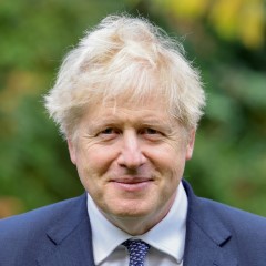 |
| Contact Details | Contact Boris Johnson |
| Political Party | Conservative |
What Council is the UB7 8BB Postcode in?
The Local Council for this Postcode is Hillingdon London Boro Council and the County Council is Greater London Authority Council.
Greater London Authority Council is responsible for providing education, libraries and maintaining highways.
Hillingdon London Boro Council is responsible for duties such as council tax, rubbish collection, housing, environmental health and planning.
You can visit the website for Hillingdon London Boro at the following link Hillingdon London Boro.How much is the Council Tax?
Hillingdon London Boro Council is responsible for collecting council tax. This will vary depending on which council tax band the property falls within. You can check the council tax band at the gov.uk website.
Once you know the council tax band you can view how much Hillingdon London Boro charge for that band by visiting the The Council Tax section of their website.
Where can I find out where the nearest Library to the UB7 8BB Postcode is?
Libraries are the responsibility of Hillingdon council
Visit the link for more information. Please note that some councils outsource library services to private companies and community groups ran by volunteers.
Libraries - Hillingdon CouncilHouse Sales in UB7 8BB
| Year | High | Low | Average | Sales |
|---|---|---|---|---|
| 2010 | £133,000 | £200,000 | £134,333 | 3 |
| 2012 | £141,500 | £205,000 | £163,167 | 3 |
| 2014 | £147,500 | £160,000 | £153,750 | 2 |
| 2015 | £186,000 | £275,000 | £247,667 | 3 |
| 2016 | £238,000 | £225,000 | £226,000 | 3 |
| 2018 | £331,500 | £331,500 | £331,500 | 1 |
| 2019 | £195,000 | £370,000 | £258,333 | 3 |
| 2020 | £235,000 | £297,408 | £266,204 | 2 |
| 2022 | £245,000 | £390,000 | £344,000 | 3 |
Contains HM Land Registry data © Crown copyright and database right 2024. This data is licensed under the Open Government Licence v3.0.
Postcodes near the UB7 8BB Postcode
What Popular Supermarkets are near the UB7 8BB Postcode?
| Supermarket | Distance | Directions |
|---|---|---|
| Aldi, High Street, Yiewsley, WEST DRAYTON, UB7 7QN | 0.71 miles | Directions from UB7 8BB to Aldi |
| Tesco, Chantry Close, Yiewsley, WEST DRAYTON, UB7 7FP | 0.76 miles | Directions from UB7 8BB to Tesco |
| Iceland, High Street, Yiewsley, WEST DRAYTON, UB7 7FB | 0.80 miles | Directions from UB7 8BB to Iceland |
| Morrisons, High Street, Yiewsley, WEST DRAYTON, UB7 7QQ | 0.92 miles | Directions from UB7 8BB to Morrisons |
| Iceland, Uxbridge Road, HAYES, UB4 8JH | 2.42 miles | Directions from UB7 8BB to Iceland |
What Popular Restaurants are near the UB7 8BB Postcode?
| Burger King | Distance | Directions |
|---|---|---|
| 25 Chequers Square, Uxbridge, UB8 1LN | 1.90 miles | Directions from UB7 8BB to 25 Chequers Square |
| Glencoe Road, Yeading, Yeading, UB4 9SN | 3.45 miles | Directions from UB7 8BB to Glencoe Road, Yeading |
| Heston Service Area, Hounslow, TW5 9NB | 3.79 miles | Directions from UB7 8BB to Heston Service Area |
| Heston Service Area, Hounslow, TW5 9NA | 3.79 miles | Directions from UB7 8BB to Heston Service Area |
| Mcdonald's | Distance | Directions |
|---|---|---|
| McDonald's, The Chimes Shopping Centre, High Street, UXBRIDGE, UB8 1GA | 1.81 miles | Directions from UB7 8BB to McDonald's, The Chimes Shopping Centre, High Street, UXBRIDGE, UB8 1GA |
| McDonald's, High Street, UXBRIDGE, UB8 1JT | 2.04 miles | Directions from UB7 8BB to McDonald's, High Street, UXBRIDGE, UB8 1JT |
| McDonald's, Station Road, HAYES, UB3 4DA | 2.31 miles | Directions from UB7 8BB to McDonald's, Station Road, HAYES, UB3 4DA |
| McDonald's, Oxford Road, Denham, UXBRIDGE, UB9 4DA | 2.37 miles | Directions from UB7 8BB to McDonald's, Oxford Road, Denham, UXBRIDGE, UB9 4DA |
| Restaurant | Distance | Directions |
|---|---|---|
| KFC, High Street, Yiewsley, WEST DRAYTON, UB7 7DS | 0.52 miles | Directions from UB7 8BB to KFC Yiewsley - High Street |
| KFC, Whiteleys Parade, Uxbridge Road, Hillingdon, UXBRIDGE, UB10 0PD | 1.15 miles | Directions from UB7 8BB to KFC Hillingdon - Whiteleys Parade |
| KFC, Uxbridge Road, HAYES, UB4 0RY | 2.42 miles | Directions from UB7 8BB to KFC Hayes End - Uxbridge Road |
| KFC, Oxford Road, Denham, UXBRIDGE, UB9 4DW | 2.83 miles | Directions from UB7 8BB to KFC Uxbridge - Oxford Road |
| KFC, Bath Road, Heathrow, HOUNSLOW, TW6 2AA | 3.45 miles | Directions from UB7 8BB to KFC Heathrow - Bath Road |