The WS11 postcode district is a postal district located in the WS Walsall postcode area with a population of 44,381 residents according to the 2021 England and Wales Census.
The area of the WS11 postcode district is 11.24 square miles which is 29.10 square kilometres or 7,190.63 acres.
Currently, the WS11 district has about 1002 postcode units spread across 8 geographic postcode sectors.
Given that each sector allows for 400 unique postcode combinations, the district has a capacity of 3,200 postcodes. With 1002 postcodes already in use, this leaves 2198 units available.
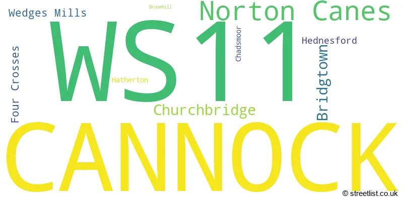
The largest settlement in the WS11 postal code is CANNOCK followed by Norton Canes, and Churchbridge.
The WS11 Postcode shares a border with WS12 (Hednesford, CANNOCK, Huntington), WS3 (WALSALL, Pelsall, Bloxwich), WS6 (WALSALL, Great Wyrley, Cheslyn Hay), WV10 (WOLVERHAMPTON, Featherstone, Shareshill) and WS8 (WALSALL, Brownhills, Clayhanger).
The primary settlement within the WS11 postcode district is Cannock, located in the county of Staffordshire in England. Other significant settlements within the district include Bridgtown, Four Crosses, Hatherton, Wedges Mills, Broomhill, Chadsmoor, Hednesford, Churchbridge, and Norton Canes. The most significant post town within the district is also Cannock.
For the district WS11, we have data on 8 postcode sectors. Here's a breakdown: The sector WS11 0, covers Cannock and Bridgtown in Staffordshire. The sector WS11 1, covers Cannock in Staffordshire. The sector WS11 4, covers Cannock in Staffordshire. The sector WS11 5, covers Cannock in Staffordshire. The sector WS11 6, covers Cannock in Staffordshire. The sector WS11 7, covers Cannock in Staffordshire. The sector WS11 8, covers Cannock and Churchbridge in Staffordshire. The sector WS11 9, covers Norton Canes in Staffordshire.

Map of the WS11 Postcode District
Explore the WS11 postcode district by using our free interactive map.

When it comes to local government, postal geography often disregards political borders. However, for a breakdown in the WS11 District: the district mostly encompasses the Cannock Chase District (963 postcodes), and finally, the South Staffordshire District area (53 postcodes).
Recent House Sales in WS11
| Date | Price | Address |
|---|---|---|
| 19/10/2023 | £100,000 | Almond Close, Cannock, WS11 7WE |
| 05/10/2023 | £180,000 | Newhall Street, Cannock, WS11 1AB |
| 02/10/2023 | £200,000 | Sanderling Street, Norton Canes, Cannock, WS11 9AJ |
| 02/10/2023 | £219,000 | Sandy Lane, Cannock, WS11 1RF |
| 15/09/2023 | £180,000 | Lilac Avenue, Cannock, WS11 0AP |
| 14/09/2023 | £160,000 | Hampton Street, Cannock, WS11 0AS |
| 04/09/2023 | £220,000 | Wilton Close, Cannock, WS11 0GP |
| 01/09/2023 | £194,000 | Oakhill Road, Cannock, WS11 6NB |
| 31/08/2023 | £103,200 | Dartmouth Road, Cannock, WS11 1HF |
| 29/08/2023 | £191,000 | Bath Road, Cannock, WS11 4QX |
Weather Forecast for WS11
Press Button to Show Forecast for Cannock
| Time Period | Icon | Description | Temperature | Rain Probability | Wind |
|---|---|---|---|---|---|
| 12:00 to 15:00 | Overcast | 8.0°C (feels like 5.0°C) | 22.00% | ENE 11 mph | |
| 15:00 to 18:00 | Overcast | 8.0°C (feels like 6.0°C) | 19.00% | ENE 9 mph | |
| 18:00 to 21:00 | Overcast | 8.0°C (feels like 5.0°C) | 15.00% | ENE 11 mph | |
| 21:00 to 00:00 | Cloudy | 6.0°C (feels like 3.0°C) | 8.00% | NE 11 mph |
Press Button to Show Forecast for Cannock
| Time Period | Icon | Description | Temperature | Rain Probability | Wind |
|---|---|---|---|---|---|
| 00:00 to 03:00 | Cloudy | 6.0°C (feels like 2.0°C) | 14.00% | NE 11 mph | |
| 03:00 to 06:00 | Light rain | 5.0°C (feels like 2.0°C) | 54.00% | NNE 11 mph | |
| 06:00 to 09:00 | Light rain | 5.0°C (feels like 2.0°C) | 56.00% | N 9 mph | |
| 09:00 to 12:00 | Light rain | 6.0°C (feels like 3.0°C) | 54.00% | NNW 11 mph | |
| 12:00 to 15:00 | Light rain | 8.0°C (feels like 6.0°C) | 47.00% | NW 9 mph | |
| 15:00 to 18:00 | Cloudy | 10.0°C (feels like 8.0°C) | 12.00% | WNW 9 mph | |
| 18:00 to 21:00 | Cloudy | 10.0°C (feels like 8.0°C) | 7.00% | W 7 mph | |
| 21:00 to 00:00 | Clear night | 7.0°C (feels like 6.0°C) | 1.00% | SW 7 mph |
Press Button to Show Forecast for Cannock
| Time Period | Icon | Description | Temperature | Rain Probability | Wind |
|---|---|---|---|---|---|
| 00:00 to 03:00 | Clear night | 6.0°C (feels like 4.0°C) | 1.00% | SW 7 mph | |
| 03:00 to 06:00 | Clear night | 5.0°C (feels like 2.0°C) | 1.00% | S 7 mph | |
| 06:00 to 09:00 | Sunny day | 6.0°C (feels like 3.0°C) | 1.00% | S 7 mph | |
| 09:00 to 12:00 | Partly cloudy (day) | 10.0°C (feels like 7.0°C) | 1.00% | S 11 mph | |
| 12:00 to 15:00 | Overcast | 13.0°C (feels like 10.0°C) | 9.00% | S 13 mph | |
| 15:00 to 18:00 | Cloudy | 13.0°C (feels like 11.0°C) | 8.00% | S 13 mph | |
| 18:00 to 21:00 | Cloudy | 13.0°C (feels like 10.0°C) | 7.00% | S 11 mph | |
| 21:00 to 00:00 | Clear night | 10.0°C (feels like 8.0°C) | 2.00% | SSE 9 mph |
Press Button to Show Forecast for Cannock
| Time Period | Icon | Description | Temperature | Rain Probability | Wind |
|---|---|---|---|---|---|
| 00:00 to 03:00 | Clear night | 9.0°C (feels like 6.0°C) | 3.00% | SE 9 mph | |
| 03:00 to 06:00 | Clear night | 8.0°C (feels like 5.0°C) | 2.00% | SE 9 mph | |
| 06:00 to 09:00 | Sunny day | 8.0°C (feels like 5.0°C) | 2.00% | ESE 9 mph | |
| 09:00 to 12:00 | Partly cloudy (day) | 12.0°C (feels like 9.0°C) | 6.00% | ESE 11 mph | |
| 12:00 to 15:00 | Partly cloudy (day) | 14.0°C (feels like 12.0°C) | 11.00% | SE 11 mph | |
| 15:00 to 18:00 | Cloudy | 15.0°C (feels like 13.0°C) | 32.00% | SE 11 mph | |
| 18:00 to 21:00 | Cloudy | 14.0°C (feels like 13.0°C) | 13.00% | SE 9 mph | |
| 21:00 to 00:00 | Partly cloudy (night) | 12.0°C (feels like 10.0°C) | 7.00% | ESE 7 mph |
Where is the WS11 Postcode District?
The data provided shows that the postcode district for WS11 is located in Cannock. Cannock is a district town in close proximity to several nearby towns. These nearby towns include Burntwood to the East, Walsall to the South East, Willenhall to the South, Rugeley to the North East, and Wolverhampton to the South West. Additionally, the data states that the distance between Cannock and London is approximately 114.43 miles.
The district is within the post town of CANNOCK.
The sector has postcodes within the nation of England.
The WS11 Postcode District is in the Staffordshire CC region of Shropshire and Staffordshire within the West Midlands (England).
| Postcode Sector | Delivery Office |
|---|---|
| WS11 1 | Cannock Delivery Office |
| WS11 2 | Cannock Delivery Office |
| WS11 3 | Cannock Delivery Office |
| WS11 4 | Cannock Delivery Office |
| WS11 5 | Cannock Delivery Office |
| WS11 6 | Cannock Delivery Office |
| WS11 7 | Cannock Delivery Office |
| WS11 8 | Cannock Delivery Office |
| WS11 9 | Cannock Delivery Office |
| W | S | 1 | 1 | - | X | X | X |
| W | S | 1 | 1 | Space | Numeric | Letter | Letter |
Tourist Attractions within the Postcode Area
We found 1 visitor attractions within the WS11 postcode area
| Cannock |
|---|
| Country Parks |
| Country Park |
| View Cannock on Google Maps |
Current Monthly Rental Prices
| # Bedrooms | Min Price | Max Price | Avg Price |
|---|---|---|---|
| 1 | £530 | £625 | £586 |
| 2 | £750 | £900 | £817 |
| 3 | £795 | £1,500 | £1,007 |
| 4 | £1,150 | £1,150 | £1,150 |
Current House Prices
| # Bedrooms | Min Price | Max Price | Avg Price |
|---|---|---|---|
| £170,000 | £170,000 | £170,000 | |
| 1 | £95,000 | £179,500 | £123,625 |
| 2 | £36,250 | £450,000 | £199,435 |
| 3 | £115,000 | £475,000 | £257,381 |
| 4 | £230,000 | £900,000 | £385,849 |
| 5 | £385,000 | £875,000 | £555,000 |
| 6 | £499,995 | £539,995 | £519,995 |
| 9 | £900,000 | £900,000 | £900,000 |
Estate Agents who Operate in the WS11 District
| Logo | Name | Brand Name | Address | Contact Number | Total Properties |
|---|---|---|---|---|---|
 | Cannock | Webbs Estate Agents | 153 Avon Road, Cannock, WS11 1LF | 01543 468846 | 51 |
 | Cannock | Butters John Bee | 23 Market Place, Cannock, WS11 1BS | 01543 228314 | 28 |
 | Cannock | Bairstow Eves | 13 Wolverhampton Road, Wolverhampton Road, Cannock, WS11 1AP | 01543 228329 | 24 |
 | Cannock | Connells | 10-12 Wolverhampton Road, Cannock, WS11 1AH | 01543 221896 | 24 |
 | covering Walsall | Purplebricks | Suite 7 First Floor Cranmore Drive Shirley Solihull B90 4RZ | 020 3910 6257 | 21 |
| Type of Property | 2018 Average | 2018 Sales | 2017 Average | 2017 Sales | 2016 Average | 2016 Sales | 2015 Average | 2015 Sales |
|---|---|---|---|---|---|---|---|---|
| Detached | £255,079 | 168 | £238,329 | 246 | £243,464 | 203 | £232,671 | 224 |
| Semi-Detached | £151,784 | 308 | £146,429 | 372 | £133,395 | 323 | £128,630 | 313 |
| Terraced | £140,171 | 92 | £130,806 | 146 | £128,026 | 136 | £119,107 | 108 |
| Flats | £88,919 | 62 | £87,690 | 58 | £91,719 | 58 | £87,043 | 57 |