YO14 0JE is a postal code used within the United Kingdom for delivering mail.
Postcodes are made up of two parts. The part before the space (YO14) is called the outward code. The part after the space (0JE) is called the inward code. The letters C, I, K, M, O and V are not allowed in the inward code. In addition to the inward and outward code, the postcode can be broken up into four parts:
- Postal Area. In our case YO which means York.
- Postal District. In our case YO14.
- Postal Sector. In our case YO16 4.
- Postcode Unit. The last two letters. In our case JE.
The regional mail center for the post area YO is the Yorkshire Distribution Centre, which is located at Silkstone House, Express Way, Wakefield Europort, NORMANTON, WF6 2XX.
The final port of call for any post addressed to the YO14 0JE postcode is the local delivery office (DO) which is . Here the post will be sorted ready for delivery.
The properties in the YO14 0JE postcode have the street address of North Burton Lane
A close-knit community! The 2021 Census indicates that only 16 individuals call the YO14 0JE postcode their home.
It is situated within the post town of FILEY within the old postal county of Yorkshire.
YO14 0JE is within the village of Reighton.
The YO14 0JE postcode area is composed of 100% residential properties, 0% commercial properties, and 0% public properties.
According to our data. Most dwellings in YO14 0JE are houses. Of these houses, most are detached.
Most properties in YO14 0JE are owned by the occupiers with the rest being unknown tenure.
Interactive Mapping Showing UPRNs within the YO14 0JE Postcode Boundaries
Use the search box to search for other postcodes or places.
| Property Type | Percentage |
|---|---|
| Residential | 100% |
| Commercial | 0% |
| Public | 0% |
Map Coordinates for YO14 0JE
| Latitude | 54.148795642 |
|---|---|
| Longitude | -0.275460373382 |
Schools within a five minute drive of YO14 0JE Postcode
Nearest Dentists
Dentists near YO14 0JE
HUNMANBY DENTAL PRACTICE
Address: TELFORD HOUSE, 17 BRIDLINGTON STREET, HUNMANBY, FILEY, NORTH YORKSHIRE, YO14 0JR
Distance: 2.86 miles
Contact: :
FILEY DENTAL CARE CENTRE
Address: STATION AVENUE, FILEY, NORTH YORKSHIRE, YO14 9AH
Distance: 4.33 miles
Contact: :
BRIDLINGTON & DISTRICT HOSPITAL
Address: BESSINGBY ROAD, BRIDLINGTON, YO16 4QP
Distance: 4.93 miles
Contact: :
BAXTER DENTAL CARE BRIDLINGTON
Address: 1 ST. JOHNS AVENUE, BRIDLINGTON, YO16 4ND
Distance: 5.16 miles
Contact: :
69 QUAY ROAD [DENTAL PRACTICE]
Address: 69 QUAY ROAD, BRIDLINGTON, NORTH HUMBERSIDE, YO16 4EL
Distance: 5.17 miles
Contact: :
BRIDLINGTON DENTAL STUDIO
Address: 8 WELLINGTON ROAD, BRIDLINGTON, NORTH HUMBERSIDE, YO15 2BG
Distance: 5.56 miles
Contact: :
Nearest Chemists
Pharmacies near YO14 0JE
FILEY BAY PHARMACY
Address: 15 SUNRISE DRIVE, MOOR ROAD, FILEY, NORTH YORKSHIRE, YO14 9GE
Distance: 2.14 miles
Contact: tel: 01723 518218
BOOTS
Address: 24A BRIDLINGTON STREET, HUNMANBY, FILEY, NORTH YORKSHIRE, YO14 0JR
Distance: 2.86 miles
Contact: tel: 01723 890422
BOOTS
Address: 32-34 MURRAY STREET, FILEY, NORTH YORKSHIRE, YO14 9DG
Distance: 4.20 miles
Contact: tel: 01723 513262
BOOTS
Address: 2 MURRAY STREET, FILEY, NORTH YORKSHIRE, YO14 9DG
Distance: 4.20 miles
Contact: tel: 01723 513224
BRIDLINGTON -PHARMACY+HEALTH
Address: 1 - 5 WESTGATE, OLD TOWN, BRIDLINGTON, YO16 4QF
Distance: 4.63 miles
Contact: tel: 01262 676847
MARTON ROAD PHARMACY
Address: 151 MARTON ROAD, BRIDLINGTON, NORTH HUMBERSIDE, YO16 7DJ
Distance: 4.87 miles
Contact: tel: 01262 608608
Nearest Opticians
Opticians near YO14 0JE
HUNMANBY OPTICIANS
Address: 24 BRIDLINGTON STREET, HUNMANBY, FILEY, NORTH YORKSHIRE, YO14 0JR
Distance: 2.86 miles
Contact: :
FILEY OPTICIANS (FILEY)
Address: 17B WEST AVENUE, FILEY, NORTH YORKSHIRE, YO14 9AA
Distance: 4.21 miles
Contact: :
OLD TOWN OPTOMETRISTS
Address: 69 HIGH STREET, BRIDLINGTON, NORTH HUMBERSIDE, YO16 4PR
Distance: 4.74 miles
Contact: :
LANGTON OPTOMETRISTS
Address: 27 PROSPECT STREET, BRIDLINGTON, NORTH HUMBERSIDE, YO15 2AE
Distance: 5.60 miles
Contact: :
SPECSAVERS (BRIDLINGTON)
Address: 29 KING STREET, BRIDLINGTON, NORTH HUMBERSIDE, YO15 2DN
Distance: 5.74 miles
Contact: :
LOCAL EYES OPTICIANS (NEWBOROUGH)
Address: 4 NEWBOROUGH, SCARBOROUGH, NORTH YORKSHIRE, YO11 1NA
Distance: 10.51 miles
Contact: :
Nearest GP Surgeries
Doctors near YO14 0JE
HUNMANBY SURGERY
Address: HUNGATE LANE, HUNMANBY, FILEY, NORTH YORKSHIRE, YO14 0NN
Distance: 2.81 miles
Contact: tel: 01723 890280
FILEY SURGERY
Address: STATION AVENUE, FILEY, NORTH YORKSHIRE, YO14 9AE
Distance: 4.28 miles
Contact: tel: 01723 515881
FILEY SURGERY - COVID LOCAL VACCINATION SERVICE 2
Address: STATION AVENUE, FILEY, YO14 9AE
Distance: 4.28 miles
Contact: :
THE WOLDS VIEW PRIMARY CARE CENTRE
Address: BRIDLINGTON & DISTRICT HOSPITAL, BESSINGBY ROAD, BRIDLINGTON, NORTH HUMBERSIDE, YO16 4QP
Distance: 4.93 miles
Contact: tel: 01262 423464
THE WOLDS VIEW PRIMARY CARE CENTRE
Address: BRIDLINGTON & DISTRICT HOSPITAL, BESSINGBY ROAD, BRIDLINGTON, YO16 4QP
Distance: 4.93 miles
Contact: :
DRS REDDY AND NUNN
Address: BRIDLINGTON MEDICAL CENTRE, STATION AVENUE, BRIDLINGTON, NORTH HUMBERSIDE, YO16 4LZ
Distance: 5.36 miles
Contact: tel: 01262 670686
Motorway Junctions near YO14 0JE
Train Stations
Motorway Junctions near YO14 0JE
Distances represent the quickest route by car.
Who are my Elected Representatives in the YO14 0JE Postcode?
| Westminster Constituency | Thirsk and Malton Co Const |
|---|---|
| Member or Parliament | 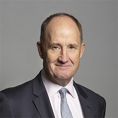 |
| Contact Details | Contact Kevin Hollinrake |
| Political Party | Conservative |
What Council is the YO14 0JE Postcode in?
The Local Council for this Postcode is Scarborough District Council and the County Council is North Yorkshire County Council.
North Yorkshire County Council is responsible for providing education, libraries and maintaining highways.
Scarborough District Council is responsible for duties such as council tax, rubbish collection, housing, environmental health and planning.
You can visit the website for Scarborough District at the following link Scarborough District.How much is the Council Tax?
Scarborough District Council is responsible for collecting council tax. This will vary depending on which council tax band the property falls within. You can check the council tax band at the gov.uk website.
Once you know the council tax band you can view how much Scarborough District charge for that band by visiting the The Council Tax section of their website.
Planning Applications
When moving house to a new post code it is worth checking out what will be built in the neighbourhood.
Few people want to live next door to a building site, have their garden overlooked or have the views from their property ruined.
Visit the local planning department and search for planning applications in this postcode granted within the last three years or still awaiting a decision. This will give an indication of what could still be built.
Where can I find out where the nearest Library to the YO14 0JE Postcode is?
Libraries are the responsibility of North Yorkshire County Council
Visit the link for more information. Please note that some councils outsource library services to private companies and community groups ran by volunteers.
Libraries | North Yorkshire County CouncilPostcodes near the YO14 0JE Postcode
What Popular Supermarkets are near the YO14 0JE Postcode?
| Supermarket | Distance | Directions |
|---|---|---|
| Tesco, Station Avenue, FILEY, YO14 9AH | 6.95 miles | Directions from YO14 0JE to Tesco |
| Aldi, St. Johns Street, BRIDLINGTON, YO16 7JS | 7.86 miles | Directions from YO14 0JE to Aldi |
| Morrisons, Bessingby Road, BRIDLINGTON, YO16 4SH | 8.40 miles | Directions from YO14 0JE to Morrisons |
| Tesco, Station Approach, BRIDLINGTON, YO15 3EP | 8.75 miles | Directions from YO14 0JE to Tesco |
| Lidl, Hilderthorpe Road, Bridlington, YO15 3HB | 8.81 miles | Directions from YO14 0JE to Lidl |
What Popular Restaurants are near the YO14 0JE Postcode?
| Burger King | Distance | Directions |
|---|---|---|
| Haven Holiday Park, Filey, YO14 9RF | 2.81 miles | Directions from YO14 0JE to Haven Holiday Park |
| Blue Dolphin Holiday Park, Filey, YO14 9PU | 6.09 miles | Directions from YO14 0JE to Blue Dolphin Holiday Park |
| Eastfields Road, Beverley, HU17 0FU | 22.32 miles | Directions from YO14 0JE to Eastfields Road |
| Stoneferry Road Retail Park, Hull, HU7 0BA | 26.40 miles | Directions from YO14 0JE to Stoneferry Road Retail Park |
| Mcdonald's | Distance | Directions |
|---|---|---|
| McDonald's, Bessingby Industrial Estate, Bessingby Way, BRIDLINGTON, YO16 4SJ | 5.44 miles | Directions from YO14 0JE to McDonald's, Bessingby Industrial Estate, Bessingby Way, BRIDLINGTON, YO16 4SJ |
| McDonald's, Dunslow Road, Eastfield, SCARBOROUGH, YO11 3UT | 8.33 miles | Directions from YO14 0JE to McDonald's, Dunslow Road, Eastfield, SCARBOROUGH, YO11 3UT |
| McDonald's, Huntriss Row, SCARBOROUGH, YO11 2ED | 10.45 miles | Directions from YO14 0JE to McDonald's, Huntriss Row, SCARBOROUGH, YO11 2ED |
| McDonald's, Wingfield Way, BEVERLEY, HU17 8XE | 23.42 miles | Directions from YO14 0JE to McDonald's, Wingfield Way, BEVERLEY, HU17 8XE |
| Restaurant | Distance | Directions |
|---|---|---|
| KFC, Huntriss Row, SCARBOROUGH, YO11 2EF | 10.44 miles | Directions from YO14 0JE to KFC Scarborough - Huntriss Way |
| KFC, Kingswood Leisure Park, Gibraltar Road, Kingswood, HULL, HU7 3DB | 24.79 miles | Directions from YO14 0JE to KFC Hull - Kingswood Retail Park |
| KFC, Beverley Road, HULL, HU3 1TY | 27.26 miles | Directions from YO14 0JE to KFC Hull - Beverley Road |
| KFC, Jameson Street, HULL, HU1 3JJ | 28.04 miles | Directions from YO14 0JE to KFC Hull - Jameson Street |
| KFC, Beacon Way, HULL, HU3 4AE | 29.18 miles | Directions from YO14 0JE to KFC Hull - The Beacon |