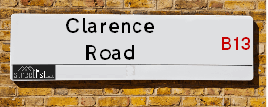
Map of Clarence Road
| Postcodes | ||
|---|---|---|
| Icon | Postcodes for Clarence Road | |
| Walking Distances | ||
| Distance Info | Green Circle = 10 Minutes Walk (800 metres) | |
About Clarence Road
Clarence Road is a street located in the city of Birmingham. The street has a length of approximately 498 metres.
Clarence Road is located within the Birmingham District (B) Council's jurisdiction. They provide various services, like refuse collection, and manage council tax collection. It's situated in the West Midlands region of the UK.
Clarence Road has been assigned the Unique Street Reference Number of 2703132 in the National Street Gazetteer.
Clarence Road is located within the county of West Midlands, situated in the West Midlands region of the UK. It's 99.68 miles North West from central London., 3 miles South from Birmingham, 15.92 miles West from Coventry and 22.14 miles North East from Worcester.

Do you know why this road is called Clarence Road?
What's it like to live here?
Ask the community a question about Clarence Road.
Do you have any questions, memories to share or know any facts about Clarence Road? We'd love to know more.
Also on streetlist.co.uk, can you help?
Swing Swang Lane
28th April 2024
I am trying to find out why the lane is named Swing Swang?
It has been known known this since at least 1905 when hedge making contents used to be held here.
Swing Swang is often used to describe a fairground ride. I remember Swing Boats. Were they a bit like this or is Swing Swang another name for swings?
Swing Swangs are also mentioned in connection to orchards. Or were orchards just good places to have swings?
Estate Agents near Clarence Road
| Name | Address | Website |
|---|---|---|
| Heritage Estate Agency | 91 High Street Kings Heath Birmingham B14 7BH | Visit Website |
| Glovers Estate Agents | 33 High Street, Kings Heath, Birmingham, B14 7BB | Visit Website |
| Robert Oulsnam & Company | 20 High Street, Kings Heath, Birmingham, B14 7JT |
Location Details
| Clarence Road | |
|---|---|

| |
| Latitude | 52.437347 |
| Longitude | -1.882685 |
| OS Easting (X): | 407974 |
| OS Northing (Y): | 282200 |
| OS Grid Reference: | SP080822 |
Neighbourhood Policing |
| Police Force: West Midlands |
 View Neighbourhood Crime and Policing View Neighbourhood Crime and Policing |
| Find a Local Neighbourhood Watch Scheme |
Frequently asked Questions for Clarence Road
What Council (Local Authority) is Clarence Road in?
Clarence Road is located within the local authority area of Birmingham Council which is a Metropolitan District.
What Parish Council is Clarence Road in?
Clarence Road is in an unparished area.
What Electoral Ward is Clarence Road in?
Clarence Road is located within the ward of Moseley.
What County is Clarence Road in?
Clarence Road is located within the ceremonial county of West Midlands.
What Constituency is Clarence Road in?
Clarence Road is located within the constituency of Birmingham &Hall Green.
What Part of the UK is Clarence Road in?
Clarence Road is located within the West Midlands (England) region of the United Kingdom.
What County Council area is Clarence Road in?
Clarence Road is located within the West Midlands Council area.
What Police Force area is Clarence Road in?
Clarence Road is located within the West Midlands Police area.
Roads that have a Junction with Clarence Road
| Street | Junction Type |
|---|---|
| Greenhill Road | junction |
| Prospect Road | junction |
| Blenheim Road | junction |
| Cambridge Road | junction |
| Woodfield Road | junction |
| Billesley Lane | junction |
Sunset and Sunrise times for Clarence Road
| Sunrise | 05:13 |
|---|---|
| Sunset | 20:54 |
Latest Weather Conditions for Clarence Road
| Observed at Weather Station: | Coleshill 12 May 2024 at 14:00 (8.67 miles away) |
|---|---|
| Current Weather: | Partly cloudy (day) |
| Temperature and Humidity: | 24.3°C (51.4%) |
| Wind Direction and Speed: | SE (8 mph) |
Population Statistics
| ONS Area Code | E00046582, E00046590 & E00046597 |
|---|---|
| ONS Area Name | Inner City Ethnic Mix & Delayed Retirement |
| Average Age | 40.79 & 38.64 |
| Area Population | 1572.00 & 1496.00 |
| Male Population | 786.00 & 720.00 (49%) |
| Female Population | 786.00 & 776.00 (51%) |
| Benefit Claimants | 33 & 23 (2%) |
| LSOA Code: | E01009187 &E01009189 |
|---|---|
| LSOA Name: | Birmingham 092C &Birmingham 104E |
| SOA Code: | 3c &3b |
| SOA Name: | |
| MSOA Code: | E02001918 &E02001930 |
| MSOA Name: | Birmingham 092 &Birmingham 104 |
Nearest Supermarkets
| Iceland Kings Heath |
|---|
| Unit 10 Institutes Road, Kings Heath, Birmingham, B14 7EG |
| 01214441862 |
| Distance: 0.41 Miles |
| Directions from Clarence Road to Iceland Kings Heath |
| Asda Kings Heath |
|---|
| 99 High Street, Kings Heath, Birmingham, B14 7BW |
| 0121 483 4410 |
| Distance: 0.41 Miles |
| Directions from Clarence Road to Asda Kings Heath |
| Sainsburys Kings Heath |
|---|
| 38-54 Alcester Road South, Birmingham, England, B14 7PT |
| 0121 444 3251 |
| Distance: 0.62 Miles |
| Directions from Clarence Road to Sainsburys Kings Heath |
| Sainsburys Alcester Road Local |
|---|
| 158-162 Alcester Road, Birmingham, England, B13 8HS |
| 1214496499 |
| Distance: 0.73 Miles |
| Directions from Clarence Road to Sainsburys Alcester Road Local |
Telephone Information
| Area Code |
|---|
| Area Code: 0121 - Birmingham |
| Area Code: 01564 - Lapworth |
| Area Code: 01675 - Coleshill |
| Area Code: 01527 - Redditch |
Broadband Information
| Speed | Average Speed | Median Speed | Maximum Speed | Next-generation access (NGA) | Number of Connections |
|---|---|---|---|---|---|
| Greater than 2 Mbps | 21.5 | 20 | >=30 | Y | 30 |
Local Government
| Local Council Details |
|---|
| Within the area of Birmingham |
| Visit the Council's Website |
| Council House, Victoria Square, Birmingham &B1 1BB |
| Send email |
| Telephone Number: 0121 303 1111 |
| Local Member of Parliament |
|---|
| Within the Westminster Parliamentary Constituency of Birmingham &Hall Green |
| The Member of Parliament is Tahir Ali |
| Details for the MP Tahir Ali on parliament.uk |
| Details for the MP Tahir Ali on theyworkforyou.com |
| In the 2019 General Election Tahir Ali won with a majority of 28,508 the result was Lab hold. The total electorate was 80,283 |
| Wards, Parish Councils and County Councils |
|---|
| Ward: Moseley Ward |
| Ceremonial County: West Midlands |
Nearest Schools
England Primary Schools
English Martyrs' Catholic Primary School
Address: English Martyrs' Catholic Primary School, Evelyn Road, Sparkhill, English Martyrs Rc Junior & Infant School, Birmingham, West Midlands, B11 3JW
Distance: 1.24 miles
Contact: 01214643150
St Bernard's Catholic Primary School
Address: St Bernard's Catholic Primary School, Wake Green Road, Moseley, Birmingham, West Midlands, B13 9QE
Distance: 0.84 miles
Contact: 01214643795
Anderton Park Primary School
Address: Anderton Park Primary School, Dennis Road, Sparkhill, Birmingham, West Midlands, B12 8BL
Distance: 0.99 miles
Contact: 01214641581
St John and Monica Catholic Primary School
Address: St John and Monica Catholic Primary School, Chantry Road, Moseley, Birmingham, West Midlands, B13 8DW
Distance: 1.03 miles
Contact: 01214645868
St Martin de Porres Catholic Primary School
Address: St Martin de Porres Catholic Primary School, Oakland Road, Moseley, Birmingham, West Midlands, B13 9DN
Distance: 0.72 miles
Contact: 01214645500
Moseley Church of England Primary School
Address: Moseley Church of England Primary School, Oxford Road, Moseley, Birmingham, West Midlands, B13 9EH
Distance: 0.46 miles
Contact: 01214490441
Nelson Mandela School
Address: Nelson Mandela School, Colville Road, Sparkbrook, Nelson Mandela Community School, Birmingham, West Midlands, B12 8EH
Distance: 1.39 miles
Contact: 01217723055
King David Primary School
Address: King David Primary School, Alcester Road, Moseley, Birmingham, West Midlands, B13 8EY
Distance: 0.60 miles
Contact: 01214493364
St Dunstan's Catholic Primary School
Address: St Dunstan's Catholic Primary School, Drayton Road, Kings Heath, Birmingham, West Midlands, B14 7LP
Distance: 0.50 miles
Contact: 01214644648
Park Hill Primary School
Address: Park Hill Primary School, Alcester Road, Birmingham, West Midlands, B13 8BB
Distance: 1.00 miles
Contact: 01214493004
Colmore Infant and Nursery School
Address: Colmore Infant and Nursery School, Colmore Road, Kings Heath, Birmingham, West Midlands, B14 6AJ
Distance: 1.02 miles
Contact: 01214642820
Colmore Junior School
Address: Colmore Junior School, Colmore Road, Kings Heath, Birmingham, West Midlands, B14 6AJ
Distance: 1.02 miles
Contact: 01214642843
St John's CofE Primary School
Address: St John's CofE Primary School, Stratford Road, Sparkhill, Birmingham, West Midlands, B11 4EA
Distance: 1.14 miles
Contact: 01216751469
Springfield Primary Academy
Address: Springfield Primary Academy, Springfield Road, Moseley, Birmingham, West Midlands, B13 9NY
Distance: 1.08 miles
Contact: 01214643618
Springfield Primary School
Address: Springfield Primary School, Springfield Road, Moseley, Birmingham, West Midlands, B13 9NY
Distance: 1.08 miles
Contact:
Billesley Primary School
Address: Billesley Primary School, Trittiford Road, Billesley, Birmingham, West Midlands, B13 0ES
Distance: 1.00 miles
Contact: 01216752800
Kings Heath Primary School
Address: Kings Heath Primary School, Valentine Road, Kings Heath, Birmingham, West Midlands, B14 7AJ
Distance: 0.30 miles
Contact: 01214649202
Wheelers Lane Primary School
Address: Wheelers Lane Primary School, Wheelers Lane, Kings Heath, Birmingham, West Midlands, B13 0SF
Distance: 0.68 miles
Contact: 01214642551
England Secondary Schools
Moseley School and Sixth Form
Address: Moseley School and Sixth Form, Wake Green Road, Moseley, Birmingham, West Midlands, B13 9UU
Distance: 0.80 miles
Contact: 01215666444
Swanshurst School
Address: Swanshurst School, Brook Lane, Billesley, Birmingham, West Midlands, B13 0TW
Distance: 0.64 miles
Contact: 01214642400
Queensbridge School
Address: Queensbridge School, Queensbridge Road, Moseley, Birmingham, West Midlands, B13 8QB
Distance: 0.61 miles
Contact: 01214645566
Kings Heath Boys
Address: Kings Heath Boys, Chamberlain Road, Kings Heath, Birmingham, West Midlands, B13 0QP
Distance: 0.94 miles
Contact: 01214644454
Bishop Challoner Catholic College
Address: Bishop Challoner Catholic College, Institute Road, Kings Heath, Birmingham, West Midlands, B14 7EG
Distance: 0.41 miles
Contact: 01214444161
Wheelers Lane Technology College
Address: Wheelers Lane Technology College, Wheelers Lane, Kings Heath, Birmingham, West Midlands, B13 0SF
Distance: 0.68 miles
Contact: 01214442864
King Edward VI Camp Hill School for Boys
Address: King Edward VI Camp Hill School for Boys, Vicarage Road, Kings Heath, Birmingham, West Midlands, B14 7QJ
Distance: 0.93 miles
Contact:
King Edward VI Camp Hill School for Girls
Address: King Edward VI Camp Hill School for Girls, Vicarage Road, Kings Heath, Birmingham, West Midlands, B14 7QJ
Distance: 0.93 miles
Contact:
Hall Green School
Address: Hall Green School, Southam Road, Hall Green, Birmingham, West Midlands, B28 0AA
Distance: 1.38 miles
Contact: 01216288787
King Edward VI Camp Hill School for Boys
Address: King Edward VI Camp Hill School for Boys, Vicarage Road, Kings Heath, Birmingham, West Midlands, B14 7QJ
Distance: 0.93 miles
Contact: 01214443188
King Edward VI Camp Hill School for Girls
Address: King Edward VI Camp Hill School for Girls, Vicarage Road, Kings Heath, Birmingham, West Midlands, B14 7QJ
Distance: 0.93 miles
Contact: 01214442150
Nearest Hospitals
| Name | Address | Postcode | Distance | Map |
|---|
Nearest Dentists
Dentists near Clarence Road
| Name | Address | Postcode | Distance | Map |
|---|
Nearest GP Surgeries
Doctors near Clarence Road
DR ABDEL-MALEK
Address: 119 SCHOOL ROAD, MOSELEY, BIRMINGHAM, WEST MIDLANDS, B13 9TX
Distance: 0.22 miles
Contact: tel: 01217530615
POPLAR PRIMARY CARE CENTRE
Address: 58-64 POPLAR ROAD, KINGS HEATH, BIRMINGHAM, WEST MIDLANDS, B14 7AG
Distance: 0.33 miles
Contact: tel: 0121 4658314
WAKE GREEN SURGERY
Address: 7 WAKE GREEN ROAD, MOSELEY, BIRMINGHAM, WEST MIDLANDS, B13 9HD
Distance: 0.61 miles
Contact: tel: 0121 4490300
ALL SAINTS MEDICAL CENTRE - COVID LOCAL VACCINATION SERVICE
Address: 2A VICARAGE ROAD, KINGS HEATH, BIRMINGHAM, B14 7RA
Distance: 0.64 miles
Contact: :
ALL SAINTS MEDICAL CENTRE - COVID LOCAL VACCINATION SERVICE 2
Address: 2A VICARAGE ROAD, KINGS HEATH, BIRMINGHAM, B14 7RA
Distance: 0.64 miles
Contact: :
ALL SAINTS MEDICAL CENTRE SURGERY
Address: 2A VICARAGE ROAD, KINGS HEATH, BIRMINGHAM, WEST MIDLANDS, B14 7QA
Distance: 0.66 miles
Contact: :
Nearest Dispensing Chemists
Pharmacies near Clarence Road
| Name | Address | Postcode | Telephone | Map | Distance in Km |
|---|
Nearest Opticians
Opticians near Clarence Road
SEESAW (POPLAR ROAD)
Address: 56B POPLAR ROAD, KINGS HEATH, BIRMINGHAM, WEST MIDLANDS, B14 7AG
Distance: 0.33 miles
Contact: :
PORTLAND EYECARE LTD (KINGS HEATH)
Address: 1 INSTITUTE ROAD, KINGS HEATH, BIRMINGHAM, WEST MIDLANDS, B14 7EG
Distance: 0.41 miles
Contact: :
BOOTS OPTICIANS (HIGH STREET - KINGS HEATH)
Address: 115 HIGH STREET, KINGS HEATH, BIRMINGHAM, WEST MIDLANDS, B14 7BW
Distance: 0.43 miles
Contact: :
SCRIVENS OPTICIANS (KINGS HEATH)
Address: 124 HIGH STREET, KINGS HEATH, BIRMINGHAM, WEST MIDLANDS, B14 7LG
Distance: 0.50 miles
Contact: :
SPECSAVERS (KINGS HEATH, BIRMINGHAM)
Address: 132 HIGH STREET, KINGS HEATH, BIRMINGHAM, WEST MIDLANDS, B14 7LG
Distance: 0.50 miles
Contact: :
BOOTS OPTICIANS (ALCESTER ROAD SOUTH - KINGS HEATH)
Address: 51A ALCESTER ROAD SOUTH, KINGS HEATH, BIRMINGHAM, WEST MIDLANDS, B14 7JQ
Distance: 0.57 miles
Contact: :
Transport
Nearest Rail Stations
Hall Green Station is 1.57 miles away.
Address: Hall Green station, off Stratford Road, Hall Green, West Midlands, B28 8AA
Hall Green is situated on the North Warwickshire (Shakespeare Line) Line.
Hall Green Station is staffed on a part time basis.
Yardley Wood Station is 1.62 miles away.
Address: Yardley Wood station, Highfield Road, Yardley Wood, West Midlands, B28 0BY
Yardley Wood is situated on the North Warwickshire (Shakespeare Line) Line.
Yardley Wood Station is staffed on a part time basis.