Map of Dumble Pit Lane
| Postcodes | ||
|---|---|---|
| Icon | Postcodes for Dumble Pit Lane | |
| Walking Distances | ||
| Distance Info | Green Circle = 10 Minutes Walk (800 metres) | |
About Dumble Pit Lane
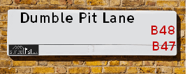
Dumble Pit Lane is a street located near the village of Inkford. It uses the postcode B48 7JG. The street has a length of approximately 474 metres.
Dumble Pit Lane is located within the Bromsgrove District Council's jurisdiction. They provide various services, like refuse collection, and manage council tax collection. It's situated in the West Midlands region of the UK.
Dumble Pit Lane has been assigned the Unique Street Reference Number of 4700333 in the National Street Gazetteer.
Dumble Pit Lane is located within the county of Worcestershire, situated in the West Midlands region of the UK. It's 96.54 miles North West from central London., 8.35 miles South from Birmingham, 16.47 miles West from Coventry and 18.08 miles North East from Worcester.

Do you know why this road is called Dumble Pit Lane?
What's it like to live here?
Ask the community a question about Dumble Pit Lane.
Do you have any questions, memories to share or know any facts about Dumble Pit Lane? We'd love to know more.
Also on streetlist.co.uk, can you help?
Swing Swang Lane
28th April 2024
I am trying to find out why the lane is named Swing Swang?
It has been known known this since at least 1905 when hedge making contents used to be held here.
Swing Swang is often used to describe a fairground ride. I remember Swing Boats. Were they a bit like this or is Swing Swang another name for swings?
Swing Swangs are also mentioned in connection to orchards. Or were orchards just good places to have swings?
Estate Agents near Dumble Pit Lane
| Name | Address | Website |
|---|---|---|
| Melvyn Danes | 321 Alcester Road, Wythall, Birmingham, B47 5HJ | Visit Website |
| Kelly Homes | 7 Drakes Cross Parade, Alcester Road, Wythall, B47 5HD | Visit Website |
| Kelly Homes | 7 Drakes Cross Parade, Alcester Road, Wythall, Birmingham, B47 5HD | Visit Website |
We have found 1 postcode for Dumble Pit Lane
Location Details
| Dumble Pit Lane | |
|---|---|

| |
| Latitude | 52.358603 |
| Longitude | -1.890214 |
| OS Easting (X): | 407475 |
| OS Northing (Y): | 273441 |
| OS Grid Reference: | SP075734 |
Neighbourhood Policing |
| Police Force: West Mercia |
 View Neighbourhood Crime and Policing View Neighbourhood Crime and Policing |
| Find a Local Neighbourhood Watch Scheme |
Frequently asked Questions for Dumble Pit Lane
What Council (Local Authority) is Dumble Pit Lane in?
Dumble Pit Lane is located within the local authority area of Bromsgrove Council which is a District Council.
What Parish Council is Dumble Pit Lane in?
Dumble Pit Lane is located within the area of Beoley Parish Council.
What Electoral Ward is Dumble Pit Lane in?
Dumble Pit Lane is located within the ward of Alvechurch South.
What County is Dumble Pit Lane in?
Dumble Pit Lane is located within the ceremonial county of Worcestershire.
What Constituency is Dumble Pit Lane in?
Dumble Pit Lane is located within the constituency of Bromsgrove.
What Part of the UK is Dumble Pit Lane in?
Dumble Pit Lane is located within the West Midlands (England) region of the United Kingdom.
What County Council area is Dumble Pit Lane in?
Dumble Pit Lane is located within the Worcestershire Council area.
What Police Force area is Dumble Pit Lane in?
Dumble Pit Lane is located within the West Mercia Police area.
Roads that have a Junction with Dumble Pit Lane
| Street | Junction Type |
|---|---|
| Watery Lane | junction |
| The Lawns | junction |
| Alcester Road (A435) | junction |
| Alcester Road (A435) | junction |
Sunset and Sunrise times for Dumble Pit Lane , B48 7JG
| Sunrise | 05:12 |
|---|---|
| Sunset | 20:55 |
Latest Weather Conditions for Dumble Pit Lane, B48 7JG
| Observed at Weather Station: | Coleshill 13 May 2024 at 19:00 (11.93 miles away) |
|---|---|
| Current Weather: | Light rain |
| Temperature and Humidity: | 14.0°C (91.2%) |
| Wind Direction and Speed: | SE (8 mph) |
Population Statistics
| ONS Area Code | E00172214 |
|---|---|
| ONS Area Name | Rural White-Collar Workers |
| Average Age | 49.57 |
| Area Population | 1524.00 |
| Male Population | 742.00 (49%) |
| Female Population | 782.00 (51%) |
| Benefit Claimants | 3 (0%) |
| LSOA Code: | E01032123 |
|---|---|
| LSOA Name: | Bromsgrove 009B |
| SOA Code: | 2b |
| SOA Name: | |
| MSOA Code: | E02006704 |
| MSOA Name: | Bromsgrove 009 |
Nearest Supermarkets
| Waitrose At Hopwood Park Services |
|---|
| M42 Motorway, Junction 2, Redditch Road, Alvechurch, Birmingham, B48 7AU |
| 0121 4474000 |
| Distance: 2.45 Miles |
| Directions from Dumble Pit Lane to Waitrose At Hopwood Park Services |
| Tesco Birmingham Alcester Express |
|---|
| 71 Alcester Rd, Hollywood, Birmingham, B47 5PN |
| 0345 671 9620 |
| Distance: 2.68 Miles |
| Directions from Dumble Pit Lane to Tesco Birmingham Alcester Express |
| Tesco Shirley Dickens Heath Express |
|---|
| 26 Main St, Dickens Heath, Shirley, Solihull, B90 1UA |
| 0345 675 7015 |
| Distance: 2.89 Miles |
| Directions from Dumble Pit Lane to Tesco Shirley Dickens Heath Express |
| Sainsburys Maypole |
|---|
| 1059-1061 Alcester Road South, Birmingham, England, B14 5TN |
| 0121 474 3102 |
| Distance: 3.16 Miles |
| Directions from Dumble Pit Lane to Sainsburys Maypole |
Telephone Information
| Area Code |
|---|
| Area Code: 01527 - Redditch |
| Area Code: 01564 - Lapworth |
| Area Code: 0121 - Birmingham |
Local Government
| Local Council Details |
|---|
| Within the area of Bromsgrove |
| Visit the Council's Website |
| The Council House, Burcot Lane, Bromsgrove, Worcestershire &B60 1AA |
| Send email |
| Telephone Number: 01527 873 232 |
| Local Member of Parliament |
|---|
| Within the Westminster Parliamentary Constituency of Bromsgrove |
| The Member of Parliament is Sajid Javid |
| Details for the MP Sajid Javid on parliament.uk |
| Details for the MP Sajid Javid on theyworkforyou.com |
| In the 2019 General Election Sajid Javid won with a majority of 23,106 the result was Con hold. The total electorate was 75,078 |
| Wards, Parish Councils and County Councils |
|---|
| Ward: Alvechurch South Ward |
| Ceremonial County: Worcestershire |
Nearest Schools
England Primary Schools
Beoley First School
Address: Beoley First School, Beoley Lane, Beoley, Redditch, Worcestershire, B98 9AN
Distance: 2.41 miles
Contact: 0152762295
Meadow Green Primary School
Address: Meadow Green Primary School, Meadow Road, Wythall, Birmingham, West Midlands, B47 6EQ
Distance: 1.23 miles
Contact: 01564823495
St Jude's Catholic Primary School
Address: St Jude's Catholic Primary School, St Jude's Close, Maypole, Birmingham, West Midlands, B14 5PD
Distance: 3.28 miles
Contact: 01214645069
England Secondary Schools
Woodrush High School
Address: Woodrush High School, Shawhurst Lane, Wythall, Worcestershire, B47 5JW
Distance: 2.11 miles
Contact: 01564823777
Nearest Hospitals
| Name | Address | Postcode | Distance | Map |
|---|
Nearest Dentists
Dentists near Dumble Pit Lane
| Name | Address | Postcode | Distance | Map |
|---|
Nearest GP Surgeries
Doctors near Dumble Pit Lane
HOLLYOAKS MEDICAL CENTRE
Address: 229 STATION ROAD, WYTHALL, BIRMINGHAM, WEST MIDLANDS, B47 6ET
Distance: 1.61 miles
Contact: tel: 01564 823182
HOLLYWOOD MEDICAL CENTRE
Address: BEAUDESERT ROAD, HOLLYWOOD, BIRMINGHAM, WEST MIDLANDS, B47 5DP
Distance: 2.17 miles
Contact: tel: 01564 822642
TANWORTH-IN-ARDEN MED CTR
Address: THE BIRCHES, BROAD LANE, TANWORTH-IN-ARDEN, SOLIHULL, WEST MIDLANDS, B94 5DP
Distance: 2.33 miles
Contact: tel: 01564 742274
DR SMART CJ
Address: ALVECHURCH MEDICAL CENTRE, 5 THE SQUARE, ALVECHURCH, BIRMINGHAM, WEST MIDLANDS, B48 7LA
Distance: 2.96 miles
Contact: tel: 01214581342
MAPLE VIEW MEDICAL PRACTICE
Address: UNIT 5, TANHOUSE LANE, REDDITCH, B98 9AA
Distance: 3.00 miles
Contact: :
DICKENS HEATH MEDICAL CENTRE
Address: 94 OLD DICKENS HEATH ROAD, SHIRLEY, SOLIHULL, B90 1SD
Distance: 3.04 miles
Contact: :
Nearest Dispensing Chemists
Pharmacies near Dumble Pit Lane
| Name | Address | Postcode | Telephone | Map | Distance in Km |
|---|
Nearest Opticians
Opticians near Dumble Pit Lane
THE EYE COLLECTIVE (WYTHALL) LTD
Address: 2 DRAKES CROSS PARADE, HOLLYWOOD, BIRMINGHAM, B47 5HD
Distance: 1.86 miles
Contact: :
MANSURA BHOGADIA
Address: 6 ALDER CLOSE, HOLLYWOOD, BIRMINGHAM, WEST MIDLANDS, B47 5RA
Distance: 2.21 miles
Contact: :
FORENSIC EYECARE LIMITED
Address: 176 EARLSWOOD COMMON, EARLSWOOD, SOLIHULL, WARWICKSHIRE, B94 5SQ
Distance: 2.36 miles
Contact: :
MATTOO DAVINDER (BEOLEY)
Address: CHURCH HILL FARM, BEOLEY, REDDITCH, WORCESTERSHIRE, B98 9AR
Distance: 2.47 miles
Contact: :
DICKENS EYE CLINIC
Address: 39 MAIN STREET, DICKENS HEATH, SHIRLEY, SOLIHULL, B90 1UB
Distance: 2.91 miles
Contact: :
J & D MASON OPTICIANS (ALVECHURCH)
Address: 23 THE SQUARE, ALVECHURCH, BIRMINGHAM, WEST MIDLANDS, B48 7LA
Distance: 2.96 miles
Contact: tel: 0121 447 8682, fax: 01214478682
Transport
Nearest Rail Stations
Earlswood (West Midlands) Station is 1.34 miles away.
Address: Earlswood (West Midlands) station, Station Drive, Earlswood, Warwickshire, B94 5JS
Earlswood (West Midlands) is situated on the North Warwickshire (Shakespeare Line) Line.
Earlswood (West Midlands) Station is an unstaffed station.
Directions from Dumble Pit Lane to Earlswood (West Midlands) Rail Station
Wythall Station is 1.80 miles away.
Address: Wythall station, Station Road / Norton Lane, Wythall, West Midlands, B47 6BY
Wythall is situated on the North Warwickshire (Shakespeare Line) Line.
Wythall Station is staffed on a part time basis.