Map of Long Furlong
| Postcodes | ||
|---|---|---|
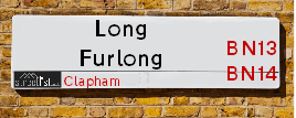
| Icon | Postcodes for Long Furlong | |
| Walking Distances | ||
| Distance Info | Green Circle = 10 Minutes Walk (800 metres) | |
About Long Furlong
Long Furlong is a street located in the village of Clapham and near the village of Findon and near the town of Worthing. The street has a length of approximately 5,533 metres.
Long Furlong is located within the Arun District Council's jurisdiction. They provide various services, like refuse collection, and manage council tax collection. It's situated in the South East region of the UK.
Long Furlong has been assigned the Unique Street Reference Numbers of 1100123, 1100124 and 1103084 in the National Street Gazetteer.
Long Furlong is located within the county of West Sussex, situated in the South East region of the UK. It's 46.56 miles South from central London., 13.06 miles West from Brighton, 15.06 miles East from Chichester and 19.79 miles West from Lewes.

Do you know why this road is called Long Furlong?
What's it like to live here?
Ask the community a question about Long Furlong.
Do you have any questions, memories to share or know any facts about Long Furlong? We'd love to know more.
Also on streetlist.co.uk, can you help?
Swing Swang Lane
28th April 2024
I am trying to find out why the lane is named Swing Swang?
It has been known known this since at least 1905 when hedge making contents used to be held here.
Swing Swang is often used to describe a fairground ride. I remember Swing Boats. Were they a bit like this or is Swing Swang another name for swings?
Swing Swangs are also mentioned in connection to orchards. Or were orchards just good places to have swings?
Eldroth Road
15th April 2024
I wondered if anyone has any old pictures of Wenning Bank House in the 1940’s and also Lane Side before of the same era .. we visited today with my Mum in law as she used to live at both these properties. Also any photos of the schools around that time .. thank you.
Can You Help?Napps Way
15th April 2024
Why is the road called Napps Way (belonging to Napp, but minus an
apostrophe as is usual with such nomenclature)? Moreover, who or
what is, or was, “Napp” in the respective, possessive case?
Several years ago, I met an elderly man (probably in his late-eighties)
who lives on Bentham Drive, Liverpool 16, and during a conversation
with him whilst in a Northwest Passenger Transport Ambulance on the
way to the former RLUH (Royal Liverpool University Hospital), he told
me that he could remember (when he was a boy, living in Childwall,
Liverpool 16) that, “Where Napps Way is now, during WW2, there was
a two-man gun emplacement on the, then, open land to protect the
railway line passing over Childwall Valley Road - next to the railway
bridge - when suddenly, as they were loading a live “shell” into the gun’s
breach, the aforementioned “shell” accidentally exploded in the gun’s
breach killing both of the two soldiers, that had been manning the gun,
instantly! (Very sad, of course, but could - perhaps - two ghosts relating
to those two, very unfortunately and prematurely-killed soldiers have
haunted that place of their deaths ever since - and have any residents
of Napps Way - formerly and in its latest incarnation - seen two, WW2
(uniformed) soldiers unexpectedly appear in or near their homes?)
Estate Agents near Long Furlong
| Name | Address | Website |
|---|---|---|
| Jacobs Steel | 228 Findon Road, Worthing, BN14 0EJ | Visit Website |
| Michael Jones & Company | 156 Findon Road, Worthing, West Sussex, BN14 0EL | Visit Website |
| BoKlok | BoKlok on the Lake, Fulbeck Avenue, West Durrington BN13 3SS | Visit Website |
Location Details
| Long Furlong | |
|---|---|

| |
| Latitude | 50.858530 |
| Longitude | -0.435272 |
| OS Easting (X): | 510116 |
| OS Northing (Y): | 107785 |
| OS Grid Reference: | TQ101078 |
Ordnance Survey Maps for Long Furlong
If you purchase a map through the links below, we may earn an affiliate commission.
| Map Series | link | Ordnance Survey |
| Explorer 1:25,000 ol10 Arundel & Pulborough | Check Price on Amazon | Buy Direct from the Ordnance Survey |
| Landranger 1:50,000 198 Brighton & Lewes | Check Price on Amazon |
Neighbourhood Policing |
| Police Force: Sussex |
 View Neighbourhood Crime and Policing View Neighbourhood Crime and Policing |
| Find a Local Neighbourhood Watch Scheme |
Frequently asked Questions for Long Furlong
What Council (Local Authority) is Long Furlong in?
Long Furlong is located within the local authority area of Arun Council which is a District Council.
What Parish Council is Long Furlong in?
Long Furlong is located within the area of Clapham, Patching & Findon Parish Council.
What Electoral Ward is Long Furlong in?
Long Furlong is located within the ward of Angmering & Findon.
What County is Long Furlong in?
Long Furlong is located within the ceremonial county of West Sussex.
What Constituency is Long Furlong in?
Long Furlong is located within the constituency of Arundel and South Downs.
What Part of the UK is Long Furlong in?
Long Furlong is located within the South East (England) region of the United Kingdom.
What County Council area is Long Furlong in?
Long Furlong is located within the West Sussex Council area.
What Police Force area is Long Furlong in?
Long Furlong is located within the Sussex Police area.
Roads that have a Junction with Long Furlong
| Street | Junction Type |
|---|---|
| Arundel Road (A280) | roundabout |
| Clapham Common | junction |
| The Street | junction |
| The Street | junction |
| Coldharbour Lane | junction |
| Longfurlong Lane | junction |
| Findon By-Pass (A24) | roundabout |
Sunset and Sunrise times for Long Furlong
| Sunrise | 05:27 |
|---|---|
| Sunset | 20:29 |
Latest Weather Conditions for Long Furlong
| Observed at Weather Station: | Shoreham 4 May 2024 at 09:00 (6.44 miles away) |
|---|---|
| Current Weather: | Clear night |
| Temperature and Humidity: | 13.5°C (78.2%) |
| Wind Direction and Speed: | SE (7 mph) |
Population Statistics
| ONS Area Code | E00160239, E00160248 & E00160240 |
|---|---|
| ONS Area Name | Renting Rural Retirement, Rural White-Collar Workers & Agricultural Communities |
| Average Age | 48.63 |
| Area Population | 1194.00 |
| Male Population | 585.00 (49%) |
| Female Population | 609.00 (51%) |
| Benefit Claimants | 6 (1%) |
| LSOA Code: | E01031426 |
|---|---|
| LSOA Name: | Arun 002D |
| SOA Code: | 2d |
| SOA Name: | |
| MSOA Code: | E02006543 |
| MSOA Name: | Arun 002 |
Nearest Supermarkets
| Tesco Worthing Findon Rd Express |
|---|
| 176-180 Findon Rd, Worthing, BN14 0EL |
| 0345 026 9012 |
| Distance: 1.79 Miles |
| Directions from Long Furlong to Tesco Worthing Findon Rd Express |
| Tesco West Durrington Extra |
|---|
| New Rd, West Durrington, Worthing, BN13 3PB |
| 0345 026 9574 |
| Distance: 1.88 Miles |
| Directions from Long Furlong to Tesco West Durrington Extra |
| Tesco Durrington Esso Express |
|---|
| 182 Littlehampton Rd, Durrington, Worthing, BN13 1QY |
| 0345 026 9936 |
| Distance: 2.39 Miles |
| Directions from Long Furlong to Tesco Durrington Esso Express |
| Sainsburys Worthing Littlehampton Road Local |
|---|
| 68 - 70 Littlehampton Road, Worthing, England, BN13 1QH |
| 1903694910 |
| Distance: 2.59 Miles |
| Directions from Long Furlong to Sainsburys Worthing Littlehampton Road Local |
Telephone Information
| Area Code |
|---|
| Area Code: 01903 - Worthing |
| Area Code: 01798 - Pulborough |
Broadband Information
| Speed | Average Speed | Median Speed | Maximum Speed | Next-generation access (NGA) | Number of Connections |
|---|---|---|---|---|---|
| Greater than 2 Mbps | 5.4 | 5.7 | 7.8 | N | 8 |
Local Government
| Local Council Details |
|---|
| Within the area of Arun |
| Visit the Council's Website |
| Maltavers Road, Littlehampton, West Sussex &BN17 5LF |
| Send email |
| Telephone Number: 01903 737 500 |
| Local Member of Parliament |
|---|
| Within the Westminster Parliamentary Constituency of Arundel and South Downs |
| The Member of Parliament is Andrew Griffith |
| Details for the MP Andrew Griffith on parliament.uk |
| Details for the MP Andrew Griffith on theyworkforyou.com |
| In the 2019 General Election Andrew Griffith won with a majority of 22,521 the result was Con hold. The total electorate was 81,726 |
| Wards, Parish Councils and County Councils |
|---|
| Ward: Angmering & Findon Ward |
| Ceremonial County: West Sussex |
Nearest Schools
England Primary Schools
St John the Baptist CofE Primary School
Address: St John the Baptist CofE Primary School, School Hill, Findon, Worthing, West Sussex, BN14 0TR
Distance: 1.37 miles
Contact: 01903873072
Clapham and Patching CofE Primary School
Address: Clapham and Patching CofE Primary School, The Street, Clapham, Worthing, West Sussex, BN13 3UU
Distance: 0.98 miles
Contact:
Nearest Hospitals
| Name | Address | Postcode | Distance | Map |
|---|
Nearest Dentists
Dentists near Long Furlong
| Name | Address | Postcode | Distance | Map |
|---|
Nearest GP Surgeries
Doctors near Long Furlong
LIME TREE SURGERY
Address: LIME TREE AVENUE, FINDON VALLEY, WORTHING, WEST SUSSEX, BN14 0DL
Distance: 1.85 miles
Contact: tel: 01903 264101
THE MAYFLOWER SURGERY
Address: DURRINGTON LANE, WORTHING, WEST SUSSEX, BN13 2RX
Distance: 2.16 miles
Contact: :
DURRINGTON HEALTH CENTRE - COVID LOCAL VACCINATION SERVICE 2
Address: DURRINGTON LANE, WORTHING, BN13 2RX
Distance: 2.16 miles
Contact: :
DURRINGTON HEALTH CENTRE
Address: DURRINGTON HEALTH CENTRE, DURRINGTON LANE, WORTHING, WEST SUSSEX, BN13 2RX
Distance: 2.16 miles
Contact: tel: 01903843800
STRAND MEDICAL GROUP - COVID LOCAL VACCINATION SERVICE 3
Address: 1B THE CAUSEWAY, GORING-BY-SEA, WORTHING, BN12 6FP
Distance: 2.94 miles
Contact: :
STRAND MEDICAL GROUP
Address: 1B THE CAUSEWAY, GORING-BY-SEA, WORTHING, BN12 6FA
Distance: 2.97 miles
Contact: tel: 01903 243351
Nearest Dispensing Chemists
Pharmacies near Long Furlong
| Name | Address | Postcode | Telephone | Map | Distance in Km |
|---|
Nearest Opticians
Opticians near Long Furlong
WEST DURRINGTON EXTRA
Address: NEW ROAD, WEST DURRINGTON, WORTHING, WEST SUSSEX, BN13 3PB
Distance: 1.87 miles
Contact: :
4792 FERRING
Address: ASDA OPTICIANS, LITTLEHAMPTON ROAD, FERRING, WORTHING, BN12 6PN
Distance: 3.03 miles
Contact: :
INDIVIDUAL EYES
Address: 324 GORING ROAD, GORING-BY-SEA, WORTHING, WEST SUSSEX, BN12 4PE
Distance: 3.24 miles
Contact: :
THOMAS H COLLISON LTD (BROADWATER ST, WORTHING)
Address: 7 CRICKETERS PARADE, BROADWATER STREET WEST, WORTHING, WEST SUSSEX, BN14 9DB
Distance: 3.31 miles
Contact: :
VISION EXPRESS (GORING-BY-SEA)
Address: 48 GORING ROAD, GORING-BY-SEA, WORTHING, WEST SUSSEX, BN12 4AD
Distance: 3.41 miles
Contact: :
BOURNEMOUTH 5 DOMICILIARY SPECSAVERS LIMITED
Address: 7 TURNER ROAD, WORTHING, WEST SUSSEX, BN14 8PX
Distance: 3.57 miles
Contact: :
Transport
Nearest Rail Stations
Goring-by-Sea Station is 2.82 miles away.
Address: Goring-by-Sea station, Goring Street, Goring-by-sea, West Sussex, BN12 6NT
Goring-by-Sea is situated on the West Coastway Line and is managed by Southern.
Goring-by-Sea Station is staffed on a part time basis.
Durrington-on-Sea Station is 3.02 miles away.
Address: Durrington-on-Sea station, The Causeway, Durrington-on-Sea, West Sussex, BN12 6BT
Durrington-on-Sea is situated on the West Coastway Line and is managed by Southern.
Durrington-on-Sea Station is staffed on a part time basis.
Directions from Long Furlong to Durrington-on-Sea Rail Station