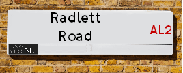
Map of Radlett Road
| Postcodes | ||
|---|---|---|
| Icon | Postcodes for Radlett Road | |
| Walking Distances | ||
| Distance Info | Green Circle = 10 Minutes Walk (800 metres) | |
About Radlett Road
Radlett Road is a street located in the otherSettlement of Colney Street and in the village of Frogmore. The street has a length of approximately 1,668 metres.
Radlett Road is located within the St. Albans District (B) and Hertsmere District (B) Council's jurisdiction. They provide various services, like refuse collection, and manage council tax collection. It's situated in the East of England region of the UK.
Radlett Road has been assigned the Unique Street Reference Number of 37314129 and 17225271 in the National Street Gazetteer.
Radlett Road is located within the county of Hertfordshire, situated in the East of England region of the UK. It's 17.36 miles North West from central London., 2.93 miles South from St Albans, 12.28 miles South from Luton and 21.88 miles East from Aylesbury.

Do you know why this road is called Radlett Road?
What's it like to live here?
Ask the community a question about Radlett Road.
Do you have any questions, memories to share or know any facts about Radlett Road? We'd love to know more.
Also on streetlist.co.uk, can you help?
Eldroth Road
15th April 2024
I wondered if anyone has any old pictures of Wenning Bank House in the 1940’s and also Lane Side before of the same era .. we visited today with my Mum in law as she used to live at both these properties. Also any photos of the schools around that time .. thank you.
Can You Help?Napps Way
15th April 2024
Why is the road called Napps Way (belonging to Napp, but minus an
apostrophe as is usual with such nomenclature)? Moreover, who or
what is, or was, “Napp” in the respective, possessive case?
Several years ago, I met an elderly man (probably in his late-eighties)
who lives on Bentham Drive, Liverpool 16, and during a conversation
with him whilst in a Northwest Passenger Transport Ambulance on the
way to the former RLUH (Royal Liverpool University Hospital), he told
me that he could remember (when he was a boy, living in Childwall,
Liverpool 16) that, “Where Napps Way is now, during WW2, there was
a two-man gun emplacement on the, then, open land to protect the
railway line passing over Childwall Valley Road - next to the railway
bridge - when suddenly, as they were loading a live “shell” into the gun’s
breach, the aforementioned “shell” accidentally exploded in the gun’s
breach killing both of the two soldiers, that had been manning the gun,
instantly! (Very sad, of course, but could - perhaps - two ghosts relating
to those two, very unfortunately and prematurely-killed soldiers have
haunted that place of their deaths ever since - and have any residents
of Napps Way - formerly and in its latest incarnation - seen two, WW2
(uniformed) soldiers unexpectedly appear in or near their homes?)
Mauritius Road
15th April 2024
Why is Mauritius Road so called, since when and by whom? Does Greenwich have any particular links with Mauritius? Very interested to know. 🤞🏼
Can You Help?Estate Agents near Radlett Road
| Name | Address | Website |
|---|---|---|
| JW&Co | 6 How Wood, Park Street, St. Albans, AL2 2RA | Visit Website |
| Bloor Homes | Harperbury Park Off Harper Lane, Radlett, WD7 9HQ | Visit Website |
| Carter Hayward | 119 Oakwood Road, Bricket Wood, AL2 3QB | Visit Website |
We have found 10 postcodes for Radlett Road
Location Details
| Radlett Road | |
|---|---|

| |
| Latitude | 51.709167 |
| Longitude | -0.331091 |
| OS Easting (X): | 515297 |
| OS Northing (Y): | 202528 |
| OS Grid Reference: | TL153025 |
Ordnance Survey Maps for Radlett Road
If you purchase a map through the links below, we may earn an affiliate commission.
| Map Series | link | Ordnance Survey |
| Explorer 1:25,000 182 St. Albans and Hatfield | Check Price on Amazon | |
| Landranger 1:50,000 166 Luton & Hertford | Check Price on Amazon | Buy Direct from the Ordnance Survey |
Neighbourhood Policing |
| Police Force: Hertfordshire |
 View Neighbourhood Crime and Policing View Neighbourhood Crime and Policing |
| Find a Local Neighbourhood Watch Scheme |
Frequently asked Questions for Radlett Road
What Council (Local Authority) is Radlett Road in?
Radlett Road is located within the local authority area of Hertsmere &St Albans Council which is a District Council.
What Parish Council is Radlett Road in?
Radlett Road is in an unparished area.
What Electoral Ward is Radlett Road in?
Radlett Road is located within the ward of Aldenham West &Park Street.
What County is Radlett Road in?
Radlett Road is located within the ceremonial county of Hertfordshire.
What Constituency is Radlett Road in?
Radlett Road is located within the constituency of Hertsmere &St Albans.
What Part of the UK is Radlett Road in?
Radlett Road is located within the East of England region of the United Kingdom.
What County Council area is Radlett Road in?
Radlett Road is located within the Hertfordshire Council area.
What Police Force area is Radlett Road in?
Radlett Road is located within the Hertfordshire Police area.
Roads that have a Junction with Radlett Road
| Street | Junction Type |
|---|---|
| Watling Street (A5183) | pseudo node |
| Victor Way | junction |
| Old Parkbury Lane | junction |
| Smug Oak Lane | junction |
| Moor Mill Lane | junction |
| Hampden Place | junction |
| Hyde Lane | junction |
| Frogmore (A5183) | pseudo node |
Sunset and Sunrise times for Radlett Road
| Sunrise | 05:39 |
|---|---|
| Sunset | 20:19 |
Latest Weather Conditions for Radlett Road
| Observed at Weather Station: | Rothamsted 26 April 2024 at 00:00 (6.85 miles away) |
|---|---|
| Current Weather: | Clear night |
| Temperature and Humidity: | 4.2°C (92.5%) |
| Wind Direction and Speed: | (0 mph) |
Population Statistics
| ONS Area Code | E00119497, E00120446 & E00120444 |
|---|---|
| ONS Area Name | Indian Tech Achievers, Communal Retirement & Self-Sufficient Retirement |
| Average Age | 42.73 & 38.72 |
| Area Population | 1780.00 & 1852.00 |
| Male Population | 869.00 & 951.00 (50%) |
| Female Population | 911.00 & 901.00 (50%) |
| Benefit Claimants | # & 30 (1%) |
| LSOA Code: | E01023526 &E01023720 |
|---|---|
| LSOA Name: | Hertsmere 005D &St Albans 019C |
| SOA Code: | 8a &3c |
| SOA Name: | |
| MSOA Code: | E02004900 &E02004942 |
| MSOA Name: | Hertsmere 005 &St Albans 019 |
Nearest Supermarkets
| Tesco Colney Express |
|---|
| 196-198 High St, London Colney, St Albans, AL2 1JQ |
| 0345 026 9210 |
| Distance: 1.84 Miles |
| Directions from Radlett Road to Tesco Colney Express |
| Tesco Radlett Watling Express |
|---|
| 295-297 Watling St, Radlett, WD7 7LA |
| 0345 026 9287 |
| Distance: 1.88 Miles |
| Directions from Radlett Road to Tesco Radlett Watling Express |
| Sainsburys London Colney |
|---|
| Colney Fields Shopping Park, London Colney, St. Albans, England, AL2 1AB |
| 01707 429220 |
| Distance: 1.95 Miles |
| Directions from Radlett Road to Sainsburys London Colney |
| Tesco Shenley Express |
|---|
| 4, Andrew Close, Shenley, Radlett, WD7 9LP |
| 0345 026 9352 |
| Distance: 2.22 Miles |
| Directions from Radlett Road to Tesco Shenley Express |
Telephone Information
| Area Code |
|---|
| Area Code: 01727 - St Albans |
| Area Code: 01923 - Watford |
| Area Code: 01442 - Hemel Hempstead |
Local Government
| Local Council Details |
|---|
| Within the area of Hertsmere &St Albans |
| Visit the Council's Website |
| Visit the Council's Website |
| Civic Offices, Elstree Way, Borehamwood, Hertfordshire, WD6 1WA, Civic Centre, St Peters Street, St Albans, Hertfordshire &AL1 3JE |
| Send email |
| Telephone Number: 020 8207 2277 &01727 866 100 |
| Local Member of Parliament |
|---|
| Within the Westminster Parliamentary Constituency of Hertsmere &St Albans |
| The Member of Parliament is Oliver Dowden &Daisy Cooper |
| Details for the MP Oliver Dowden &Daisy Cooper on parliament.uk |
| Details for the MP Oliver Dowden &Daisy Cooper on theyworkforyou.com |
| In the 2019 General Election Oliver Dowden &Daisy Cooper won with a majority of 21,313 the result was Con hold &LD gain from Con. The total electorate was 73,971 |
| Wards, Parish Councils and County Councils |
|---|
| Ward: Aldenham West &Park Street Ward |
| Ceremonial County: Hertfordshire |
Nearest Schools
England Primary Schools
Clore Shalom School
Address: Clore Shalom School, Hugo Gryn Way, Shenley, Hertfordshire, WD7 9BL
Distance: 1.80 miles
Contact: 01923855631
Saint Bernadette Catholic Primary School
Address: Saint Bernadette Catholic Primary School, Walsingham Way, London Colney, St Albans, Hertfordshire, AL2 1NL
Distance: 1.48 miles
Contact: 01727822489
Newberries Primary School
Address: Newberries Primary School, Newberries Avenue, Radlett, Hertfordshire, WD7 7EL
Distance: 2.07 miles
Contact: 01923857180
St John's Church of England Infant and Nursery School
Address: St John's Church of England Infant and Nursery School, Gills Hill Lane, Radlett, Hertfordshire, WD7 8DD
Distance: 1.81 miles
Contact:
Park Street Church of England Voluntary Aided Primary School
Address: Park Street Church of England Voluntary Aided Primary School, Branch Road, Park Street, St Albans, Hertfordshire, AL2 2LX
Distance: 0.85 miles
Contact: 01727872158
Fair Field Junior School
Address: Fair Field Junior School, Watford Road, Radlett, Radlett, Hertfordshire, WD7 8LU
Distance: 1.98 miles
Contact: 01923856341
How Wood Primary and Nursery School
Address: How Wood Primary and Nursery School, Spooners Drive, Park Street, St Albans, Hertfordshire, AL2 2HU
Distance: 0.98 miles
Contact: 01727768885
St Adrian Roman Catholic Primary School
Address: St Adrian Roman Catholic Primary School, Watling View, St Albans, Hertfordshire, AL1 2PB
Distance: 2.06 miles
Contact: 01727852687
Mount Pleasant Lane Junior Mixed and Infant School and Nursery
Address: Mount Pleasant Lane Junior Mixed and Infant School and Nursery, Mount Pleasant Lane, Bricket Wood, St Albans, Hertfordshire, AL2 3XA
Distance: 2.08 miles
Contact:
England Secondary Schools
The Marlborough Science Academy
Address: The Marlborough Science Academy, Watling Street, St Albans, Hertfordshire, AL1 2QA
Distance: 2.19 miles
Contact: 01727856874
Nearest Hospitals
| Name | Address | Postcode | Distance | Map |
|---|
Nearest Dentists
Dentists near Radlett Road
| Name | Address | Postcode | Distance | Map |
|---|
Nearest GP Surgeries
Doctors near Radlett Road
PARK STREET SURGERY
Address: 10 WITHEY PLACE, PARK STREET, HERTFORDSHIRE, AL2 2SN
Distance: 1.01 miles
Contact: tel: 01923 855606
VERULAM MEDICAL GROUP BRICKET WOOD
Address: ST. LUKES CHURCH, THE CRESCENT, BRICKET WOOD, ST. ALBANS, HERTFORDSHIRE, AL2 3NF
Distance: 1.44 miles
Contact: tel: 01923 671746
SUMMERFIELD HEALTH CENTRE
Address: CALEDON ROAD, LONDON COLNEY, ST. ALBANS, AL2 1PU
Distance: 1.65 miles
Contact: tel: 01727 823245
VERULAM MEDICAL GROUP
Address: COLNEY MEDICAL CENTRE, 45-47 KINGS ROAD, LONDON COLNEY, ST. ALBANS, AL2 1ES
Distance: 1.65 miles
Contact: tel: 01727 822138
THE RED HOUSE GROUP
Address: THE RED HOUSE SURGERY, 124 WATLING STREET, RADLETT, HERTFORDSHIRE, WD7 7JQ
Distance: 1.92 miles
Contact: tel: 01923 855606
MIDWAY SURGERY
Address: 93 WATFORD ROAD, ST. ALBANS, HERTFORDSHIRE, AL2 3JX
Distance: 2.00 miles
Contact: tel: 01727 832125
Nearest Dispensing Chemists
Pharmacies near Radlett Road
| Name | Address | Postcode | Telephone | Map | Distance in Km |
|---|
Nearest Opticians
Opticians near Radlett Road
THE LENS ROOM
Address: 2 WOODLANDS, RADLETT, WD7 7NT
Distance: 1.46 miles
Contact: :
DOCTOR DAVID GLOVER
Address: 24 CANONS CLOSE, RADLETT, HERTFORDSHIRE, WD7 7ER
Distance: 1.86 miles
Contact: :
GRANT AND GLASS OPTICIANS
Address: 365-367 WATLING STREET, RADLETT, HERTFORDSHIRE, WD7 7LB
Distance: 1.93 miles
Contact: :
RADLETT OPTICIANS LTD
Address: 353 WATLING STREET, RADLETT, WD7 7LB
Distance: 1.93 miles
Contact: :
M&S OPTICIANS - LONDON COLNEY
Address: COLNEY FIELDS SHOPPING PARK, LONDON COLNEY, ST. ALBANS, AL2 1AB
Distance: 2.13 miles
Contact: :
LONDON COLNEY SPECSAVERS
Address: COLNEY FIELDS SHOPPING PARK, LONDON COLNEY, ST. ALBANS, HERTFORDSHIRE, AL2 1AB
Distance: 2.13 miles
Contact: :
Transport
Nearest Rail Stations
How Wood (Hertfordshire) Station is 0.83 miles away.
Address: How Wood station, Hyde Lane, How Wood, Hertfordshire, AL2 2NG
How Wood (Hertfordshire) is situated on the Abbey Line and is managed by Grand Central North West.
How Wood (Hertfordshire) Station is an unstaffed station.
Directions from Radlett Road to How Wood (Hertfordshire) Rail Station
Park Street Station is 1.19 miles away.
Address: Park Street station, Watling Street, Park Street, Hertfordshire, AL2 2NG
Park Street is situated on the Abbey Line and is managed by Grand Central North West.
Park Street Station is an unstaffed station.