This section of the site is all about the AL Postcode area, also known as the St Albans Postal Area. Explore links to the next level to learn more about specific postcode districts such as AL1.
Map of the AL Postcode for St Albans
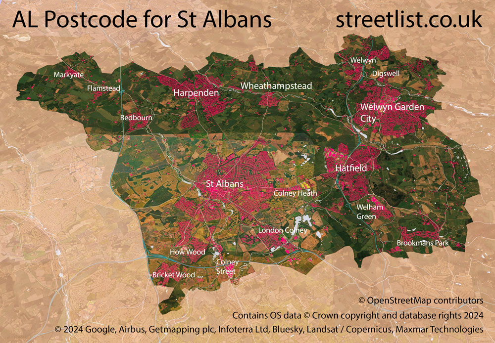
The AL postcode area represents a group of postal districts in the St Albans area of the United Kingdom. The area code AL stands for the letters a and l in Saint Aorlbans. AL has a population of 250,427 and covers an area of 298,294 hectares. Fun fact: 0.39% of the population of Great Britain lives in this area.
The postcode area falls within the following counties: Hertfordshire (99.93%), Bedfordshire (0.07%).
Post Towns and Postcode Districts for the AL Postcode
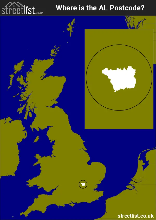
Where is the AL Postcode Area?
The AL St Albans Postcode is in Eastern England. The postal area borders the following neighbouring postal areas: SG - Stevenage, WD - Watford, EN - Enfield, HP - Hemel Hempstead and LU - Luton, and is located inland.
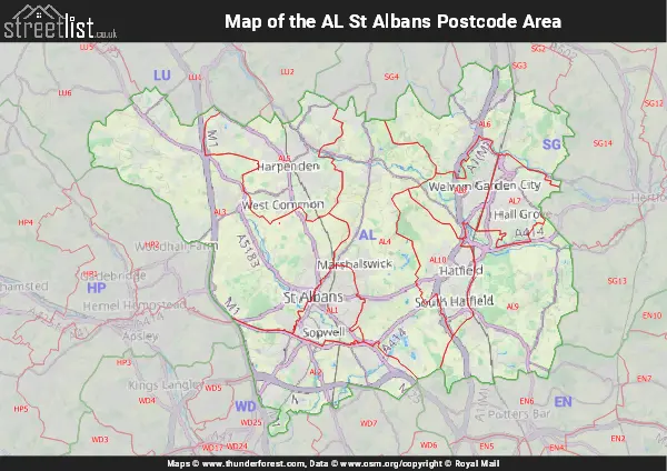
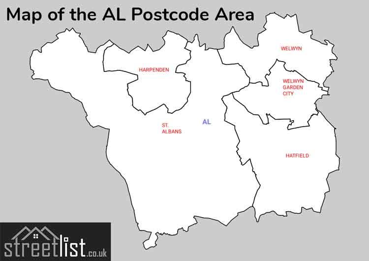
Map of the AL St Albans Postcode Area
Explore the AL St Albans postcode area by using our interactive map.
Postcode Districts within the AL St Albans Postcode Area
There are 10 postcode districts within the St Albans postcode area
A map showing the boundary of in relation to other areas
There are 3 towns within the St Albans postcode area.
| Unit | Area² |
|---|---|
| Hectares | 298,294² |
| Miles | 1,152² |
| Feet | 32,108,067,866² |
| Kilometres | 2,983² |
Postal Delivery Offices serving the AL St Albans Postcode Area
- Harpenden Delivery Office
- Hatfield (al) Delivery Office
- Redbourn Scale Payment Delivery Office
- St. Albans Delivery Office
- Welwyn Garden City Delivery Office
Councils with Postcodes in AL
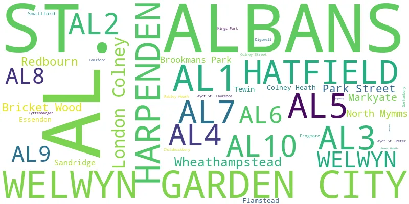
Towns and Villages within the AL St Albans Postcode Area
- Aley Green - village
- Ayot Green - village
- Ayot St Lawrence - village
- Blackmore End - village
- Bricket Wood - village
- Broad Colney - otherSettlement
- Brookmans Park - village
- Bull's Green - village
- Burnham Green - village
- Chiswell Green - village
- Colney Heath - village
- Colney Street - otherSettlement
- Essendon - village
- Flamstead - village
- Frogmore - village
- Gustard Wood - village
- Harpenden - town
- Hatfield - town
- How Wood - village
- Kinsbourne Green - village
- Lea Valley - village
- Lemsford - village
- London Colney - village
- Markyate - village
- North Mymms - village
- Oaklands - village
- Park Street - village
- Pottersheath - village
- Rableyheath - village
- Redbourn - village
- Sandridge - village
- Sleapshyde - village
- Smallford - village
- St Albans - city
- Stanborough - village
- Tewin - village
- Tewin Wood - village
- The Folly - village
- Trowley Bottom - village
- Tyttenhanger - village
- Welham Green - village
- Welwyn - village
- Welwyn Garden City - town
- Wheathampstead - village
- Wildhill - village