Map of Westfield Grange
| Street Crime (updated 04/05/2024) | ||
|---|---|---|
| Location Note | Central Point of Street - Not Actual Location | |
| MSOA Info | For MSOA E02001930 (Statistical Neighbourhood) | |
| Click Hint | Click on a Circle for a detailed breakdown below map. | |
| Crime Levels |
Green = Very Low Yellow = Low Orange = High Red = Very High |
|
| Postcodes | ||
| Icon | Postcodes for Westfield Grange | |
| Walking Distances | ||
| Distance Info | Green Circle = 10 Minutes Walk (800 metres) | |
About Westfield Grange
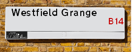
Westfield Grange is a street located in the city of Birmingham. It uses the postcode B14 7SB. The street has a length of approximately 39 metres.
The street is not publicly maintained and is unadopted which means that a private body or even the householder could be responsible for the repair and upkeep of the highway. Check the status with your local council or enquire if the street is covered by a PUSWA (public utilities street works act).
Westfield Grange is located within the Birmingham District (B) Council's jurisdiction. They provide various services, like refuse collection, and manage council tax collection. It's situated in the West Midlands region of the UK.
Westfield Grange has been assigned the Unique Street Reference Number of 2744807 in the National Street Gazetteer.
Westfield Grange is located within the county of West Midlands, situated in the West Midlands region of the UK. It's 100.14 miles North West from central London., 2.92 miles South from Birmingham, 16.53 miles West from Coventry and 21.73 miles North East from Worcester.
Westfield Grange is within the Post Town of BIRMINGHAM

Do you know why this road is called Westfield Grange?
What's it like to live here?
Ask the community a question about Westfield Grange.
Do you have any questions, memories to share or know any facts about Westfield Grange? We'd love to know more.
Also on streetlist.co.uk, can you help?
Swing Swang Lane
28th April 2024
I am trying to find out why the lane is named Swing Swang?
It has been known known this since at least 1905 when hedge making contents used to be held here.
Swing Swang is often used to describe a fairground ride. I remember Swing Boats. Were they a bit like this or is Swing Swang another name for swings?
Swing Swangs are also mentioned in connection to orchards. Or were orchards just good places to have swings?
House Sales in Westfield Grange
| Year | High | Low | Average | Sales |
|---|---|---|---|---|
| 2012 | £155,000 | £155,000 | £155,000 | 1 |
| 2013 | £150,000 | £150,000 | £150,000 | 1 |
| 2015 | £171,500 | £171,500 | £171,500 | 1 |
| 2020 | £195,000 | £195,000 | £195,000 | 1 |
Contains HM Land Registry data © Crown copyright and database right 2024. This data is licensed under the Open Government Licence v3.0.
Estate Agents near Westfield Grange
| Name | Address | Website |
|---|---|---|
| Robert Oulsnam & Company | 20 High Street, Kings Heath, Birmingham, B14 7JT | |
| Glovers Estate Agents | 33 High Street, Kings Heath, Birmingham, B14 7BB | Visit Website |
| Heritage Estate Agency | 91 High Street Kings Heath Birmingham B14 7BH | Visit Website |
We have found 1 postcode for Westfield Grange
Location Details
| Westfield Grange | |
|---|---|

| |
| Latitude | 52.437087 |
| Longitude | -1.897205 |
| OS Easting (X): | 406987 |
| OS Northing (Y): | 282170 |
| OS Grid Reference: | SP070822 |
Neighbourhood Policing |
| Police Force: West Midlands |
 View Neighbourhood Crime and Policing View Neighbourhood Crime and Policing |
| Find a Local Neighbourhood Watch Scheme |
Frequently asked Questions for Westfield Grange
What Council (Local Authority) is Westfield Grange in?
Westfield Grange is located within the local authority area of Birmingham Council which is a Metropolitan District.
What Parish Council is Westfield Grange in?
Westfield Grange is in an unparished area.
What Electoral Ward is Westfield Grange in?
Westfield Grange is located within the ward of Brandwood & King's Heath.
What County is Westfield Grange in?
Westfield Grange is located within the ceremonial county of West Midlands.
What Constituency is Westfield Grange in?
Westfield Grange is located within the constituency of Birmingham &Hall Green.
What Part of the UK is Westfield Grange in?
Westfield Grange is located within the West Midlands (England) region of the United Kingdom.
What County Council area is Westfield Grange in?
Westfield Grange is located within the West Midlands Council area.
What Police Force area is Westfield Grange in?
Westfield Grange is located within the West Midlands Police area.
Roads that have a Junction with Westfield Grange
| Street | Junction Type |
|---|---|
| Westfield Road | junction |
Sunset and Sunrise times for Westfield Grange , B14 7SB
| Sunrise | 05:10 |
|---|---|
| Sunset | 20:57 |
Latest Weather Conditions for Westfield Grange, B14 7SB
| Observed at Weather Station: | Coleshill 14 May 2024 at 09:00 (9.25 miles away) |
|---|---|
| Current Weather: | Light rain |
| Temperature and Humidity: | 14.0°C (94.3%) |
| Wind Direction and Speed: | SSE (7 mph) |
Population Statistics
| ONS Area Code | E00046599 |
|---|---|
| ONS Area Name | Social Renting New Arrivals |
| Average Age | 34.63 |
| Area Population | 1578.00 |
| Male Population | 769.00 (49%) |
| Female Population | 809.00 (51%) |
| Benefit Claimants | 31 (2%) |
| LSOA Code: | E01009177 |
|---|---|
| LSOA Name: | Birmingham 104B |
| SOA Code: | 3d |
| SOA Name: | |
| MSOA Code: | E02001930 |
| MSOA Name: | Birmingham 104 |
Nearest Supermarkets
| Asda Kings Heath |
|---|
| 99 High Street, Kings Heath, Birmingham, B14 7BW |
| 0121 483 4410 |
| Distance: 0.26 Miles |
| Directions from Westfield Grange to Asda Kings Heath |
| Iceland Kings Heath |
|---|
| Unit 10 Institutes Road, Kings Heath, Birmingham, B14 7EG |
| 01214441862 |
| Distance: 0.38 Miles |
| Directions from Westfield Grange to Iceland Kings Heath |
| Sainsburys Kings Heath |
|---|
| 38-54 Alcester Road South, Birmingham, England, B14 7PT |
| 0121 444 3251 |
| Distance: 0.43 Miles |
| Directions from Westfield Grange to Sainsburys Kings Heath |
| Sainsburys Alcester Road Local |
|---|
| 158-162 Alcester Road, Birmingham, England, B13 8HS |
| 1214496499 |
| Distance: 0.82 Miles |
| Directions from Westfield Grange to Sainsburys Alcester Road Local |
Telephone Information
| Area Code |
|---|
| Area Code: 0121 - Birmingham |
| Area Code: 01564 - Lapworth |
| Area Code: 01527 - Redditch |
| Area Code: 01384 - Dudley |
Broadband Information
| Speed | Average Speed | Median Speed | Maximum Speed | Next-generation access (NGA) | Number of Connections |
|---|---|---|---|---|---|
| Greater than 2 Mbps | 12.4 | 12 | 18.9 | N | 6 |
Local Government
| Local Council Details |
|---|
| Within the area of Birmingham |
| Visit the Council's Website |
| Council House, Victoria Square, Birmingham &B1 1BB |
| Send email |
| Telephone Number: 0121 303 1111 |
| Local Member of Parliament |
|---|
| Within the Westminster Parliamentary Constituency of Birmingham &Hall Green |
| The Member of Parliament is Tahir Ali |
| Details for the MP Tahir Ali on parliament.uk |
| Details for the MP Tahir Ali on theyworkforyou.com |
| In the 2019 General Election Tahir Ali won with a majority of 28,508 the result was Lab hold. The total electorate was 80,283 |
| Wards, Parish Councils and County Councils |
|---|
| Ward: Brandwood & King's Heath Ward |
| Parish: Unparished area |
| Ceremonial County: West Midlands |
Nearest Schools
England Secondary Schools
Queensbridge School
Address: Queensbridge School, Queensbridge Road, Moseley, Birmingham, West Midlands, B13 8QB
Distance: 0.21 miles
Contact: 01214645566
Kings Heath Boys
Address: Kings Heath Boys, Chamberlain Road, Kings Heath, Birmingham, West Midlands, B13 0QP
Distance: 1.13 miles
Contact: 01214644454
Bishop Challoner Catholic College
Address: Bishop Challoner Catholic College, Institute Road, Kings Heath, Birmingham, West Midlands, B14 7EG
Distance: 0.38 miles
Contact: 01214444161
Wheelers Lane Technology College
Address: Wheelers Lane Technology College, Wheelers Lane, Kings Heath, Birmingham, West Midlands, B13 0SF
Distance: 0.76 miles
Contact: 01214442864
King Edward VI Camp Hill School for Boys
Address: King Edward VI Camp Hill School for Boys, Vicarage Road, Kings Heath, Birmingham, West Midlands, B14 7QJ
Distance: 0.47 miles
Contact:
King Edward VI Camp Hill School for Girls
Address: King Edward VI Camp Hill School for Girls, Vicarage Road, Kings Heath, Birmingham, West Midlands, B14 7QJ
Distance: 0.47 miles
Contact:
King Edward VI Camp Hill School for Boys
Address: King Edward VI Camp Hill School for Boys, Vicarage Road, Kings Heath, Birmingham, West Midlands, B14 7QJ
Distance: 0.47 miles
Contact: 01214443188
King Edward VI Camp Hill School for Girls
Address: King Edward VI Camp Hill School for Girls, Vicarage Road, Kings Heath, Birmingham, West Midlands, B14 7QJ
Distance: 0.47 miles
Contact: 01214442150
England Primary Schools
King David Primary School
Address: King David Primary School, Alcester Road, Moseley, Birmingham, West Midlands, B13 8EY
Distance: 0.63 miles
Contact: 01214493364
St Dunstan's Catholic Primary School
Address: St Dunstan's Catholic Primary School, Drayton Road, Kings Heath, Birmingham, West Midlands, B14 7LP
Distance: 0.42 miles
Contact: 01214644648
Allens Croft Primary School
Address: Allens Croft Primary School, Allens Croft Road, Kings Heath, Birmingham, West Midlands, B14 6RP
Distance: 1.32 miles
Contact: 01216752611
Colmore Infant and Nursery School
Address: Colmore Infant and Nursery School, Colmore Road, Kings Heath, Birmingham, West Midlands, B14 6AJ
Distance: 0.70 miles
Contact: 01214642820
Colmore Junior School
Address: Colmore Junior School, Colmore Road, Kings Heath, Birmingham, West Midlands, B14 6AJ
Distance: 0.70 miles
Contact: 01214642843
Woodthorpe Junior and Infant School
Address: Woodthorpe Junior and Infant School, Greenwood Close, Kings Heath, Birmingham, West Midlands, B14 6ET
Distance: 1.25 miles
Contact: 01214645203
Kings Heath Primary School
Address: Kings Heath Primary School, Valentine Road, Kings Heath, Birmingham, West Midlands, B14 7AJ
Distance: 0.31 miles
Contact: 01214649202
Wheelers Lane Primary School
Address: Wheelers Lane Primary School, Wheelers Lane, Kings Heath, Birmingham, West Midlands, B13 0SF
Distance: 0.76 miles
Contact: 01214642551
Moor Green Primary Academy
Address: Moor Green Primary Academy, Moor Green Lane, Moseley, Birmingham, B13 8QP
Distance: 0.52 miles
Contact: 01214645662
Nearest Hospitals
| Juniper Centre |
|---|
| Address: Moseley Hall Hospital site, Alcester Road, Moseley, Birmingham, |
| NHS Sector |
| Birmingham and Solihull Mental Health NHS Foundation Trust |
| Telephone: 0121 301 5700 |
| Visit Hospital Website |
| Distance: 1.02 (miles) |
| Directions from to Juniper Centre |
| Moseley Hall Hospital |
|---|
| Address: Alcester Road, Birmingham, |
| NHS Sector |
| Birmingham Community Healthcare NHS Foundation Trust |
| Telephone: 0121 466 6000 |
| Visit Hospital Website |
| Distance: 1.02 (miles) |
| Directions from to Moseley Hall Hospital |
| Grove Avenue |
|---|
| Address: 32 Grove Avenue, Moseley, Birmingham, |
| NHS Sector |
| Birmingham and Solihull Mental Health NHS Foundation Trust |
| Telephone: 0121 678 4004 |
| Visit Hospital Website |
| Distance: 1.03 (miles) |
| Directions from to Grove Avenue |
Nearest Dentists
Dentists near Westfield Grange
JAMES HULL DENTAL CARE
Address: 108 HIGH STREET, KINGS HEATH, BIRMINGHAM, WEST MIDLANDS, B14 7LG
Distance: 0.27 miles
Contact: :
DENTAL SURGERY
Address: 9 SALISBURY ROAD, MOSELEY, BIRMINGHAM, WEST MIDLANDS, B13 8JS
Distance: 0.72 miles
Contact: :
MIDLANDS SMILE CENTRES
Address: 306 VICARAGE ROAD, KINGS HEATH, BIRMINGHAM, B14 7NH
Distance: 0.77 miles
Contact: :
MANGO TREE DENTAL
Address: 11 WAKE GREEN ROAD, BIRMINGHAM, B13 9HB
Distance: 0.86 miles
Contact: :
SOUTH BIRMINGHAM ORTHODONTICS
Address: 681 PERSHORE ROAD, SELLY PARK, BIRMINGHAM, WEST MIDLANDS, B29 7NY
Distance: 0.90 miles
Contact: :
DENTAL SURGERY
Address: 31 LIVINGSTONE ROAD, KINGS HEATH, BIRMINGHAM, WEST MIDLANDS, B14 6DJ
Distance: 0.93 miles
Contact: :
Nearest GP Surgeries
Doctors near Westfield Grange
POPLAR PRIMARY CARE CENTRE
Address: 58-64 POPLAR ROAD, KINGS HEATH, BIRMINGHAM, WEST MIDLANDS, B14 7AG
Distance: 0.29 miles
Contact: tel: 0121 4658314
ALL SAINTS MEDICAL CENTRE - COVID LOCAL VACCINATION SERVICE
Address: 2A VICARAGE ROAD, KINGS HEATH, BIRMINGHAM, B14 7RA
Distance: 0.35 miles
Contact: :
ALL SAINTS MEDICAL CENTRE - COVID LOCAL VACCINATION SERVICE 2
Address: 2A VICARAGE ROAD, KINGS HEATH, BIRMINGHAM, B14 7RA
Distance: 0.35 miles
Contact: :
ALL SAINTS MEDICAL CENTRE SURGERY
Address: 2A VICARAGE ROAD, KINGS HEATH, BIRMINGHAM, WEST MIDLANDS, B14 7QA
Distance: 0.38 miles
Contact: :
DR ABDEL-MALEK
Address: 119 SCHOOL ROAD, MOSELEY, BIRMINGHAM, WEST MIDLANDS, B13 9TX
Distance: 0.39 miles
Contact: tel: 01217530615
MOOR GREEN LANE MEDICAL CENTRE
Address: 339 MOOR GREEN LANE, BIRMINGHAM, WEST MIDLANDS, B13 8QS
Distance: 0.57 miles
Contact: tel: 0121 4110393
Nearest Dispensing Chemists
Pharmacies near Westfield Grange
TWILIGHT PHARMACY
Address: 128-130 HIGH STREET, KINGS HEATH, BIRMINGHAM, WEST MIDLANDS, B14 7LG
Distance: 0.27 miles
Contact: tel: 01214 441179
BOOTS
Address: 145-147 HIGH STREET, KINGS HEATH, BIRMINGHAM, WEST MIDLANDS, B14 7DG
Distance: 0.28 miles
Contact: tel: 0121 4441016
PHARMACY CARE MATTERS
Address: 197 ALCESTER ROAD, BIRMINGHAM, WEST MIDLANDS, B13 8PX
Distance: 0.46 miles
Contact: tel: 0121 4490089
BAGGALEY CHEMIST
Address: 131 ALCESTER ROAD, MOSELEY, BIRMINGHAM, WEST MIDLANDS, B13 8JP
Distance: 0.70 miles
Contact: tel: 0121 4490096
ASKERS CHEMIST
Address: 146 ALCESTER ROAD SOUTH, KINGS HEATH, BIRMINGHAM, WEST MIDLANDS, B14 6AA
Distance: 0.70 miles
Contact: tel: 0121 4446234
KINGS HEATH PHARMACY
Address: 294 VICARAGE ROAD, KINGS HEATH, BIRMINGHAM, WEST MIDLANDS, B14 7NH
Distance: 0.77 miles
Contact: tel: 0121 4445049
Nearest Opticians
Opticians near Westfield Grange
BOOTS OPTICIANS (HIGH STREET - KINGS HEATH)
Address: 115 HIGH STREET, KINGS HEATH, BIRMINGHAM, WEST MIDLANDS, B14 7BW
Distance: 0.25 miles
Contact: :
SCRIVENS OPTICIANS (KINGS HEATH)
Address: 124 HIGH STREET, KINGS HEATH, BIRMINGHAM, WEST MIDLANDS, B14 7LG
Distance: 0.27 miles
Contact: :
SPECSAVERS (KINGS HEATH, BIRMINGHAM)
Address: 132 HIGH STREET, KINGS HEATH, BIRMINGHAM, WEST MIDLANDS, B14 7LG
Distance: 0.27 miles
Contact: :
SEESAW (POPLAR ROAD)
Address: 56B POPLAR ROAD, KINGS HEATH, BIRMINGHAM, WEST MIDLANDS, B14 7AG
Distance: 0.29 miles
Contact: :
PORTLAND EYECARE LTD (KINGS HEATH)
Address: 1 INSTITUTE ROAD, KINGS HEATH, BIRMINGHAM, WEST MIDLANDS, B14 7EG
Distance: 0.38 miles
Contact: :
BOOTS OPTICIANS (ALCESTER ROAD SOUTH - KINGS HEATH)
Address: 51A ALCESTER ROAD SOUTH, KINGS HEATH, BIRMINGHAM, WEST MIDLANDS, B14 7JQ
Distance: 0.41 miles
Contact: :
Transport
Nearest Rail Stations
Bournville Station is 1.42 miles away.
Address: Bournville station, Bournville Lane, Bournville, West Midlands, B30 1LG
Bournville is situated on the Bristol to Brimingham Line.
Bournville Station is staffed on a part time basis.
Selly Oak Station is 1.66 miles away.
Address: Selly Oak station, Bristol Road, Selly Oak, West Midlands, B29 6DW
Selly Oak is situated on the Bristol to Brimingham Line.
Selly Oak Station is staffed on a part time basis.