The B1 1 postcode sector is within the county of West Midlands.
Did you know? According to the 2021 Census, the B1 1 postcode sector is home to a bustling 4,602 residents!
Given that each sector allows for 400 unique postcode combinations. Letters C, I, K, M, O and V are not allowed in the last two letters of a postcode. With 118 postcodes already in use, this leaves 282 units available.
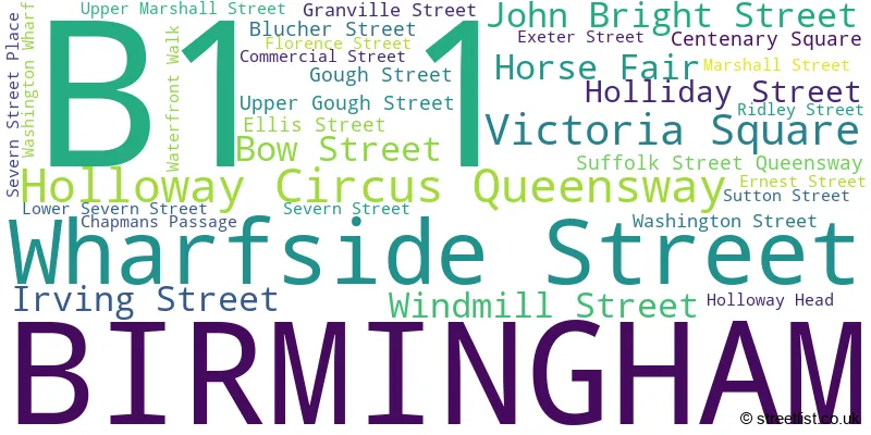
The B1 1 postal code covers the settlement of BIRMINGHAM.
The B1 1 Postcode shares a border with B5 4 (BIRMINGHAM), B1 2 (BIRMINGHAM), B5 7 (BIRMINGHAM, Edgbaston), B15 1 (BIRMINGHAM, Edgbaston) and B15 2 (BIRMINGHAM, Edgbaston).
The sector is within the post town of BIRMINGHAM.
B1 1 is a postcode sector within the B1 postcode district which is within the B Birmingham postcode area.
The Royal Mail delivery office for the B1 1 postal sector is the Birmingham Central Delivery Office.
The area of the B1 1 postcode sector is 0.14 square miles which is 0.35 square kilometres or 86.89 square acres.
Waterways within the B1 1 postcode sector include the Worcester & Birmingham Canal.

Map of the B1 1 Postcode Sector
Explore the B1 1 postcode sector by using our free interactive map.
| B | 1 | - | 1 | X | X |
| B | 1 | Space | 1 | Letter | Letter |
Official List of Streets
BIRMINGHAM (33 Streets)
Unofficial Streets or Alternative Spellings
BIRMINGHAM
BATH ROW BRIDGE STREET BRISTOL STREET COMMUNICATION ROW CREGOE STREET ESSEX STREET LANGLEY WALK LYTHAM CROFT NAVIGATION STREET SMALLBROOK QUEENSWAY STATION STREET SWALLOW STREET THORP STREET BEAK STREET BRUNEL STREET EXETER PASSAGE GRANVILLE STREET GOODS TUNNEL HOLLIDAY PASSAGE MAILBOX SQUARE NEW STREET STATION SUBWAY TO SORTING OFFICE PARADISE CIRCUS SALVAGE TURN BRIDGE SCALA SUBWAY SUFFOLK PLACE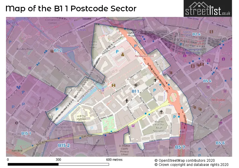
House Prices in the B1 1 Postcode Sector
| Type of Property | 2018 Average | 2018 Sales | 2017 Average | 2017 Sales | 2016 Average | 2016 Sales | 2015 Average | 2015 Sales |
|---|---|---|---|---|---|---|---|---|
| Detached | £265,000 | 1 | £0 | 0 | £0 | 0 | £0 | 0 |
| Semi-Detached | £0 | 0 | £0 | 0 | £0 | 0 | £0 | 0 |
| Terraced | £180,000 | 1 | £170,000 | 1 | £0 | 0 | £0 | 0 |
| Flats | £214,366 | 149 | £203,283 | 225 | £186,581 | 205 | £193,381 | 189 |
Important Postcodes B1 1 in the Postcode Sector
B1 1SB is the postcode for GOLDING HOUSE, The Maltings, Granville Street, NEWCOMBE HOUSE, The Maltings, Granville Street, THOMAS HOUSE, The Maltings, Granville Street, SPORTS HALL & BAR ONE, The Maltings, Granville Street, ATKINSON HOUSE & SMITH HOUSE, The Maltings, Granville Street, HOLDER HOUSE & VULCAN HOUSE, The Maltings, Granville Street, DAVENPORT HOUSE, The Maltings, Granville Street, DARBY HOUSE, The Maltings, Granville Street, OAST HOUSE, The Maltings, Granville Street, BELLAMY HOUSE, The Maltings, Granville Street, LADY ASTOR HOUSE, The Maltings, Granville Street, HARGREAVES HOUSE, The Maltings, Granville Street, LONG HOUSE, The Maltings, Granville Street, CHERRY HOUSE, The Maltings, Granville Street, DARES HOUSE, The Maltings, Granville Street, and NORTHDOWN HOUSE, The Maltings, Granville Street
B1 1SJ is the postcode for 239, Holliday Street
B1 1TJ is the postcode for Register Office, Holliday Street, and Birmingham Register Office, Holliday Street
B1 1UP is the postcode for 2ND FLOOR SOUTH AND WEST, British Transport Police, 10 Holliday Street, and British Transport Police, 10 Holliday Street
| The B1 1 Sector is within these Local Authorities |
|
|---|---|
| The B1 1 Sector is within these Counties |
|
| The B1 1 Sector is within these Water Company Areas |
|