The CF14 9 postcode sector stands on the Gwent and South Glamorgan border.
Did you know? According to the 2021 Census, the CF14 9 postcode sector is home to a bustling 6,922 residents!
Given that each sector allows for 400 unique postcode combinations. Letters C, I, K, M, O and V are not allowed in the last two letters of a postcode. With 129 postcodes already in use, this leaves 271 units available.
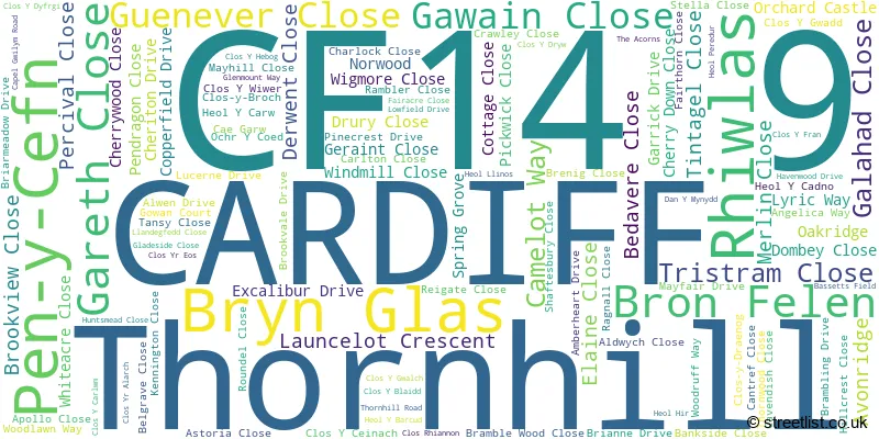
The largest settlement in the CF14 9 postal code is THORNHILL followed by CARDIFF, and RHIWBINA.
The CF14 9 Postcode shares a border with CF83 1 (CAERPHILLY, LANSBURY PARK, WATFORD), CF83 3 (CAERPHILLY, LLANBRADACH, MORNINGTON MEADOWS), CF14 0 (LISVANE, LLANISHEN, CARDIFF), CF14 5 (LLANISHEN, CARDIFF) and CF14 6 (RHIWBINA, WHITCHURCH, CARDIFF).
The sector is within the post town of CARDIFF.
CF14 9 is a postcode sector within the CF14 postcode district which is within the CF Cardiff postcode area.
The Royal Mail delivery office for the CF14 9 postal sector is the Cardiff North Delivery Office.
The area of the CF14 9 postcode sector is 1.65 square miles which is 4.28 square kilometres or 1,056.85 square acres.

Map of the CF14 9 Postcode Sector
Explore the CF14 9 postcode sector by using our free interactive map.
| C | F | 1 | 4 | - | 9 | X | X |
| C | F | 1 | 4 | Space | 9 | Letter | Letter |
Official List of Streets
Thornhill (100 Streets)
CARDIFF (8 Streets)
Unofficial Streets or Alternative Spellings
Thornhill
CLOS-Y-BROCH CLOS-Y-DRAENOG PEN-Y-CEFNLlanishen
HEOL HIRLisvane
CEFN ONN MEADOWS CHERRY ORCHARD ROADCARDIFF
CLOS Y FR�N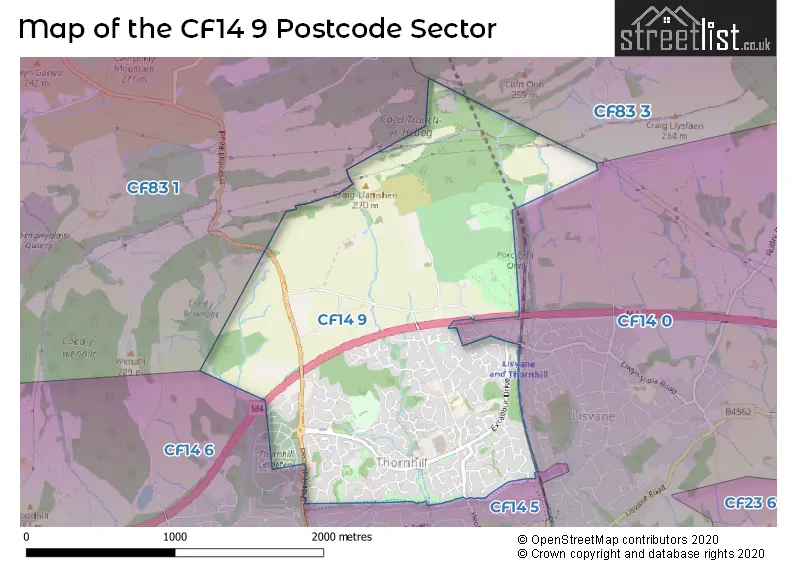
House Prices in the CF14 9 Postcode Sector
| Type of Property | 2018 Average | 2018 Sales | 2017 Average | 2017 Sales | 2016 Average | 2016 Sales | 2015 Average | 2015 Sales |
|---|---|---|---|---|---|---|---|---|
| Detached | £359,879 | 47 | £338,234 | 49 | £322,150 | 34 | £314,692 | 46 |
| Semi-Detached | £218,573 | 46 | £207,500 | 30 | £200,106 | 32 | £186,914 | 25 |
| Terraced | £179,317 | 52 | £177,330 | 44 | £173,296 | 59 | £170,818 | 71 |
| Flats | £115,458 | 12 | £152,500 | 9 | £135,700 | 13 | £119,571 | 7 |
Important Postcodes CF14 9 in the Postcode Sector
CF14 9LA is the postcode for Thornhill Junior & Infants School, Heol Hir
CF14 9UA is the postcode for NEW BEREAVEMENT SERVICES OFFICE, Bereavement Services, Thornhill Cemetery & Cardiff Crematorium, Thornhill Road, John Kane Court, 150 Thornhill Road, Rhiwbina, Cardiff Crematorium, Thornhill Road, and 150 Thornhill Road
| The CF14 9 Sector is within these Local Authorities |
|
|---|---|
| The CF14 9 Sector is within these Counties |
|
| The CF14 9 Sector is within these Water Company Areas |
|