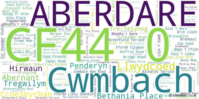
The CF44 0 postcode sector is within the county of Mid Glamorgan.
Did you know? According to the 2021 Census, the CF44 0 postcode sector is home to a bustling 8,764 residents!
Given that each sector allows for 400 unique postcode combinations. Letters C, I, K, M, O and V are not allowed in the last two letters of a postcode. With 236 postcodes already in use, this leaves 164 units available.
The largest settlement in the CF44 0 postal code is ABERDARE followed by CWM-BACH, and LLWYDCOED.
The CF44 0 Postcode shares a border with CF44 6 (Aberaman, ABERDARE, CWMAMAN), CF44 7 (ABERDARE, CWMDARE, ABERAMAN), CF44 8 (ABERDARE, TRECYNON, CWMDARE), CF44 9 (HIRWAUN, ABERDARE, RHIGOS), CF45 4 (Abercynon, MOUNTAIN ASH, TYNTETOWN), CF48 1 (MERTHYR TYDFIL, HEOLGERRIG, SWANSEA ROAD) and CF48 2 (PANT, CEFN COED, TREFECHAN).
The sector is within the post town of ABERDARE.
CF44 0 is a postcode sector within the CF44 postcode district which is within the CF Cardiff postcode area.
The Royal Mail delivery office for the CF44 0 postal sector is the Aberdare Delivery Office.
The area of the CF44 0 postcode sector is 18.71 square miles which is 48.47 square kilometres or 11,976.84 square acres.


Map of the CF44 0 Postcode Sector
Explore the CF44 0 postcode sector by using our free interactive map.
| C | F | 4 | 4 | - | 0 | X | X |
| C | F | 4 | 4 | Space | 0 | Letter | Letter |
Official List of Streets
ABERDARE (133 Streets)
Abernant (4 Streets)
Cwmbach (6 Streets)
Penderyn (3 Streets)
Llwydcoed (9 Streets)
Unofficial Streets or Alternative Spellings
MOUNTAIN ASH
NEW ROAD BRO DEG BRON HAUL BRYN GLAS CWMYNYSMINTAN ROAD CYNON TRAIL GLAS-Y-GORS HAFANDEG HEADS OF THE VALLEYS ROAD HEOL-Y-DAIL HEOL-Y-DERI INCLINE ROAD LLE HYFRYD LLYS-Y-COED MAES YR HAF MAES- YR-HELYG NANT-Y-GROES DRIVE PLAS MOREIA RICHARDS ROW THE GNOLL TRE GWILYM TRE TELYNOG TRE-IFOR TY-DRAW ROAD WERFA LANEABERDARE
HEOL-Y-PARC PANT-Y-CERDIN PANT-YR-EOS WELLINGTON STREETCwmbach
CRAIG-Y-LLYN CRESCENTHirwaun
PENYARD ROADPenderyn
BEACONS PARK LAMB ROAD
House Prices in the CF44 0 Postcode Sector
| Type of Property | 2018 Average | 2018 Sales | 2017 Average | 2017 Sales | 2016 Average | 2016 Sales | 2015 Average | 2015 Sales |
|---|---|---|---|---|---|---|---|---|
| Detached | £219,416 | 37 | £218,884 | 40 | £206,455 | 62 | £192,575 | 102 |
| Semi-Detached | £140,797 | 45 | £124,588 | 38 | £128,601 | 38 | £119,529 | 66 |
| Terraced | £102,333 | 39 | £99,301 | 35 | £88,061 | 32 | £88,234 | 32 |
| Flats | £63,333 | 6 | £58,373 | 2 | £58,500 | 6 | £66,083 | 6 |
Important Postcodes CF44 0 in the Postcode Sector
CF44 0AT is the postcode for MAIN BUILDING, Cwmbach C in W Primary School, Crown Row
CF44 0DJ is the postcode for Llwydcoed Crematorium, Llwydcoed
CF44 0HS is the postcode for Cwmbach Community Primary School, Llangorse Road, Cwmbach Junior School, Llangorse Road, and CWMBACH COMMUNITY PRIMARY SCHOOL, LLANGORSE ROAD, CWM-BACH
CF44 0JE is the postcode for Aberdare Magistrates & County Courts, The Courthouse
CF44 0NF is the postcode for BUILDING TWO, Aberdare Girls Comprehensive Upper School, Cwmbach Road, MAIN BUILDING, Aberdare Girls Comprehensive Upper School, Cwmbach Road, and South Wales Fire & Rescue Service, Fire Station, Cwmbach Road
CF44 0NW is the postcode for Magistrates Clerks Office, Cwmbach Road
CF44 0RF is the postcode for Aberdare General Hospital
CF44 0SF is the postcode for Abernant Primary School, Richmond Terrace
CF44 0YA is the postcode for Llwydcoed Primary School, Corner House Street
| The CF44 0 Sector is within these Local Authorities |
|
|---|---|
| The CF44 0 Sector is within these Counties |
|
| The CF44 0 Sector is within these Water Company Areas |
|