The CF44 6 postcode sector is within the county of Mid Glamorgan.
Did you know? According to the 2021 Census, the CF44 6 postcode sector is home to a bustling 10,101 residents!
Given that each sector allows for 400 unique postcode combinations. Letters C, I, K, M, O and V are not allowed in the last two letters of a postcode. With 220 postcodes already in use, this leaves 180 units available.
The largest settlement in the CF44 6 postal code is Aberaman followed by ABERDARE, and CWMAMAN.
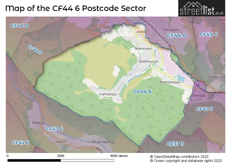
The CF44 6 Postcode shares a border with CF43 4 (FERNDALE, MAERDY, Blaenllechau), CF44 0 (ABERDARE, CWM-BACH, LLWYDCOED), CF44 7 (ABERDARE, CWMDARE, ABERAMAN), CF45 3 (MOUNTAIN ASH, Penrhiwceiber, PERTHCELYN), CF45 4 (Abercynon, MOUNTAIN ASH, TYNTETOWN) and CF37 3 (YNYS-Y-BWL, Glyncoch, Ynysybwl).
The sector is within the post town of ABERDARE.
CF44 6 is a postcode sector within the CF44 postcode district which is within the CF Cardiff postcode area.
The Royal Mail delivery office for the CF44 6 postal sector is the Aberdare Delivery Office.
The area of the CF44 6 postcode sector is 6.51 square miles which is 16.86 square kilometres or 4,165.18 square acres.

Map of the CF44 6 Postcode Sector
Explore the CF44 6 postcode sector by using our free interactive map.
| C | F | 4 | 4 | - | 6 | X | X |
| C | F | 4 | 4 | Space | 6 | Letter | Letter |
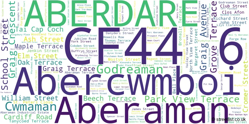
Official List of Streets
Aberaman (9 Streets)
ABERDARE (99 Streets)
Cwmaman (28 Streets)
Abercwmboi (17 Streets)
Unofficial Streets or Alternative Spellings
House Prices in the CF44 6 Postcode Sector
| Type of Property | 2018 Average | 2018 Sales | 2017 Average | 2017 Sales | 2016 Average | 2016 Sales | 2015 Average | 2015 Sales |
|---|---|---|---|---|---|---|---|---|
| Detached | £210,412 | 21 | £173,400 | 11 | £185,317 | 18 | £179,313 | 16 |
| Semi-Detached | £116,076 | 23 | £104,671 | 19 | £117,271 | 19 | £125,600 | 31 |
| Terraced | £68,243 | 140 | £64,127 | 144 | £58,166 | 126 | £65,387 | 134 |
| Flats | £53,667 | 3 | £0 | 0 | £24,667 | 3 | £40,000 | 1 |
Important Postcodes CF44 6 in the Postcode Sector
CF44 6AD is the postcode for CAPCOCH PRIMARY SCHOOL, SCHOOL STREET, ABERCWMBOI, and Cap-Coch Primary School, School Street
CF44 6DA is the postcode for Royal Opera House, Aberaman Industrial Estate
CF44 6DF is the postcode for Aman Community Education Centre, Godreaman Street, and Aman Continuing Education Centre, Godreaman Street, Godreaman
CF44 6LD is the postcode for Glynhafod Junior School, Glynhafod Street
CF44 6NS is the postcode for Cwmaman Infant School, Fforchaman Road
CF44 6RS is the postcode for Rhondda Cynon Taff County Borough Council, Ty Caradog Unit 6, Gasworks Road Industrial Estate
CF44 6TF is the postcode for Oaklands Primary School, Maes-Y-Deri, Aberaman, and Oaklands Primary School, Maes-y-Deri
CF44 6TN is the postcode for Blaengwawr Comprehensive School, Club Street
CF44 6TW is the postcode for Maesffynon Home for the Elderly, Blaengwawr Close
| The CF44 6 Sector is within these Local Authorities |
|
|---|---|
| The CF44 6 Sector is within these Counties |
|
| The CF44 6 Sector is within these Water Company Areas |
|